-
Monthly Rent
$1,550 - $1,895
-
Bedrooms
Studio - 1 bd
-
Bathrooms
1 ba
-
Square Feet
390 - 507 sq ft
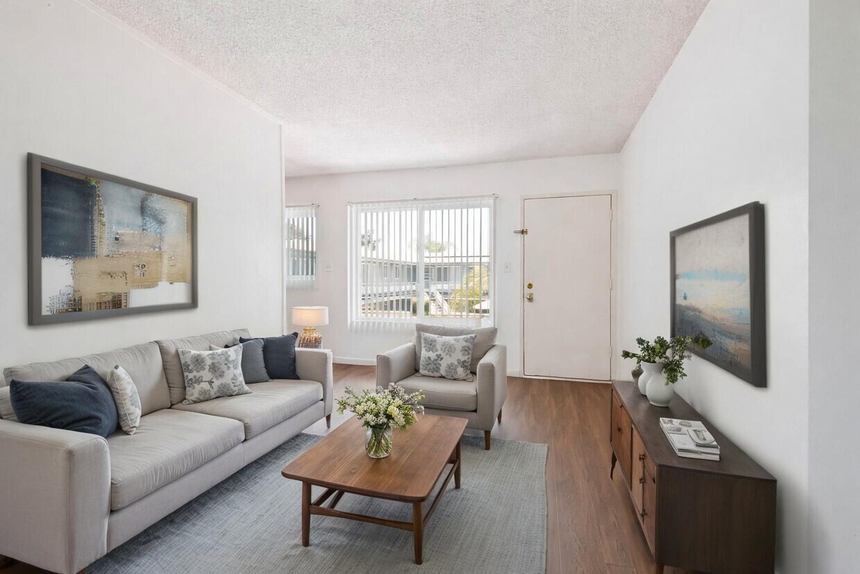
Discover your new apartment at Caribe. Located at 9903 Belmont St in Bellflower, this community is convenient to everything. The professional leasing team will assist you in finding your ideal place. Start living the good life at Caribe. Contact us or stop in to see available floor plans.
Highlights
- Pool
- Gated
- Hardwood Floors
Pricing & Floor Plans
-
Unit 09price $1,550square feet 390availibility Jul 24
-
Unit 04price $1,895square feet 507availibility Now
-
Unit 21price $1,895square feet 507availibility Now
-
Unit 09price $1,550square feet 390availibility Jul 24
-
Unit 04price $1,895square feet 507availibility Now
-
Unit 21price $1,895square feet 507availibility Now
Fees and Policies
The fees listed below are community-provided and may exclude utilities or add-ons. All payments are made directly to the property and are non-refundable unless otherwise specified.
-
One-Time Basics
-
Due at Application
-
Application Fee Per ApplicantCharged per applicant.$30
-
-
Due at Move-In
-
Amenity FeeCharged per unit.$0
-
Administrative FeeCharged per unit.$0
-
Move-In FeeCharged per unit.$0
-
OtherCharged per unit.$0
-
Satellite FeeCharged per unit.$0
-
-
Due at Application
-
Surface Lot
-
Storage Unit
-
Storage RentCharged per rentable item.$0 / mo
-
Property Fee Disclaimer: Based on community-supplied data and independent market research. Subject to change without notice. May exclude fees for mandatory or optional services and usage-based utilities.
Details
Utilities Included
-
Water
-
Trash Removal
-
Sewer
Lease Options
-
6 - 12 Month Leases
Property Information
-
Built in 1959
-
36 units/2 stories
About Caribe Apts
Discover your new apartment at Caribe. Located at 9903 Belmont St in Bellflower, this community is convenient to everything. The professional leasing team will assist you in finding your ideal place. Start living the good life at Caribe. Contact us or stop in to see available floor plans.
Caribe Apts is an apartment community located in Los Angeles County and the 90706 ZIP Code. This area is served by the Abc Unified School District attendance zone.
Unique Features
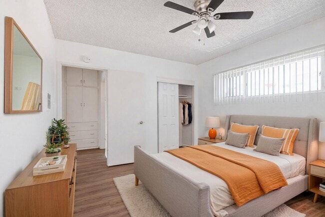
- Ceiling Fan
- Extra Storage
- Off Street Parking
- Spanish Speaking Staff
Contact
Community Amenities
Pool
Laundry Facilities
Gated
Maintenance on site
- Laundry Facilities
- Maintenance on site
- Pool
- Gated
Apartment Features
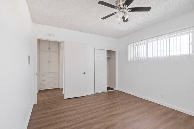
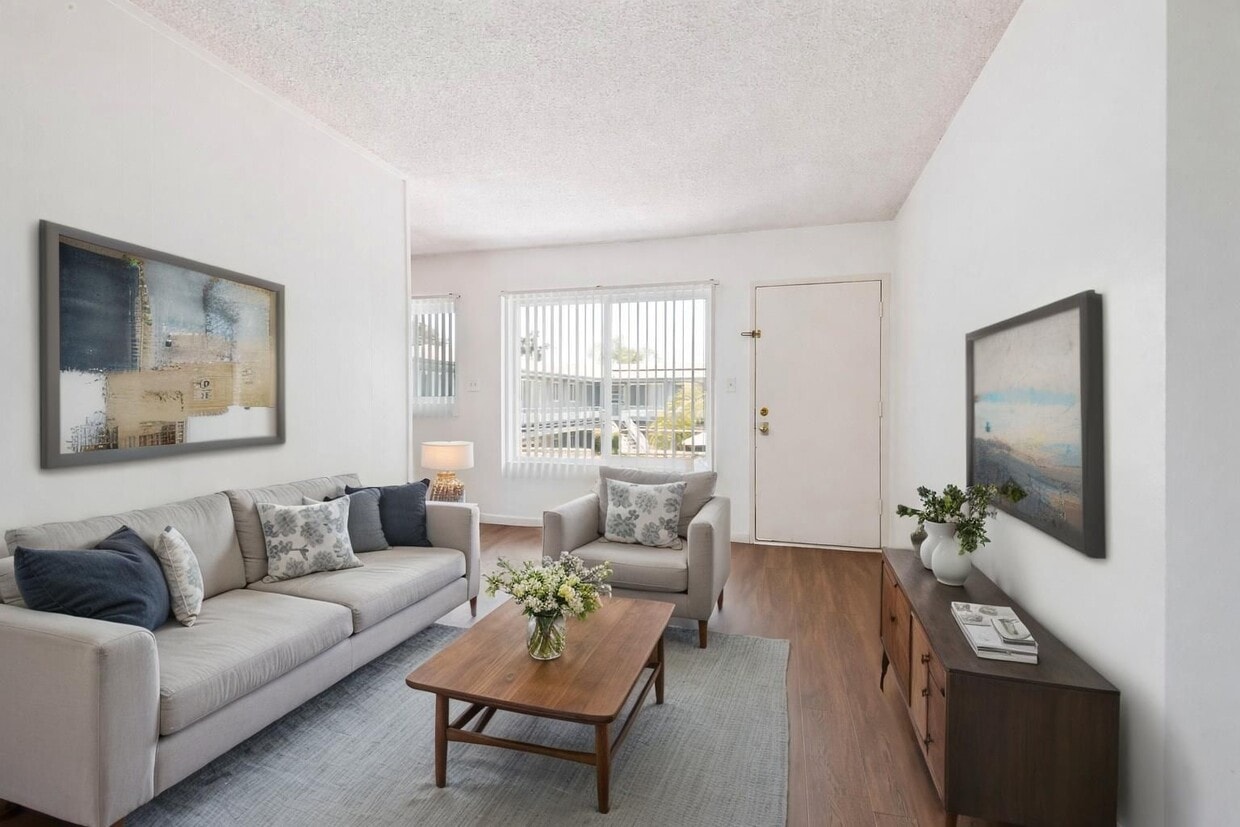
Hardwood Floors
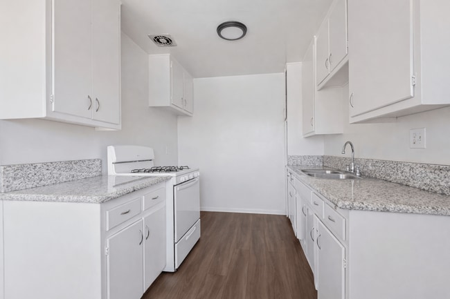
Refrigerator
Disposal
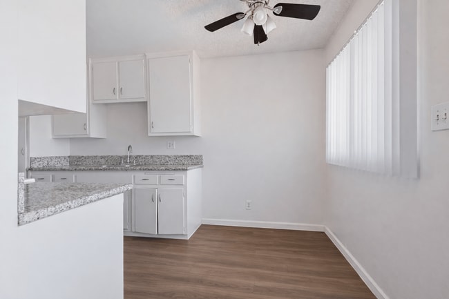
Ceiling Fans
- Ceiling Fans
- Cable Ready
- Disposal
- Refrigerator
- Gas Range
- Hardwood Floors
- Window Coverings
Bellflower is a dense, compact city in southeastern Los Angeles County, sitting about 20 miles from downtown LA with a character that feels distinctly its own. Incorporated in 1957, it grew from farmland into a tightly knit community that still carries traces of its agricultural past. Its name traces back to the Belle Fleur apple, a variety once harvested across local orchards before the area transitioned into the suburban city it is today. Bellflower Boulevard serves as the city's main artery, lined with small businesses, eateries, and a steady pulse of everyday activity.
The housing stock leans toward garden-style apartment communities, duplexes, and single-family rentals, with newer builds filling in alongside older midcentury construction. Renters looking for options between the sprawl of Long Beach and the denser urban core of LA find Bellflower sits in a practical middle ground.
Learn more about living in Bellflower- Laundry Facilities
- Maintenance on site
- Gated
- Pool
- Ceiling Fan
- Extra Storage
- Off Street Parking
- Spanish Speaking Staff
- Ceiling Fans
- Cable Ready
- Disposal
- Refrigerator
- Gas Range
- Hardwood Floors
- Window Coverings
| Monday | 8am - 5pm |
|---|---|
| Tuesday | 8am - 5pm |
| Wednesday | 8am - 5pm |
| Thursday | 8am - 5pm |
| Friday | 8am - 5pm |
| Saturday | Closed |
| Sunday | Closed |
| Colleges & Universities | Distance | ||
|---|---|---|---|
| Colleges & Universities | Distance | ||
| Drive: | 7 min | 2.7 mi | |
| Drive: | 10 min | 4.7 mi | |
| Drive: | 10 min | 6.2 mi | |
| Drive: | 15 min | 8.2 mi |

View GreatSchools Rating Methodology
Data provided by GreatSchools.org © 2026. All rights reserved.
Transportation options available in Bellflower include Lakewood Station, located 3.2 miles from Caribe Apts. Caribe Apts is near Long Beach (Daugherty Field), located 7.7 miles or 14 minutes away, and Los Angeles International, located 20.2 miles or 27 minutes away.
| Transit / Subway | Distance | ||
|---|---|---|---|
| Transit / Subway | Distance | ||
|
|
Drive: | 6 min | 3.2 mi |
|
|
Drive: | 6 min | 3.8 mi |
|
|
Drive: | 12 min | 7.2 mi |
|
|
Drive: | 11 min | 7.2 mi |
|
|
Drive: | 11 min | 7.6 mi |
| Commuter Rail | Distance | ||
|---|---|---|---|
| Commuter Rail | Distance | ||
|
|
Drive: | 11 min | 6.0 mi |
|
|
Drive: | 16 min | 8.8 mi |
|
|
Drive: | 17 min | 10.1 mi |
|
|
Drive: | 16 min | 10.8 mi |
|
|
Drive: | 20 min | 14.2 mi |
| Airports | Distance | ||
|---|---|---|---|
| Airports | Distance | ||
|
Long Beach (Daugherty Field)
|
Drive: | 14 min | 7.7 mi |
|
Los Angeles International
|
Drive: | 27 min | 20.2 mi |
Scores provided by
Traffic
BusyAirport
CalmBusinesses
ActiveScores provided by
HowLoud What is a Sound Score Rating? A Sound Score Rating aggregates noise caused by vehicle traffic, airplane traffic and local sources. How It WorksTime and distance from Caribe Apts.
| Shopping Centers | Distance | ||
|---|---|---|---|
| Shopping Centers | Distance | ||
| Walk: | 7 min | 0.4 mi | |
| Walk: | 10 min | 0.5 mi | |
| Walk: | 11 min | 0.6 mi |
| Parks and Recreation | Distance | ||
|---|---|---|---|
| Parks and Recreation | Distance | ||
|
Earl Burns Miller Japanese Garden
|
Drive: | 14 min | 7.3 mi |
|
El Dorado Nature Center
|
Drive: | 12 min | 7.7 mi |
|
El Dorado East Regional Park
|
Drive: | 14 min | 8.6 mi |
|
Compton Creek Natural Park at George Washington Elementary
|
Drive: | 14 min | 9.3 mi |
|
Watts Towers-Rodia State Park
|
Drive: | 15 min | 10.1 mi |
| Hospitals | Distance | ||
|---|---|---|---|
| Hospitals | Distance | ||
| Drive: | 5 min | 2.4 mi | |
| Drive: | 5 min | 2.7 mi | |
| Drive: | 6 min | 3.1 mi |
| Military Bases | Distance | ||
|---|---|---|---|
| Military Bases | Distance | ||
| Drive: | 20 min | 12.1 mi | |
| Drive: | 29 min | 17.6 mi | |
| Drive: | 24 min | 17.6 mi |
Caribe Apts Photos
-
Caribe Apts
-
-
-
-
-
-
-
-
Nearby Apartments
Within 50 Miles of Caribe Apts
-
Town Center Terrace
16200 Vermont Ave
Paramount, CA 90723
$1,703
1 Br 2.3 mi
-
Northview Terrace
821 N Wilcox Ave
Montebello, CA 90640
$2,450
2 Br 10.1 mi
-
Mountainview Venture
1375 W San Bernardino Rd
Covina, CA 91722
$1,795 - $2,450
1-2 Br 18.4 mi
-
South Pointe Apts
1408-1430 N Citrus Ave
Covina, CA 91722
$1,750
1-2 Br 20.3 mi
-
Bowles Apts
1150-1170 E Alosta Ave
Azusa, CA 91702
$1,999 - $2,074
1 Br 21.8 mi
-
Helix at University Village
510 E 3rd St
Pomona, CA 91766
$2,216
2 Br 24.7 mi
While Caribe Apts does not provide in‑unit laundry, on‑site laundry facilities are available for shared resident use.
Select utilities are included in rent at Caribe Apts, including water, trash removal, and sewer. Residents are responsible for any other utilities not listed.
Parking is available at Caribe Apts. Contact this property for details.
Caribe Apts has studios to one-bedroom with rent ranges from $1,550/mo. to $1,895/mo.
Yes, Caribe Apts welcomes pets. Breed restrictions, weight limits, and additional fees may apply. View this property's pet policy.
A good rule of thumb is to spend no more than 30% of your gross income on rent. Based on the lowest available rent of $1,550 for a studio, you would need to earn about $62,000 per year to qualify. Want to double-check your budget? Calculate how much rent you can afford with our Rent Affordability Calculator.
Caribe Apts is not currently offering any rent specials. Check back soon, as promotions change frequently.
While Caribe Apts does not offer Matterport 3D tours, renters can explore units through In-Person tours. Schedule a tour now.
9903 Belmont St
Bellflower, CA 90706