
Enso
4001 198th St SW,
Lynnwood, WA 98036
$1,875 - $3,500
Studio - 3 Beds
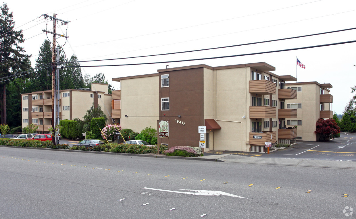
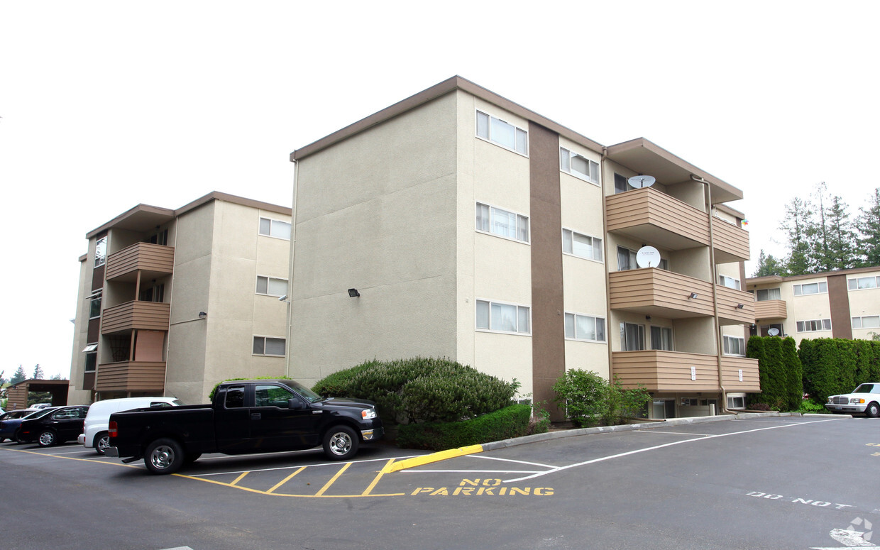
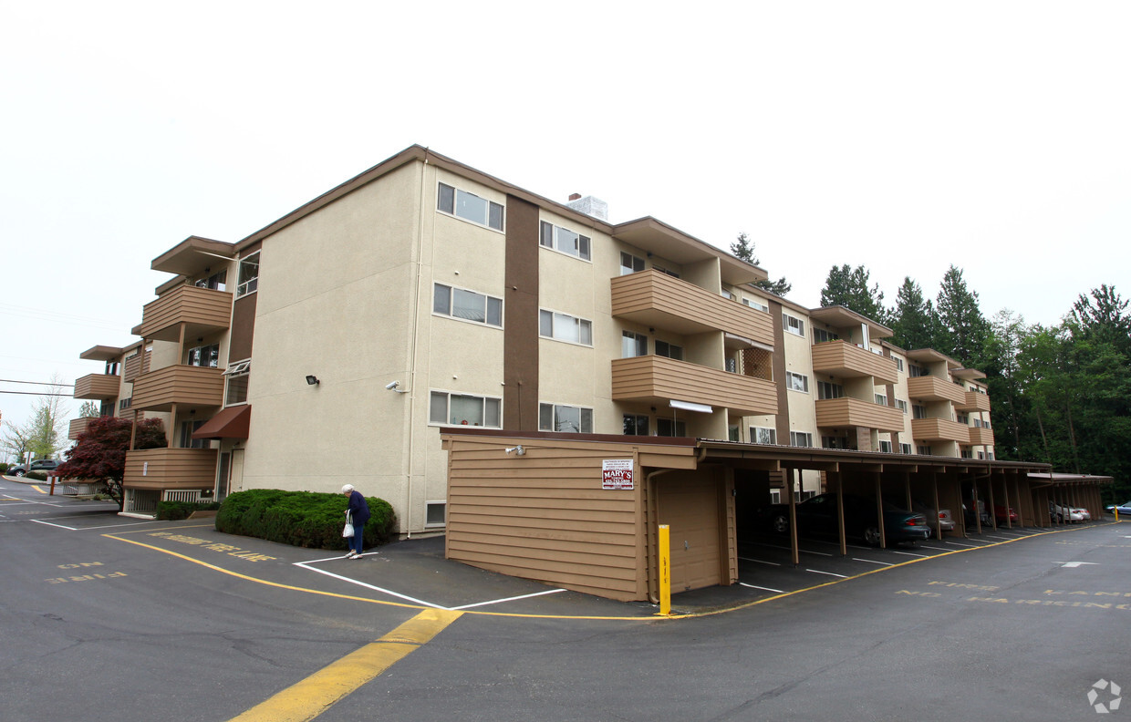

Find your new apartment at Camelot West in Lynnwood. Come by to view the available floorplans. The leasing staff is waiting to show you all that this community has to offer. At this community, you'll experience a wide variety in options of amenities and features like a sauna, convenient on-site parking options, and high-speed internet access. Contact us or drop by the leasing office to find out current pricing and see Camelot West.
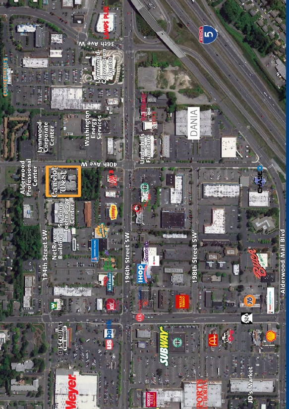
Camelot West is an apartment community located in Snohomish County and the 98036 ZIP Code. This area is served by the Edmonds School District attendance zone.
Instalaciones de lavandería
Comunidad cerrada
Sauna
Almacén/trastero
Lavavajillas
Acceso a Internet de alta velocidad
Nevera
Zona de eliminación de desechos
Situated in Snohomish County, Lynnwood sits 16 miles north of Seattle, combining residential neighborhoods with a strong retail presence. The city's centerpiece, Alderwood Mall, anchors an extensive shopping district that contributes significantly to local tax revenue. One-bedroom apartments in Lynnwood average $1,808 per month, with a 0.2% annual increase. Housing options range from apartment communities near Alderwood Mall to residential areas near Scriber Lake Park, which offers walking trails and natural areas.
The arrival of Sound Transit's Link light rail service has enhanced transportation options, connecting Lynnwood to Seattle and surrounding communities. Located at the intersection of Interstate 5 and Interstate 405, the city provides convenient access throughout the Puget Sound region. Local parks include Heritage Park, featuring preserved buildings that showcase early 20th-century architecture.
Learn more about living in Lynnwood| Colleges & Universities | Distance | ||
|---|---|---|---|
| Colleges & Universities | Distance | ||
| Drive: | 6 min | 2.2 mi | |
| Drive: | 15 min | 7.9 mi | |
| Drive: | 21 min | 8.7 mi | |
| Drive: | 14 min | 9.1 mi |


Transportation options available in Lynnwood include Shoreline North/185Th, located 6.1 miles from Camelot West. Camelot West is near Seattle Paine Field International, located 8.5 miles or 15 minutes away, and Seattle-Tacoma International, located 30.1 miles or 43 minutes away.
| Transit / Subway | Distance | ||
|---|---|---|---|
| Transit / Subway | Distance | ||
| Drive: | 10 min | 6.1 mi |
| Commuter Rail | Distance | ||
|---|---|---|---|
| Commuter Rail | Distance | ||
|
|
Drive: | 13 min | 5.3 mi |
|
|
Drive: | 21 min | 11.3 mi |
|
|
Drive: | 21 min | 13.5 mi |
|
|
Drive: | 24 min | 16.9 mi |
|
|
Drive: | 50 min | 37.5 mi |
| Airports | Distance | ||
|---|---|---|---|
| Airports | Distance | ||
|
Seattle Paine Field International
|
Drive: | 15 min | 8.5 mi |
|
Seattle-Tacoma International
|
Drive: | 43 min | 30.1 mi |
Time and distance from Camelot West.
| Shopping Centers | Distance | ||
|---|---|---|---|
| Shopping Centers | Distance | ||
| Walk: | 4 min | 0.2 mi | |
| Walk: | 5 min | 0.3 mi | |
| Walk: | 5 min | 0.3 mi |
| Parks and Recreation | Distance | ||
|---|---|---|---|
| Parks and Recreation | Distance | ||
|
Pioneer Park
|
Drive: | 3 min | 1.2 mi |
|
Meadowdale Athletic Complex
|
Drive: | 8 min | 3.3 mi |
|
Meadowdale Beach Park
|
Drive: | 10 min | 3.7 mi |
|
Southwest County Olympic View Park
|
Drive: | 10 min | 3.8 mi |
|
Stamm Overlook Park
|
Drive: | 11 min | 4.5 mi |
| Hospitals | Distance | ||
|---|---|---|---|
| Hospitals | Distance | ||
| Drive: | 7 min | 3.4 mi | |
| Drive: | 14 min | 9.3 mi | |
| Drive: | 18 min | 11.5 mi |
| Military Bases | Distance | ||
|---|---|---|---|
| Military Bases | Distance | ||
| Drive: | 23 min | 14.2 mi | |
| Drive: | 34 min | 16.4 mi | |
| Drive: | 73 min | 27.8 mi |
What Are Walk Score®, Transit Score®, and Bike Score® Ratings?
Walk Score® measures the walkability of any address. Transit Score® measures access to public transit. Bike Score® measures the bikeability of any address.
What is a Sound Score Rating?
A Sound Score Rating aggregates noise caused by vehicle traffic, airplane traffic and local sources.

19412 40th Ave W
Lynnwood, WA 98036


