
Vision on Wilshire
6245 Wilshire Blvd,
Los Angeles, CA 90048
$3,469 - $13,070
Studio - 3 Beds

Bedrooms
1 bd
Bathrooms
1 ba
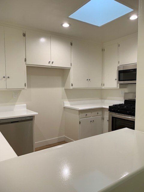
Square Feet
550 sq ft
Beverly Rexford is located conveniently near Gregory Way and Olympic Blvd. We are situated a block away from Beverly Vista School and near the prestigious Beverly Hills High School. We have easy access to the 405 and 10 freeways, Westwood, Century City and the beautiful Beverly Hills hotels and shopping. We offer spacious one and two bedrooms apartments.
Beverly Rexford is located conveniently near Gregory Way and Olympic Blvd. We are situated a block away from Beverly Vista School and near the prestigious Beverly Hills High School. We have easy access to the 405 and 10 freeways, Westwood, Century City and the beautiful Beverly Hills hotels and shopping. We offer spacious one and two bedrooms apartments.
Beverly Rexford is an apartment community located in Los Angeles County and the 90212 ZIP Code. This area is served by the Los Angeles Unified Rocp School District attendance zone.
Unique Features
Pool
Laundry Facilities
Gated
Video Patrol
Air Conditioning
Dishwasher
Refrigerator
Disposal
Beverly Hills, spanning just 5.71 square miles, combines elegant residential areas with world-class shopping and dining. Tree-lined streets and well-maintained green spaces like Beverly Gardens Park along Santa Monica Boulevard create an inviting atmosphere. The Golden Triangle shopping district, home to the renowned Rodeo Drive, offers high-end retail experiences. Housing options range from estates in Trousdale Estates to apartments south of Wilshire Boulevard, where one-bedroom apartments currently average $2,728 with a 1.1% increase year-over-year.
The city celebrates arts and culture through venues like the Wallis Annenberg Center for the Performing Arts and the historic Greystone Mansion. Landmarks such as the Beverly Hills Hotel and Beverly Wilshire Hotel contribute to the area's distinctive character. Notable areas include the residential streets north of Santa Monica Boulevard and the South Beverly Drive district, with its local shops and eateries.
Learn more about living in Beverly Hills| Colleges & Universities | Distance | ||
|---|---|---|---|
| Colleges & Universities | Distance | ||
| Drive: | 10 min | 4.3 mi | |
| Drive: | 13 min | 5.3 mi | |
| Drive: | 14 min | 5.3 mi | |
| Drive: | 12 min | 6.4 mi |


Transportation options available in Beverly Hills include Palms, located 2.7 miles from Beverly Rexford. Beverly Rexford is near Los Angeles International, located 10.6 miles or 22 minutes away, and Bob Hope, located 14.7 miles or 28 minutes away.
| Transit / Subway | Distance | ||
|---|---|---|---|
| Transit / Subway | Distance | ||
|
|
Drive: | 7 min | 2.7 mi |
|
|
Drive: | 8 min | 3.0 mi |
|
|
Drive: | 8 min | 3.1 mi |
| Drive: | 8 min | 3.5 mi | |
|
|
Drive: | 8 min | 3.5 mi |
| Commuter Rail | Distance | ||
|---|---|---|---|
| Commuter Rail | Distance | ||
|
|
Drive: | 19 min | 10.0 mi |
|
|
Drive: | 21 min | 10.2 mi |
|
|
Drive: | 22 min | 12.3 mi |
|
|
Drive: | 25 min | 12.6 mi |
|
|
Drive: | 27 min | 13.6 mi |
| Airports | Distance | ||
|---|---|---|---|
| Airports | Distance | ||
|
Los Angeles International
|
Drive: | 22 min | 10.6 mi |
|
Bob Hope
|
Drive: | 28 min | 14.7 mi |
Scores provided by
Traffic
-Airport
-Businesses
-Scores provided by
HowLoud What is a Sound Score Rating? A Sound Score Rating aggregates noise caused by vehicle traffic, airplane traffic and local sources. How It WorksTime and distance from Beverly Rexford.
| Shopping Centers | Distance | ||
|---|---|---|---|
| Shopping Centers | Distance | ||
| Walk: | 5 min | 0.3 mi | |
| Walk: | 6 min | 0.3 mi | |
| Walk: | 10 min | 0.5 mi |
| Parks and Recreation | Distance | ||
|---|---|---|---|
| Parks and Recreation | Distance | ||
|
Zimmer Children's Museum
|
Drive: | 5 min | 2.2 mi |
|
La Brea Tar Pits
|
Drive: | 5 min | 2.6 mi |
|
Virginia Robinson Gardens
|
Drive: | 7 min | 2.7 mi |
|
Mathias Botanical Garden
|
Drive: | 9 min | 3.9 mi |
|
Hannah Carter Japanese Garden
|
Drive: | 10 min | 4.5 mi |
| Hospitals | Distance | ||
|---|---|---|---|
| Hospitals | Distance | ||
| Drive: | 4 min | 2.0 mi | |
| Drive: | 5 min | 2.0 mi | |
| Drive: | 4 min | 2.1 mi |
| Military Bases | Distance | ||
|---|---|---|---|
| Military Bases | Distance | ||
| Drive: | 22 min | 12.2 mi | |
| Drive: | 43 min | 30.8 mi | |
| Drive: | 46 min | 33.0 mi |
Pets Allowed In Unit Washer & Dryer Maintenance on site Heat Controlled Access Elevator
Pets Allowed Fitness Center Pool Maintenance on site High-Speed Internet Controlled Access EV Charging
What Are Walk Score®, Transit Score®, and Bike Score® Ratings?
Walk Score® measures the walkability of any address. Transit Score® measures access to public transit. Bike Score® measures the bikeability of any address.
What is a Sound Score Rating?
A Sound Score Rating aggregates noise caused by vehicle traffic, airplane traffic and local sources.
345 S Rexford Dr
Beverly Hills, CA 90212


