
Laurel Crossing Apartment Homes
203 Laurie Meadows Dr,
San Mateo, CA 94403
$2,624 - $3,966
Studio - 2 Beds
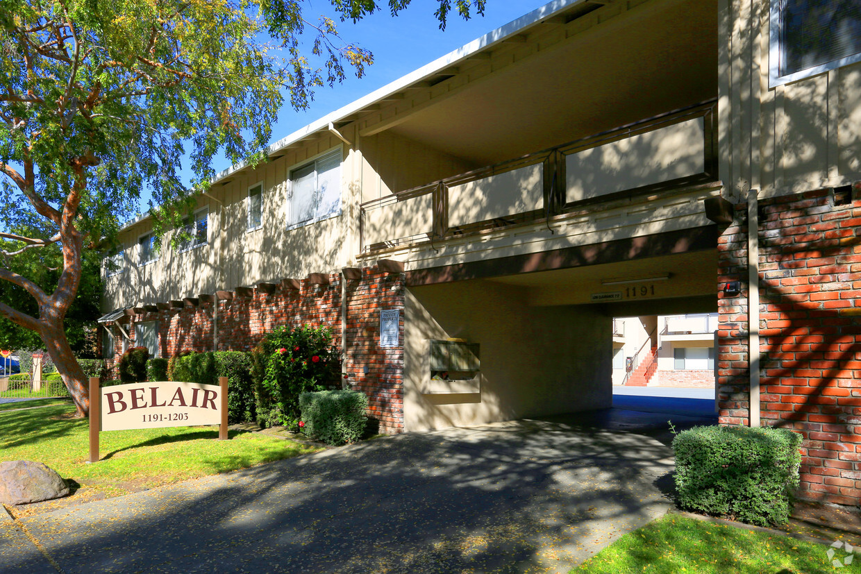
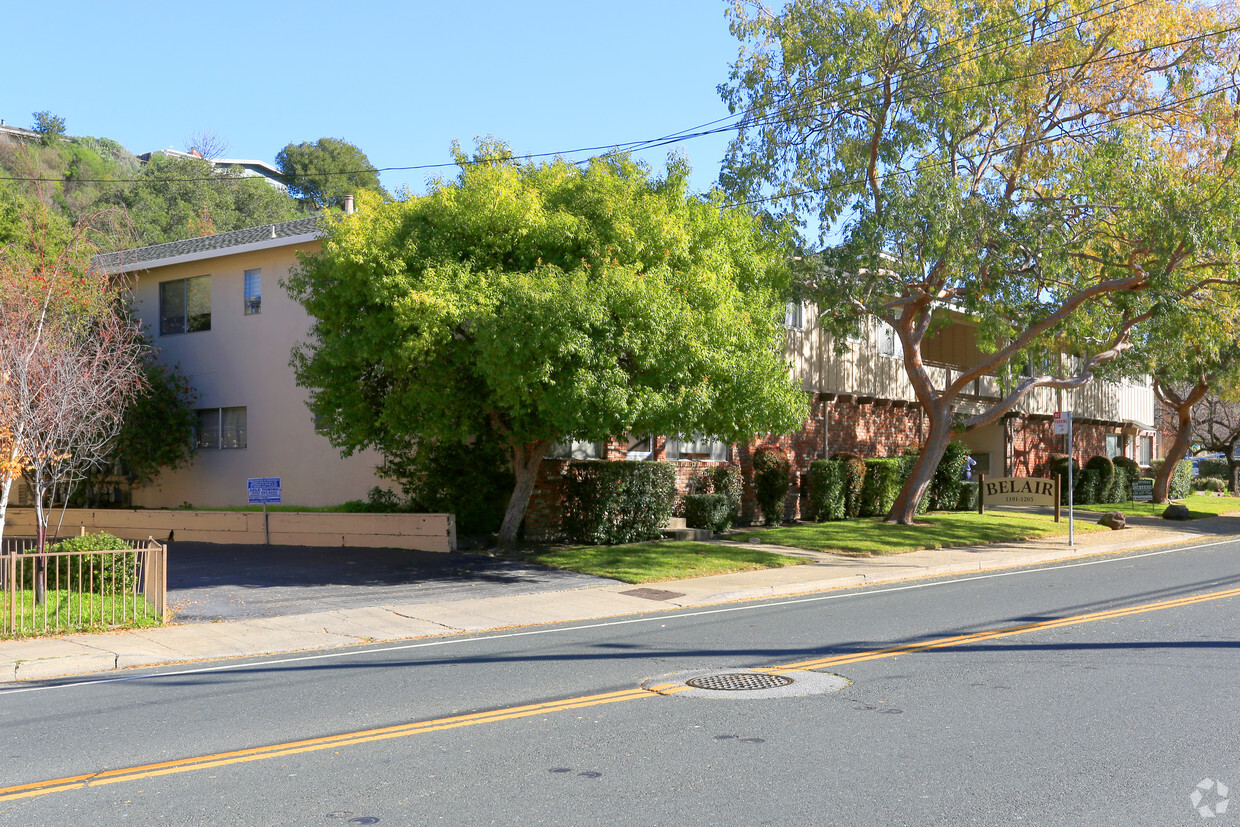
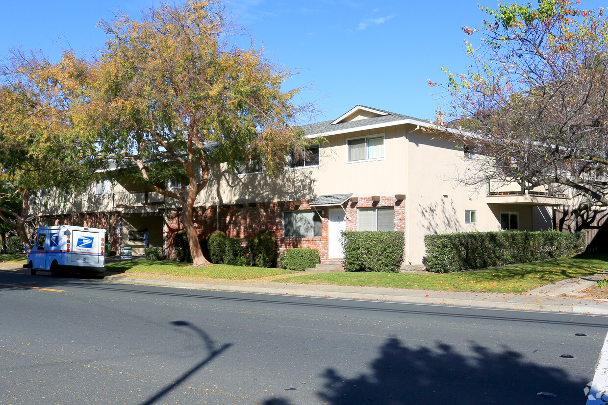
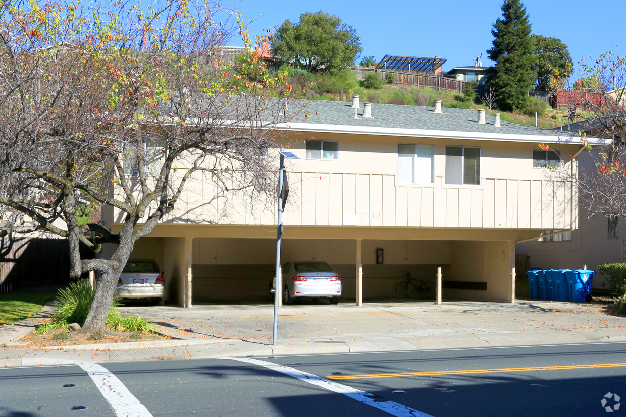

Come enjoy Belmont living at Bel-Air. The 94002 location has much to offer its residents. Be sure to come for a visit to see the available floorplan options. From amenities to location, the leasing staff is ready to help you find your perfect new home. Drop by Bel-Air today.
Bel-Air is an apartment community located in San Mateo County and the 94002 ZIP Code. This area is served by the Millbrae Elementary attendance zone.
Dishwasher
Microwave
Refrigerator
Fireplace
Situated midway between San Francisco and San Jose, Belmont is a tranquil community known for its wooded hills, vast stretches of open space, and expansive views of the San Francisco Bay. Belmont’s pervasive natural beauty and laidback atmosphere provide a calm reprieve from the bustle of city life.
Residents often flock to Twin Pines Park, Water Dog Lake Park, and nearby Laurelwood Park to enjoy scenic trails and various outdoor activities. Belmont’s close-knit community is frequently brought together for a wide variety of special city events and programs as well.
Belmont offers a host of diverse eateries and shops along its stretch of El Camino Real. Numerous metropolitan amenities are within close reach with quick access to the CalTrain and multiple major roadways.
Known for its wooded hills, views of the San Francisco Bay, and stretches of open space, Belmont is a quiet residential community in the midst of the culturally and technologically rich Bay Area.
Learn more about living in Belmont| Colleges & Universities | Distance | ||
|---|---|---|---|
| Colleges & Universities | Distance | ||
| Drive: | 9 min | 4.6 mi | |
| Drive: | 17 min | 7.4 mi | |
| Drive: | 16 min | 8.6 mi | |
| Drive: | 26 min | 11.0 mi |


Transportation options available in Belmont include Millbrae (Caltrain Transfer Platform), located 11.4 miles from Bel-Air. Bel-Air is near San Francisco International, located 12.5 miles or 19 minutes away, and Metro Oakland International, located 28.2 miles or 38 minutes away.
| Transit / Subway | Distance | ||
|---|---|---|---|
| Transit / Subway | Distance | ||
|
|
Drive: | 18 min | 11.4 mi |
|
|
Drive: | 18 min | 11.4 mi |
| Drive: | 19 min | 12.1 mi | |
|
|
Drive: | 19 min | 12.3 mi |
|
|
Drive: | 19 min | 12.5 mi |
| Commuter Rail | Distance | ||
|---|---|---|---|
| Commuter Rail | Distance | ||
| Drive: | 4 min | 1.6 mi | |
| Drive: | 4 min | 1.6 mi | |
| Drive: | 5 min | 2.4 mi | |
| Drive: | 7 min | 3.1 mi | |
| Drive: | 9 min | 4.0 mi |
| Airports | Distance | ||
|---|---|---|---|
| Airports | Distance | ||
|
San Francisco International
|
Drive: | 19 min | 12.5 mi |
|
Metro Oakland International
|
Drive: | 38 min | 28.2 mi |
Time and distance from Bel-Air.
| Shopping Centers | Distance | ||
|---|---|---|---|
| Shopping Centers | Distance | ||
| Walk: | 4 min | 0.2 mi | |
| Drive: | 4 min | 1.5 mi | |
| Drive: | 4 min | 1.5 mi |
| Parks and Recreation | Distance | ||
|---|---|---|---|
| Parks and Recreation | Distance | ||
|
Edgewood Park & Natural Preserve
|
Drive: | 8 min | 4.3 mi |
|
Red Morton Park
|
Drive: | 12 min | 4.6 mi |
|
San Mateo Arboretum
|
Drive: | 10 min | 4.8 mi |
|
Pulgas Ridge Open Space Preserve
|
Drive: | 12 min | 5.7 mi |
|
Filoli Gardens
|
Drive: | 17 min | 6.7 mi |
| Hospitals | Distance | ||
|---|---|---|---|
| Hospitals | Distance | ||
| Drive: | 5 min | 2.0 mi | |
| Drive: | 7 min | 3.2 mi | |
| Drive: | 10 min | 4.8 mi |
| Military Bases | Distance | ||
|---|---|---|---|
| Military Bases | Distance | ||
| Drive: | 26 min | 17.0 mi |
What Are Walk Score®, Transit Score®, and Bike Score® Ratings?
Walk Score® measures the walkability of any address. Transit Score® measures access to public transit. Bike Score® measures the bikeability of any address.
What is a Sound Score Rating?
A Sound Score Rating aggregates noise caused by vehicle traffic, airplane traffic and local sources

1191 Alameda de las Pulgas
Belmont, CA 94002


