
Radius At The Banks
44 W Freedom Way,
Cincinnati, OH 45202
$1,324 - $2,974
Studio - 2 Beds
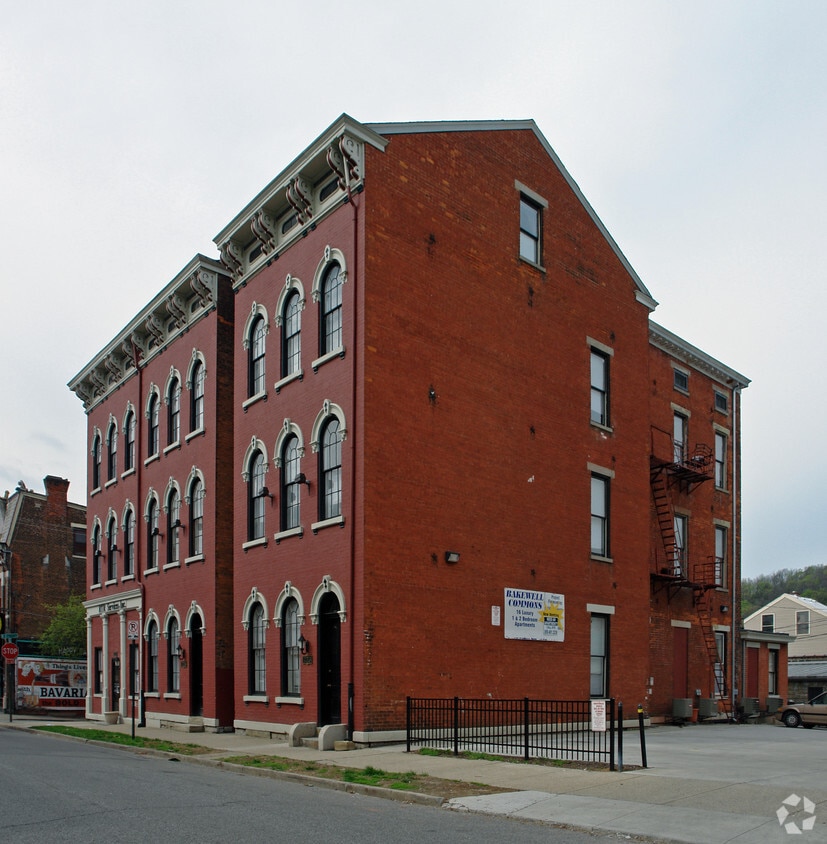
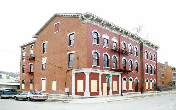
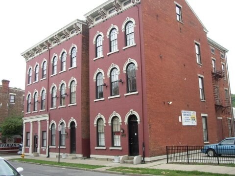
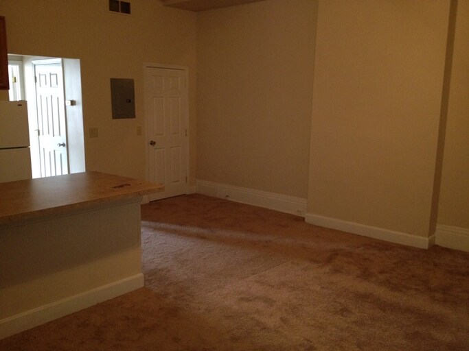

Bakewell Commons in Covington, KY is ready for your visit. The 723-727 Bakewell St. location in Covington's 41011 Zip code has so much to offer its residents. Make sure you to view the available floorplans. Here at this community, the leasing staff is ready to help you find the perfect fit. Contact us or drop by to check the availability and set up a tour today and see Bakewell Commons.
Bakewell Commons is an apartment community located in Kenton County and the 41011 ZIP Code. This area is served by the Newport Independent School District attendance zone.
Nestled in the northern portion of the city, Downtown Covington is home to the central business district along with a slew of cultural and recreational amenities. Madison Avenue brims with vintage charm, with colorful buildings in a diverse range of architectural stylings containing numerous specialty shops, entertainment venues, and local restaurants serving international cuisine.
Many of Downtown Covington’s buildings are adorned with vibrant murals painted by local and international artists. Goebel Park is also located in the area, offering traditional park amenities like a public pool and playground as well as a German-style Carroll Chimes Clock Tower, which displays a charming puppet show of the Pied Piper every hour.
The neighborhood’s close-knit community comes together for a wide variety of exciting events, including Mainstrasse Oktoberfest, Maifest, Mardi Gras, the First Friday Gallery Hop, and many others. Close proximity to I-71, Clay Wade Bailey Bridge, and John A.
Learn more about living in Downtown CovingtonCompare neighborhood and city base rent averages by bedroom.
| Downtown Covington | Covington, KY | |
|---|---|---|
| Studio | $1,374 | $1,336 |
| 1 Bedroom | $1,602 | $1,420 |
| 2 Bedrooms | $2,113 | $1,884 |
| 3 Bedrooms | $1,625 | $1,676 |
| Colleges & Universities | Distance | ||
|---|---|---|---|
| Colleges & Universities | Distance | ||
| Drive: | 11 min | 5.2 mi | |
| Drive: | 11 min | 6.0 mi | |
| Drive: | 12 min | 6.0 mi | |
| Drive: | 14 min | 6.2 mi |


Transportation options available in Covington include The Banks Station - 2Nd & Main, located 1.8 miles from Bakewell Commons. Bakewell Commons is near Cincinnati/Northern Kentucky International, located 12.4 miles or 25 minutes away.
| Transit / Subway | Distance | ||
|---|---|---|---|
| Transit / Subway | Distance | ||
| Drive: | 4 min | 1.8 mi | |
| Drive: | 5 min | 1.9 mi | |
| Drive: | 5 min | 2.0 mi | |
| Drive: | 5 min | 2.1 mi | |
| Drive: | 6 min | 2.2 mi |
| Commuter Rail | Distance | ||
|---|---|---|---|
| Commuter Rail | Distance | ||
|
|
Drive: | 7 min | 2.9 mi |
| Airports | Distance | ||
|---|---|---|---|
| Airports | Distance | ||
|
Cincinnati/Northern Kentucky International
|
Drive: | 25 min | 12.4 mi |
Scores provided by
Traffic
-Airport
-Businesses
-Scores provided by
HowLoud What is a Sound Score Rating? A Sound Score Rating aggregates noise caused by vehicle traffic, airplane traffic and local sources. How It WorksTime and distance from Bakewell Commons.
| Shopping Centers | Distance | ||
|---|---|---|---|
| Shopping Centers | Distance | ||
| Drive: | 5 min | 1.5 mi | |
| Drive: | 5 min | 1.9 mi | |
| Drive: | 6 min | 2.0 mi |
| Parks and Recreation | Distance | ||
|---|---|---|---|
| Parks and Recreation | Distance | ||
|
John G. & Phyllis W. Smale Riverfront Park
|
Drive: | 4 min | 1.9 mi |
|
Newport Aquarium
|
Drive: | 7 min | 2.2 mi |
|
OMNIMAX Theater
|
Drive: | 7 min | 2.9 mi |
|
Museum of Natural History and Science
|
Drive: | 7 min | 2.9 mi |
|
Cincinnati History Museum
|
Drive: | 7 min | 2.9 mi |
| Hospitals | Distance | ||
|---|---|---|---|
| Hospitals | Distance | ||
| Drive: | 8 min | 4.3 mi | |
| Drive: | 10 min | 4.9 mi | |
| Drive: | 9 min | 5.2 mi |
| Military Bases | Distance | ||
|---|---|---|---|
| Military Bases | Distance | ||
| Drive: | 73 min | 56.4 mi | |
| Drive: | 79 min | 61.4 mi | |
| Drive: | 82 min | 64.7 mi |
What Are Walk Score®, Transit Score®, and Bike Score® Ratings?
Walk Score® measures the walkability of any address. Transit Score® measures access to public transit. Bike Score® measures the bikeability of any address.
What is a Sound Score Rating?
A Sound Score Rating aggregates noise caused by vehicle traffic, airplane traffic and local sources.


