
7 West 7th Apartments
7 W 7th St,
Cincinnati, OH 45202
$1,500 - $5,045
1-3 Beds

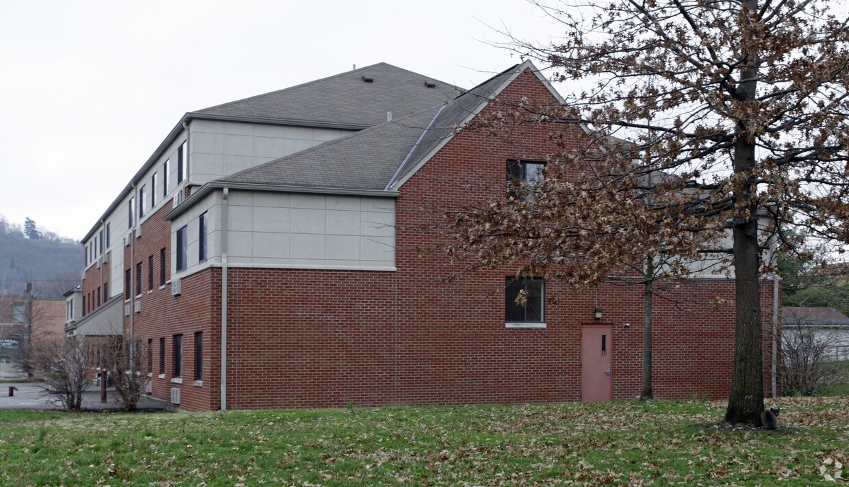
At Austinburg in Covington, experience fine living. The 411 Patton St. location in Covington's 41014 area has much to offer its residents. From location to floorplan options, the leasing team is ready to match you with the perfect floorplan option. Be sure to see the current floorplan options. Contact us or drop by to schedule a tour today and find your new home at Austinburg.
Austinburg Apts is an apartment community located in Kenton County and the 41014 ZIP Code. This area is served by the Covington Independent attendance zone.
Air Conditioning
Heating
Range
Kitchen
Covington is a vibrant suburban city located directly across the Ohio River from Cincinnati. The north side of the city is well known for its stunning historic architecture, from the numerous magnificent churches to the iconic John A. Roebling Suspension Bridge (connecting Covington with Cincinnati) to the brick townhomes of the Mutter Gottes Historic District. Farther south, things spread out considerably as the urban layout begins to blend into the surrounding countryside.
The local rental market is huge and diverse, ranging from upscale historic homes and swanky downtown condos to sensible suburban homes to budget-friendly efficiency apartments. The variety of housing options combined with the easy access to Cincinnati has bade Covington a longtime favorite for commuters, and frequent travelers will love the close proximity to Cincinnati/Northern Kentucky International Airport.
Learn more about living in CovingtonCompare neighborhood and city base rent averages by bedroom.
| Northern Kentucky | Covington, KY | |
|---|---|---|
| Studio | $1,036 | $1,364 |
| 1 Bedroom | $1,249 | $1,427 |
| 2 Bedrooms | $1,460 | $1,867 |
| 3 Bedrooms | $1,810 | $1,631 |
| Colleges & Universities | Distance | ||
|---|---|---|---|
| Colleges & Universities | Distance | ||
| Drive: | 12 min | 5.6 mi | |
| Drive: | 15 min | 6.8 mi | |
| Drive: | 15 min | 6.8 mi | |
| Drive: | 15 min | 7.6 mi |


Transportation options available in Covington include The Banks Station - 2Nd & Main, located 2.1 miles from Austinburg Apts. Austinburg Apts is near Cincinnati/Northern Kentucky International, located 13.2 miles or 27 minutes away.
| Transit / Subway | Distance | ||
|---|---|---|---|
| Transit / Subway | Distance | ||
| Drive: | 8 min | 2.1 mi | |
| Drive: | 9 min | 2.3 mi | |
| Drive: | 9 min | 2.5 mi | |
| Drive: | 9 min | 3.6 mi | |
| Drive: | 10 min | 3.9 mi |
| Commuter Rail | Distance | ||
|---|---|---|---|
| Commuter Rail | Distance | ||
|
|
Drive: | 11 min | 4.6 mi |
| Airports | Distance | ||
|---|---|---|---|
| Airports | Distance | ||
|
Cincinnati/Northern Kentucky International
|
Drive: | 27 min | 13.2 mi |
Scores provided by
Traffic
-Airport
-Businesses
-Scores provided by
HowLoud What is a Sound Score Rating? A Sound Score Rating aggregates noise caused by vehicle traffic, airplane traffic and local sources. How It WorksTime and distance from Austinburg Apts.
| Shopping Centers | Distance | ||
|---|---|---|---|
| Shopping Centers | Distance | ||
| Walk: | 9 min | 0.5 mi | |
| Drive: | 6 min | 2.0 mi | |
| Drive: | 7 min | 2.2 mi |
| Parks and Recreation | Distance | ||
|---|---|---|---|
| Parks and Recreation | Distance | ||
|
Newport Aquarium
|
Drive: | 8 min | 2.6 mi |
|
John G. & Phyllis W. Smale Riverfront Park
|
Drive: | 8 min | 3.6 mi |
|
Theodore M. Berry Friendship Park
|
Drive: | 10 min | 3.7 mi |
|
Krohn Conservatory
|
Drive: | 11 min | 5.3 mi |
|
Eden Park
|
Drive: | 11 min | 5.5 mi |
| Hospitals | Distance | ||
|---|---|---|---|
| Hospitals | Distance | ||
| Drive: | 8 min | 3.2 mi | |
| Drive: | 13 min | 6.0 mi | |
| Drive: | 14 min | 6.6 mi |
| Military Bases | Distance | ||
|---|---|---|---|
| Military Bases | Distance | ||
| Drive: | 77 min | 58.1 mi | |
| Drive: | 83 min | 63.1 mi | |
| Drive: | 86 min | 66.4 mi |
What Are Walk Score®, Transit Score®, and Bike Score® Ratings?
Walk Score® measures the walkability of any address. Transit Score® measures access to public transit. Bike Score® measures the bikeability of any address.
What is a Sound Score Rating?
A Sound Score Rating aggregates noise caused by vehicle traffic, airplane traffic and local sources.
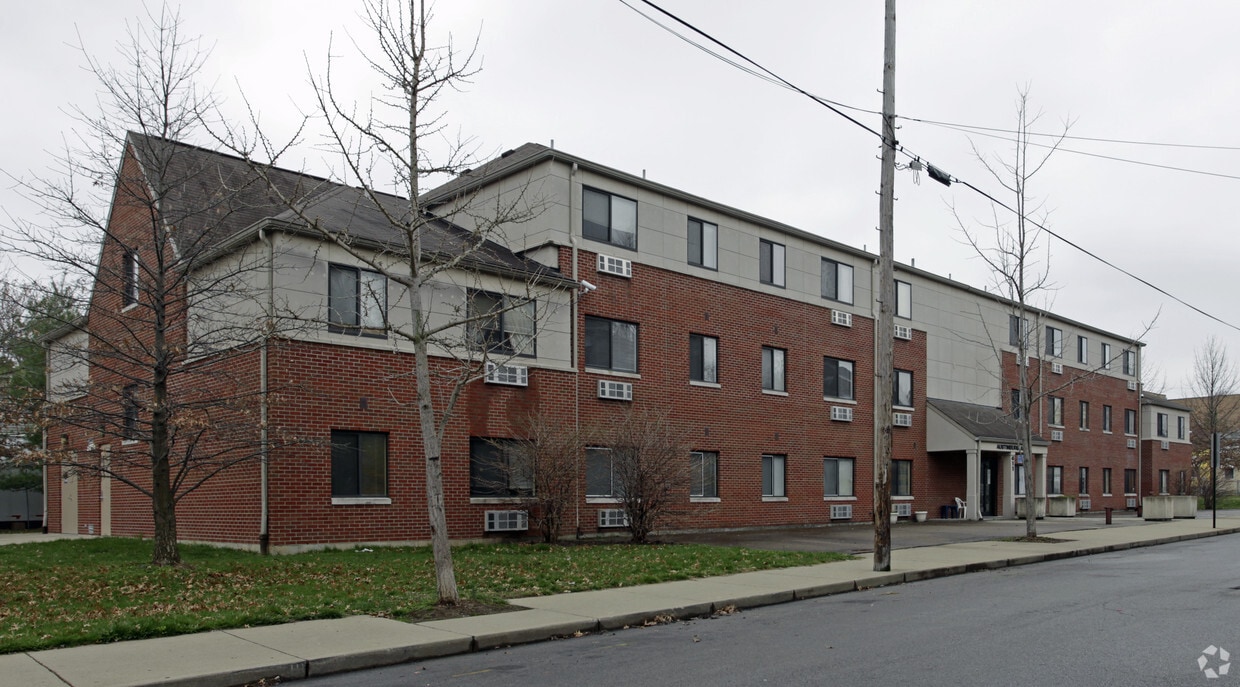
411 Patton St
Covington, KY 41014


