
Williamsburg
200 W Galbraith Rd,
Cincinnati, OH 45215
$857 - $3,564
Studio - 3 Beds
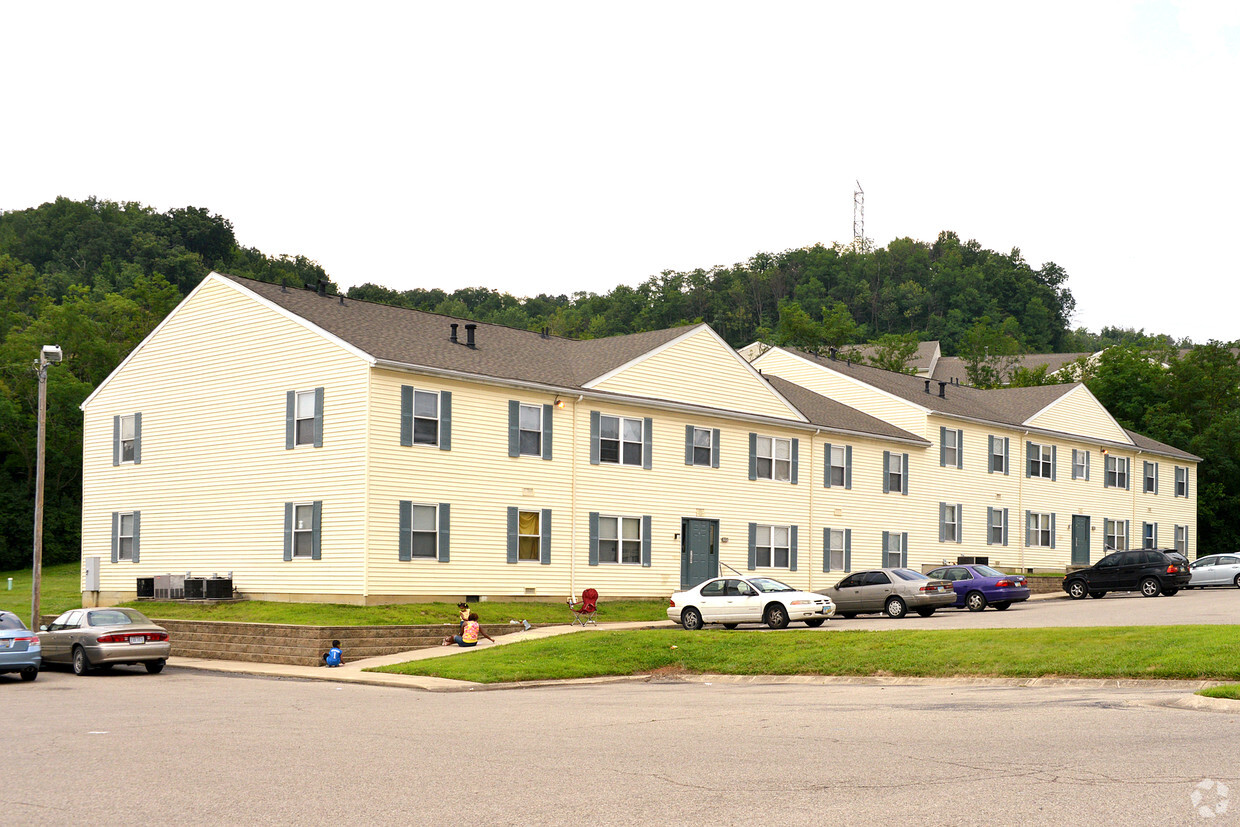
Ashwood Apartments offers a mixture of style and livability. The 45223 location in Cincinnati has much to offer its residents. Make sure you to check out the current floorplan options. The leasing staff is ready for you to visit. Stop by the leasing office to schedule a tour.
Ashwood Apartments is an apartment community located in Hamilton County and the 45223 ZIP Code. This area is served by the Cincinnati Public Schools attendance zone.
Air Conditioning
High Speed Internet Access
Tub/Shower
Smoke Free
Located about five miles northwest of Downtown Cincinnati, College Hill blends the urban with the suburban, touting vibrant storefronts along Hamilton Avenue and historic residences along tranquil backroads. College Hill is home to a diverse, close-knit community known for being welcoming to all.
Delectable restaurants, independent shops, and cozy cafes are among the many eclectic businesses lining the charming and walkable Hamilton Avenue. Recreational opportunities abound at a number of neighborhood parks as well as the nearby Mount Airy Forest. College Hill is also within a 15-minute drive to Downtown Cincinnati.
Learn more about living in College HillCompare neighborhood and city base rent averages by bedroom.
| College Hill | Cincinnati, OH | |
|---|---|---|
| Studio | $656 | $1,062 |
| 1 Bedroom | $862 | $1,129 |
| 2 Bedrooms | $989 | $1,407 |
| 3 Bedrooms | $1,203 | $1,704 |
| Colleges & Universities | Distance | ||
|---|---|---|---|
| Colleges & Universities | Distance | ||
| Drive: | 9 min | 3.0 mi | |
| Drive: | 11 min | 5.0 mi | |
| Drive: | 13 min | 5.4 mi | |
| Drive: | 16 min | 7.0 mi |


Transportation options available in Cincinnati include Brewery District Station - Elm & Henry, located 5.7 miles from Ashwood Apartments. Ashwood Apartments is near Cincinnati/Northern Kentucky International, located 19.7 miles or 36 minutes away.
| Transit / Subway | Distance | ||
|---|---|---|---|
| Transit / Subway | Distance | ||
| Drive: | 12 min | 5.7 mi | |
| Drive: | 12 min | 5.8 mi | |
| Drive: | 12 min | 5.9 mi | |
| Drive: | 12 min | 5.9 mi | |
| Drive: | 13 min | 6.0 mi |
| Commuter Rail | Distance | ||
|---|---|---|---|
| Commuter Rail | Distance | ||
|
|
Drive: | 11 min | 5.7 mi |
| Airports | Distance | ||
|---|---|---|---|
| Airports | Distance | ||
|
Cincinnati/Northern Kentucky International
|
Drive: | 36 min | 19.7 mi |
Time and distance from Ashwood Apartments.
| Shopping Centers | Distance | ||
|---|---|---|---|
| Shopping Centers | Distance | ||
| Drive: | 5 min | 1.7 mi | |
| Drive: | 8 min | 2.9 mi | |
| Drive: | 9 min | 3.2 mi |
| Parks and Recreation | Distance | ||
|---|---|---|---|
| Parks and Recreation | Distance | ||
|
Buttercup Valley
|
Walk: | 13 min | 0.7 mi |
|
LaBoiteaux Woods
|
Drive: | 4 min | 1.4 mi |
|
Mt. Airy Forest
|
Drive: | 8 min | 3.3 mi |
|
Burnet Woods
|
Drive: | 10 min | 3.8 mi |
|
Trailside Nature Center
|
Drive: | 11 min | 4.9 mi |
| Hospitals | Distance | ||
|---|---|---|---|
| Hospitals | Distance | ||
| Drive: | 9 min | 4.3 mi | |
| Drive: | 12 min | 4.8 mi | |
| Drive: | 13 min | 5.5 mi |
| Military Bases | Distance | ||
|---|---|---|---|
| Military Bases | Distance | ||
| Drive: | 71 min | 53.4 mi | |
| Drive: | 77 min | 58.5 mi | |
| Drive: | 79 min | 61.8 mi |
What Are Walk Score®, Transit Score®, and Bike Score® Ratings?
Walk Score® measures the walkability of any address. Transit Score® measures access to public transit. Bike Score® measures the bikeability of any address.
What is a Sound Score Rating?
A Sound Score Rating aggregates noise caused by vehicle traffic, airplane traffic and local sources

1717 Casey Dr
Cincinnati, OH 45223


