
Williamsburg
200 W Galbraith Rd,
Cincinnati, OH 45215
$658 - $2,852
Studio - 3 Beds
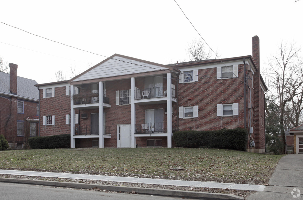
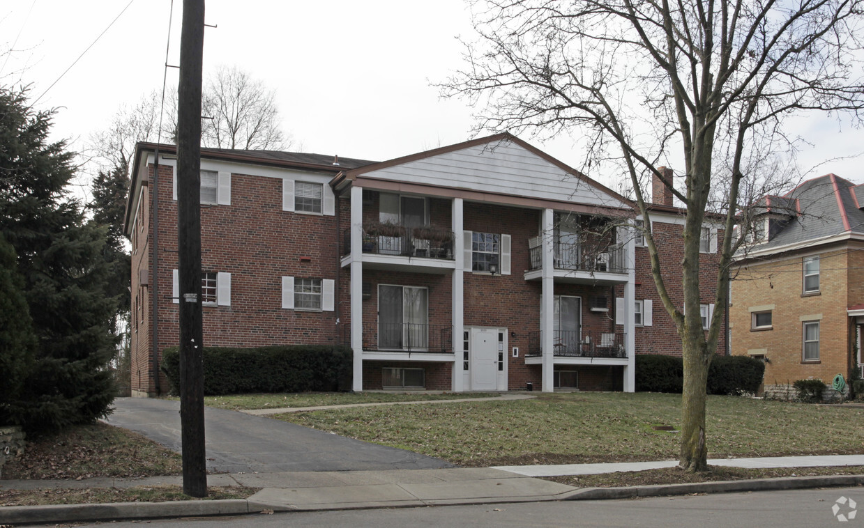
Meet your new home at Arnsby Apartments in Cincinnati. The 45227 location in Cincinnati has much to offer its residents. The knowledgeable leasing staff is waiting to show you all that this community has in store. Be sure to see the current floorplan options. Experience a new standard at Arnsby Apartments.
Arnsby Apartments is an apartment community located in Hamilton County and the 45227 ZIP Code. This area is served by the Cincinnati Public Schools attendance zone.
Madisonville is a fast-growing community along Cincinnati's eastern border. The neighborhood's proximity to excellent schools, restaurants, and businesses attracts downtown commuters, families, and Cincinnati newcomers to this affordable and convenient area.
Whether you value proximity to major business chains or are looking for somewhere with plenty of entertainment options, Madisonville is a great match for you. With a wide selection of residential options, all located a short drive from the Red Bank Expressway, traveling from home to anywhere in the neighborhood is a breeze. Madisonville delights with some of the most interesting styles of homes anywhere in Cincinnati. Craftsman houses share streets with Victorians, and Colonial-style homes meet more contemporary apartments.
Situated between Columbia Parkway and Interstate 71, this neighborhood is convenient for residents and travelers alike.
Learn more about living in MadisonvilleCompare neighborhood and city base rent averages by bedroom.
| Madisonville | Cincinnati, OH | |
|---|---|---|
| Studio | $1,399 | $1,069 |
| 1 Bedroom | $1,473 | $1,141 |
| 2 Bedrooms | $1,613 | $1,434 |
| 3 Bedrooms | $1,862 | $1,752 |
| Colleges & Universities | Distance | ||
|---|---|---|---|
| Colleges & Universities | Distance | ||
| Drive: | 13 min | 5.0 mi | |
| Drive: | 14 min | 6.7 mi | |
| Drive: | 15 min | 6.8 mi | |
| Drive: | 15 min | 8.5 mi |


Transportation options available in Cincinnati include Hanke Exchange Station - 12Th & Main, located 8.1 miles from Arnsby Apartments. Arnsby Apartments is near Cincinnati/Northern Kentucky International, located 22.7 miles or 41 minutes away.
| Transit / Subway | Distance | ||
|---|---|---|---|
| Transit / Subway | Distance | ||
| Drive: | 16 min | 8.1 mi | |
| Drive: | 16 min | 8.3 mi | |
| Drive: | 16 min | 8.4 mi | |
| Drive: | 17 min | 8.4 mi | |
| Drive: | 18 min | 8.8 mi |
| Commuter Rail | Distance | ||
|---|---|---|---|
| Commuter Rail | Distance | ||
|
|
Drive: | 20 min | 10.6 mi |
| Airports | Distance | ||
|---|---|---|---|
| Airports | Distance | ||
|
Cincinnati/Northern Kentucky International
|
Drive: | 41 min | 22.7 mi |
Scores provided by
Traffic
-Airport
-Businesses
-Scores provided by
HowLoud What is a Sound Score Rating? A Sound Score Rating aggregates noise caused by vehicle traffic, airplane traffic and local sources. How It WorksTime and distance from Arnsby Apartments.
| Shopping Centers | Distance | ||
|---|---|---|---|
| Shopping Centers | Distance | ||
| Walk: | 9 min | 0.5 mi | |
| Walk: | 15 min | 0.8 mi | |
| Walk: | 18 min | 1.0 mi |
| Parks and Recreation | Distance | ||
|---|---|---|---|
| Parks and Recreation | Distance | ||
|
Cincinnati Observatory
|
Drive: | 5 min | 1.9 mi |
|
Ault Park
|
Drive: | 5 min | 1.9 mi |
|
Rowe Arboretum
|
Drive: | 8 min | 3.1 mi |
|
Otto Armleder Park
|
Drive: | 8 min | 3.1 mi |
|
Avoca Trailhead
|
Drive: | 9 min | 3.4 mi |
| Hospitals | Distance | ||
|---|---|---|---|
| Hospitals | Distance | ||
| Drive: | 8 min | 4.1 mi | |
| Drive: | 8 min | 4.7 mi | |
| Drive: | 13 min | 8.6 mi |
| Military Bases | Distance | ||
|---|---|---|---|
| Military Bases | Distance | ||
| Drive: | 69 min | 54.0 mi | |
| Drive: | 75 min | 59.0 mi | |
| Drive: | 78 min | 62.3 mi |
What Are Walk Score®, Transit Score®, and Bike Score® Ratings?
Walk Score® measures the walkability of any address. Transit Score® measures access to public transit. Bike Score® measures the bikeability of any address.
What is a Sound Score Rating?
A Sound Score Rating aggregates noise caused by vehicle traffic, airplane traffic and local sources.


