
Adara
888 N 4th St,
Phoenix, AZ 85004
$740 - $3,000
Studio - 4 Beds
Bedrooms
1 - 2 bd
Bathrooms
1 - 2 ba
Square Feet
781 - 1,152 sq ft
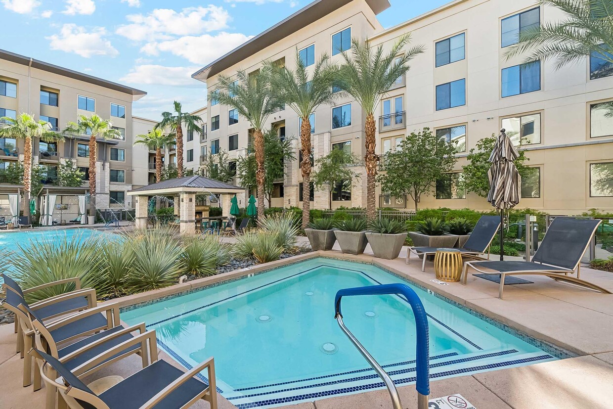
You'll feel right at home in one of our custom decorated apartments, featuring luxurious quartz counters, stainless-steel appliances, modern slab-style cabinetry, and incredible views of Squaw Peak Mountain. Browse our available apartments to see how Altitude Sixteen 75 can upgrade your lifestyle! Disclaimer: All square foot measurements are approximate. Prices, availability, and interior specifications may vary and are subject to change.
Altitude Sixteen 75 is an apartment community located in Maricopa County and the 85020 ZIP Code. This area is served by the Madison Elementary District attendance zone.
Unique Features
Pool
Fitness Center
Clubhouse
Business Center
Walk-In Closets
Granite Countertops
Refrigerator
Fireplace
North Phoenix refers to the vast swath of land that stretches from Bethany Home Road up towards the Phoenix mountains. Bounded to the east by State Route 51 and to the west by 51st Avenue, North Phoenix is home a slew of diverse communities and neighborhoods all offering a variety of rentals ranging from the upscale to the more affordable. There are numerous golf courses and of course the mountains that offer residents a number of outdoor activities to engage in. For shopping and dining, residents head to Desert Ridge Marketplace on High Street, which is filled with upscale boutiques, nightlife hotspots, restaurants, and more. Interstate 17 and Route 101 make commuting around this desirable area simple.
Learn more about living in North Phoenix| Colleges & Universities | Distance | ||
|---|---|---|---|
| Colleges & Universities | Distance | ||
| Drive: | 10 min | 4.8 mi | |
| Drive: | 11 min | 5.0 mi | |
| Drive: | 15 min | 7.2 mi | |
| Drive: | 17 min | 7.2 mi |


Transportation options available in Phoenix include Glendale/19Th Ave, located 3.9 miles from Altitude Sixteen 75. Altitude Sixteen 75 is near Phoenix Sky Harbor International, located 10.4 miles or 18 minutes away, and Phoenix-Mesa Gateway, located 37.2 miles or 50 minutes away.
| Transit / Subway | Distance | ||
|---|---|---|---|
| Transit / Subway | Distance | ||
|
|
Drive: | 8 min | 3.9 mi |
|
|
Drive: | 9 min | 4.1 mi |
|
|
Drive: | 10 min | 4.7 mi |
|
|
Drive: | 10 min | 4.8 mi |
|
|
Drive: | 10 min | 4.8 mi |
| Commuter Rail | Distance | ||
|---|---|---|---|
| Commuter Rail | Distance | ||
|
|
Drive: | 50 min | 38.3 mi |
| Airports | Distance | ||
|---|---|---|---|
| Airports | Distance | ||
|
Phoenix Sky Harbor International
|
Drive: | 18 min | 10.4 mi |
|
Phoenix-Mesa Gateway
|
Drive: | 50 min | 37.2 mi |
Time and distance from Altitude Sixteen 75.
| Shopping Centers | Distance | ||
|---|---|---|---|
| Shopping Centers | Distance | ||
| Walk: | 14 min | 0.7 mi | |
| Walk: | 16 min | 0.8 mi | |
| Walk: | 16 min | 0.9 mi |
| Parks and Recreation | Distance | ||
|---|---|---|---|
| Parks and Recreation | Distance | ||
|
Granada Park
|
Drive: | 4 min | 1.6 mi |
|
Desert Storm Park
|
Drive: | 5 min | 2.7 mi |
|
North Mountain Park
|
Drive: | 8 min | 3.7 mi |
|
Tonto National Forest
|
Drive: | 9 min | 4.8 mi |
|
Dreamy Draw Recreation Area
|
Drive: | 8 min | 5.0 mi |
| Hospitals | Distance | ||
|---|---|---|---|
| Hospitals | Distance | ||
| Drive: | 7 min | 3.0 mi | |
| Drive: | 7 min | 4.3 mi | |
| Drive: | 9 min | 4.3 mi |
| Military Bases | Distance | ||
|---|---|---|---|
| Military Bases | Distance | ||
| Drive: | 18 min | 10.2 mi | |
| Drive: | 37 min | 18.9 mi | |
| Drive: | 108 min | 81.8 mi |
What Are Walk Score®, Transit Score®, and Bike Score® Ratings?
Walk Score® measures the walkability of any address. Transit Score® measures access to public transit. Bike Score® measures the bikeability of any address.
What is a Sound Score Rating?
A Sound Score Rating aggregates noise caused by vehicle traffic, airplane traffic and local sources

1675 E Morten Ave
Phoenix, AZ 85020


