
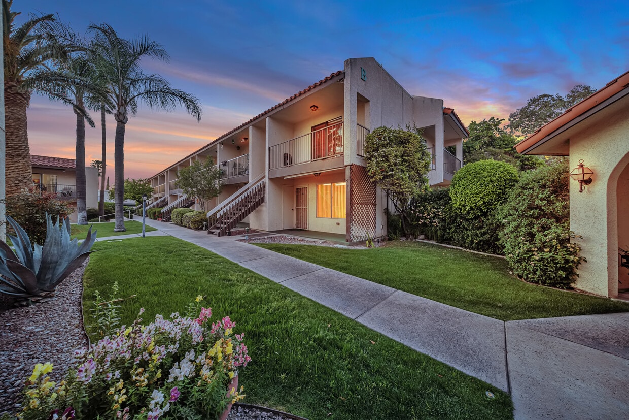
Villas Las Naranjas
1345 S Kolb Rd,
Tucson, AZ 85710
$749 - $1,399
Studio - 3 Beds
Bedrooms
1 - 2 bd
Bathrooms
1 - 2 ba
Square Feet
580 - 943 sq ft
The Tucson East Apartments provide residents with roomy and reasonably priced one and two-bedroom homes. Positioned on the East Side, the location is conveniently close to medical facilities, public transportation, and shopping centers. The community offers a variety of amenities, including a laundry room, clubhouse, organized tenant activities, heated spa and pool, gas barbeque grills, and on-site management. Additionally, the property is gated for added security. Tucson East is located in Pima County within the 85710 ZIP Code, and falls under the attendance zone of the Tucson Unified District.
Tucson East is an apartment community located in Pima County and the 85710 ZIP Code. This area is served by the Tucson Unified District attendance zone.
Ward 2 is a sprawling area along the Pantano Wash backed by the Santa Catalina Mountains. The thriving town features residential neighborhoods, local parks, medical facilities, shopping centers, and more. The Tucson Medical Center is situated in the north end of town and provides not only high-quality healthcare but an abundance of jobs as well. The commercial section of town is centered around East Grant Road, featuring boutiques, big-box stores, and a variety of restaurants. Golf Courses, parks, and waterfront trails dot Ward 2, providing outdoor recreation. While Ward 2 has a lot to offer on its own, places like the Tucson Botanical Gardens, Park Place Mall, and Downtown Tucson are all within minutes of town as well. A plethora of apartments, houses, condos, and townhomes make up the neighborhood’s diverse rental scene.
Learn more about living in Ward 2Compare neighborhood and city base rent averages by bedroom.
| Ward 2 | Tucson, AZ | |
|---|---|---|
| Studio | $759 | $789 |
| 1 Bedroom | $903 | $987 |
| 2 Bedrooms | $1,170 | $1,268 |
| 3 Bedrooms | $1,556 | $1,685 |
| Colleges & Universities | Distance | ||
|---|---|---|---|
| Colleges & Universities | Distance | ||
| Drive: | 11 min | 5.3 mi | |
| Drive: | 20 min | 9.5 mi | |
| Drive: | 23 min | 11.0 mi | |
| Drive: | 24 min | 12.8 mi |


Transportation options available in Tucson include Sl/2Nd St/Cherry Av, located 9.1 miles from Tucson East. Tucson East is near Tucson International, located 14.4 miles or 26 minutes away.
| Transit / Subway | Distance | ||
|---|---|---|---|
| Transit / Subway | Distance | ||
| Drive: | 19 min | 9.1 mi | |
| Drive: | 19 min | 9.2 mi | |
| Drive: | 20 min | 9.3 mi | |
| Drive: | 20 min | 9.5 mi | |
| Drive: | 21 min | 9.5 mi |
| Commuter Rail | Distance | ||
|---|---|---|---|
| Commuter Rail | Distance | ||
|
|
Drive: | 20 min | 10.8 mi |
|
|
Drive: | 53 min | 42.9 mi |
| Airports | Distance | ||
|---|---|---|---|
| Airports | Distance | ||
|
Tucson International
|
Drive: | 26 min | 14.4 mi |
Scores provided by
Traffic
ActiveAirport
CalmBusinesses
ActiveScores provided by
HowLoud What is a Sound Score Rating? A Sound Score Rating aggregates noise caused by vehicle traffic, airplane traffic and local sources. How It WorksTime and distance from Tucson East.
| Shopping Centers | Distance | ||
|---|---|---|---|
| Shopping Centers | Distance | ||
| Walk: | 13 min | 0.7 mi | |
| Walk: | 14 min | 0.7 mi | |
| Walk: | 18 min | 1.0 mi |
| Parks and Recreation | Distance | ||
|---|---|---|---|
| Parks and Recreation | Distance | ||
|
Jesse Owens Park
|
Walk: | 17 min | 0.9 mi |
|
Case Park
|
Walk: | 17 min | 0.9 mi |
|
Stefan Gollob Park
|
Drive: | 5 min | 2.1 mi |
|
Palo Verde Park
|
Drive: | 7 min | 2.8 mi |
|
Lakeside (Charles Ford) Park
|
Drive: | 9 min | 4.2 mi |
| Hospitals | Distance | ||
|---|---|---|---|
| Hospitals | Distance | ||
| Drive: | 6 min | 3.2 mi | |
| Drive: | 8 min | 4.2 mi | |
| Drive: | 11 min | 5.8 mi |
| Military Bases | Distance | ||
|---|---|---|---|
| Military Bases | Distance | ||
| Drive: | 11 min | 6.4 mi | |
| Drive: | 27 min | 14.5 mi | |
| Drive: | 87 min | 69.7 mi |
Pets Allowed Fitness Center In Unit Washer & Dryer Maintenance on site Stainless Steel Appliances Ceiling Fans Granite Countertops
What Are Walk Score®, Transit Score®, and Bike Score® Ratings?
Walk Score® measures the walkability of any address. Transit Score® measures access to public transit. Bike Score® measures the bikeability of any address.
What is a Sound Score Rating?
A Sound Score Rating aggregates noise caused by vehicle traffic, airplane traffic and local sources.

8490 E Old Spanish Trl
Tucson, AZ 85710


