
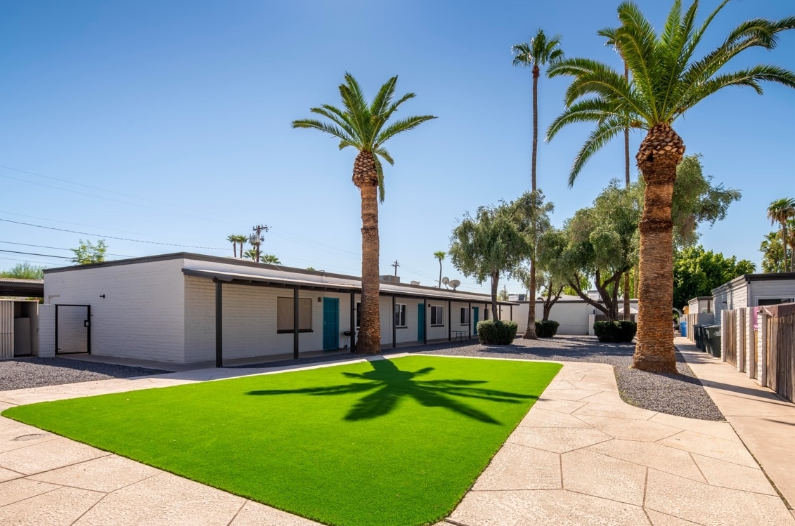
Adara
888 N 4th St,
Phoenix, AZ 85004
$741 - $3,461 Total Monthly Price
Studio - 4 Beds 12 Month Lease

Come enjoy Phoenix living at Agave. Located at 6801 N 17th Ave in Phoenix, this community has much to offer its residents. The professional leasing staff is ready to help you find your new home. Experience a new standard at Agave.
Agave is an apartment community located in Maricopa County and the 85015 ZIP Code. This area is served by the Washington Elementary School District attendance zone.
North Phoenix refers to the vast swath of land that stretches from Bethany Home Road up towards the Phoenix mountains. Bounded to the east by State Route 51 and to the west by 51st Avenue, North Phoenix is home a slew of diverse communities and neighborhoods all offering a variety of rentals ranging from the upscale to the more affordable. There are numerous golf courses and of course the mountains that offer residents a number of outdoor activities to engage in. For shopping and dining, residents head to Desert Ridge Marketplace on High Street, which is filled with upscale boutiques, nightlife hotspots, restaurants, and more. Interstate 17 and Route 101 make commuting around this desirable area simple.
Learn more about living in North PhoenixCompare neighborhood and city base rent averages by bedroom.
| North Phoenix | Phoenix, AZ | |
|---|---|---|
| Studio | $1,037 | $1,088 |
| 1 Bedroom | $1,084 | $1,301 |
| 2 Bedrooms | $1,502 | $1,562 |
| 3 Bedrooms | $2,299 | $2,084 |
| Colleges & Universities | Distance | ||
|---|---|---|---|
| Colleges & Universities | Distance | ||
| Drive: | 6 min | 2.7 mi | |
| Drive: | 7 min | 2.8 mi | |
| Drive: | 10 min | 3.9 mi | |
| Drive: | 11 min | 4.1 mi |


Transportation options available in Phoenix include Glendale/19Th Ave, located 0.5 mile from Agave. Agave is near Phoenix Sky Harbor International, located 12.7 miles or 22 minutes away, and Phoenix-Mesa Gateway, located 39.5 miles or 54 minutes away.
| Transit / Subway | Distance | ||
|---|---|---|---|
| Transit / Subway | Distance | ||
|
|
Walk: | 9 min | 0.5 mi |
|
|
Drive: | 3 min | 1.4 mi |
|
|
Drive: | 3 min | 1.4 mi |
|
|
Drive: | 6 min | 2.5 mi |
|
|
Drive: | 6 min | 2.6 mi |
| Commuter Rail | Distance | ||
|---|---|---|---|
| Commuter Rail | Distance | ||
|
|
Drive: | 54 min | 40.6 mi |
| Airports | Distance | ||
|---|---|---|---|
| Airports | Distance | ||
|
Phoenix Sky Harbor International
|
Drive: | 22 min | 12.7 mi |
|
Phoenix-Mesa Gateway
|
Drive: | 54 min | 39.5 mi |
Scores provided by
Traffic
-Airport
-Businesses
-Scores provided by
HowLoud What is a Sound Score Rating? A Sound Score Rating aggregates noise caused by vehicle traffic, airplane traffic and local sources. How It WorksTime and distance from Agave.
| Shopping Centers | Distance | ||
|---|---|---|---|
| Shopping Centers | Distance | ||
| Walk: | 7 min | 0.4 mi | |
| Drive: | 4 min | 1.2 mi | |
| Drive: | 4 min | 1.4 mi |
| Parks and Recreation | Distance | ||
|---|---|---|---|
| Parks and Recreation | Distance | ||
|
Granada Park
|
Drive: | 9 min | 4.0 mi |
|
Steele Indian School Park
|
Drive: | 10 min | 4.4 mi |
|
North Mountain Park
|
Drive: | 10 min | 4.9 mi |
|
Desert Storm Park
|
Drive: | 9 min | 5.0 mi |
|
Dreamy Draw Recreation Area
|
Drive: | 13 min | 8.3 mi |
| Hospitals | Distance | ||
|---|---|---|---|
| Hospitals | Distance | ||
| Walk: | 13 min | 0.7 mi | |
| Drive: | 3 min | 1.3 mi | |
| Drive: | 7 min | 3.6 mi |
| Military Bases | Distance | ||
|---|---|---|---|
| Military Bases | Distance | ||
| Drive: | 22 min | 12.5 mi | |
| Drive: | 30 min | 14.9 mi | |
| Drive: | 104 min | 77.9 mi |
Pets Allowed Fitness Center Pool Dishwasher Grill Hardwood Floors Individual Locking Bedrooms
Pets Allowed Fitness Center Pool Dishwasher In Unit Washer & Dryer Stainless Steel Appliances Controlled Access
Pets Allowed Fitness Center Pool Dishwasher In Unit Washer & Dryer Stainless Steel Appliances EV Charging
Pets Allowed Dishwasher In Unit Washer & Dryer Stainless Steel Appliances Controlled Access Granite Countertops Hardwood Floors
What Are Walk Score®, Transit Score®, and Bike Score® Ratings?
Walk Score® measures the walkability of any address. Transit Score® measures access to public transit. Bike Score® measures the bikeability of any address.
What is a Sound Score Rating?
A Sound Score Rating aggregates noise caused by vehicle traffic, airplane traffic and local sources.
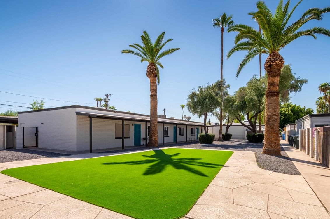
6801 N 17th Ave
Phoenix, AZ 85015


