
Four Corners Apartments
8102 Evergreen Way,
Everett, WA 98203
$1,475 - $2,909
1-5 Beds

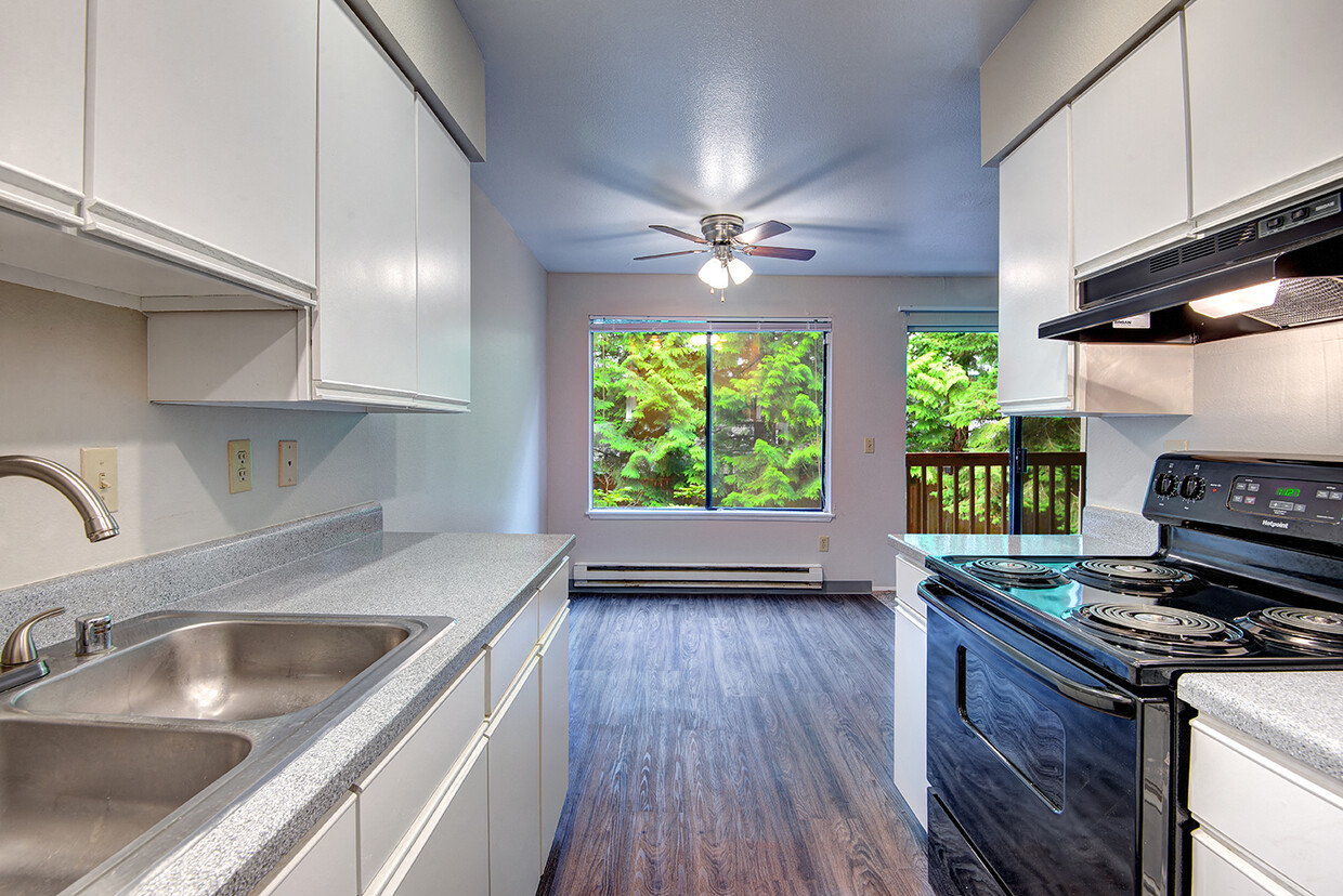
Welcome home to Aerohaven Apartments. Come and see our spacious, newly renovated Everett, WA apartments for rent. We have a wide selection of floor plans, including one- and two-bedroom apartments with plenty of room for you and yours to stretch out and relax. Each of our homes comes with a complete appliance package, including a dishwasher, range, oven, and refrigerator, wood-style flooring in common areas, carpeted bedrooms, and of course, the all-important oversized closets giving you a ton of storage space.
Aerohaven is an apartment community located in Snohomish County and the 98204 ZIP Code. This area is served by the Mukilteo attendance zone.
Laundry Facilities
Playground
Recycling
24 Hour Access
Dishwasher
High Speed Internet Access
Walk-In Closets
Refrigerator
Tub/Shower
Disposal
Freezer
Fireplace
Paine Field-Lake Stickney is an amenity-laden neighborhood located about eight miles south of Downtown Everett. The neighborhood is a mix of industrial, commercial, and residential areas. Paine Field, a large industrial airport primarily used by Boeing's sprawling airplane manufacturing plant, dominates the northwest end of the neighborhood. Along with restaurants, stores, grocers, and parks, Paine Field-Lake Stickney has a variety of entertainment options in the neighborhood. Go ziplining at High Trek Adventures Seattle, visit a casino, or explore Lake Stickney Park. Paine Field-Lake Stickney’s rental options are just as vast as its amenities. The neighborhood has apartments, townhomes, houses, and condos for every style and budget. Several major highways like Interstate 5 run through Paine Field-Lake Stickney so commuting into Downtown Everett and Seattle is made easy.
Learn more about living in Paine Field-Lake Stickney| Colleges & Universities | Distance | ||
|---|---|---|---|
| Colleges & Universities | Distance | ||
| Drive: | 14 min | 7.0 mi | |
| Drive: | 18 min | 9.3 mi | |
| Drive: | 18 min | 12.7 mi | |
| Drive: | 24 min | 14.2 mi |


Transportation options available in Everett include Lynnwood City Center, located 7.2 miles from Aerohaven. Aerohaven is near Seattle Paine Field International, located 2.2 miles or 5 minutes away, and Seattle-Tacoma International, located 36.5 miles or 52 minutes away.
| Transit / Subway | Distance | ||
|---|---|---|---|
| Transit / Subway | Distance | ||
| Drive: | 13 min | 7.2 mi | |
| Drive: | 19 min | 12.5 mi | |
| Drive: | 21 min | 14.0 mi |
| Commuter Rail | Distance | ||
|---|---|---|---|
| Commuter Rail | Distance | ||
|
|
Drive: | 13 min | 6.3 mi |
|
|
Drive: | 14 min | 7.7 mi |
|
|
Drive: | 21 min | 10.1 mi |
|
|
Drive: | 33 min | 23.2 mi |
|
|
Drive: | 44 min | 31.7 mi |
| Airports | Distance | ||
|---|---|---|---|
| Airports | Distance | ||
|
Seattle Paine Field International
|
Drive: | 5 min | 2.2 mi |
|
Seattle-Tacoma International
|
Drive: | 52 min | 36.5 mi |
Time and distance from Aerohaven.
| Shopping Centers | Distance | ||
|---|---|---|---|
| Shopping Centers | Distance | ||
| Walk: | 5 min | 0.3 mi | |
| Walk: | 7 min | 0.4 mi | |
| Walk: | 13 min | 0.7 mi |
| Parks and Recreation | Distance | ||
|---|---|---|---|
| Parks and Recreation | Distance | ||
|
Sullivan Park-Silver Lake
|
Drive: | 5 min | 1.9 mi |
|
Green Lantern Park
|
Drive: | 6 min | 2.4 mi |
|
Hauge Homestead Park
|
Drive: | 8 min | 2.9 mi |
|
Hannabrook Park
|
Drive: | 10 min | 4.2 mi |
|
Picnic Point Park
|
Drive: | 12 min | 5.4 mi |
| Hospitals | Distance | ||
|---|---|---|---|
| Hospitals | Distance | ||
| Drive: | 15 min | 8.1 mi | |
| Drive: | 17 min | 9.1 mi |
| Military Bases | Distance | ||
|---|---|---|---|
| Military Bases | Distance | ||
| Drive: | 16 min | 7.0 mi | |
| Drive: | 43 min | 22.7 mi | |
| Drive: | 62 min | 27.2 mi |
What Are Walk Score®, Transit Score®, and Bike Score® Ratings?
Walk Score® measures the walkability of any address. Transit Score® measures access to public transit. Bike Score® measures the bikeability of any address.
What is a Sound Score Rating?
A Sound Score Rating aggregates noise caused by vehicle traffic, airplane traffic and local sources
1020 112th St SW
Everett, WA 98204


