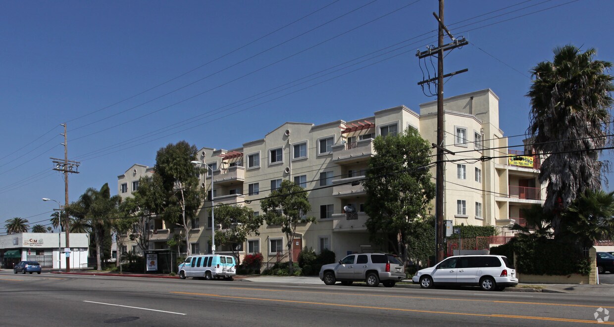
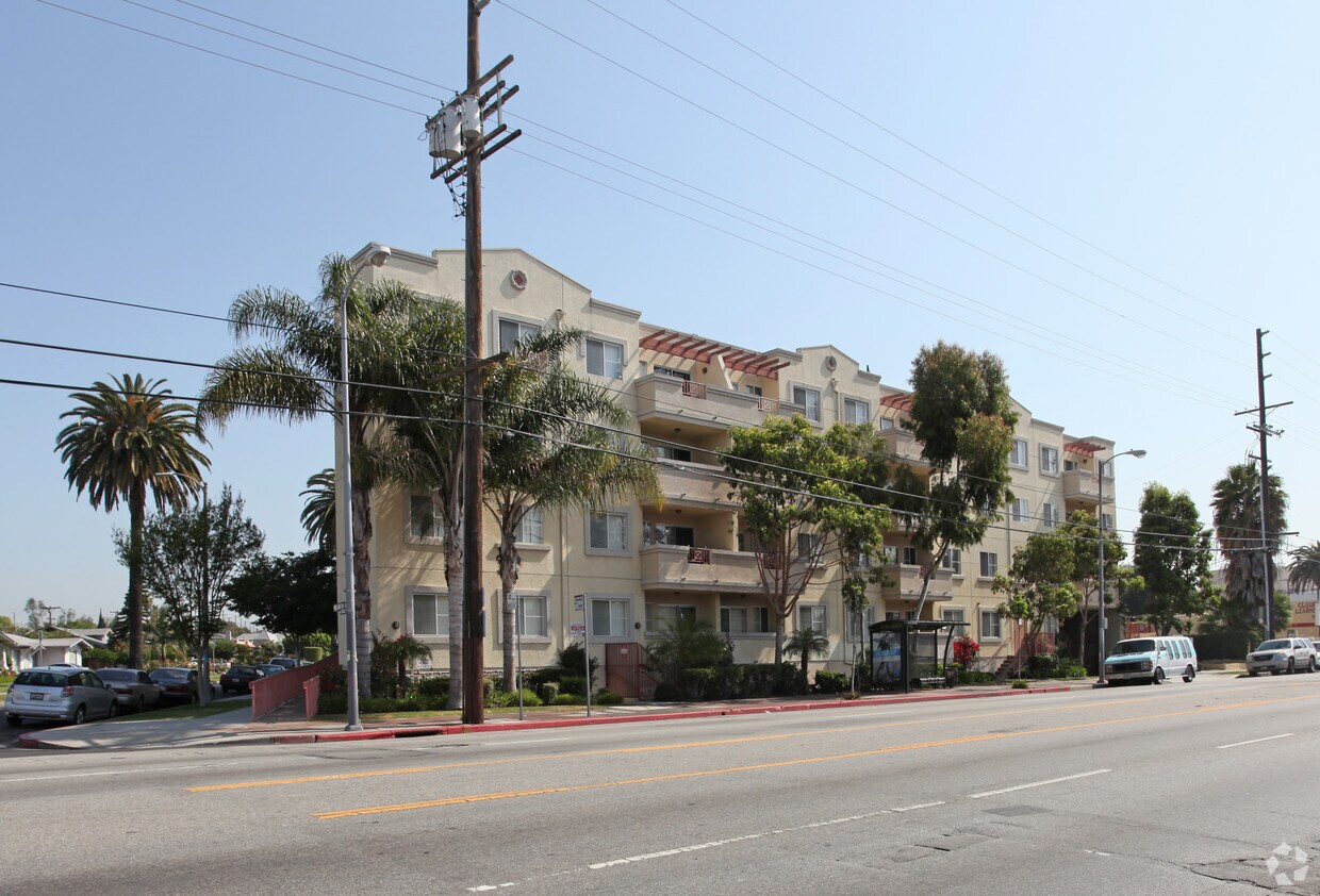
Park East
200 Mesnager St,
Los Angeles, CA 90012
Studio - 2 Beds $975 - $4,179


At Adams City Lights Foundation in Los Angeles, CA, experience great living. This community is located at 4471 W. Adams Blvd in the 90016 area of Los Angeles. Be sure to come for a visit to check out the current floorplan options. The professional leasing staff is ready and waiting for you to come for a visit. Come see Adams City Lights Foundation today.
Adams City Lights Foundation is an apartment community located in Los Angeles County and the 90016 ZIP Code. This area is served by the Los Angeles Unified attendance zone.
Located in the western part of Los Angeles, West Adams is home to a variety of popular attractions and places. West Adams residents enjoy being less than 10 miles from Downtown Los Angeles, making the neighborhood a short drive from places like the Los Angeles Convention Center, Staples Center, and the Los Angeles County Museum of Art. In addition, the community is close to the University of Southern California and Los Angeles Trade Technical College. The neighborhood itself features a number of small businesses, restaurants, bars, and shops as well as a few small parks for residents to enjoy. Those looking to rent in West Adams will find a variety of rental choices throughout the neighborhood’s well-populated streets.
Learn more about living in West Adams| Colleges & Universities | Distance | ||
|---|---|---|---|
| Colleges & Universities | Distance | ||
| Drive: | 6 min | 3.9 mi | |
| Drive: | 7 min | 4.0 mi | |
| Drive: | 8 min | 4.2 mi | |
| Drive: | 11 min | 4.7 mi |
 The GreatSchools Rating helps parents compare schools within a state based on a variety of school quality indicators and provides a helpful picture of how effectively each school serves all of its students. Ratings are on a scale of 1 (below average) to 10 (above average) and can include test scores, college readiness, academic progress, advanced courses, equity, discipline and attendance data. We also advise parents to visit schools, consider other information on school performance and programs, and consider family needs as part of the school selection process.
Transportation options available in Los Angeles include Expo/Crenshaw, located 0.9 mile from Adams City Lights Foundation. Adams City Lights Foundation is near Los Angeles International, located 9.1 miles or 18 minutes away, and Bob Hope, located 14.9 miles or 26 minutes away.
| Transit / Subway | Distance | ||
|---|---|---|---|
| Transit / Subway | Distance | ||
|
|
Walk: | 16 min | 0.9 mi |
|
|
Walk: | 18 min | 1.0 mi |
|
|
Drive: | 3 min | 1.4 mi |
| Drive: | 4 min | 1.9 mi | |
|
|
Drive: | 5 min | 2.5 mi |
| Commuter Rail | Distance | ||
|---|---|---|---|
| Commuter Rail | Distance | ||
|
|
Drive: | 11 min | 7.1 mi |
|
|
Drive: | 13 min | 7.2 mi |
|
|
Drive: | 17 min | 10.0 mi |
| Drive: | 15 min | 11.1 mi | |
|
|
Drive: | 23 min | 13.7 mi |
| Airports | Distance | ||
|---|---|---|---|
| Airports | Distance | ||
|
Los Angeles International
|
Drive: | 18 min | 9.1 mi |
|
Bob Hope
|
Drive: | 26 min | 14.9 mi |
Time and distance from Adams City Lights Foundation.
| Shopping Centers | Distance | ||
|---|---|---|---|
| Shopping Centers | Distance | ||
| Walk: | 5 min | 0.3 mi | |
| Walk: | 13 min | 0.7 mi | |
| Walk: | 18 min | 1.0 mi |
| Parks and Recreation | Distance | ||
|---|---|---|---|
| Parks and Recreation | Distance | ||
|
Kenneth Hahn State Recreation Area
|
Drive: | 8 min | 3.1 mi |
|
La Brea Tar Pits
|
Drive: | 7 min | 3.6 mi |
|
Natural History Museum of LA County
|
Drive: | 7 min | 3.7 mi |
|
Exposition Park Rose Garden
|
Drive: | 7 min | 3.8 mi |
|
Zimmer Children's Museum
|
Drive: | 7 min | 4.2 mi |
| Hospitals | Distance | ||
|---|---|---|---|
| Hospitals | Distance | ||
| Drive: | 4 min | 2.7 mi | |
| Drive: | 6 min | 3.3 mi | |
| Drive: | 6 min | 3.5 mi |
| Military Bases | Distance | ||
|---|---|---|---|
| Military Bases | Distance | ||
| Drive: | 18 min | 10.7 mi |
What Are Walk Score®, Transit Score®, and Bike Score® Ratings?
Walk Score® measures the walkability of any address. Transit Score® measures access to public transit. Bike Score® measures the bikeability of any address.
What is a Sound Score Rating?
A Sound Score Rating aggregates noise caused by vehicle traffic, airplane traffic and local sources