
$7,945
Total Monthly Price
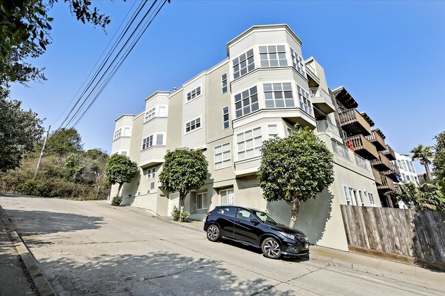
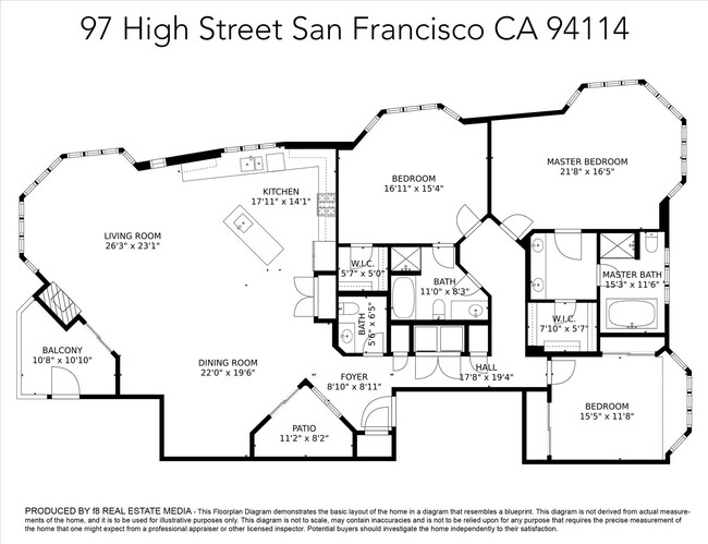
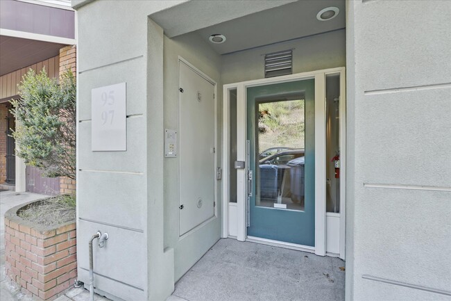
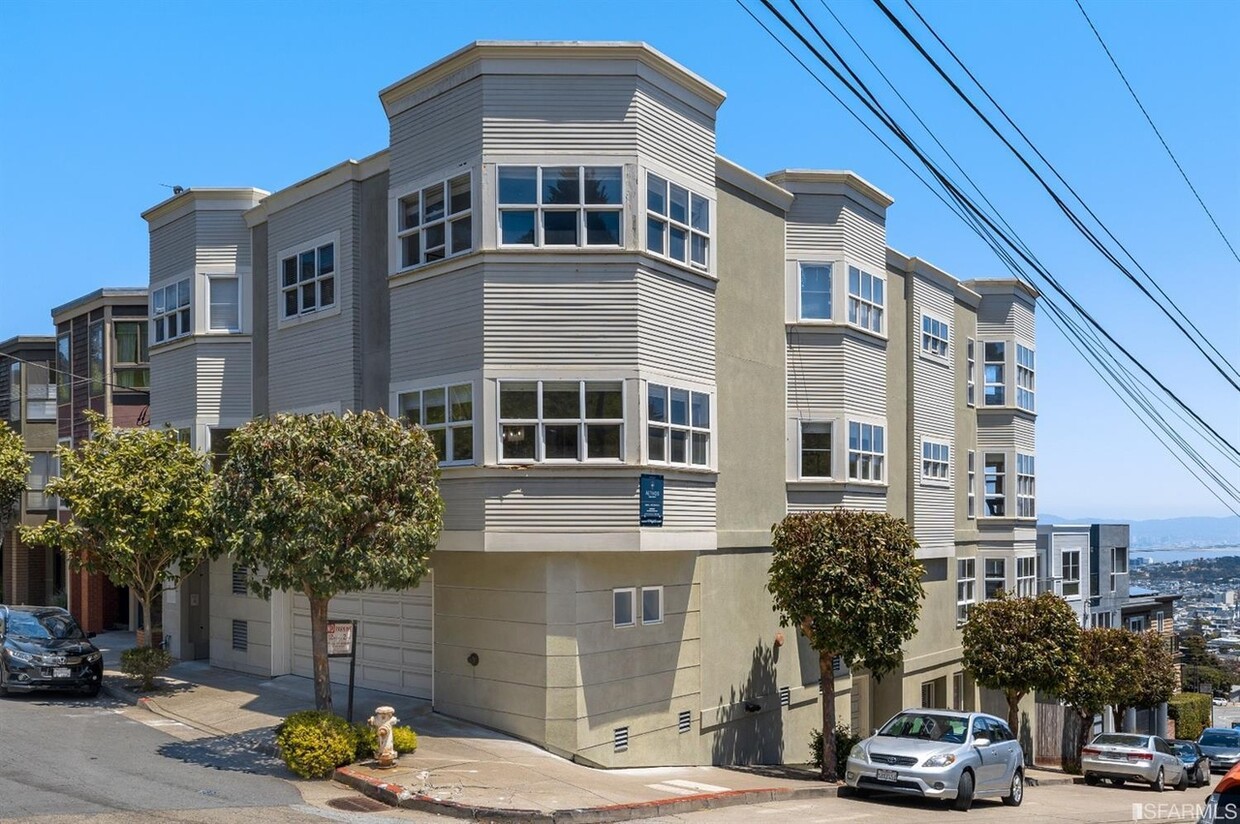
97 High St
San Francisco, CA 94114
Favorites
97 High St

Favorites
Check Back Soon for Upcoming Availability
| Beds | Baths | Average SF |
|---|---|---|
| 3 Bedrooms 3 Bedrooms 3 Br | 2.5 Baths 2.5 Baths 2.5 Ba | 2,332 SF |
Fees and Policies
The fees listed below are community-provided and may exclude utilities or add-ons. All payments are made directly to the property and are non-refundable unless otherwise specified.
- Dogs Allowed
-
Fees not specified
- Cats Allowed
-
Fees not specified
- Parking
-
Garage--
Details
Utilities Included
-
Gas
-
Water
-
Trash Removal
-
Sewer
Property Information
-
3 units
About This Property
This home is managed by Belong. Belong offers a new kind of rental experience with 24/7 support, concierge service, and an app to pay rent and report repairs. To schedule tours or apply for this home, reach out directly through the Belong website!
97 High St is an apartment community located in San Francisco County and the 94114 ZIP Code. This area is served by the San Francisco Unified School District attendance zone.
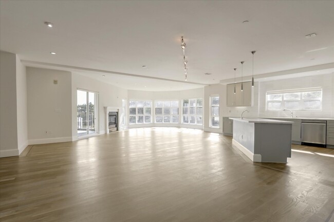
Apartment Features
Washer/Dryer
Dishwasher
Refrigerator
Disposal
- Washer/Dryer
- Heating
- Storage Space
- Fireplace
- Intercom
- Dishwasher
- Disposal
- Kitchen
- Range
- Refrigerator
- Concierge
- Yard
- Garden
97 High St,
San Francisco,
CA
94114
Noe Valley is in central San Francisco, encompassed by modern comforts. Many renters choose Noe Valley apartments because of the convenient access to city transit. The SFMTA Light Rails pick up along Church Street, and BART 24th Street Mission Station is a short walk away.
Most of the neighborhood’s bars, eateries, and bakeries are found along 24th Street. A couple of green spaces are in Noe Valley, such as Upper Noe Recreation Center and Noe Valley Courts. Residents enjoy hiking along the trails at nearby Twin Peaks and perusing the luxury jewelry shops and boutiques in town3.
Learn more about living in Noe ValleyBelow are rent ranges for similar nearby apartments
Amenities
- Washer/Dryer
- Heating
- Storage Space
- Fireplace
- Intercom
- Dishwasher
- Disposal
- Kitchen
- Range
- Refrigerator
- Concierge
- Yard
- Garden
Expenses
Utilities Included
Gas, Water, Trash Removal, Sewer
Included
Education
| Colleges & Universities | Distance | ||
|---|---|---|---|
| Colleges & Universities | Distance | ||
| Drive: | 7 min | 2.4 mi | |
| Drive: | 7 min | 3.2 mi | |
| Drive: | 10 min | 3.2 mi | |
| Drive: | 8 min | 3.5 mi |
97 High St is within 8 minutes or 3.5 miles from City College of San Francisco. It is also near UC San Francisco, Parnassus and University of San Francisco.
Schools


Public Elementary School
Grades K-5
Nearby
Public Elementary School
Grades K-5
538 Students
Attendance Zone
Public Middle School
Grades 6-8
479 Students
Attendance Zone
Public High School
Grades 9-12
123 Students
Attendance Zone
Public High School
Grades 9-12
680 Students
Attendance Zone
Private Elementary & Middle School
Grades PK-8
533 Students
Nearby
Private Elementary, Middle & High School
Grades K-12
Nearby
Private Elementary & Middle School
Grades PK-8
263 Students
Nearby
School data provided by
 The GreatSchools Rating helps parents compare schools within a state based on a variety of school quality indicators and provides a helpful picture of how effectively each school serves all of its students. Ratings are on a scale of 1 (below average) to 10 (above average) and can include test scores, college readiness, academic progress, advanced courses, equity, discipline and attendance data. We also advise parents to visit schools, consider other information on school performance and programs, and consider family needs as part of the school selection process.
View GreatSchools Rating Methodology
Data provided by GreatSchools.org © 2026. All rights reserved.
View GreatSchools Rating Methodology
Data provided by GreatSchools.org © 2026. All rights reserved.
Transportation options available in San Francisco include Church St & 26 St, located 1.0 mile from 97 High St. 97 High St is near San Francisco International, located 13.5 miles or 22 minutes away, and Metro Oakland International, located 23.4 miles or 38 minutes away.
| Transit / Subway | Distance | ||
|---|---|---|---|
| Transit / Subway | Distance | ||
| Walk: | 18 min | 1.0 mi | |
| Walk: | 20 min | 1.1 mi | |
| Drive: | 3 min | 1.2 mi | |
|
|
Drive: | 3 min | 1.2 mi |
| Drive: | 4 min | 1.3 mi |
| Commuter Rail | Distance | ||
|---|---|---|---|
| Commuter Rail | Distance | ||
| Drive: | 11 min | 4.4 mi | |
| Drive: | 12 min | 5.7 mi | |
| Drive: | 17 min | 10.1 mi | |
| Drive: | 19 min | 11.6 mi | |
|
|
Drive: | 27 min | 15.0 mi |
| Airports | Distance | ||
|---|---|---|---|
| Airports | Distance | ||
|
San Francisco International
|
Drive: | 22 min | 13.5 mi |
|
Metro Oakland International
|
Drive: | 38 min | 23.4 mi |
Walkability Near 97 High St San Francisco, CA 94114
Getting Around
 What do Walkability, Transit, Drivability, and Bikeability mean?
Walkability measures the walking distance to day-to-day needs.
Transit measures access to public transportation.
Drivability measures congestion, parking availability, and access to major roads.
Bikeability measures the suitability for cycling.
How It Works
What do Walkability, Transit, Drivability, and Bikeability mean?
Walkability measures the walking distance to day-to-day needs.
Transit measures access to public transportation.
Drivability measures congestion, parking availability, and access to major roads.
Bikeability measures the suitability for cycling.
How It Works
Very Walkable
Walkability
80
/ 100
Exceptional Public Transit
Transit
90
/ 100
Moderately Drivable
Drivability
70
/ 100
Moderately Bikeable
Bikeability
60
/ 100
Scores provided by
-
Soundscore™
-
/ 100
Traffic
-Airport
-Businesses
-Scores provided by
HowLoud What is a Sound Score Rating? A Sound Score Rating aggregates noise caused by vehicle traffic, airplane traffic and local sources. How It WorksTime and distance from 97 High St.
| Shopping Centers | Distance | ||
|---|---|---|---|
| Shopping Centers | Distance | ||
| Walk: | 11 min | 0.6 mi | |
| Drive: | 4 min | 1.5 mi | |
| Drive: | 5 min | 1.7 mi |
97 High St has 3 shopping centers within 1.7 miles, which is about a 5-minute drive. The miles and minutes will be for the farthest away property.
| Parks and Recreation | Distance | ||
|---|---|---|---|
| Parks and Recreation | Distance | ||
|
Buena Vista Park
|
Drive: | 6 min | 2.2 mi |
|
Randall Museum
|
Drive: | 6 min | 2.2 mi |
|
Conservatory of Flowers
|
Drive: | 7 min | 3.0 mi |
|
California Academy of Sciences
|
Drive: | 10 min | 3.8 mi |
|
Steinhart Aquarium
|
Drive: | 10 min | 3.8 mi |
97 High St has 5 parks within 3.8 miles, including Randall Museum, Buena Vista Park, and Conservatory of Flowers.
| Hospitals | Distance | ||
|---|---|---|---|
| Hospitals | Distance | ||
| Drive: | 3 min | 1.1 mi | |
| Drive: | 4 min | 1.4 mi | |
| Drive: | 5 min | 2.0 mi |
97 High St has 3 hospitals within 2.0 miles, the nearest is Laguna Honda Hospital & Rehabilitation Center which is 1.1 miles away and a 3 minute drive.
| Military Bases | Distance | ||
|---|---|---|---|
| Military Bases | Distance | ||
| Drive: | 15 min | 5.6 mi | |
| Drive: | 16 min | 6.1 mi | |
| Drive: | 20 min | 9.5 mi |
97 High St has 3 military bases within 9.5 miles, the nearest is East Fort Miley which is 5.6 miles away and a 15 minute drive.
You May Also Like
Similar Rentals Nearby
-
-
-
-
-
-
3 Beds$4,327+Total Monthly PriceTotal Monthly Price NewPrices include base rent and required monthly fees of $6. Variable costs based on usage may apply.Base Rent:3 Beds$4,320+1 Month Free
Pets Allowed Fitness Center Pool In Unit Washer & Dryer Clubhouse Stainless Steel Appliances Hardwood Floors
-
-
-
-


What Are Walk Score®, Transit Score®, and Bike Score® Ratings?
Walk Score® measures the walkability of any address. Transit Score® measures access to public transit. Bike Score® measures the bikeability of any address.
What is a Sound Score Rating?
A Sound Score Rating aggregates noise caused by vehicle traffic, airplane traffic and local sources.
97 High St
San Francisco, CA 94114