
$5,000
Total Monthly Price
96 Washburn Ave
Wellesley, MA 02481
Today
Favorites
781-789-8965
-
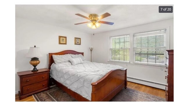
Bedrooms
4
-
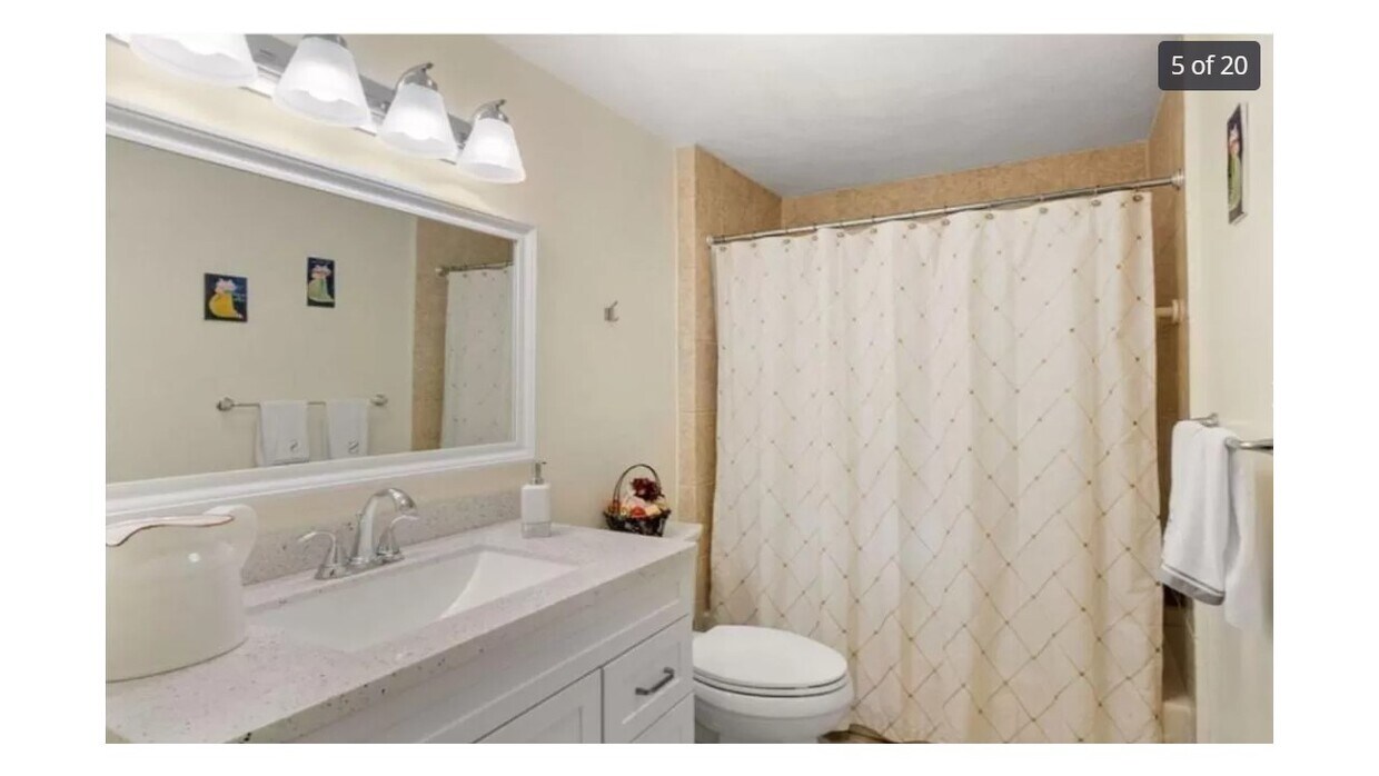
Bathrooms
2.25
-
Square Feet
2,100 sq ft
-
Available
Available Sep 15
96 Washburn Ave

Favorites
About This Home
$4,999 deposit,
Available Sep 15
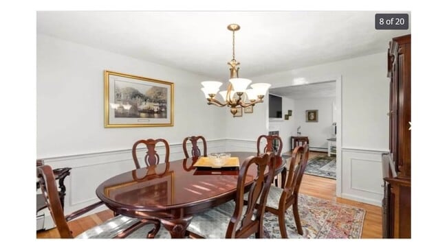
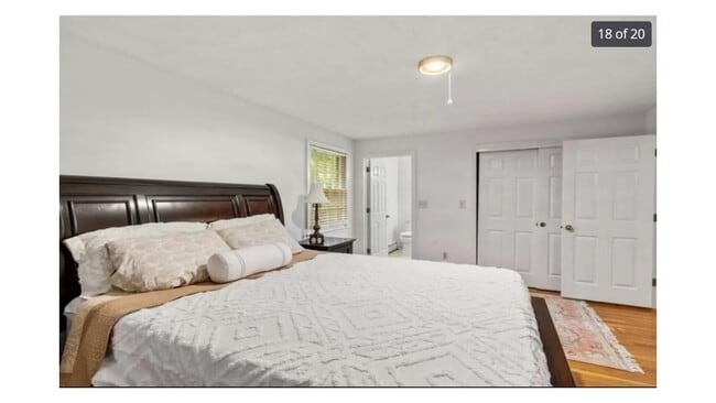
Well-Maintained Split-Level Home in Prime Location Conveniently located near top-rated schools, parks, Newton-Wellesley Hospital, and a variety of retail stores. This semi-furnished home features a formal dining room complete with a table, six chairs, and a china cabinet. The first floor also includes a full-size bed, two couches, additional seating, and a study desk. Enjoy easy access to major highways including the Mass Pike, Route 128, and Route 9. Colleges & Universities Distance Babson College ==> Drive: 8 min 3.1 mi Wellesley College ==> Drive: 9 min 3.5 mi Brandeis University ==> Drive: 12 min 4.7 mi Boston College ==> Drive: 14 min 6.9 mi 96 Washburn Ave is within 8 minutes or 3.1 miles from Babson College. It is also near Wellesley College and Brandeis University. Transportation options available in Wellesley include Woodland Station, located 2.2 miles from 96 Washburn Ave. 96 Washburn Ave is near General Edward Lawrence Logan International, located 16.2 miles or 27 minutes away, and Worcester Regional, located 33.6 miles or 57 minutes away. Transit / Subway: Woodland Station Green Line - D Drive: 5 min 2.2 mi Riverside Station Green Line - D Drive: 6 min 2.3 mi Waban Station Green Line - D Drive: 6 min 2.9 mi Newton Highlands Green Line - D Drive: 9 min 4.1 mi Commuter Rail Wellesley Hills Drive: 2 min 1.1 mi Wellesley Farms Drive: 4 min 1.4 mi Wellesley Square Drive: 5 min 2.5 mi Needham Heights Drive: 9 min 3.6 mi Auburndale Drive: 16 min 9.2 mi
96 Washburn Ave is a house located in Norfolk County and the 02481 ZIP Code. This area is served by the Wellesley attendance zone.
* Price shown is total price including community-supplied monthly required fees. Price, availability, fees, and any applicable rent special are subject to change without notice.
* Square footage definitions vary. Displayed square footage is approximate.
House Features
- Washer/Dryer
- Washer/Dryer Hookup
- Dishwasher
Fees and Policies
The fees below are based on community-supplied data and may exclude additional fees and utilities.
- Dogs Allowed
-
Fees not specified
- Cats Allowed
-
Fees not specified
Contact
- Listed by Demetrios Mavrommatis
- Phone Number
- Contact
Location
Get Directions
Amenities
- Washer/Dryer
- Washer/Dryer Hookup
- Dishwasher
Just west of Boston and East of Worcester sits Metro West, a region that houses a group of towns and cities with significant historical backgrounds. A total of 19 municipalities make up the core of this community, but other municipalities are considered to be a part of the Interstate 495/Metro West Corridor.
Learn more about living in Metro West
Education
| Colleges & Universities | Distance | ||
|---|---|---|---|
| Colleges & Universities | Distance | ||
| Drive: | 8 min | 3.1 mi | |
| Drive: | 9 min | 3.5 mi | |
| Drive: | 12 min | 4.7 mi | |
| Drive: | 14 min | 6.9 mi |
96 Washburn Ave is within 8 minutes or 3.1 miles from Babson College. It is also near Wellesley College and Brandeis University.
Schools


Public Elementary School
Grades K-5
280 Students
Nearby
Public Elementary School
Grades K-5
333 Students
Attendance Zone
Public Middle School
Grades 6-8
922 Students
Attendance Zone
Public High School
Grades 9-12
1,412 Students
Attendance Zone
Private Elementary & Middle School
Grades PK-8
185 Students
Nearby
Private Elementary School
Grades PK-6
174 Students
Nearby
Private Middle & High School
Grades 6-12
475 Students
Nearby
Private High School
Grades 9-12
10 Students
Nearby
School data provided by
 The GreatSchools Rating helps parents compare schools within a state based on a variety of school quality indicators and provides a helpful picture of how effectively each school serves all of its students. Ratings are on a scale of 1 (below average) to 10 (above average) and can include test scores, college readiness, academic progress, advanced courses, equity, discipline and attendance data. We also advise parents to visit schools, consider other information on school performance and programs, and consider family needs as part of the school selection process.
View GreatSchools Rating Methodology
Data provided by GreatSchools.org © 2025. All rights reserved.
View GreatSchools Rating Methodology
Data provided by GreatSchools.org © 2025. All rights reserved.
Transportation options available in Wellesley include Woodland Station, located 2.2 miles from 96 Washburn Ave. 96 Washburn Ave is near General Edward Lawrence Logan International, located 16.2 miles or 27 minutes away, and Worcester Regional, located 33.6 miles or 57 minutes away.
| Transit / Subway | Distance | ||
|---|---|---|---|
| Transit / Subway | Distance | ||
|
|
Drive: | 5 min | 2.2 mi |
|
|
Drive: | 6 min | 2.3 mi |
|
|
Drive: | 6 min | 2.9 mi |
|
|
Drive: | 9 min | 4.1 mi |
|
|
Drive: | 9 min | 4.2 mi |
| Commuter Rail | Distance | ||
|---|---|---|---|
| Commuter Rail | Distance | ||
|
|
Drive: | 2 min | 1.1 mi |
|
|
Drive: | 4 min | 1.4 mi |
|
|
Drive: | 5 min | 2.5 mi |
|
|
Drive: | 9 min | 3.6 mi |
|
|
Drive: | 16 min | 9.2 mi |
| Airports | Distance | ||
|---|---|---|---|
| Airports | Distance | ||
|
General Edward Lawrence Logan International
|
Drive: | 27 min | 16.2 mi |
|
Worcester Regional
|
Drive: | 57 min | 33.6 mi |
Time and distance from 96 Washburn Ave.
| Shopping Centers | Distance | ||
|---|---|---|---|
| Shopping Centers | Distance | ||
| Drive: | 5 min | 2.0 mi | |
| Drive: | 5 min | 2.3 mi | |
| Drive: | 8 min | 4.4 mi |
96 Washburn Ave has 3 shopping centers within 4.4 miles, which is about a 8-minute drive. The miles and minutes will be for the farthest away property.
| Parks and Recreation | Distance | ||
|---|---|---|---|
| Parks and Recreation | Distance | ||
|
Whitin Observatory
|
Drive: | 7 min | 3.0 mi |
|
Wellesley College Botanic Gardens
|
Drive: | 6 min | 3.2 mi |
|
Hemlock Gorge Reservation
|
Drive: | 9 min | 3.8 mi |
|
Horticultural Society at Elm Bank
|
Drive: | 13 min | 4.9 mi |
|
Cutler Park Reservation
|
Drive: | 10 min | 5.0 mi |
96 Washburn Ave has 5 parks within 5.0 miles, including Whitin Observatory, Wellesley College Botanic Gardens, and Hemlock Gorge Reservation.
| Hospitals | Distance | ||
|---|---|---|---|
| Hospitals | Distance | ||
| Drive: | 4 min | 1.9 mi | |
| Drive: | 10 min | 4.9 mi | |
| Drive: | 11 min | 5.1 mi |
96 Washburn Ave has 3 hospitals within 5.1 miles, the nearest is Newton - Wellesley Hospital which is 1.9 miles away and a 4 minute drive.
| Military Bases | Distance | ||
|---|---|---|---|
| Military Bases | Distance | ||
| Drive: | 12 min | 6.6 mi | |
| Drive: | 22 min | 12.1 mi |
96 Washburn Ave is 6.6 miles from US Military Reservation, and is convenient to other military bases, including Hanscom Air Force Base.
You May Also Like
Similar Rentals Nearby
-
-

-

-
 $5,000Total Monthly Price12 Month Lease4 Beds, 2.5 Baths, 2,100 sq ftHouse for Rent
 -
 $9,998Total Monthly Price12 Month Lease6 Beds, 4.5 Baths, 6,575 sq ftHouse for Rent
 -
 $7,000Total Monthly Price12 Month Lease6 Beds, 4 Baths, 2,500 sq ftHouse for Rent
 -
 $8,800Total Monthly Price6 Month Lease4 Beds, 3.5 Baths, 3,878 sq ftHouse for Rent
 -
 $9,500Total Monthly Price12 Month Lease5 Beds, 3 Baths, 2,800 sq ftHouse for Rent
 -
 $11,500Total Monthly Price12 Month Lease5 Beds, 4.5 Baths, 4,885 sq ftHouse for Rent
 -
 $6,500Total Monthly Price12 Month Lease5 Beds, 3.5 Baths, 2,498 sq ftHouse for Rent
What Are Walk Score®, Transit Score®, and Bike Score® Ratings?
Walk Score® measures the walkability of any address. Transit Score® measures access to public transit. Bike Score® measures the bikeability of any address.
What is a Sound Score Rating?
A Sound Score Rating aggregates noise caused by vehicle traffic, airplane traffic and local sources

96 Washburn Ave
Wellesley, MA 02481