
The Vitagraph
1277 E 14th St,
Brooklyn, NY 11230
$2,770 - $4,499
1-3 Beds
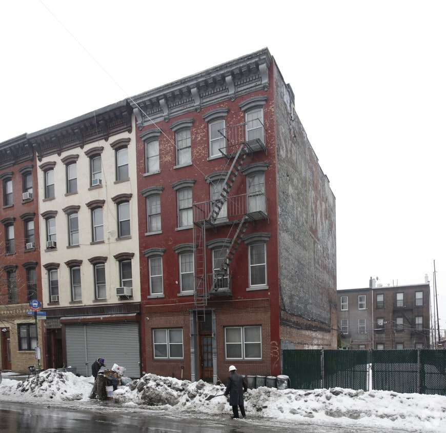
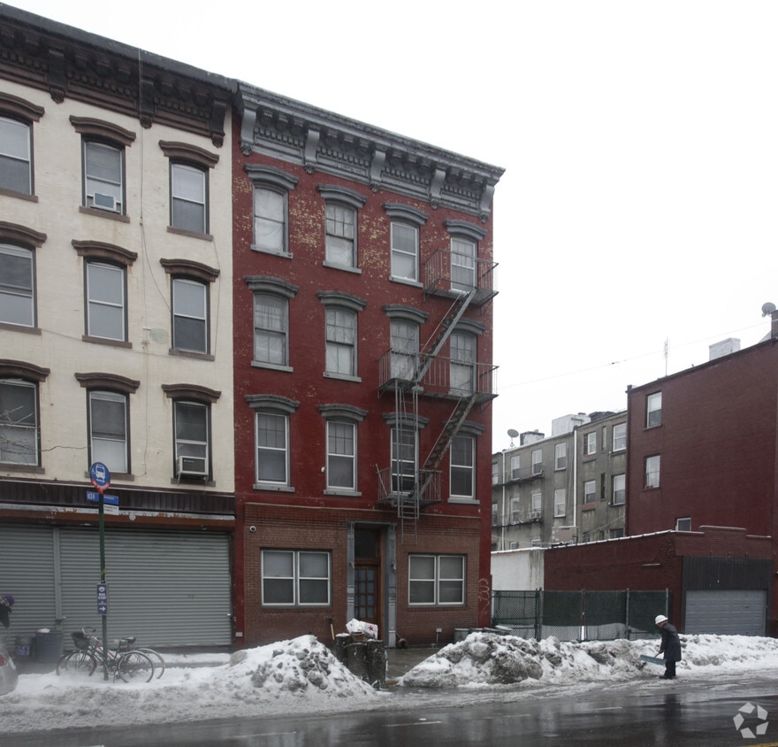
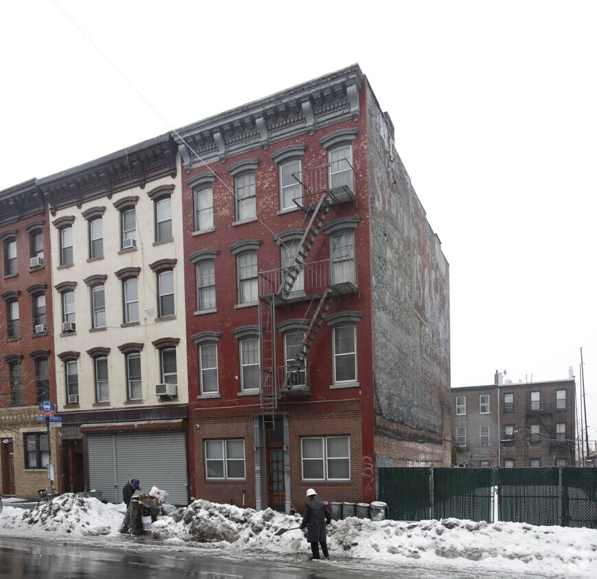
Meet a new place to live at 96 Greenpoint Ave in Brooklyn, NY. Located in the 11222 area of Brooklyn on Greenpoint Ave, local residents have easy access to a mixture of great nearby highlights. From location to floorplan options, the community staff is ready to help you find your perfect new place. Be sure to view the available floorplans. Experience a new standard at 96 Greenpoint Ave.
96 Greenpoint Ave is an apartment community located in Kings County and the 11222 ZIP Code. This area is served by the New York City Geographic District #14 attendance zone.
With rows of historic and colorful buildings lining wide sidewalks and jaunty awnings adorning locally-owned shops and cafes, there's good reason many new residents seek out Greenpoint. This trendy neighborhood is located in northern Brooklyn, and it really does have something for everyone: it is filled with artists, it is the go-to place for the finest restaurants and bars around, and it has some of the best public schools in New York. The neighborhood is so photogenic it was even used as the setting for HBO's hit series, Girls. It provides terrific parks, such as McCarren Park, which is home to the Greenpoint McCarren Park Greenmarket -- a year-round farmer's market. Msgr. McGolrick Park is home to a historic pavilion, a playground, picnic areas, and several monuments.
Go walking along Manhattan Avenue, Greenpoint's busy shopping district, and you'll discover why so many are moving to this once-hidden location.
Learn more about living in GreenpointCompare neighborhood and city base rent averages by bedroom.
| Greenpoint | Brooklyn, NY | |
|---|---|---|
| Studio | $3,440 | $2,674 |
| 1 Bedroom | $4,442 | $2,996 |
| 2 Bedrooms | $6,195 | $3,925 |
| 3 Bedrooms | $10,267 | $4,864 |
| Colleges & Universities | Distance | ||
|---|---|---|---|
| Colleges & Universities | Distance | ||
| Drive: | 5 min | 1.8 mi | |
| Drive: | 8 min | 3.3 mi | |
| Drive: | 10 min | 3.7 mi | |
| Drive: | 10 min | 3.7 mi |


Transportation options available in Brooklyn include Greenpoint Avenue, located 0.2 mile from 96 Greenpoint Ave. 96 Greenpoint Ave is near LaGuardia, located 6.9 miles or 15 minutes away, and John F Kennedy International, located 15.0 miles or 24 minutes away.
| Transit / Subway | Distance | ||
|---|---|---|---|
| Transit / Subway | Distance | ||
|
|
Walk: | 4 min | 0.2 mi |
|
|
Walk: | 10 min | 0.6 mi |
|
|
Walk: | 20 min | 1.1 mi |
|
|
Drive: | 4 min | 1.3 mi |
|
|
Drive: | 4 min | 1.5 mi |
| Commuter Rail | Distance | ||
|---|---|---|---|
| Commuter Rail | Distance | ||
|
|
Drive: | 4 min | 1.4 mi |
|
|
Drive: | 5 min | 1.7 mi |
|
|
Drive: | 10 min | 3.6 mi |
|
|
Drive: | 10 min | 3.9 mi |
|
|
Drive: | 12 min | 4.4 mi |
| Airports | Distance | ||
|---|---|---|---|
| Airports | Distance | ||
|
LaGuardia
|
Drive: | 15 min | 6.9 mi |
|
John F Kennedy International
|
Drive: | 24 min | 15.0 mi |
Scores provided by
Traffic
-Airport
-Businesses
-Scores provided by
HowLoud What is a Sound Score Rating? A Sound Score Rating aggregates noise caused by vehicle traffic, airplane traffic and local sources. How It WorksTime and distance from 96 Greenpoint Ave.
| Shopping Centers | Distance | ||
|---|---|---|---|
| Shopping Centers | Distance | ||
| Drive: | 4 min | 1.3 mi | |
| Drive: | 10 min | 3.9 mi | |
| Drive: | 12 min | 4.3 mi |
| Parks and Recreation | Distance | ||
|---|---|---|---|
| Parks and Recreation | Distance | ||
|
East River State Park
|
Walk: | 13 min | 0.7 mi |
|
McCarren Park
|
Walk: | 16 min | 0.9 mi |
|
Gantry Plaza State Park
|
Drive: | 5 min | 1.6 mi |
|
Asser Levy Playground
|
Drive: | 10 min | 3.9 mi |
|
East River Park
|
Drive: | 14 min | 5.5 mi |
| Hospitals | Distance | ||
|---|---|---|---|
| Hospitals | Distance | ||
| Drive: | 7 min | 2.4 mi | |
| Drive: | 9 min | 3.5 mi | |
| Drive: | 10 min | 3.7 mi |
| Military Bases | Distance | ||
|---|---|---|---|
| Military Bases | Distance | ||
| Drive: | 19 min | 7.6 mi | |
| Drive: | 28 min | 13.9 mi |
What Are Walk Score®, Transit Score®, and Bike Score® Ratings?
Walk Score® measures the walkability of any address. Transit Score® measures access to public transit. Bike Score® measures the bikeability of any address.
What is a Sound Score Rating?
A Sound Score Rating aggregates noise caused by vehicle traffic, airplane traffic and local sources.
96 Greenpoint Ave
Brooklyn, NY 11222


