
$785
/ Month
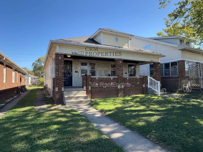
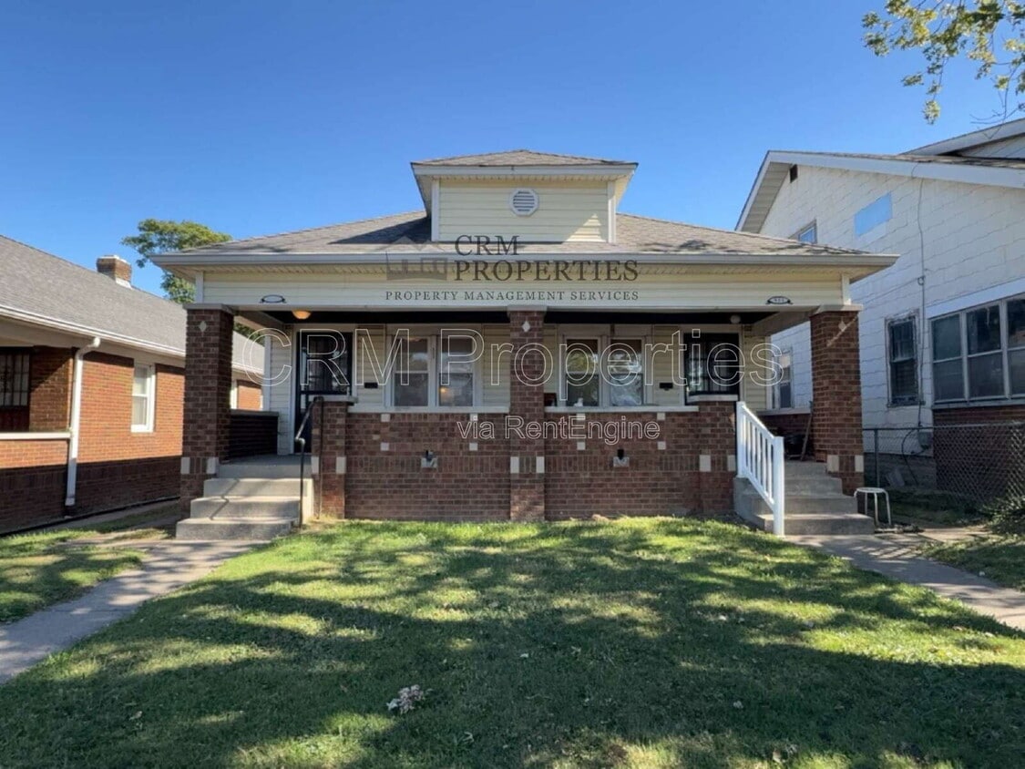
933 N Linwood Ave
Indianapolis, IN 46201
Today
|
Edit
Favorites
765-600-1007
-
Bedrooms
1
-
Bathrooms
1
-
Square Feet
--
-
Available
Available Now
933 N Linwood Ave

Favorites
About This Home
Available Now
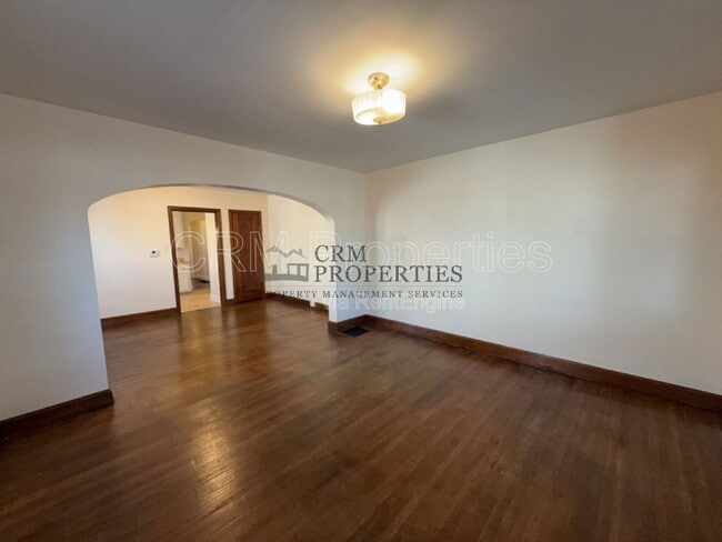
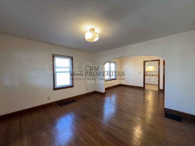
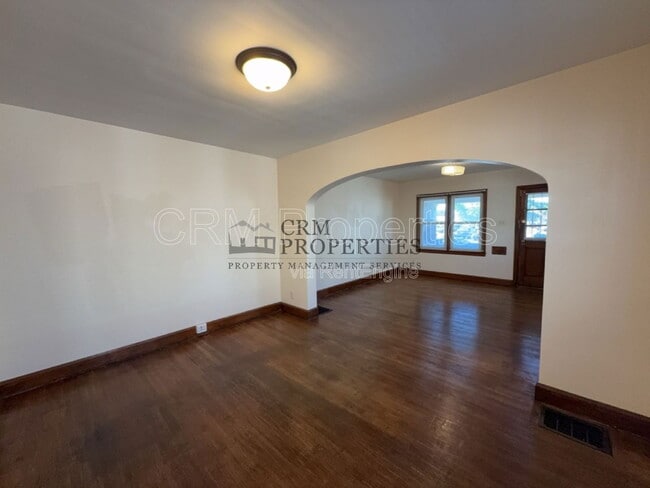
*SELF-SHOW AVAILABILITY* -SPECIAL- FIRST MONTH'S BASE RENT FREE- Enjoy comfortable living in this 1 bedroom, 1 bathroom duplex featuring central A/C and a 1-car detached garage. The home offers a separate dining room, *unfinished basement for extra storage, and a shared partially fenced backyard for outdoor enjoyment. The kitchen comes equipped with a stove and refrigerator, providing everything you need for everyday convenience. Resident is responsible for electric, gas, water, and sanitation. Qualifying pets 40lbs and under accepted with additional fees. *Please note: Unfinished basements can take on moisture during heavy rain or snow. We recommend storing items on an elevated surface to avoid possible water damage. *Please Note: The advertised rental rate does not include the required $50/month enrollment in CRM’s Resident Benefits Package. This fee may vary depending on the selections you make during the leasing process, with a minimum cost of $50/month. *PLEASE NOTE: CRM PROPERTIES DOES NOT ALLOW LEASES TO END IN THE WINTER MONTHS. ALL LEASES WILL HAVE A LEASE END DATE OF 03/31/2027. By submitting your information on this page you consent to being contacted by the Property Manager and RentEngine via SMS, phone, or email.
933 N Linwood Ave is a townhome located in Marion County and the 46201 ZIP Code. This area is served by the Indianapolis Public Schools attendance zone.
* Price shown is base rent. Excludes user-selected optional fees and variable or usage-based fees and required charges due at or prior to move-in or at move-out. Price, availability, fees, and any applicable rent special are subject to change without notice.
* Square footage definitions vary. Displayed square footage is approximate.
Fees and Policies
The fees below are based on community-supplied data and may exclude additional fees and utilities.
-
One-Time Basics
-
Due at Application
-
Application Fee Per ApplicantCharged per applicant.$60
-
-
Due at Application
Property Fee Disclaimer: Based on community-supplied data and independent market research. Subject to change without notice. May exclude fees for mandatory or optional services and usage-based utilities.
Townhome Features
- Range
Contact
- Listed by CRM Properties | CRM Properties
- Phone Number
- Contact
Location
Get Directions
Amenities
- Range
Near Eastside is a large neighborhood spanning south of Interstate 70. The densely populated area features several neighborhoods with options for affordable apartments in a range of styles. The residential sections of town are complemented by convenient shopping centers, peaceful parks, and highly rated schools that make Near Eastside an ideal place to settle down. Residents enjoy relaxing and exploring places like Brookside Park and the Pogues Run Trail. Commuters appreciate the less than 10-mile drive into the heart of Indianapolis via the interstate or an IndyGo bus. Apart from the attractions offered by Downtown Indianapolis, Near Eastside is in proximity to resort-like golf courses, parks, and shopping centers.
Learn more about living in Near Eastside
Education
| Colleges & Universities | Distance | ||
|---|---|---|---|
| Colleges & Universities | Distance | ||
| Drive: | 9 min | 4.6 mi | |
| Drive: | 11 min | 5.3 mi | |
| Drive: | 12 min | 5.4 mi | |
| Drive: | 14 min | 7.4 mi |
933 N Linwood Ave is within 9 minutes or 4.6 miles from IU - School of Medicine. It is also near IU - Indianapolis and Ivy Tech Community College.
Schools


Public Elementary School
Grades PK-6
259 Students
Attendance Zone
Public Elementary & Middle School
Grades K-8
444 Students
Attendance Zone
Public Middle School
Grades 7-8
259 Students
Attendance Zone
Public High School
Grades 9-12
2,366 Students
Attendance Zone
Public High School
Grades 9-12
1,188 Students
Attendance Zone
Private Elementary & Middle School
Grades PK-8
341 Students
Nearby
Private High School
Grades 9-12
405 Students
Nearby
School data provided by
 The GreatSchools Rating helps parents compare schools within a state based on a variety of school quality indicators and provides a helpful picture of how effectively each school serves all of its students. Ratings are on a scale of 1 (below average) to 10 (above average) and can include test scores, college readiness, academic progress, advanced courses, equity, discipline and attendance data. We also advise parents to visit schools, consider other information on school performance and programs, and consider family needs as part of the school selection process.
View GreatSchools Rating Methodology
Data provided by GreatSchools.org © 2026. All rights reserved.
View GreatSchools Rating Methodology
Data provided by GreatSchools.org © 2026. All rights reserved.
You May Also Like
Similar Rentals Nearby
-
-
-
-
-
-
-
-
-
1 / 27

-


What Are Walk Score®, Transit Score®, and Bike Score® Ratings?
Walk Score® measures the walkability of any address. Transit Score® measures access to public transit. Bike Score® measures the bikeability of any address.
What is a Sound Score Rating?
A Sound Score Rating aggregates noise caused by vehicle traffic, airplane traffic and local sources
933 N Linwood Ave
Indianapolis, IN 46201