
Hue39
3909 San Fernando Rd,
Glendale, CA 91204
$2,495 - $2,800
1-2 Beds
At a walking distance from Glendale Community College, easy access to Freeways 134 & 2 Close to shops, schools, freeways, bus stops, etc.
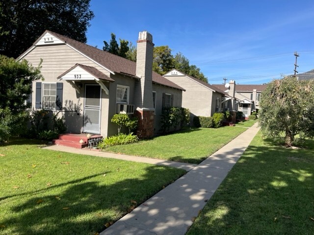
933 N Glendale Ave is an apartment community located in Los Angeles County and the 91206 ZIP Code. This area is served by the Glendale Unified School District attendance zone.
Air Conditioning
Washer/Dryer Hookup
Hardwood Floors
Oven
The urban neighborhood of Rossmoyne is filled with residential areas, located just north of downtown Glendale. Travel into downtown to explore the shops at Glendale Galleria, try various cuisines from an abundance of restaurants, check out local museums, or catch a movie at Pacific Theatres.
Enjoy open green space, a playground, and athletic courts at Nibley Park in the heart of Rossmoyne. This peaceful neighborhood is situated just 11 miles north of downtown Los Angeles, offering residents small town charm with access to metropolitan attractions. Discover famous museums, local restaurants, and popular community parks in this bustling downtown.
With views of the San Gabriel Mountains and access to downtown Los Angeles, residents of Rossmoyne enjoy beautiful natural landscapes, scenic views, and upscale amenities. Unique apartments, condos, and houses are available for rent in this Southern California neighborhood.
Learn more about living in RossmoyneCompare neighborhood and city base rent averages by bedroom.
| Rossmoyne | Glendale, CA | |
|---|---|---|
| Studio | $911 | $2,028 |
| 1 Bedroom | $1,117 | $2,120 |
| 2 Bedrooms | $1,310 | $2,682 |
| 3 Bedrooms | $1,522 | $3,449 |
| Colleges & Universities | Distance | ||
|---|---|---|---|
| Colleges & Universities | Distance | ||
| Walk: | 17 min | 0.9 mi | |
| Drive: | 8 min | 3.7 mi | |
| Drive: | 8 min | 5.9 mi | |
| Drive: | 13 min | 7.8 mi |


Transportation options available in Glendale include Southwest Museum Station, located 5.8 miles from 933 N Glendale Ave. 933 N Glendale Ave is near Bob Hope, located 10.7 miles or 15 minutes away, and Los Angeles International, located 23.8 miles or 37 minutes away.
| Transit / Subway | Distance | ||
|---|---|---|---|
| Transit / Subway | Distance | ||
|
|
Drive: | 11 min | 5.8 mi |
|
|
Drive: | 9 min | 6.5 mi |
|
|
Drive: | 11 min | 6.8 mi |
|
|
Drive: | 11 min | 7.3 mi |
|
|
Drive: | 13 min | 8.0 mi |
| Commuter Rail | Distance | ||
|---|---|---|---|
| Commuter Rail | Distance | ||
|
|
Drive: | 7 min | 2.9 mi |
|
|
Drive: | 8 min | 5.3 mi |
|
|
Drive: | 12 min | 8.0 mi |
| Drive: | 11 min | 8.5 mi | |
|
|
Drive: | 15 min | 9.7 mi |
| Airports | Distance | ||
|---|---|---|---|
| Airports | Distance | ||
|
Bob Hope
|
Drive: | 15 min | 10.7 mi |
|
Los Angeles International
|
Drive: | 37 min | 23.8 mi |
Scores provided by
Traffic
-Airport
-Businesses
-Scores provided by
HowLoud What is a Sound Score Rating? A Sound Score Rating aggregates noise caused by vehicle traffic, airplane traffic and local sources. How It WorksTime and distance from 933 N Glendale Ave.
| Shopping Centers | Distance | ||
|---|---|---|---|
| Shopping Centers | Distance | ||
| Walk: | 2 min | 0.1 mi | |
| Walk: | 5 min | 0.3 mi | |
| Walk: | 14 min | 0.8 mi |
| Parks and Recreation | Distance | ||
|---|---|---|---|
| Parks and Recreation | Distance | ||
|
Descanso Gardens
|
Drive: | 8 min | 4.7 mi |
|
Elyria Canyon Park
|
Drive: | 11 min | 5.3 mi |
|
Los Angeles Zoo
|
Drive: | 14 min | 5.5 mi |
|
Marsh Park
|
Drive: | 10 min | 5.7 mi |
|
Jet Propulsion Laboratory
|
Drive: | 11 min | 8.2 mi |
| Hospitals | Distance | ||
|---|---|---|---|
| Hospitals | Distance | ||
| Drive: | 4 min | 1.3 mi | |
| Drive: | 6 min | 2.7 mi | |
| Drive: | 6 min | 4.1 mi |
| Military Bases | Distance | ||
|---|---|---|---|
| Military Bases | Distance | ||
| Drive: | 34 min | 25.3 mi | |
| Drive: | 47 min | 33.8 mi | |
| Drive: | 49 min | 36.1 mi |
Pets Allowed Fitness Center Pool In Unit Washer & Dryer Clubhouse Balcony
Pets Allowed Fitness Center Pool Maintenance on site High-Speed Internet Controlled Access EV Charging
What Are Walk Score®, Transit Score®, and Bike Score® Ratings?
Walk Score® measures the walkability of any address. Transit Score® measures access to public transit. Bike Score® measures the bikeability of any address.
What is a Sound Score Rating?
A Sound Score Rating aggregates noise caused by vehicle traffic, airplane traffic and local sources.

933 N Glendale Ave
Glendale, CA 91206


