
1213 Walnut
1213 Walnut St,
Philadelphia, PA 19107
$1,995 - $7,115
Studio - 2 Beds
Enjoy Philadelphia living at 929 N 29th St. The location of this community is in the 19130 area of Philadelphia. Be sure to come for a visit to check out the current floorplan options. The professional leasing staff is ready and waiting for you to come by for a tour. Contact us or drop by to check the current floorplan availability today and see 929 N 29th St.
929 N 29th St is an apartment community located in Philadelphia County and the 19130 ZIP Code. This area is served by the The School District of Philadelphia attendance zone.
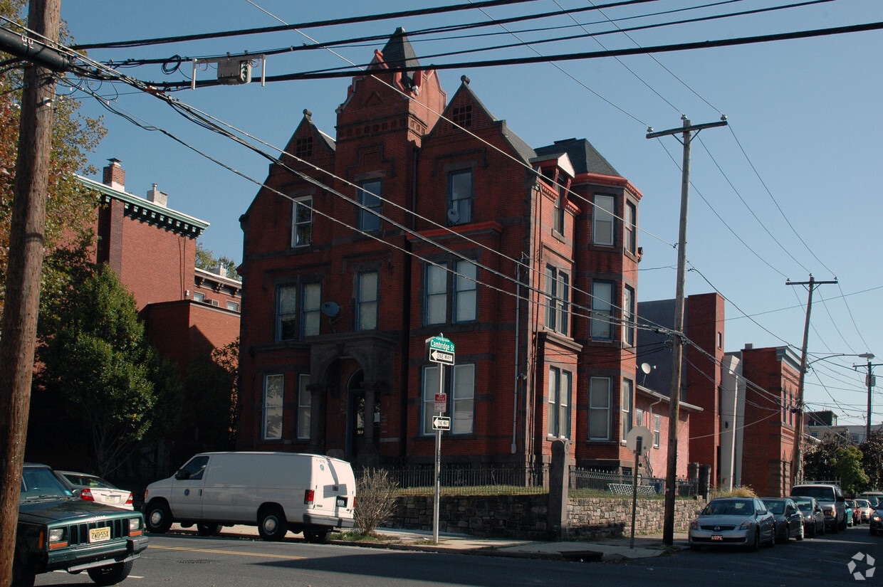
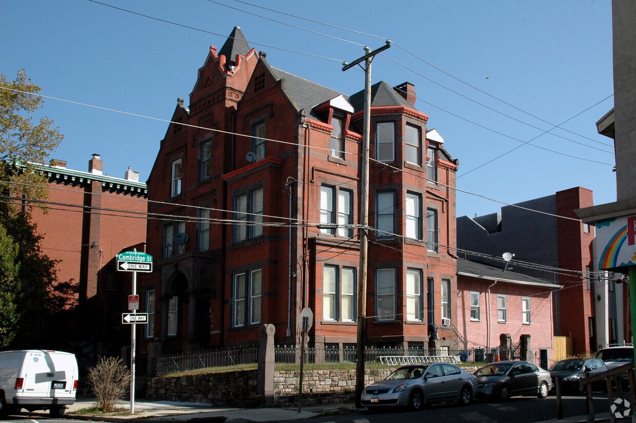
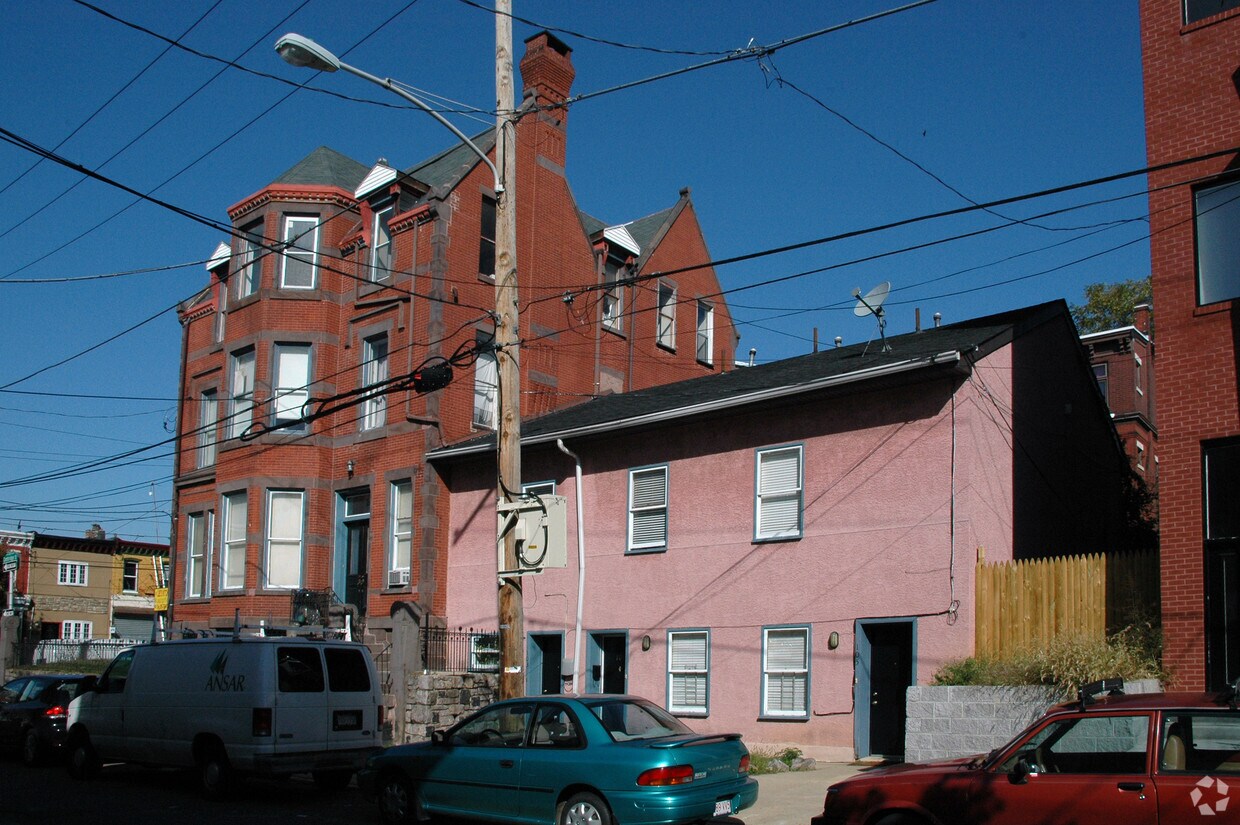
Located in North Philly, Brewerytown is a historic in-town neighborhood undergoing a modern transformation. Brewerytown was originally named for the more than 20 breweries that operated in the neighborhood during the late 19th and early 20th centuries. Today, Brewerytown contains an array of craft breweries and brewpubs in addition to a slew of eclectic eateries, boutique shops, markets, and longstanding businesses on Girard Avenue, the commercial heart of the neighborhood.
Brewerytown’s revitalization has inspired many renovated lofts and luxury apartments available for rent in historic, red-brick buildings. The neighborhood’s accessibility makes it a top choice for many residents, including walkable access to the commercial core as well as the historic streetcar line, which connects Brewerytown to nearby Fishtown.
Learn more about living in BrewerytownCompare neighborhood and city base rent averages by bedroom.
| Brewerytown | Philadelphia, PA | |
|---|---|---|
| Studio | $1,440 | $1,429 |
| 1 Bedroom | $1,654 | $1,788 |
| 2 Bedrooms | $2,085 | $2,221 |
| 3 Bedrooms | $1,875 | $2,916 |
| Colleges & Universities | Distance | ||
|---|---|---|---|
| Colleges & Universities | Distance | ||
| Drive: | 5 min | 1.7 mi | |
| Drive: | 4 min | 1.8 mi | |
| Drive: | 5 min | 2.1 mi | |
| Drive: | 5 min | 2.5 mi |


Transportation options available in Philadelphia include Girard Av & 29Th St, located 0.1 mile from 929 N 29th St. 929 N 29th St is near Philadelphia International, located 12.0 miles or 23 minutes away, and Trenton Mercer, located 35.5 miles or 52 minutes away.
| Transit / Subway | Distance | ||
|---|---|---|---|
| Transit / Subway | Distance | ||
| Walk: | 1 min | 0.1 mi | |
| Walk: | 2 min | 0.1 mi | |
| Walk: | 3 min | 0.2 mi | |
| Walk: | 4 min | 0.2 mi | |
| Walk: | 5 min | 0.3 mi |
| Commuter Rail | Distance | ||
|---|---|---|---|
| Commuter Rail | Distance | ||
|
|
Drive: | 5 min | 2.1 mi |
|
|
Drive: | 6 min | 2.5 mi |
|
|
Drive: | 8 min | 2.8 mi |
| Drive: | 7 min | 2.8 mi | |
|
|
Drive: | 7 min | 2.9 mi |
| Airports | Distance | ||
|---|---|---|---|
| Airports | Distance | ||
|
Philadelphia International
|
Drive: | 23 min | 12.0 mi |
|
Trenton Mercer
|
Drive: | 52 min | 35.5 mi |
Scores provided by
Traffic
-Airport
-Businesses
-Scores provided by
HowLoud What is a Sound Score Rating? A Sound Score Rating aggregates noise caused by vehicle traffic, airplane traffic and local sources. How It WorksTime and distance from 929 N 29th St.
| Shopping Centers | Distance | ||
|---|---|---|---|
| Shopping Centers | Distance | ||
| Drive: | 4 min | 1.6 mi | |
| Drive: | 6 min | 1.8 mi | |
| Drive: | 6 min | 2.0 mi |
| Parks and Recreation | Distance | ||
|---|---|---|---|
| Parks and Recreation | Distance | ||
|
Philadelphia Zoo
|
Drive: | 5 min | 1.6 mi |
|
Fels Planetarium
|
Drive: | 4 min | 1.7 mi |
|
Wagner Free Institute of Science
|
Drive: | 5 min | 1.7 mi |
|
Franklin Institute
|
Drive: | 4 min | 1.7 mi |
|
The Academy of Natural Sciences
|
Drive: | 4 min | 1.8 mi |
| Hospitals | Distance | ||
|---|---|---|---|
| Hospitals | Distance | ||
| Drive: | 5 min | 2.3 mi | |
| Drive: | 6 min | 2.6 mi | |
| Drive: | 8 min | 3.0 mi |
| Military Bases | Distance | ||
|---|---|---|---|
| Military Bases | Distance | ||
| Drive: | 16 min | 9.3 mi | |
| Drive: | 41 min | 19.3 mi | |
| Drive: | 43 min | 21.3 mi |
What Are Walk Score®, Transit Score®, and Bike Score® Ratings?
Walk Score® measures the walkability of any address. Transit Score® measures access to public transit. Bike Score® measures the bikeability of any address.
What is a Sound Score Rating?
A Sound Score Rating aggregates noise caused by vehicle traffic, airplane traffic and local sources.

929 N 29th St
Philadelphia, PA 19130


