
$1,895
/ Month
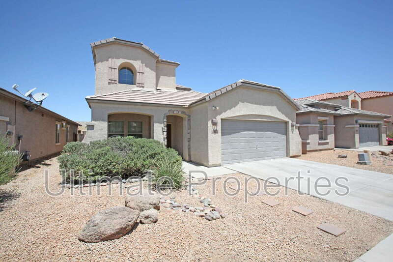
9234 W Milkweed Loop
Phoenix, AZ 85037
Today
|
Edit
Favorites
623-263-9157
-
Bedrooms
3
-
Bathrooms
2.5
-
Square Feet
2,137 sq ft
-
Available
Available Now
9234 W Milkweed Loop

Favorites
About This Home
$1,895 deposit,
Available Now
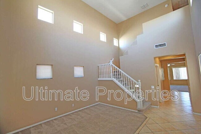
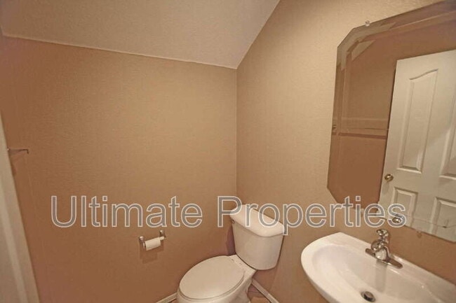
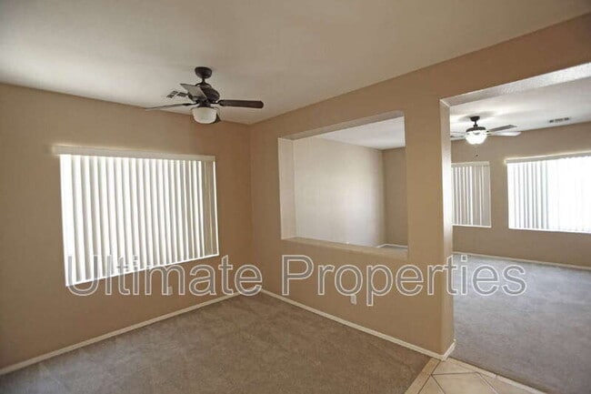
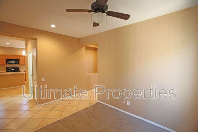
Large 3 Bedroom Home With 2.5 Bathrooms, Enter Into A Large Living Room With A Soaring Ceiling, 18-inch Tile Flooring Leads To A Large Kitchen With Center Island And Black Appliances, Built-In Microwave, Range/Oven, Dishwasher, Refrigerator, Spacious Dining In Kitchen Area, Separate Formal Dining Room, Large Family Room, Ceiling Fans, Laundry Room With Storage Area, Upstairs Spacious Standard Bedroom, Double Sink Vanity Hall Bathroom, Large Master Suite, Master Suite Bathroom Includes Separate Shower & Soaking Tub, Double Sink Vanity With Counter Sitting Space, Walk-In Closet. Covered Patio, Desert Landscaping, Private Courtyard With Covered Patio. Pet Details: All Pets Allowed
9234 W Milkweed Loop is a house located in Maricopa County and the 85037 ZIP Code. This area is served by the Tolleson Elementary District attendance zone.
* Price shown is base rent. Excludes user-selected optional fees and variable or usage-based fees and required charges due at or prior to move-in or at move-out. Price, availability, fees, and any applicable rent special are subject to change without notice.
* Square footage definitions vary. Displayed square footage is approximate.
Fees and Policies
The fees listed below are community-provided and may exclude utilities or add-ons. All payments are made directly to the property and are non-refundable unless otherwise specified. Use the Cost Calculator to determine costs based on your needs.
-
One-Time Basics
-
Due at Move-In
-
Security Deposit - RefundableCharged per unit.$1,895
-
-
Due at Move-In
-
Dogs
-
Allowed
-
-
Cats
-
Allowed
-
Property Fee Disclaimer: Based on community-supplied data and independent market research. Subject to change without notice. May exclude fees for mandatory or optional services and usage-based utilities.
Contact
- Phone Number
- Contact
Location
Get Directions
Maryvale is a suburban community approximately 12 miles west of Downtown Phoenix. Residents have easy access to Interstate 10 and 17, as well as US Highway 60. Although many residents work in the Phoenix area, some commute to other areas nearby like Glendale, Scottsdale, Tempe, and Mesa. Maryvale offers abundant conveniences for residents and is home to Desert Sky Mall, El Oso Park, and several other shopping centers filled with restaurants and retailers. Good schools reside in Maryvale like Maryvale High School, with colleges nearby like Grand Canyon University. Apartments, houses, condos, and townhomes in the neighborhood vary from affordable to upscale, so there’s something for every renter.
Learn more about living in Maryvale
Education
| Colleges & Universities | Distance | ||
|---|---|---|---|
| Colleges & Universities | Distance | ||
| Drive: | 13 min | 7.6 mi | |
| Drive: | 20 min | 11.7 mi | |
| Drive: | 21 min | 11.8 mi | |
| Drive: | 19 min | 12.8 mi |
9234 W Milkweed Loop is within 13 minutes or 7.6 miles from Estrella Mountain Comm. Coll.. It is also near Grand Canyon University and Glendale Community College.
Schools


Public Elementary & Middle School
Grades PK-8
627 Students
Attendance Zone
Public High School
Grades 9-12
2,779 Students
Attendance Zone
Private Elementary, Middle & High School
Grades PK-12
Nearby
Private Elementary, Middle & High School
Grades PK-4, 6-7 & 9-12
36 Students
Nearby
Private Elementary & Middle School
Grades PK-8
451 Students
Nearby
Private Elementary School
Grades PK-5
Nearby
Private Elementary School
Grades PK-4
Nearby
Private Elementary School
Grades PK-1
Nearby
School data provided by
 The GreatSchools Rating helps parents compare schools within a state based on a variety of school quality indicators and provides a helpful picture of how effectively each school serves all of its students. Ratings are on a scale of 1 (below average) to 10 (above average) and can include test scores, college readiness, academic progress, advanced courses, equity, discipline and attendance data. We also advise parents to visit schools, consider other information on school performance and programs, and consider family needs as part of the school selection process.
View GreatSchools Rating Methodology
Data provided by GreatSchools.org © 2026. All rights reserved.
View GreatSchools Rating Methodology
Data provided by GreatSchools.org © 2026. All rights reserved.
Transportation options available in Phoenix include 19Th Ave/Camelback, located 13.7 miles from 9234 W Milkweed Loop. 9234 W Milkweed Loop is near Phoenix Sky Harbor International, located 17.5 miles or 25 minutes away.
| Transit / Subway | Distance | ||
|---|---|---|---|
| Transit / Subway | Distance | ||
|
|
Drive: | 20 min | 13.7 mi |
|
|
Drive: | 20 min | 14.5 mi |
| Commuter Rail | Distance | ||
|---|---|---|---|
| Commuter Rail | Distance | ||
|
|
Drive: | 58 min | 46.8 mi |
| Airports | Distance | ||
|---|---|---|---|
| Airports | Distance | ||
|
Phoenix Sky Harbor International
|
Drive: | 25 min | 17.5 mi |
Time and distance from 9234 W Milkweed Loop.
| Shopping Centers | Distance | ||
|---|---|---|---|
| Shopping Centers | Distance | ||
| Walk: | 9 min | 0.5 mi | |
| Walk: | 19 min | 1.0 mi | |
| Drive: | 4 min | 1.8 mi |
9234 W Milkweed Loop has 3 shopping centers within 1.8 miles, which is about a 4-minute drive. The miles and minutes will be for the farthest away property.
| Parks and Recreation | Distance | ||
|---|---|---|---|
| Parks and Recreation | Distance | ||
|
El Oso Park
|
Drive: | 8 min | 3.6 mi |
|
Friendship Park
|
Drive: | 11 min | 5.0 mi |
|
Maryvale Park
|
Drive: | 14 min | 7.0 mi |
|
Base and Meridian Wildlife Area
|
Drive: | 16 min | 9.1 mi |
|
Colter Park
|
Drive: | 15 min | 11.2 mi |
9234 W Milkweed Loop has 5 parks within 11.2 miles, including El Oso Park, Friendship Park, and Maryvale Park.
| Hospitals | Distance | ||
|---|---|---|---|
| Hospitals | Distance | ||
| Walk: | 19 min | 1.0 mi | |
| Drive: | 4 min | 2.5 mi | |
| Drive: | 11 min | 7.3 mi |
9234 W Milkweed Loop has 3 hospitals within 7.3 miles, the nearest is Banner Estrella Medical Center which is 1.0 miles away and a 19 minute walk.
| Military Bases | Distance | ||
|---|---|---|---|
| Military Bases | Distance | ||
| Drive: | 16 min | 9.9 mi | |
| Drive: | 25 min | 17.3 mi | |
| Drive: | 86 min | 63.8 mi |
9234 W Milkweed Loop has 3 military bases within 63.8 miles, the nearest is Luke Air Force Base which is 9.9 miles away and a 16 minute drive.
You May Also Like
Similar Rentals Nearby
-
-
-
3 Beds$2,616+Total Monthly PriceTotal Monthly Price NewPrices include base rent and required monthly fees of $56. Variable costs based on usage may apply.Base Rent:3 Beds$2,560+2 Months Free
Pets Allowed Fitness Center Pool Dishwasher Refrigerator Kitchen
-
-
-
1 / 22

-
-
1 / 17

-
-


What Are Walk Score®, Transit Score®, and Bike Score® Ratings?
Walk Score® measures the walkability of any address. Transit Score® measures access to public transit. Bike Score® measures the bikeability of any address.
What is a Sound Score Rating?
A Sound Score Rating aggregates noise caused by vehicle traffic, airplane traffic and local sources
9234 W Milkweed Loop
Phoenix, AZ 85037