
-
3 br, 3 bath House - 923 Snapdragon Way
$2,200
/ Month
923 Snapdragon Way
Brentwood, CA 94513
2 Weeks Ago
|
Edit
Favorites
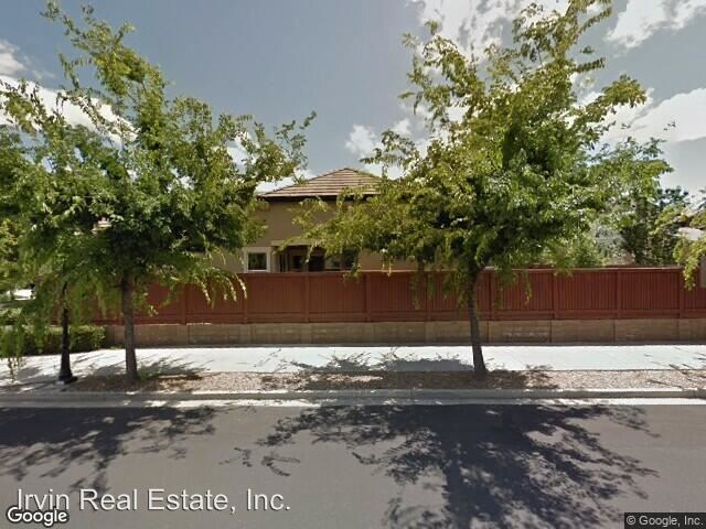
923 Snapdragon Way

Favorites
Check Back Soon for Upcoming Availability
| Beds | Baths | Average SF |
|---|---|---|
| 3 Bedrooms 3 Bedrooms 3 Br | 3 Baths 3 Baths 3 Ba | 2,480 SF |
Fees and Policies
The fees listed below are community-provided and may exclude utilities or add-ons. All payments are made directly to the property and are non-refundable unless otherwise specified.
About This Property
(925) 472-6534 - Coming Soon! 4 Bedroom. 2.5 Baths - Coming soon! Garin Ranch Beauty! Single story home featuring 4 bedrooms, 2.5 bathrooms plus office/den. Nestled on a 6,474 sq. ft. corner lot, walk to downtown, and all three schools. Bright, open floor plan featuring a dine-in kitchen with center island, gas cooktop stove with plenty of counters & cabinet space. No section 8 Available August 15th Please visit www.mattirvin.com for application, criteria, and qualification. Property can only be viewed once an application is submitted. No Pets Allowed (RLNE4201671) Pet policies - No Dogs Allowed, No Cats Allowed.
923 Snapdragon Way is a house located in Contra Costa County and the 94513 ZIP Code. This area is served by the Brentwood Union Elementary attendance zone.
Unique Features
- No Dogs Allowed, No Cats Allowed
Location
Get Directions
Brentwood, California is a great place to live for those seeking a peaceful suburban lifestyle while still being within close proximity to the action of The Bay. Located in Contra Costa County, Brentwood has a population of around 60,000 people and is known for its picturesque parks, top-notch schools, and friendly community.
For potential renters looking for a place to call home in Brentwood, there are a variety of options available. Rental properties in the area range from apartments and townhomes to single-family homes and condos, giving renters a wide range of choices to fit their lifestyle and budget. One of the most attractive features of Brentwood is its abundance of parks and outdoor recreation areas. For those who love to hike, bike, or simply enjoy a leisurely stroll, the Iron Horse Trail is a popular choice. This paved trail stretches over 30 miles from Concord to Dublin and is perfect for all fitness levels.
Learn more about living in BrentwoodBelow are rent ranges for similar nearby apartments
Amenities
- No Dogs Allowed, No Cats Allowed
Education
| Colleges & Universities | Distance | ||
|---|---|---|---|
| Colleges & Universities | Distance | ||
| Drive: | 3 min | 1.2 mi | |
| Drive: | 25 min | 14.1 mi | |
| Drive: | 32 min | 17.8 mi | |
| Drive: | 41 min | 26.0 mi |
923 Snapdragon Way is within 3 minutes or 1.2 miles from Los Medanos College, Brentwood. It is also near Los Medanos College, Pittsburg and San Joaquin Delta, Mtn. House.
Schools


Public Elementary School
Grades K-5
496 Students
Nearby
Public Elementary School
Grades K-5
701 Students
Attendance Zone
Public Middle School
Grades 6-8
995 Students
Attendance Zone
Public High School
Grades 9-12
2,786 Students
Attendance Zone
Private Elementary School
Grades PK-5
Nearby
Private Elementary, Middle & High School
Grades K-12
Nearby
Private Elementary School
Grades K
Nearby
School data provided by
 The GreatSchools Rating helps parents compare schools within a state based on a variety of school quality indicators and provides a helpful picture of how effectively each school serves all of its students. Ratings are on a scale of 1 (below average) to 10 (above average) and can include test scores, college readiness, academic progress, advanced courses, equity, discipline and attendance data. We also advise parents to visit schools, consider other information on school performance and programs, and consider family needs as part of the school selection process.
View GreatSchools Rating Methodology
Data provided by GreatSchools.org © 2026. All rights reserved.
View GreatSchools Rating Methodology
Data provided by GreatSchools.org © 2026. All rights reserved.
Transportation options available in Brentwood include Antioch, located 8.6 miles from 923 Snapdragon Way. 923 Snapdragon Way is near Stockton Metro, located 31.6 miles or 47 minutes away, and Metro Oakland International, located 50.2 miles or 68 minutes away.
| Transit / Subway | Distance | ||
|---|---|---|---|
| Transit / Subway | Distance | ||
|
|
Drive: | 13 min | 8.6 mi |
| Commuter Rail | Distance | ||
|---|---|---|---|
| Commuter Rail | Distance | ||
|
|
Drive: | 19 min | 11.8 mi |
| Drive: | 34 min | 21.8 mi | |
| Drive: | 39 min | 23.8 mi | |
| Drive: | 39 min | 24.6 mi | |
| Drive: | 42 min | 25.2 mi |
| Airports | Distance | ||
|---|---|---|---|
| Airports | Distance | ||
|
Stockton Metro
|
Drive: | 47 min | 31.6 mi |
|
Metro Oakland International
|
Drive: | 68 min | 50.2 mi |
Time and distance from 923 Snapdragon Way.
| Shopping Centers | Distance | ||
|---|---|---|---|
| Shopping Centers | Distance | ||
| Walk: | 12 min | 0.6 mi | |
| Walk: | 12 min | 0.6 mi | |
| Walk: | 12 min | 0.6 mi |
923 Snapdragon Way has 3 shopping centers within 0.6 mile, which is about a 12-minute walk. The miles and minutes will be for the farthest away property.
| Parks and Recreation | Distance | ||
|---|---|---|---|
| Parks and Recreation | Distance | ||
|
Marsh Creek Regional Trail
|
Drive: | 4 min | 2.0 mi |
|
Big Break Regional Shoreline
|
Drive: | 14 min | 7.2 mi |
|
Vasco Caves Regional Preserve
|
Drive: | 13 min | 7.5 mi |
|
Contra Loma Regional Park
|
Drive: | 20 min | 9.4 mi |
|
Franks Tract State Recreation Area
|
Drive: | 25 min | 11.1 mi |
923 Snapdragon Way has 5 parks within 11.1 miles, including Marsh Creek Regional Trail, Big Break Regional Shoreline, and Vasco Caves Regional Preserve.
| Hospitals | Distance | ||
|---|---|---|---|
| Hospitals | Distance | ||
| Drive: | 16 min | 7.8 mi | |
| Drive: | 16 min | 8.6 mi |
923 Snapdragon Way is 7.8 miles from Kaiser Foundation Hospital - Antioch, and is convenient to other hospitals, including Sutter Delta Medical Center.
| Military Bases | Distance | ||
|---|---|---|---|
| Military Bases | Distance | ||
| Drive: | 39 min | 24.7 mi |
923 Snapdragon Way is 24.7 miles and a 39 minute drive from Stockton Naval Commun Station.
You May Also Like
Similar Rentals Nearby


What Are Walk Score®, Transit Score®, and Bike Score® Ratings?
Walk Score® measures the walkability of any address. Transit Score® measures access to public transit. Bike Score® measures the bikeability of any address.
What is a Sound Score Rating?
A Sound Score Rating aggregates noise caused by vehicle traffic, airplane traffic and local sources

923 Snapdragon Way
Brentwood, CA 94513