
Fayette Arms Apartments
2680 Fayette Dr,
Mountain View, CA 94040
$3,577 - $4,497
1-2 Beds

Se trata de un edificio de seis pisos en Old Mountain View, ubicado a media cuadra de Castro St. y de todas las tiendas y tiendas del centro de la ciudad. Está a menos de media cuadra de un parque grande. Todas las unidades tienen ventanas de doble panel y vienen con una plaza de estacionamiento descubierta asignada. Damos la bienvenida a gatos castrados y aceptaremos un perro castrado adulto pequeño o mediano de la mayoría de las razas no agresivas y no molestas sin cargo adicional. Esta comunidad en un entorno de jardín tiene una piscina muy grande y también una lavandería. El alquiler incluye agua y basura, y no aceptamos el alquiler del último mes en el momento de la mudanza. Se requiere un seguro para los inquilinos.
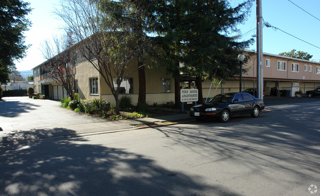
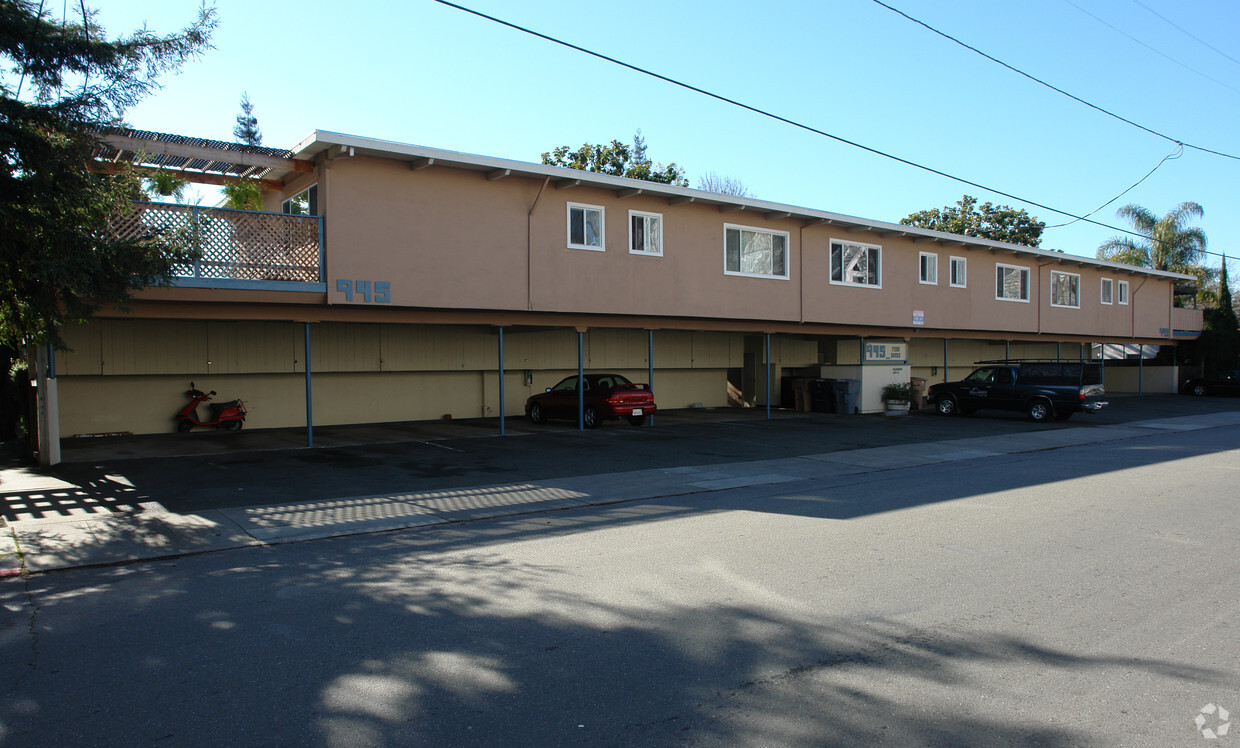
921-945 High School Way is an apartment community located in Santa Clara County and the 94041 ZIP Code. This area is served by the Mountain View Whisman School District attendance zone.
Suelos de madera maciza
Suelos de baldosas
Ventiladores de techo
Libre de humo
Downtown Mountain View is largely concentrated on Castro Street, roughly between the Central Expressway in the north and El Camino Real in the south. The neighborhood is vibrant, boasting a slew of diverse restaurants, shops, cafes, and bars in a walkable locale. Downtown Mountain View also hosts a bevy of year-round events for the community, including the Farmer’s Market, Annual Spring Parade, Art and Wine Festival, and more.
Government buildings are clustered in the southern portion of the neighborhood, along with the Mountain View Public Library, Pioneer Memorial Park, Mountain View Center for the Performing Arts, and the sprawling Eagle Park. In addition to being close to these exciting amenities, Downtown Mountain View apartments are also convenient to multiple buses, commuter shuttles, and Caltrain lines.
Learn more about living in Downtown Mountain ViewCompare neighborhood and city base rent averages by bedroom.
| Downtown Mountain View | Mountain View, CA | |
|---|---|---|
| Studio | $2,273 | $2,860 |
| 1 Bedroom | $3,615 | $3,378 |
| 2 Bedrooms | $4,670 | $4,289 |
| 3 Bedrooms | $3,938 | $5,225 |
| Colleges & Universities | Distance | ||
|---|---|---|---|
| Colleges & Universities | Distance | ||
| Drive: | 9 min | 3.4 mi | |
| Drive: | 10 min | 3.8 mi | |
| Drive: | 10 min | 5.9 mi | |
| Drive: | 15 min | 6.0 mi |


Transportation options available in Mountain View include Mountain View Station, located 0.8 mile from 921-945 High School Way. 921-945 High School Way is near Norman Y Mineta San Jose International, located 10.3 miles or 16 minutes away, and San Francisco International, located 25.9 miles or 35 minutes away.
| Transit / Subway | Distance | ||
|---|---|---|---|
| Transit / Subway | Distance | ||
| Walk: | 15 min | 0.8 mi | |
|
|
Drive: | 6 min | 2.2 mi |
|
|
Drive: | 5 min | 2.8 mi |
| Drive: | 7 min | 3.0 mi | |
| Drive: | 8 min | 4.5 mi |
| Commuter Rail | Distance | ||
|---|---|---|---|
| Commuter Rail | Distance | ||
| Walk: | 16 min | 0.9 mi | |
| Drive: | 5 min | 2.3 mi | |
| Drive: | 8 min | 3.6 mi | |
| Drive: | 12 min | 4.8 mi | |
| Drive: | 12 min | 7.2 mi |
| Airports | Distance | ||
|---|---|---|---|
| Airports | Distance | ||
|
Norman Y Mineta San Jose International
|
Drive: | 16 min | 10.3 mi |
|
San Francisco International
|
Drive: | 35 min | 25.9 mi |
Scores provided by
Traffic
-Airport
-Businesses
-Scores provided by
HowLoud What is a Sound Score Rating? A Sound Score Rating aggregates noise caused by vehicle traffic, airplane traffic and local sources. How It WorksTime and distance from 921-945 High School Way.
| Shopping Centers | Distance | ||
|---|---|---|---|
| Shopping Centers | Distance | ||
| Walk: | 14 min | 0.7 mi | |
| Walk: | 18 min | 0.9 mi |
| Parks and Recreation | Distance | ||
|---|---|---|---|
| Parks and Recreation | Distance | ||
|
Redwood Grove
|
Drive: | 9 min | 3.3 mi |
|
Terman Park
|
Drive: | 9 min | 3.5 mi |
|
Foothill College Observatory
|
Drive: | 11 min | 4.1 mi |
|
J. Pearce Mitchell Park
|
Drive: | 11 min | 4.3 mi |
|
Esther Clark Nature Preserve
|
Drive: | 11 min | 4.9 mi |
| Hospitals | Distance | ||
|---|---|---|---|
| Hospitals | Distance | ||
| Drive: | 4 min | 1.6 mi | |
| Drive: | 14 min | 6.6 mi | |
| Drive: | 18 min | 7.2 mi |
| Military Bases | Distance | ||
|---|---|---|---|
| Military Bases | Distance | ||
| Drive: | 9 min | 3.2 mi | |
| Drive: | 60 min | 42.1 mi | |
| Drive: | 60 min | 42.3 mi |
What Are Walk Score®, Transit Score®, and Bike Score® Ratings?
Walk Score® measures the walkability of any address. Transit Score® measures access to public transit. Bike Score® measures the bikeability of any address.
What is a Sound Score Rating?
A Sound Score Rating aggregates noise caused by vehicle traffic, airplane traffic and local sources.

921-945 High School Way
Mountain View, CA 94041


