
Sevens
777 W Middlefield Rd,
Mountain View, CA 94043
$3,505 - $8,238
Studio - 2 Beds
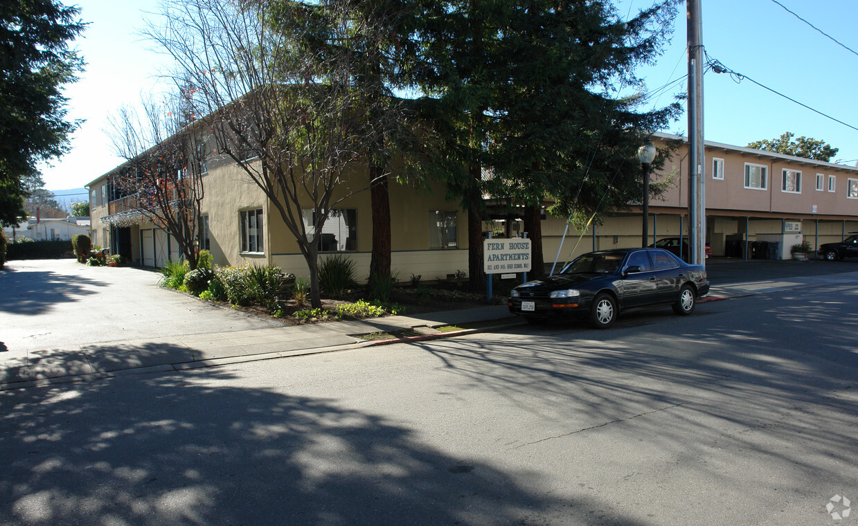
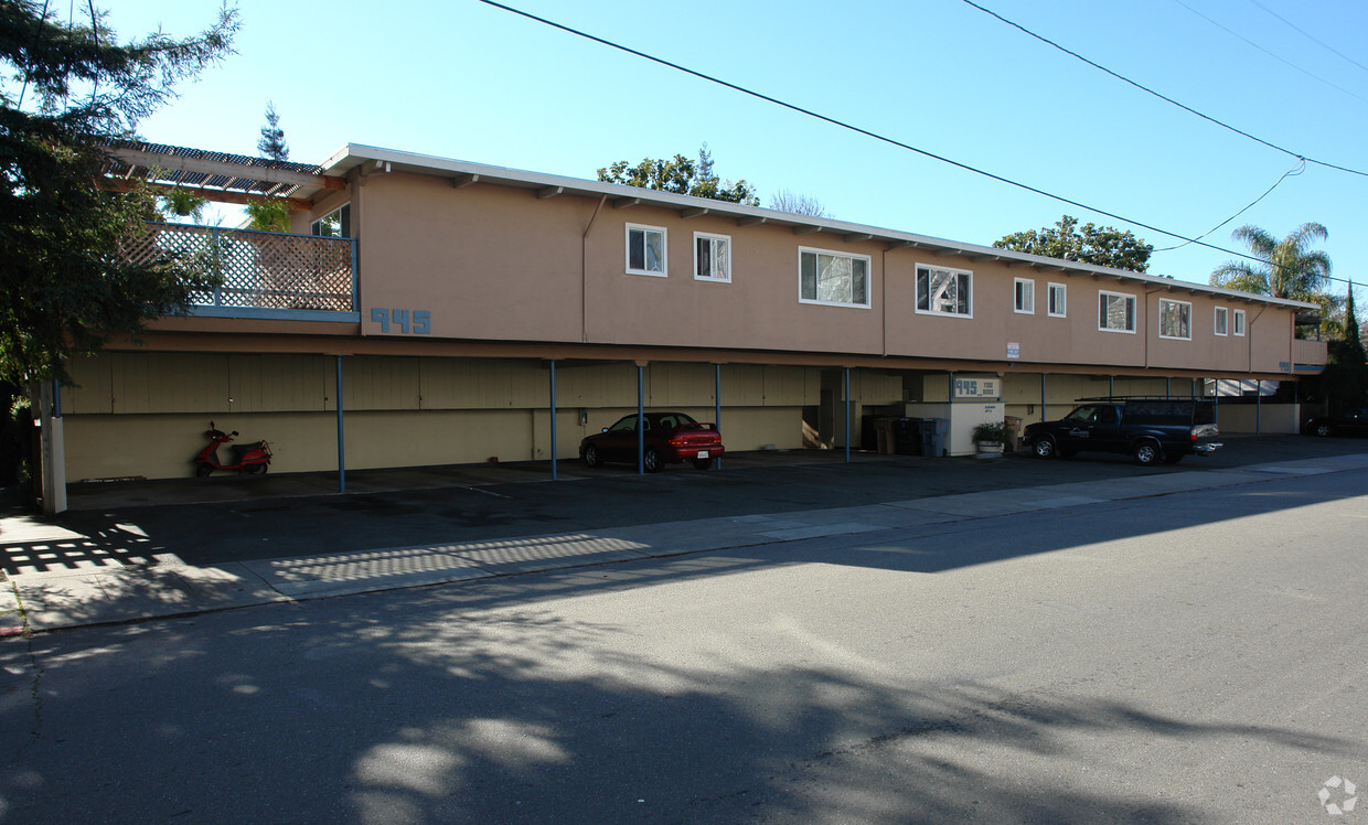

This is a 6-plex in Old Mountain View, located half a block from Castro St. and all the action and shops downtown. It is less than half a block from a large park. All units have double pane windows and come with one assigned uncovered parking spot. We welcome neutered cats and will accept one small to medium-sized adult neutered dog of most non-aggressive, non-baying breeds for no extra charge. This community in a garden setting has a very big pool and also a laundry room. The rent includes water and garbage and we do not take the last month's rent upon move-in. Renter's insurance is required.
921-945 High School Way is an apartment community located in Santa Clara County and the 94041 ZIP Code. This area is served by the Mountain View Whisman attendance zone.
Hardwood Floors
Tile Floors
Ceiling Fans
Smoke Free
Downtown Mountain View is largely concentrated on Castro Street, roughly between the Central Expressway in the north and El Camino Real in the south. The neighborhood is vibrant, boasting a slew of diverse restaurants, shops, cafes, and bars in a walkable locale. Downtown Mountain View also hosts a bevy of year-round events for the community, including the Farmer’s Market, Annual Spring Parade, Art and Wine Festival, and more.
Government buildings are clustered in the southern portion of the neighborhood, along with the Mountain View Public Library, Pioneer Memorial Park, Mountain View Center for the Performing Arts, and the sprawling Eagle Park. In addition to being close to these exciting amenities, Downtown Mountain View apartments are also convenient to multiple buses, commuter shuttles, and Caltrain lines.
Learn more about living in Downtown Mountain ViewCompare neighborhood and city base rent averages by bedroom.
| Downtown Mountain View | Mountain View, CA | |
|---|---|---|
| Studio | $2,252 | $2,784 |
| 1 Bedroom | $3,415 | $3,252 |
| 2 Bedrooms | $4,448 | $4,139 |
| 3 Bedrooms | $4,004 | $4,871 |
| Colleges & Universities | Distance | ||
|---|---|---|---|
| Colleges & Universities | Distance | ||
| Drive: | 9 min | 3.4 mi | |
| Drive: | 10 min | 3.8 mi | |
| Drive: | 10 min | 5.9 mi | |
| Drive: | 15 min | 6.0 mi |


Transportation options available in Mountain View include Mountain View Station, located 0.8 mile from 921-945 High School Way. 921-945 High School Way is near Norman Y Mineta San Jose International, located 10.3 miles or 16 minutes away, and San Francisco International, located 25.9 miles or 35 minutes away.
| Transit / Subway | Distance | ||
|---|---|---|---|
| Transit / Subway | Distance | ||
| Walk: | 15 min | 0.8 mi | |
|
|
Walk: | 15 min | 0.8 mi |
|
|
Drive: | 6 min | 2.2 mi |
|
|
Drive: | 5 min | 2.8 mi |
| Drive: | 7 min | 3.0 mi |
| Commuter Rail | Distance | ||
|---|---|---|---|
| Commuter Rail | Distance | ||
| Walk: | 16 min | 0.9 mi | |
| Walk: | 17 min | 0.9 mi | |
| Drive: | 6 min | 2.5 mi | |
| Drive: | 9 min | 3.9 mi | |
| Drive: | 12 min | 5.2 mi |
| Airports | Distance | ||
|---|---|---|---|
| Airports | Distance | ||
|
Norman Y Mineta San Jose International
|
Drive: | 16 min | 10.3 mi |
|
San Francisco International
|
Drive: | 35 min | 25.9 mi |
Time and distance from 921-945 High School Way.
| Shopping Centers | Distance | ||
|---|---|---|---|
| Shopping Centers | Distance | ||
| Walk: | 14 min | 0.7 mi | |
| Walk: | 18 min | 0.9 mi | |
| Walk: | 18 min | 1.0 mi |
| Parks and Recreation | Distance | ||
|---|---|---|---|
| Parks and Recreation | Distance | ||
|
Redwood Grove
|
Drive: | 9 min | 3.3 mi |
|
Terman Park
|
Drive: | 9 min | 3.5 mi |
|
Foothill College Observatory
|
Drive: | 11 min | 4.1 mi |
|
J. Pearce Mitchell Park
|
Drive: | 11 min | 4.3 mi |
|
Esther Clark Nature Preserve
|
Drive: | 11 min | 4.9 mi |
| Hospitals | Distance | ||
|---|---|---|---|
| Hospitals | Distance | ||
| Drive: | 4 min | 1.6 mi | |
| Drive: | 14 min | 6.6 mi | |
| Drive: | 18 min | 7.2 mi |
| Military Bases | Distance | ||
|---|---|---|---|
| Military Bases | Distance | ||
| Drive: | 9 min | 3.2 mi |
What Are Walk Score®, Transit Score®, and Bike Score® Ratings?
Walk Score® measures the walkability of any address. Transit Score® measures access to public transit. Bike Score® measures the bikeability of any address.
What is a Sound Score Rating?
A Sound Score Rating aggregates noise caused by vehicle traffic, airplane traffic and local sources

921-945 High School Way
Mountain View, CA 94041


