
Presidential Towers
555 W Madison St,
Chicago, IL 60661
$1,659 - $6,667
Studio - 2 Beds

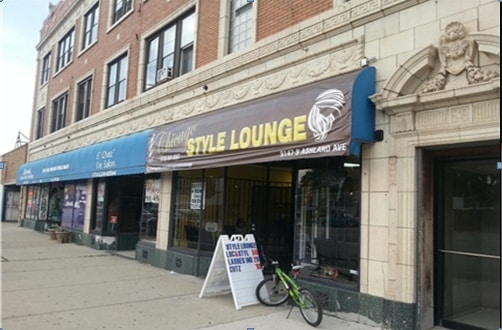

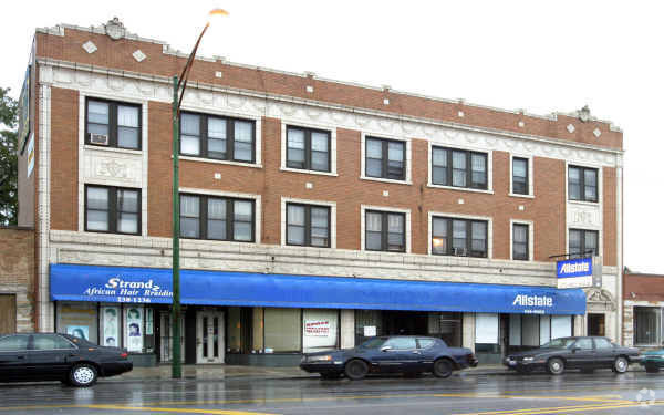
Find your new home at 9141-9147 S Ashland Ave. The address for this community is in Chicago on S. Ashland Ave in the 60620 area. Schedule a time to see the available floorplan options. The knowledgeable leasing staff is waiting to show you all that this community has in store. Get moving on finding your next place. Contact or stop by 9141-9147 S Ashland Ave to check the current floorplan availability!
9141-9147 S Ashland Ave is an apartment community located in Cook County and the 60620 ZIP Code. This area is served by the Chicago Public Schools attendance zone.
High Speed Internet Access
Refrigerator
Ceiling Fans
Smoke Free
Brainerd, a Chicago neighborhood dating back to the 1830s, sits 12 miles south of the Chicago Loop. Residents enjoy apartments and condos for rent with easy access to Brainerd Park, a community focal point featuring a gymnasium, multipurpose rooms, and volleyball, baseball, tennis, and basketball courts. City-sponsored picnics, programs and holiday events regularly take place at the park.
The Carter G. Woodson Regional Library, another favorite gathering place, contains the largest collection of African-American history and literature in the Midwest. After visiting, head to Poppin Dough for freshly-made donuts or Maxwell's Charcoal Grill for traditional hot dogs and burgers. Locals enjoy Harold's Chicken Shack No. 26 for its tasty poultry.
Learn more about living in BrainerdCompare neighborhood and city base rent averages by bedroom.
| Brainerd | Chicago, IL | |
|---|---|---|
| Studio | $781 | $1,651 |
| 1 Bedroom | $954 | $2,055 |
| 2 Bedrooms | $1,081 | $2,591 |
| 3 Bedrooms | $1,385 | $3,101 |
| Colleges & Universities | Distance | ||
|---|---|---|---|
| Colleges & Universities | Distance | ||
| Drive: | 10 min | 3.9 mi | |
| Drive: | 9 min | 4.0 mi | |
| Drive: | 10 min | 5.1 mi | |
| Drive: | 15 min | 7.5 mi |


Transportation options available in Chicago include 87Th Street Station, located 3.4 miles from 9141-9147 S Ashland Ave. 9141-9147 S Ashland Ave is near Chicago Midway International, located 9.3 miles or 17 minutes away, and Chicago O'Hare International, located 30.2 miles or 46 minutes away.
| Transit / Subway | Distance | ||
|---|---|---|---|
| Transit / Subway | Distance | ||
|
|
Drive: | 6 min | 3.4 mi |
|
|
Drive: | 7 min | 3.5 mi |
|
|
Drive: | 7 min | 3.6 mi |
|
|
Drive: | 8 min | 4.2 mi |
|
|
Drive: | 9 min | 4.9 mi |
| Commuter Rail | Distance | ||
|---|---|---|---|
| Commuter Rail | Distance | ||
|
|
Walk: | 10 min | 0.6 mi |
|
|
Walk: | 13 min | 0.7 mi |
|
|
Drive: | 2 min | 1.1 mi |
|
|
Drive: | 4 min | 1.5 mi |
|
|
Drive: | 5 min | 1.7 mi |
| Airports | Distance | ||
|---|---|---|---|
| Airports | Distance | ||
|
Chicago Midway International
|
Drive: | 17 min | 9.3 mi |
|
Chicago O'Hare International
|
Drive: | 46 min | 30.2 mi |
Scores provided by
Traffic
-Airport
-Businesses
-Scores provided by
HowLoud What is a Sound Score Rating? A Sound Score Rating aggregates noise caused by vehicle traffic, airplane traffic and local sources. How It WorksTime and distance from 9141-9147 S Ashland Ave.
| Shopping Centers | Distance | ||
|---|---|---|---|
| Shopping Centers | Distance | ||
| Drive: | 4 min | 1.6 mi | |
| Drive: | 4 min | 1.7 mi | |
| Drive: | 5 min | 2.2 mi |
| Parks and Recreation | Distance | ||
|---|---|---|---|
| Parks and Recreation | Distance | ||
|
Foster Park
|
Drive: | 3 min | 1.3 mi |
|
Graver Park
|
Drive: | 4 min | 2.0 mi |
|
Dan Ryan Woods
|
Drive: | 4 min | 2.1 mi |
|
Prospect Gardens Park
|
Drive: | 6 min | 2.7 mi |
|
Munroe Park
|
Drive: | 6 min | 3.1 mi |
| Hospitals | Distance | ||
|---|---|---|---|
| Hospitals | Distance | ||
| Drive: | 3 min | 2.0 mi | |
| Drive: | 7 min | 4.1 mi | |
| Drive: | 9 min | 4.1 mi |
| Military Bases | Distance | ||
|---|---|---|---|
| Military Bases | Distance | ||
| Drive: | 50 min | 33.8 mi | |
| Drive: | 55 min | 37.8 mi | |
| Drive: | 61 min | 38.8 mi |
What Are Walk Score®, Transit Score®, and Bike Score® Ratings?
Walk Score® measures the walkability of any address. Transit Score® measures access to public transit. Bike Score® measures the bikeability of any address.
What is a Sound Score Rating?
A Sound Score Rating aggregates noise caused by vehicle traffic, airplane traffic and local sources.
9141-9147 S Ashland Ave
Chicago, IL 60620


