9 Sewall St
Boston, MA 02120
-
Bedrooms
6
-
Bathrooms
4
-
Square Feet
1,920 sq ft
-
Available
Available Now

About This Home
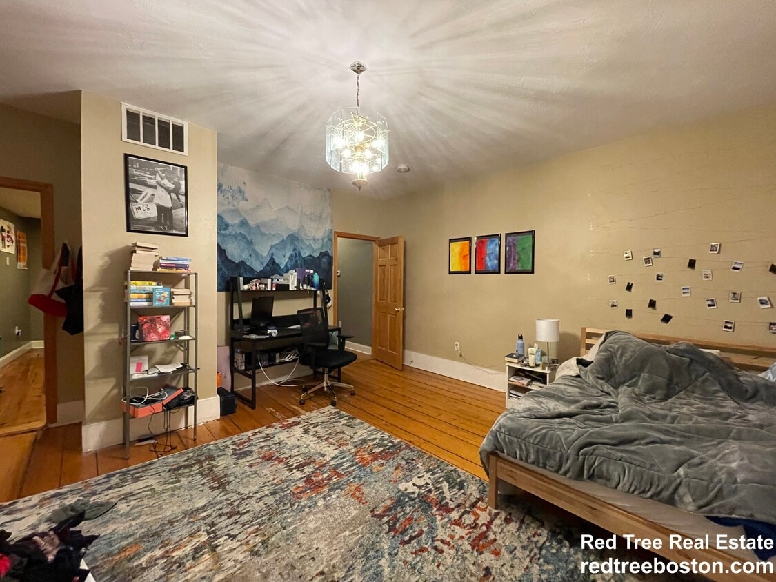
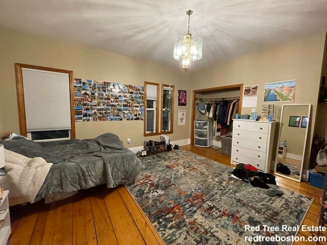
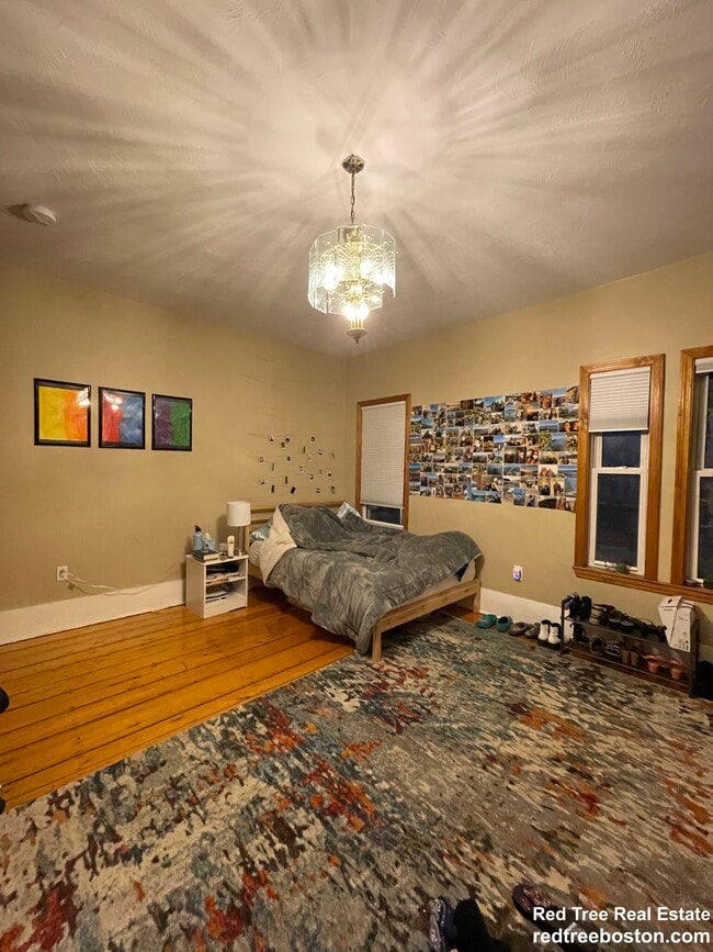
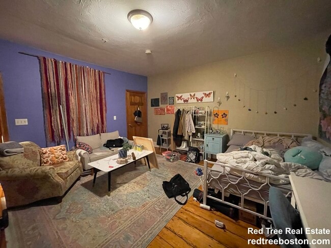
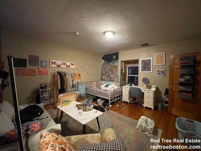
Amazing Stone Single family in Heart of flat part of Mission Hill. Wonderful opportunity to live in a great location, close to the Orange Line, Northeastern University, and Longwood Medical Area. Central heat. Spiral staircase. Beautiful patio and private yard. Finished walkout lower level includes bedroom, full bath, and entertainment area.
9 Sewall St is a house located in Suffolk County and the 02120 ZIP Code. This area is served by the Boston Public Schools attendance zone.
House Features
- Washer/Dryer
- Granite Countertops
Fees and Policies
Details
Lease Options
-
12 Months
Contact
- Phone Number
- Website View Property Website
- Contact
-
Source

- Washer/Dryer
- Granite Countertops
Boston is the iconic capital and largest city of Massachusetts, known for its historical significance, top-notch culinary scene, and beautiful Bayfront views. Nestled on Massachusetts Bay, Boston is home to numerous universities including Harvard University, Boston College, Northeastern University, the University of Massachusetts-Boston, the Berklee College of Music, and the Benjamin Franklin Institute of Technology. In fact, there are 54 colleges and universities in the Boston area, dating all the way back to 1636 when Harvard was established.
Boston played a crucial role in the American Revolution, being the site of major events like the Boston Massacre and the Boston Tea Party. This city is filled with historic sites, landmarks, and architecture like the Boston Common, the first park in the country, dating back to 1624. Locals frequent Freedom Trail for its walking park that begins at the park and leads past several historic sites, including Paul Revere’s House and Faneuil Hall.
Learn more about living in Boston| Colleges & Universities | Distance | ||
|---|---|---|---|
| Colleges & Universities | Distance | ||
| Walk: | 10 min | 0.5 mi | |
| Walk: | 10 min | 0.5 mi | |
| Walk: | 10 min | 0.5 mi | |
| Drive: | 4 min | 1.7 mi |


View GreatSchools Rating Methodology
Data provided by GreatSchools.org © 2025. All rights reserved.
Transportation options available in Boston include Roxbury Crossing Station, located 0.3 mile from 9 Sewall St. 9 Sewall St is near General Edward Lawrence Logan International, located 6.6 miles or 13 minutes away.
| Transit / Subway | Distance | ||
|---|---|---|---|
| Transit / Subway | Distance | ||
|
|
Walk: | 5 min | 0.3 mi |
|
|
Walk: | 9 min | 0.5 mi |
|
|
Walk: | 9 min | 0.5 mi |
|
|
Walk: | 10 min | 0.5 mi |
|
|
Walk: | 11 min | 0.6 mi |
| Commuter Rail | Distance | ||
|---|---|---|---|
| Commuter Rail | Distance | ||
|
|
Walk: | 13 min | 0.7 mi |
| Drive: | 4 min | 1.9 mi | |
|
|
Drive: | 4 min | 2.0 mi |
|
|
Drive: | 7 min | 2.0 mi |
|
|
Drive: | 9 min | 4.8 mi |
| Airports | Distance | ||
|---|---|---|---|
| Airports | Distance | ||
|
General Edward Lawrence Logan International
|
Drive: | 13 min | 6.6 mi |
Time and distance from 9 Sewall St.
| Shopping Centers | Distance | ||
|---|---|---|---|
| Shopping Centers | Distance | ||
| Walk: | 16 min | 0.9 mi | |
| Drive: | 3 min | 1.5 mi | |
| Drive: | 4 min | 1.7 mi |
| Parks and Recreation | Distance | ||
|---|---|---|---|
| Parks and Recreation | Distance | ||
|
Roxbury Heritage State Park
|
Walk: | 10 min | 0.5 mi |
|
Charles River Reservation
|
Drive: | 4 min | 2.1 mi |
|
Frederick Law Olmsted National Historic Site
|
Drive: | 4 min | 2.1 mi |
|
John Fitzgerald Kennedy National Historic Site
|
Drive: | 6 min | 2.1 mi |
|
Coit Observatory
|
Drive: | 5 min | 2.5 mi |
| Hospitals | Distance | ||
|---|---|---|---|
| Hospitals | Distance | ||
| Walk: | 12 min | 0.6 mi | |
| Walk: | 13 min | 0.7 mi | |
| Walk: | 14 min | 0.7 mi |
| Military Bases | Distance | ||
|---|---|---|---|
| Military Bases | Distance | ||
| Drive: | 27 min | 15.1 mi | |
| Drive: | 31 min | 15.6 mi |
9 Sewall St Photos
Nearby Apartments
Within 50 Miles of 9 Sewall St Boston, MA 02120
-
12 Dalrymple St
Boston, MA 02130
$3,600
4 Br 12 Month Lease 1.1 mi
-
44 Gerrish St
Boston, MA 02135
$7,200
5 Br 12 Month Lease 3.7 mi
-
48 Woodward St
Newton, MA 02461
$8,750
4 Br 6.0 mi
-
3 Day Cir
Woburn, MA 01801
$7,000
4 Br 12 Month Lease 10.1 mi
-
215 Jaffrey St
Weymouth, MA 02188
$3,500
4 Br 12 Month Lease 10.8 mi
-
15 Boyden Dr
Foxborough, MA 02035
$4,500
4 Br 19.6 mi
What Are Walk Score®, Transit Score®, and Bike Score® Ratings?
Walk Score® measures the walkability of any address. Transit Score® measures access to public transit. Bike Score® measures the bikeability of any address.
What is a Sound Score Rating?
A Sound Score Rating aggregates noise caused by vehicle traffic, airplane traffic and local sources

9 Sewall St
Boston, MA 02120