
$2,250
/ Month
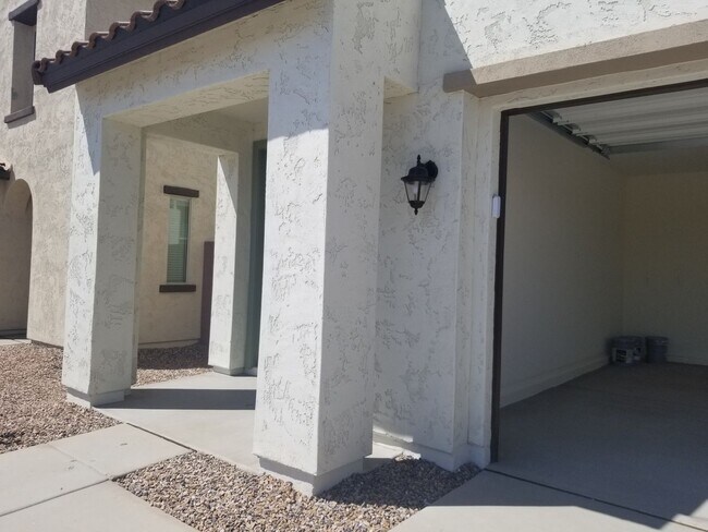
8830 Fleetwood Ln
Glendale, AZ 85305
Today
|
Edit
Favorites
623-707-3661
-
Bedrooms
5
-
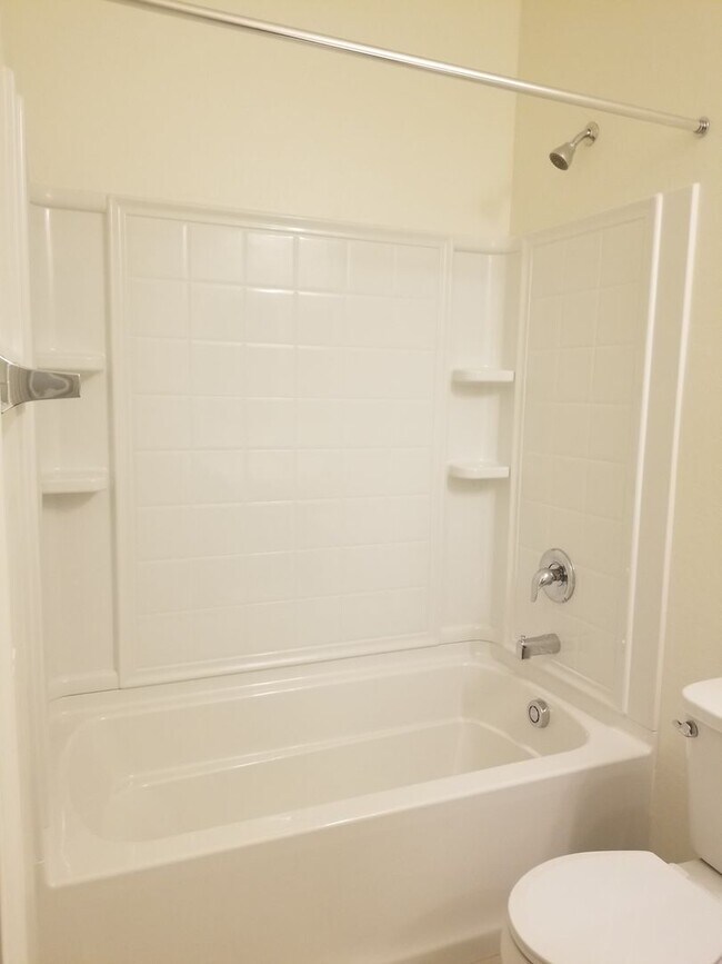
Bathrooms
3
-
Square Feet
2,700 sq ft
-
Available
Available Now
8830 Fleetwood Ln

Favorites
About This Home
$2,250 deposit,
Available Now
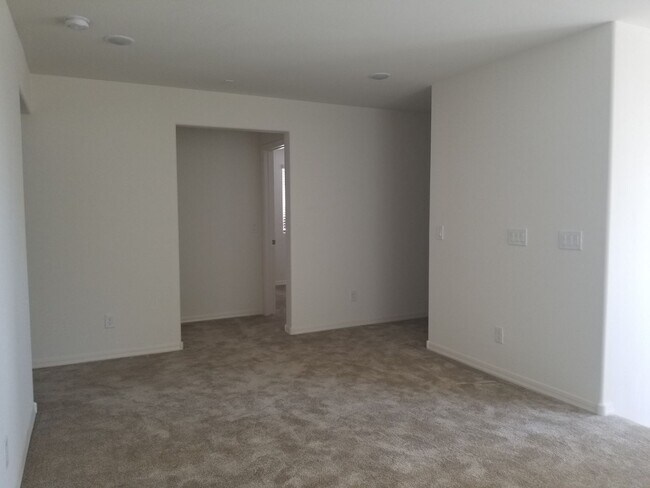
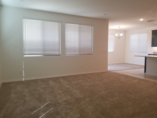
Spacious 5 bedroom home is gated community. Near shopping, restaurants an entertainment.
8830 Fleetwood Ln is a house located in Maricopa County and the 85305 ZIP Code. This area is served by the Pendergast Elementary District attendance zone.
* Price shown is base rent. Excludes user-selected optional fees and variable or usage-based fees and required charges due at or prior to move-in or at move-out. Price, availability, fees, and any applicable rent special are subject to change without notice.
* Square footage definitions vary. Displayed square footage is approximate.
Fees and Policies
The fees listed below are community-provided and may exclude utilities or add-ons. All payments are made directly to the property and are non-refundable unless otherwise specified. Use the Cost Calculator to determine costs based on your needs.
-
One-Time Basics
-
Due at Move-In
-
Security Deposit - RefundableCharged per unit.$2,250
-
-
Due at Move-In
Property Fee Disclaimer: Based on community-supplied data and independent market research. Subject to change without notice. May exclude fees for mandatory or optional services and usage-based utilities.
Contact
- Listed by Easy | Easy Street Realty & Management
- Phone Number
- Contact
Location
Get Directions
Welcome to Glendale, Arizona, a welcoming city in the Phoenix metropolitan area. Located just nine miles northwest of downtown Phoenix, this community offers diverse rental options from contemporary apartments near the Westgate Entertainment District to historic properties in the Catlin Court Historic District. Current rental trends show one-bedroom units averaging $1,238, with rates decreasing 3.7% over the past year.
The city's centerpiece attractions include State Farm Stadium, home of the Arizona Cardinals NFL team, and Desert Diamond Arena, which hosts major concerts and events throughout the year. The Westgate Entertainment District serves as a destination for shopping and dining. History enthusiasts can explore two preserved historic properties: Sahuaro Ranch Park, featuring a 19th-century ranch house and beautiful rose garden, and Manistee Ranch, showcasing territorial-style architecture.
Learn more about living in Glendale
Education
| Colleges & Universities | Distance | ||
|---|---|---|---|
| Colleges & Universities | Distance | ||
| Drive: | 13 min | 5.8 mi | |
| Drive: | 17 min | 9.4 mi | |
| Drive: | 20 min | 10.3 mi | |
| Drive: | 21 min | 10.9 mi |
8830 Fleetwood Ln is within 13 minutes or 5.8 miles from Glendale Community College. It is also near Estrella Mountain Comm. Coll. and Thunderbird, West Campus.
Schools

Public Elementary & Middle School
Grades PK-8
674 Students
Attendance Zone
Public High School
Grades 9-12
2,176 Students
Attendance Zone
Private Elementary, Middle & High School
Grades 5-12
Nearby
Private Elementary & Middle School
Grades PK-8
125 Students
Nearby
Private Elementary & Middle School
Grades 3-8
Nearby
School data provided by
 The GreatSchools Rating helps parents compare schools within a state based on a variety of school quality indicators and provides a helpful picture of how effectively each school serves all of its students. Ratings are on a scale of 1 (below average) to 10 (above average) and can include test scores, college readiness, academic progress, advanced courses, equity, discipline and attendance data. We also advise parents to visit schools, consider other information on school performance and programs, and consider family needs as part of the school selection process.
View GreatSchools Rating Methodology
Data provided by GreatSchools.org © 2026. All rights reserved.
View GreatSchools Rating Methodology
Data provided by GreatSchools.org © 2026. All rights reserved.
Transportation options available in Glendale include Glendale/19Th Ave, located 8.9 miles from 8830 Fleetwood Ln. 8830 Fleetwood Ln is near Phoenix Sky Harbor International, located 21.7 miles or 33 minutes away.
| Transit / Subway | Distance | ||
|---|---|---|---|
| Transit / Subway | Distance | ||
|
|
Drive: | 19 min | 8.9 mi |
|
|
Drive: | 19 min | 9.5 mi |
|
|
Drive: | 21 min | 10.2 mi |
|
|
Drive: | 21 min | 10.5 mi |
|
|
Drive: | 21 min | 10.6 mi |
| Airports | Distance | ||
|---|---|---|---|
| Airports | Distance | ||
|
Phoenix Sky Harbor International
|
Drive: | 33 min | 21.7 mi |
Time and distance from 8830 Fleetwood Ln.
| Shopping Centers | Distance | ||
|---|---|---|---|
| Shopping Centers | Distance | ||
| Walk: | 9 min | 0.5 mi | |
| Walk: | 15 min | 0.8 mi | |
| Drive: | 3 min | 1.2 mi |
8830 Fleetwood Ln has 3 shopping centers within 1.2 miles, which is about a 3-minute drive. The miles and minutes will be for the farthest away property.
| Parks and Recreation | Distance | ||
|---|---|---|---|
| Parks and Recreation | Distance | ||
|
El Oso Park
|
Drive: | 11 min | 5.3 mi |
|
Maryvale Park
|
Drive: | 15 min | 7.6 mi |
|
Friendship Park
|
Drive: | 17 min | 10.5 mi |
|
Wildlife World Zoo
|
Drive: | 20 min | 11.4 mi |
|
Acoma Park
|
Drive: | 23 min | 12.5 mi |
8830 Fleetwood Ln has 5 parks within 12.5 miles, including El Oso Park, Maryvale Park, and Friendship Park.
| Hospitals | Distance | ||
|---|---|---|---|
| Hospitals | Distance | ||
| Drive: | 9 min | 4.7 mi | |
| Drive: | 13 min | 6.6 mi | |
| Drive: | 13 min | 6.6 mi |
8830 Fleetwood Ln has 3 hospitals within 6.6 miles, the nearest is Banner Estrella Medical Center which is 4.7 miles away and a 9 minute drive.
| Military Bases | Distance | ||
|---|---|---|---|
| Military Bases | Distance | ||
| Drive: | 11 min | 5.9 mi | |
| Drive: | 33 min | 21.6 mi | |
| Drive: | 92 min | 68.9 mi |
8830 Fleetwood Ln has 3 military bases within 68.9 miles, the nearest is Luke Air Force Base which is 5.9 miles away and a 11 minute drive.
You May Also Like
Similar Rentals Nearby
-
-
4 Beds$2,882+Total Monthly PriceTotal Monthly Price NewPrices include base rent and required monthly fees of $170. Variable costs based on usage may apply.Base Rent:4 Beds$2,712+2 Months Free
-

-

-

-

-

-
-

-


What Are Walk Score®, Transit Score®, and Bike Score® Ratings?
Walk Score® measures the walkability of any address. Transit Score® measures access to public transit. Bike Score® measures the bikeability of any address.
What is a Sound Score Rating?
A Sound Score Rating aggregates noise caused by vehicle traffic, airplane traffic and local sources

8830 Fleetwood Ln
Glendale, AZ 85305