
$1,150
/ Month
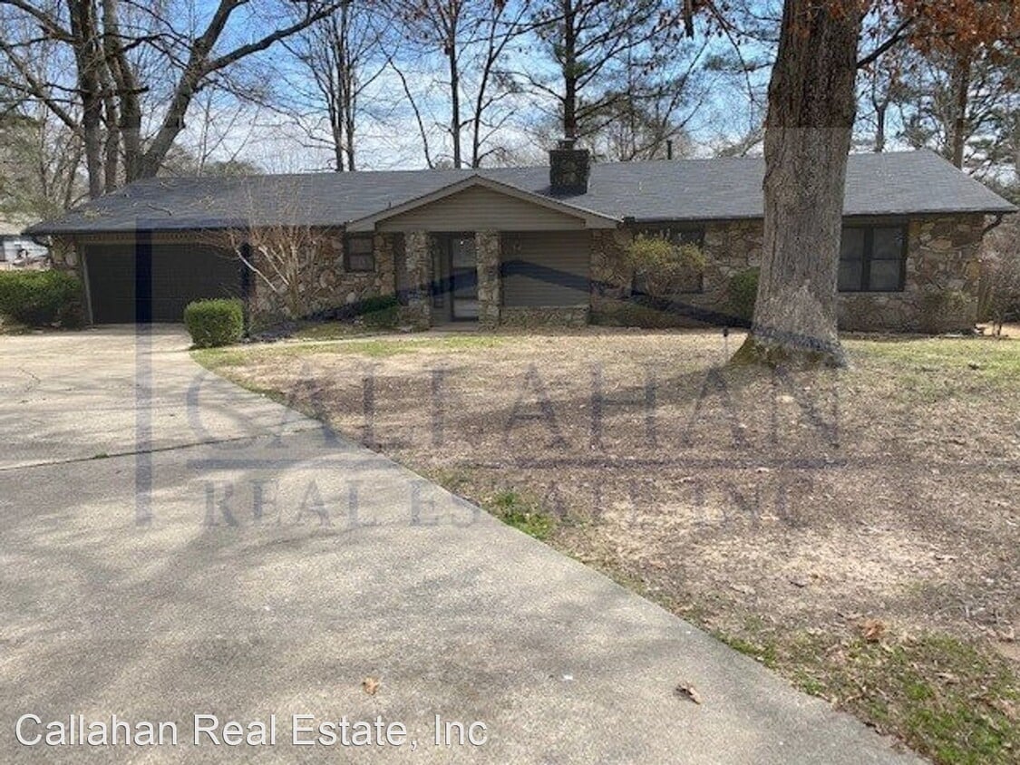
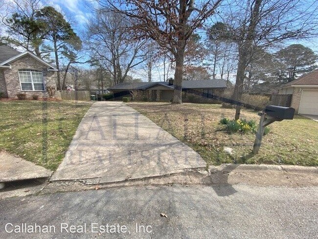
8710 Manassas Cir
Little Rock, AR 72103
2 Weeks Ago
|
Edit
Favorites
8710 Manassas Cir

Favorites
Check Back Soon for Upcoming Availability
| Beds | Baths | Average SF |
|---|---|---|
| 3 Bedrooms 3 Bedrooms 3 Br | 2 Baths 2 Baths 2 Ba | 1,607 SF |
About This Property
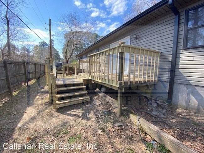
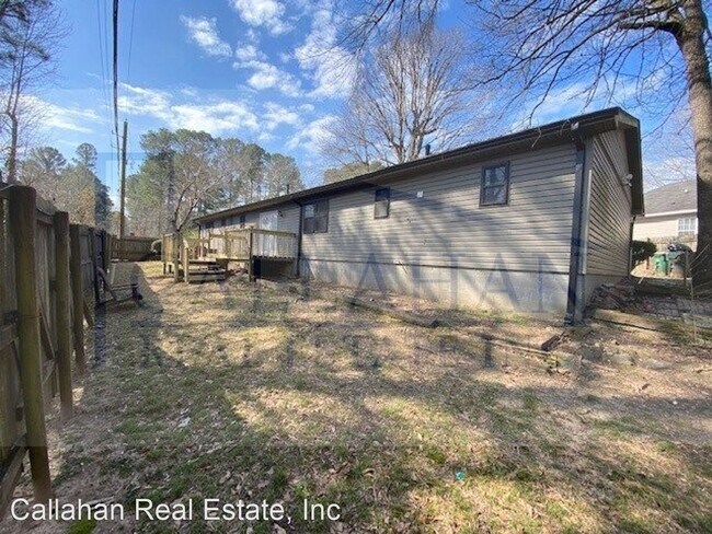
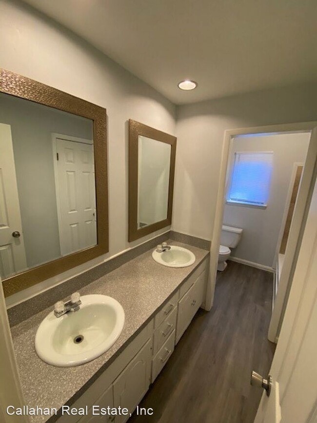
(501) 758-9555 - Updated Mablevale 3 bedroom Home - This updated 3 bedroom 2 bath home is located in the Shiloh section of Mabelvale. Close to shopping, city parks, and freeway access. There is new flooring fresh pant updated kitchen and bath rooms, new deck on the back of the home and tons more. Call today for more information to make this house your home. Copy this link to your browser to schedule a showing at your convenience. https://secure.rently.com/properties/3008162?source=marketing (RLNE6491206)
8710 Manassas Cir is a house located in Pulaski County and the 72103 ZIP Code. This area is served by the Little Rock School District attendance zone.
8710 Manassas Cir,
Little Rock,
AR
72103
The Chicot West section of Little Rock, located just south of Interstate 30, sits approximately 14 miles southwest of downtown's state government complex along the Arkansas River. Most of the residences and homes for rent lie in the northeast part of the neighborhood, near the intersection of I-30 and Chicot Road.
When the desire to eat out strikes, residents cross over I-30 for David's Burgers, which serves signature home-cut fries and fresh ground beef. For exercise, head to Morehart Park to tame the challenging nine-hole disc golf course. Navigate your disc among the tall trees to try to beat the par 65 score in the heart of this natural oasis.
Learn more about living in Chicot West I-30 SouthBelow are rent ranges for similar nearby apartments
Education
| Colleges & Universities | Distance | ||
|---|---|---|---|
| Colleges & Universities | Distance | ||
| Drive: | 14 min | 6.8 mi | |
| Drive: | 19 min | 9.5 mi | |
| Drive: | 18 min | 11.7 mi | |
| Drive: | 26 min | 16.1 mi |
8710 Manassas Cir is within 14 minutes or 6.8 miles from UA Little Rock. It is also near Univ. of Ark. Medical Scis. and Philander Smith College.
Schools


Public Elementary School
Grades PK-5
Nearby
Public Elementary School
Grades K-5
Attendance Zone
Public Middle School
Grades 6-8
Attendance Zone
Public High School
Grades 9-12
Attendance Zone
Private Elementary, Middle & High School
Grades K-12
Nearby
School data provided by
 The GreatSchools Rating helps parents compare schools within a state based on a variety of school quality indicators and provides a helpful picture of how effectively each school serves all of its students. Ratings are on a scale of 1 (below average) to 10 (above average) and can include test scores, college readiness, academic progress, advanced courses, equity, discipline and attendance data. We also advise parents to visit schools, consider other information on school performance and programs, and consider family needs as part of the school selection process.
View GreatSchools Rating Methodology
Data provided by GreatSchools.org © 2026. All rights reserved.
View GreatSchools Rating Methodology
Data provided by GreatSchools.org © 2026. All rights reserved.
Transportation options available in Little Rock include 2Nd St & Rock St, located 11.8 miles from 8710 Manassas Cir. 8710 Manassas Cir is near Bill and Hillary Clinton Ntl/Adams Field, located 12.7 miles or 19 minutes away.
| Transit / Subway | Distance | ||
|---|---|---|---|
| Transit / Subway | Distance | ||
| Drive: | 18 min | 11.8 mi | |
| Drive: | 18 min | 11.9 mi | |
| Drive: | 18 min | 11.9 mi | |
| Drive: | 18 min | 12.0 mi | |
| Drive: | 18 min | 12.2 mi |
| Commuter Rail | Distance | ||
|---|---|---|---|
| Commuter Rail | Distance | ||
|
|
Drive: | 20 min | 12.8 mi |
|
|
Drive: | 43 min | 36.2 mi |
| Airports | Distance | ||
|---|---|---|---|
| Airports | Distance | ||
|
Bill and Hillary Clinton Ntl/Adams Field
|
Drive: | 19 min | 12.7 mi |
Walkability Near 8710 Manassas Cir Little Rock, AR 72103
Getting Around
 What do Walkability, Transit, Drivability, and Bikeability mean?
Walkability measures the walking distance to day-to-day needs.
Transit measures access to public transportation.
Drivability measures congestion, parking availability, and access to major roads.
Bikeability measures the suitability for cycling.
How It Works
What do Walkability, Transit, Drivability, and Bikeability mean?
Walkability measures the walking distance to day-to-day needs.
Transit measures access to public transportation.
Drivability measures congestion, parking availability, and access to major roads.
Bikeability measures the suitability for cycling.
How It Works
Somewhat Walkable
Walkability
20
/ 100
Limited Public Transit
Transit
20
/ 100
Exceptionally Drivable
Drivability
100
/ 100
Somewhat Bikeable
Bikeability
20
/ 100
Scores provided by
-
Soundscore™
-
/ 100
Traffic
-Airport
-Businesses
-Scores provided by
HowLoud What is a Sound Score Rating? A Sound Score Rating aggregates noise caused by vehicle traffic, airplane traffic and local sources. How It WorksTime and distance from 8710 Manassas Cir.
| Shopping Centers | Distance | ||
|---|---|---|---|
| Shopping Centers | Distance | ||
| Drive: | 5 min | 2.1 mi | |
| Drive: | 5 min | 2.2 mi | |
| Drive: | 5 min | 2.2 mi |
8710 Manassas Cir has 3 shopping centers within 2.2 miles, which is about a 5-minute drive. The miles and minutes will be for the farthest away property.
| Parks and Recreation | Distance | ||
|---|---|---|---|
| Parks and Recreation | Distance | ||
|
Little Rock Zoo
|
Drive: | 17 min | 8.5 mi |
|
Central High School National Historic Site
|
Drive: | 19 min | 8.9 mi |
|
Little Rock Audubon Center
|
Drive: | 16 min | 10.6 mi |
|
Museum of Discovery
|
Drive: | 18 min | 11.7 mi |
|
Lorance Creek Natural Area
|
Drive: | 26 min | 18.5 mi |
8710 Manassas Cir has 5 parks within 18.5 miles, including Little Rock Zoo, Central High School National Historic Site, and Little Rock Audubon Center.
| Hospitals | Distance | ||
|---|---|---|---|
| Hospitals | Distance | ||
| Drive: | 18 min | 9.1 mi | |
| Drive: | 18 min | 9.3 mi | |
| Drive: | 19 min | 10.6 mi |
8710 Manassas Cir has 3 hospitals within 10.6 miles, the nearest is Arkansas State Hospital which is 9.1 miles away and a 18 minute drive.
| Military Bases | Distance | ||
|---|---|---|---|
| Military Bases | Distance | ||
| Drive: | 43 min | 26.2 mi | |
| Drive: | 43 min | 29.0 mi | |
| Drive: | 47 min | 33.8 mi |
8710 Manassas Cir has 3 military bases within 33.8 miles, the nearest is Camp Joseph T. Robinson Hill which is 26.2 miles away and a 43 minute drive.
You May Also Like
Similar Rentals Nearby


What Are Walk Score®, Transit Score®, and Bike Score® Ratings?
Walk Score® measures the walkability of any address. Transit Score® measures access to public transit. Bike Score® measures the bikeability of any address.
What is a Sound Score Rating?
A Sound Score Rating aggregates noise caused by vehicle traffic, airplane traffic and local sources.

8710 Manassas Cir
Little Rock, AR 72103