1 / 23


Bedrooms
3
Bathrooms
2
Square Feet
1,595 sq ft
Available
Available Now

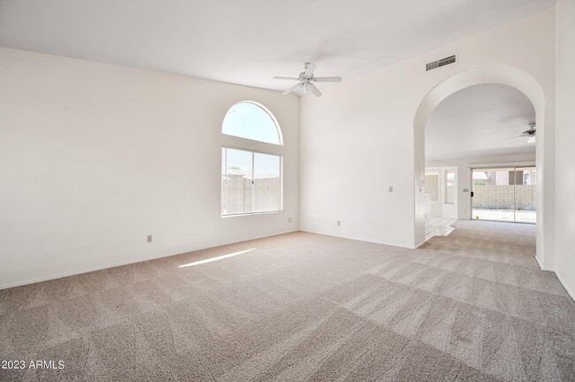
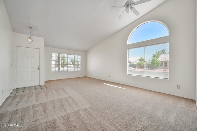
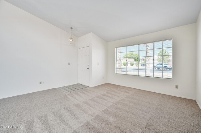
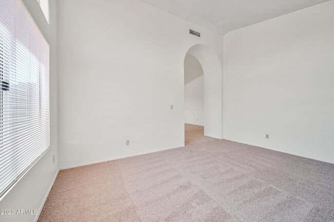
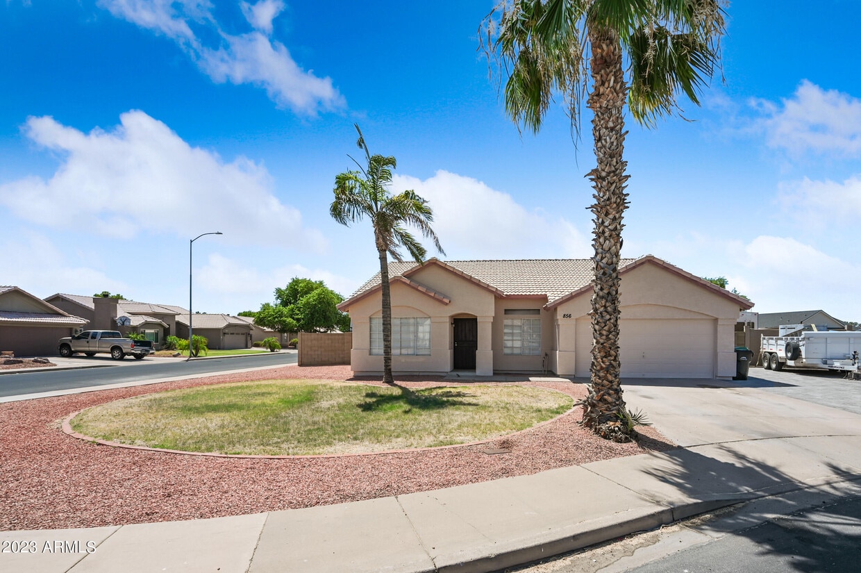
Cute three bedroom,two bath home ready for your family to make their own! Nice corner lot for easy access. Very popular floor plan. New Carpet! New Paint! Living room and dining room in front and roomy family room in rear. Open kitchen with breakfast bar and eat in kitchen. Roomy primary bedroom with private bath and walk in closet. RV gate to store your toys. Large backyard,great for family Barbecue's and entertaining. Convenient location. Easy access to schools and shopping in Mesa. Tour today.
856 54 Cir is a house located in Maricopa County and the 85206 ZIP Code. This area is served by the Mesa Unified attendance zone.
Year Built
Bedrooms and Bathrooms
Flooring
Home Design
Interior Spaces
Kitchen
Laundry
Listing and Financial Details
Lot Details
Outdoor Features
Parking
Schools
Utilities
Overview
Recreation
North of the Phoenix Mesa Gateway Airport is Superstition Springs, a community just 20 minutes outside of Mesa. The north section of the neighborhood boasts an expansive variety of shops and dining establishments.
The Superstition Springs Center mall is a major fashion hub, surrounded by Burlington, Target, and WinCo Foods market. Restaurants in the area include Olive Garden, The Cheesecake Factory, and BJ’s Restaurant and Brewhouse. The mall itself houses its own food court, along with an outdoor amphitheater and movie theater. Residents enjoy the convenience of being close to Mesa, Scottsdale, and Phoenix. Golfers will appreciate the championship golf course at the Superstition Springs Golf Club off Baseline Road.
Learn more about living in Superstition Springs| Colleges & Universities | Distance | ||
|---|---|---|---|
| Colleges & Universities | Distance | ||
| Drive: | 7 min | 2.8 mi | |
| Drive: | 12 min | 6.1 mi | |
| Drive: | 17 min | 8.7 mi | |
| Drive: | 14 min | 9.1 mi |


Transportation options available in Mesa include Gilbert Rd/Main St, located 6.0 miles from 856 54 Cir. 856 54 Cir is near Phoenix-Mesa Gateway, located 9.2 miles or 17 minutes away, and Phoenix Sky Harbor International, located 21.4 miles or 30 minutes away.
| Transit / Subway | Distance | ||
|---|---|---|---|
| Transit / Subway | Distance | ||
|
|
Drive: | 11 min | 6.0 mi |
|
|
Drive: | 12 min | 6.6 mi |
|
|
Drive: | 13 min | 7.4 mi |
|
|
Drive: | 15 min | 8.0 mi |
|
|
Drive: | 14 min | 10.1 mi |
| Commuter Rail | Distance | ||
|---|---|---|---|
| Commuter Rail | Distance | ||
|
|
Drive: | 52 min | 39.4 mi |
| Airports | Distance | ||
|---|---|---|---|
| Airports | Distance | ||
|
Phoenix-Mesa Gateway
|
Drive: | 17 min | 9.2 mi |
|
Phoenix Sky Harbor International
|
Drive: | 30 min | 21.4 mi |
Time and distance from 856 54 Cir.
| Shopping Centers | Distance | ||
|---|---|---|---|
| Shopping Centers | Distance | ||
| Walk: | 13 min | 0.7 mi | |
| Walk: | 15 min | 0.8 mi | |
| Walk: | 18 min | 1.0 mi |
| Parks and Recreation | Distance | ||
|---|---|---|---|
| Parks and Recreation | Distance | ||
|
Riparian Preserve at Water Ranch
|
Drive: | 7 min | 3.6 mi |
|
Red Mountain Park
|
Drive: | 10 min | 5.7 mi |
|
Arizona Museum of Natural History
|
Drive: | 15 min | 8.2 mi |
|
i.d.e.a. Museum
|
Drive: | 15 min | 10.3 mi |
|
Usery Mountain Recreation Area
|
Drive: | 24 min | 12.1 mi |
| Hospitals | Distance | ||
|---|---|---|---|
| Hospitals | Distance | ||
| Drive: | 2 min | 1.4 mi | |
| Drive: | 5 min | 2.4 mi | |
| Drive: | 5 min | 2.4 mi |
| Military Bases | Distance | ||
|---|---|---|---|
| Military Bases | Distance | ||
| Drive: | 29 min | 22.1 mi | |
| Drive: | 59 min | 46.6 mi | |
| Drive: | 120 min | 98.2 mi |
What Are Walk Score®, Transit Score®, and Bike Score® Ratings?
Walk Score® measures the walkability of any address. Transit Score® measures access to public transit. Bike Score® measures the bikeability of any address.
What is a Sound Score Rating?
A Sound Score Rating aggregates noise caused by vehicle traffic, airplane traffic and local sources
856 54 Cir
Mesa, AZ 85206


