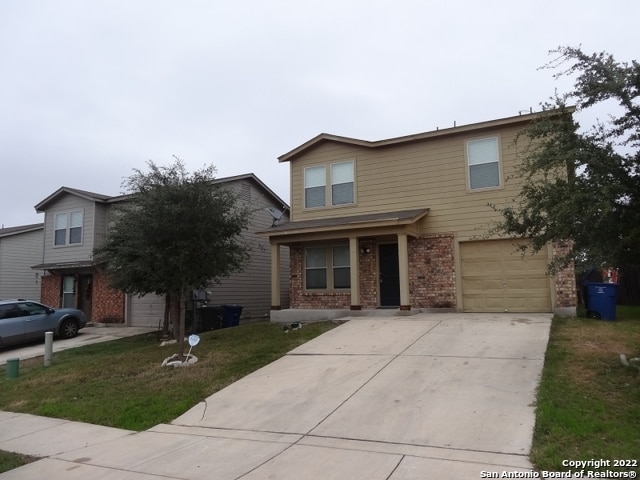
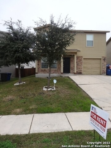

$1,500
/ Month
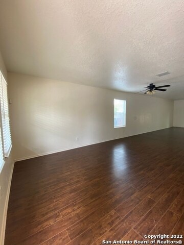
8414 Miners Point
San Antonio, TX 78252
Favorites
-
Bedrooms
3
-
Bathrooms
3
-
Square Feet
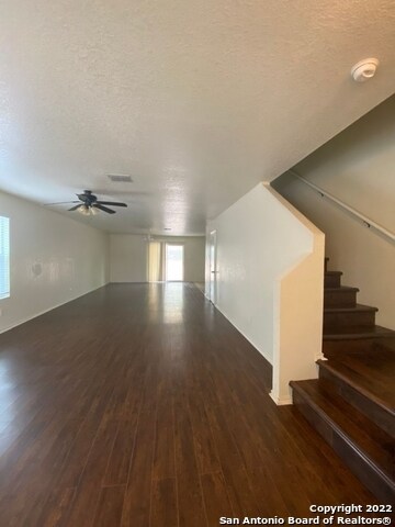
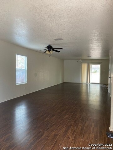
2,060 sq ft
8414 Miners Point

Favorites
Contact
- Listed by Locayt
Location
Get Directions
Framed by the Cleto Rodriguez Freeway and the PanAm Expressway, South San Antonio includes Palo Alto College on its southeast side and Lackland Air Force Base on its northwest side. With less than 15 minutes to downtown and easy access to major roadways, South San Antonio is a great option for students, military personnel, and commuters. In addition to Palo Alto College, students have access to Texas A&M University San Antonio and Baptist University of the Americas.
Those who enjoy thrifting will appreciate Traders Village San Antonio, situated on the southeast side of the neighborhood. South San Antonio is home to Pearsall Park, a 505-acre park with hiking trails, a playground, the Pearsall Water-Skate Park, and Pearsall Dog Park. Shops and restaurants are scattered throughout the neighborhood with a heavy concentration along Military Drive.
Learn more about living in South San Antonio
Education
| Colleges & Universities | Distance | ||
|---|---|---|---|
| Colleges & Universities | Distance | ||
| Drive: | 12 min | 7.1 mi | |
| Drive: | 16 min | 7.5 mi | |
| Drive: | 15 min | 9.3 mi | |
| Drive: | 20 min | 12.8 mi |
8414 Miners Point is within 12 minutes or 7.1 miles from Palo Alto College. It is also near St. Philip's College, SWC and Texas A&M University.
Getting Around
 What do Walkability, Transit, Drivability, and Bikeability mean?
Walkability measures the walking distance to day-to-day needs.
Transit measures access to public transportation.
Drivability measures congestion, parking availability, and access to major roads.
Bikeability measures the suitability for cycling.
How It Works
What do Walkability, Transit, Drivability, and Bikeability mean?
Walkability measures the walking distance to day-to-day needs.
Transit measures access to public transportation.
Drivability measures congestion, parking availability, and access to major roads.
Bikeability measures the suitability for cycling.
How It Works
Somewhat Walkable
Walkability
30
/ 100
Minimal Public Transit
Transit
0
/ 100
Exceptionally Drivable
Drivability
90
/ 100
Fairly Bikeable
Bikeability
40
/ 100
Scores provided by
-
Soundscore™
-
/ 100
Traffic
-Airport
-Businesses
-Scores provided by
HowLoud What is a Sound Score Rating? A Sound Score Rating aggregates noise caused by vehicle traffic, airplane traffic and local sources. How It WorksYou May Also Like
Similar Rentals Nearby


What Are Walk Score®, Transit Score®, and Bike Score® Ratings?
Walk Score® measures the walkability of any address. Transit Score® measures access to public transit. Bike Score® measures the bikeability of any address.
What is a Sound Score Rating?
A Sound Score Rating aggregates noise caused by vehicle traffic, airplane traffic and local sources.

8414 Miners Point
San Antonio, TX 78252