
Sevens
777 W Middlefield Rd,
Mountain View, CA 94043
$3,752 - $7,137 Total Monthly Price
Studio - 2 Beds
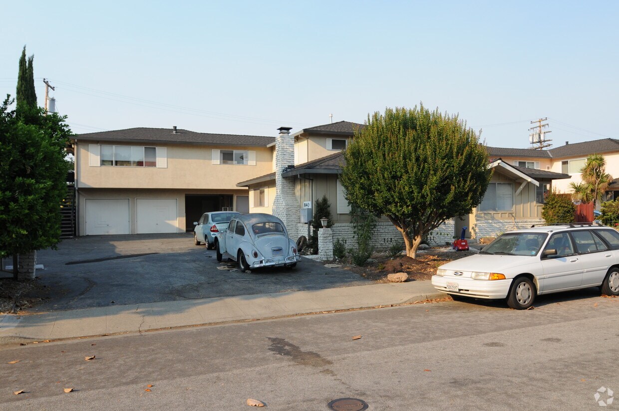
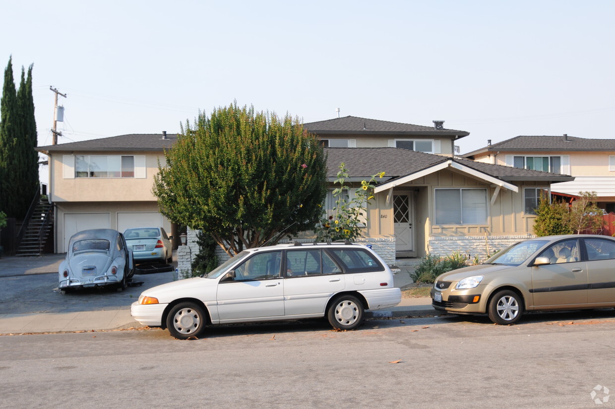

840 Williams Way in Mountain View, CA is ready for your visit. The 94040 location has much to offer its residents. The team of leasing professionals is ready to match you with the perfect floorplan option. Schedule a time to check out the current floorplan options. Find your new home at 840 Williams Way. Stop by the leasing office to schedule your tour.
840 Williams Way is an apartment community located in Santa Clara County and the 94040 ZIP Code. This area is served by the Mountain View Whisman School District attendance zone.
Sitting on the eastern edge of the city, the Cuernavaca neighborhood of Mountain View, California, borders the neighboring town of Sunnyvale. The neighborhood's prime location in the Bay Area makes it highly desirable. San Jose sits 15 miles to the southeast and Downtown San Francisco lies 40 miles northwest.
The neighborhood is known for its variety of apartments for rent, all offering a slightly different living arrangement from the detached homes which occupy many of the surrounding neighborhoods. Largely residential, the neighborhood maintains a tranquility that residents appreciate. Countless restaurants, bars, and shopping centers are well within reach, but a Cuernavaca home provides a nice enclave to retreat to at the end of the day.
Learn more about living in CuernavacaCompare neighborhood and city base rent averages by bedroom.
| Cuernavaca | Mountain View, CA | |
|---|---|---|
| Studio | $1,819 | $2,783 |
| 1 Bedroom | $3,120 | $3,294 |
| 2 Bedrooms | $3,791 | $4,205 |
| 3 Bedrooms | $4,906 | $5,078 |
| Colleges & Universities | Distance | ||
|---|---|---|---|
| Colleges & Universities | Distance | ||
| Drive: | 13 min | 4.7 mi | |
| Drive: | 10 min | 5.0 mi | |
| Drive: | 9 min | 5.5 mi | |
| Drive: | 19 min | 7.5 mi |


Transportation options available in Mountain View include Whisman Station, located 1.9 miles from 840 Williams Way. 840 Williams Way is near Norman Y Mineta San Jose International, located 9.5 miles or 15 minutes away, and San Francisco International, located 26.9 miles or 34 minutes away.
| Transit / Subway | Distance | ||
|---|---|---|---|
| Transit / Subway | Distance | ||
|
|
Drive: | 5 min | 1.9 mi |
|
|
Drive: | 5 min | 2.0 mi |
| Drive: | 5 min | 2.1 mi | |
| Drive: | 6 min | 2.8 mi | |
| Drive: | 7 min | 3.7 mi |
| Commuter Rail | Distance | ||
|---|---|---|---|
| Commuter Rail | Distance | ||
| Drive: | 5 min | 1.9 mi | |
| Drive: | 6 min | 2.6 mi | |
| Drive: | 9 min | 3.9 mi | |
| Drive: | 10 min | 5.1 mi | |
| Drive: | 11 min | 7.2 mi |
| Airports | Distance | ||
|---|---|---|---|
| Airports | Distance | ||
|
Norman Y Mineta San Jose International
|
Drive: | 15 min | 9.5 mi |
|
San Francisco International
|
Drive: | 34 min | 26.9 mi |
Scores provided by
Traffic
-Airport
-Businesses
-Scores provided by
HowLoud What is a Sound Score Rating? A Sound Score Rating aggregates noise caused by vehicle traffic, airplane traffic and local sources. How It WorksTime and distance from 840 Williams Way.
| Shopping Centers | Distance | ||
|---|---|---|---|
| Shopping Centers | Distance | ||
| Walk: | 2 min | 0.1 mi | |
| Walk: | 3 min | 0.2 mi | |
| Walk: | 8 min | 0.4 mi |
| Parks and Recreation | Distance | ||
|---|---|---|---|
| Parks and Recreation | Distance | ||
|
Redwood Grove
|
Drive: | 12 min | 4.2 mi |
|
Stevens Creek Shoreline Nature Study Area
|
Drive: | 10 min | 4.8 mi |
|
Foothill College Observatory
|
Drive: | 13 min | 4.9 mi |
|
Deer Hollow Farm
|
Drive: | 12 min | 6.1 mi |
|
Rancho San Antonio County Park
|
Drive: | 12 min | 6.2 mi |
| Hospitals | Distance | ||
|---|---|---|---|
| Hospitals | Distance | ||
| Drive: | 4 min | 1.7 mi | |
| Drive: | 10 min | 5.1 mi | |
| Drive: | 10 min | 5.4 mi |
| Military Bases | Distance | ||
|---|---|---|---|
| Military Bases | Distance | ||
| Drive: | 9 min | 3.9 mi |
Fitness Center Pool In Unit Washer & Dryer High-Speed Internet Stainless Steel Appliances Package Service
What Are Walk Score®, Transit Score®, and Bike Score® Ratings?
Walk Score® measures the walkability of any address. Transit Score® measures access to public transit. Bike Score® measures the bikeability of any address.
What is a Sound Score Rating?
A Sound Score Rating aggregates noise caused by vehicle traffic, airplane traffic and local sources.


