
19 East
19 E 19th St,
Bayonne, NJ 07002
$2,150 - $3,200 Total Monthly Price
Studio - 2 Beds

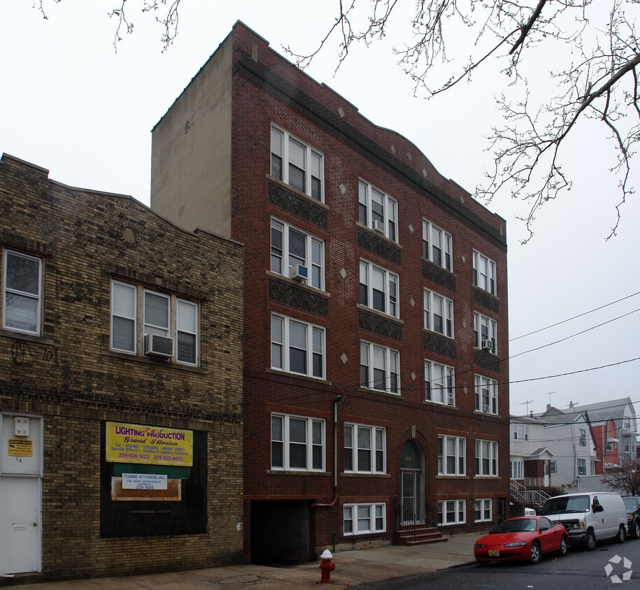
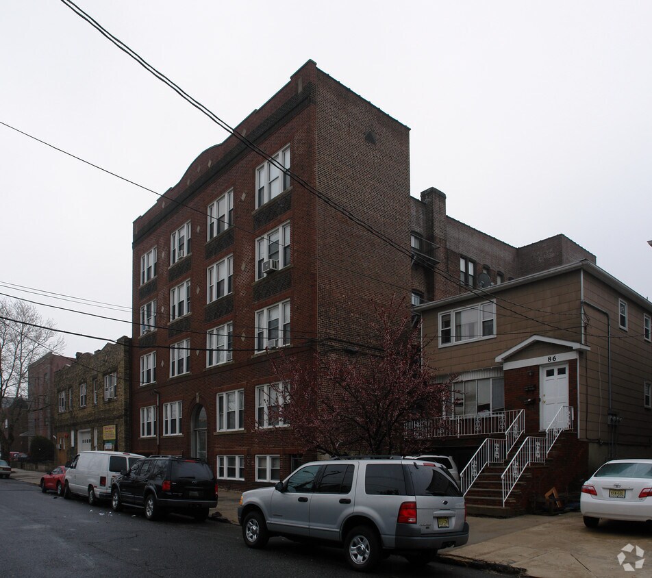
At 84 W 25th St in Bayonne, find a great place to live. In the 07002 area of Bayonne on W. 25th St., local residents have easy access to a number of attractions in the surrounding area. Come by to check out the apartment floorplan options. You'll experience a variety of features and amenities at this community including smoke free options, high-speed internet access, and convenient on-site parking options. Everything you need can be found at 84 W 25th St. Contact or drop by the leasing office to schedule your tour.
84 W 25th St is an apartment community located in Hudson County and the 07002 ZIP Code. This area is served by the Bayonne School District attendance zone.
High Speed Internet Access
Tub/Shower
Smoke Free
Heating
Also known as Constable's Hook, historic Constable Hook is one of New Jersey and the East Coast’s oldest communities. Nestled between the Hudson River and Newark Bay, Constable Hook consists of the southern portion of Bayonne. Bayonne prides itself on natural conservation and the area is home to several marinas and waterfront greenspaces. Golf fans spend days on the green at the Bayonne Golf Club, while Dennis P. Collins Park is a local favorite for its skatepark and views of the Bayonne Bridge and freight and cruise ships. Along Broadway, residents have access to restaurants, shops, and bars giving the area the feel of a small town. The neighborhood has a relatively low cost of living and has a variety of mid-range to upscale options available for rent.
Learn more about living in Constable HookCompare neighborhood and city base rent averages by bedroom.
| Constable Hook | Bayonne, NJ | |
|---|---|---|
| Studio | $1,866 | $2,158 |
| 1 Bedroom | $2,274 | $2,346 |
| 2 Bedrooms | $2,828 | $3,078 |
| 3 Bedrooms | $1,765 | $3,835 |
| Colleges & Universities | Distance | ||
|---|---|---|---|
| Colleges & Universities | Distance | ||
| Drive: | 9 min | 3.9 mi | |
| Drive: | 11 min | 5.2 mi | |
| Drive: | 12 min | 5.6 mi | |
| Drive: | 17 min | 7.2 mi |


Transportation options available in Bayonne include 22Nd Street, located 0.6 mile from 84 W 25TH St. 84 W 25TH St is near Newark Liberty International, located 6.9 miles or 12 minutes away, and LaGuardia, located 19.3 miles or 38 minutes away.
| Transit / Subway | Distance | ||
|---|---|---|---|
| Transit / Subway | Distance | ||
|
|
Walk: | 12 min | 0.6 mi |
|
|
Walk: | 20 min | 1.1 mi |
| Walk: | 22 min | 1.1 mi | |
|
|
Drive: | 6 min | 2.8 mi |
|
|
Drive: | 6 min | 3.0 mi |
| Commuter Rail | Distance | ||
|---|---|---|---|
| Commuter Rail | Distance | ||
|
|
Drive: | 19 min | 7.8 mi |
|
|
Drive: | 18 min | 8.1 mi |
|
|
Drive: | 19 min | 8.4 mi |
|
|
Drive: | 17 min | 8.8 mi |
|
|
Drive: | 19 min | 10.3 mi |
| Airports | Distance | ||
|---|---|---|---|
| Airports | Distance | ||
|
Newark Liberty International
|
Drive: | 12 min | 6.9 mi |
|
LaGuardia
|
Drive: | 38 min | 19.3 mi |
Scores provided by
Traffic
-Airport
-Businesses
-Scores provided by
HowLoud What is a Sound Score Rating? A Sound Score Rating aggregates noise caused by vehicle traffic, airplane traffic and local sources. How It WorksTime and distance from 84 W 25TH St.
| Shopping Centers | Distance | ||
|---|---|---|---|
| Shopping Centers | Distance | ||
| Walk: | 18 min | 0.9 mi | |
| Walk: | 20 min | 1.0 mi | |
| Drive: | 4 min | 1.3 mi |
| Parks and Recreation | Distance | ||
|---|---|---|---|
| Parks and Recreation | Distance | ||
|
G. Thomas DiDomenico Park
|
Walk: | 14 min | 0.7 mi |
|
Stephen Gregg Park
|
Drive: | 5 min | 2.0 mi |
|
Faber Park
|
Drive: | 8 min | 4.0 mi |
|
Snug Harbor Cultural Center & Botanical Garden
|
Drive: | 13 min | 6.2 mi |
|
Staten Island Children's Museum
|
Drive: | 13 min | 6.2 mi |
| Hospitals | Distance | ||
|---|---|---|---|
| Hospitals | Distance | ||
| Walk: | 11 min | 0.6 mi | |
| Drive: | 12 min | 5.8 mi | |
| Drive: | 13 min | 6.1 mi |
| Military Bases | Distance | ||
|---|---|---|---|
| Military Bases | Distance | ||
| Drive: | 7 min | 2.5 mi | |
| Drive: | 20 min | 8.0 mi | |
| Drive: | 22 min | 11.5 mi |
What Are Walk Score®, Transit Score®, and Bike Score® Ratings?
Walk Score® measures the walkability of any address. Transit Score® measures access to public transit. Bike Score® measures the bikeability of any address.
What is a Sound Score Rating?
A Sound Score Rating aggregates noise caused by vehicle traffic, airplane traffic and local sources.
84 W 25TH St
Bayonne, NJ 07002


