

$2,595 / Month
836 Booker Dr
Capitol Heights, MD 20743
Today
Favorites
757-328-6602
-
Bedrooms
4
-
Bathrooms
1.5
-
Square Feet
--
-
Available
Available Now
Highlights
- Colonial Architecture
- Central Heating and Cooling System
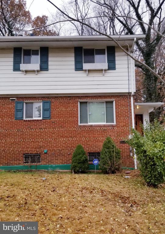
836 Booker Dr

Favorites
About This Home
Available Now
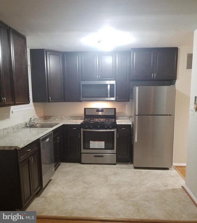
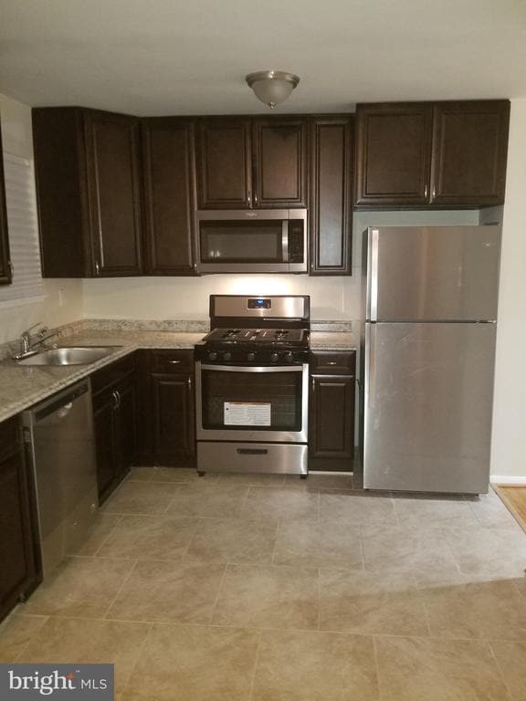
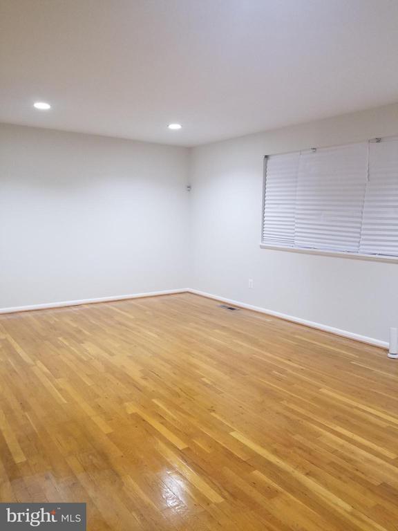
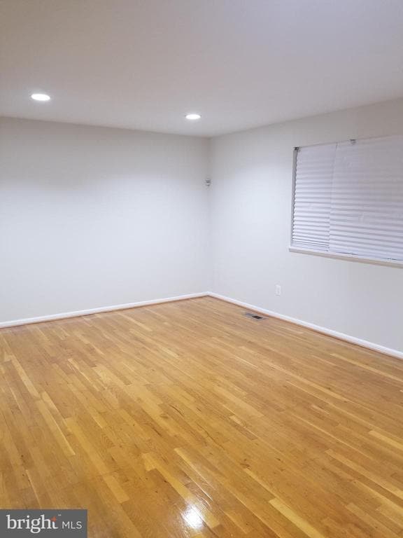
WOW!! **RENOVATED RENTAL** This is not your typical rental property. This 4 BR, 2BATH Townhome features gourmet kitchen w/42IN CABIENTS, stainless steel, hardwood floors, new carpet, new paint, new roof & HUGE back yard. Located close to Route 202, 214, & I-495, DC AND Metro rail. Section 8 welcomed. 1 Year Lease
836 Booker Dr is a house located in Prince George's County and the 20743 ZIP Code. This area is served by the Prince George's County Public Schools attendance zone.
* Price shown is base rent and may not include non-optional fees and utilities.
Price, availability, fees, and any applicable rent special are subject to change without notice.
* Square footage definitions vary. Displayed square footage is approximate.
Home Details
Home Type
Semi-Detached or Twin Home
Year Built
Built in 1963
Bedrooms and Bathrooms
4 Main Level Bedrooms
1.5 Bathrooms
Home Design
Colonial Architecture
Brick Exterior Construction
Brick Foundation
Interior Spaces
1,160 Sq Ft Home
Property has 3 Levels
Listing and Financial Details
Security Deposit $2,600
12-Month Lease Term
Available 4/23/25
Assessor Parcel Number 17181997873
No Smoking Allowed
Residential Lease
Lot Details
3,990 Sq Ft Lot
Parking
Driveway
Utilities
Central Heating and Cooling System
Natural Gas Water Heater
Community Details
Overview
Highland Gardens Subdivision
Pet Policy
No Pets Allowed
Contact
- Listed by April Mitchell | Bennett Realty Solutions
- Phone Number
- Contact
-
Source
 Bright MLS, Inc.
Copyright © 2025 Bright MLS, Inc.
Location
Get Directions
Amenities
- Basement
Capitol Heights -- named for its location near Washington, DC -- provides the perfect location: near DC, near the Capital Beltway, and minutes away from FedEx Field, home of the NFL's Washington Football Team. It is also close to the Anacostia River, the United States National Arboretum, and Joint Base Anacostia-Bolling. Nearby Fort Circle Park provides Capitol Heights residents with 10 miles of hiking trails -- it is also a popular concert venue and is home to Fort Dupont Ice Rink.
Capitol Heights is a terrific location for your DC-area apartment, only about seven miles southeast of downtown. Hop on the Metro at the Capitol Heights Metro Station for a fast, car-free commute. Despite being so close to the historic sites of DC, Capitol Heights was a rural area with no paved roads or streetlights. In 1910, the 200 residents in the area named their town "Capitol Heights," but it wasn't until 1980 and the arrival of the Metro Blue Line that the town began to grow.
Learn more about living in Capitol Heights
Education
| Colleges & Universities | Distance | ||
|---|---|---|---|
| Colleges & Universities | Distance | ||
| Drive: | 8 min | 4.0 mi | |
| Drive: | 12 min | 6.3 mi | |
| Drive: | 14 min | 6.8 mi | |
| Drive: | 15 min | 8.4 mi |
836 Booker Dr is within 8 minutes or 4.0 miles from Univ. of Md. Univ. Coll.. It is also near Prince George's Comm. Coll. and Gallaudet University.
Schools


Public Elementary School
Grades PK-6
271 Students
Attendance Zone
Public Middle School
Grades 6-8
867 Students
Attendance Zone
Public High School
Grades 9-12
1,039 Students
Attendance Zone
Private Elementary & Middle School
Grades PK-8
222 Students
Nearby
Private High School
Grades 9-12
Nearby
School data provided by
 The GreatSchools Rating helps parents compare schools within a state based on a variety of school quality indicators and provides a helpful picture of how effectively each school serves all of its students. Ratings are on a scale of 1 (below average) to 10 (above average) and can include test scores, college readiness, academic progress, advanced courses, equity, discipline and attendance data. We also advise parents to visit schools, consider other information on school performance and programs, and consider family needs as part of the school selection process.
View GreatSchools Rating Methodology
Data provided by GreatSchools.org © 2025. All rights reserved.
View GreatSchools Rating Methodology
Data provided by GreatSchools.org © 2025. All rights reserved.
Transportation options available in Capitol Heights include Capitol Heights, Blue/Silver Line Center Platform, located 2.1 miles from 836 Booker Dr. 836 Booker Dr is near Ronald Reagan Washington Ntl, located 13.3 miles or 24 minutes away, and Baltimore/Washington International Thurgood Marshall, located 29.1 miles or 44 minutes away.
| Transit / Subway | Distance | ||
|---|---|---|---|
| Transit / Subway | Distance | ||
|
Capitol Heights, Blue/Silver Line Center Platform
|
Drive: | 4 min | 2.1 mi |
|
|
Drive: | 4 min | 2.2 mi |
|
|
Drive: | 7 min | 2.7 mi |
|
|
Drive: | 6 min | 3.3 mi |
|
|
Drive: | 9 min | 4.3 mi |
| Commuter Rail | Distance | ||
|---|---|---|---|
| Commuter Rail | Distance | ||
| Drive: | 12 min | 6.6 mi | |
|
|
Drive: | 12 min | 6.6 mi |
|
|
Drive: | 15 min | 7.4 mi |
| Drive: | 18 min | 8.6 mi | |
| Drive: | 18 min | 8.8 mi |
| Airports | Distance | ||
|---|---|---|---|
| Airports | Distance | ||
|
Ronald Reagan Washington Ntl
|
Drive: | 24 min | 13.3 mi |
|
Baltimore/Washington International Thurgood Marshall
|
Drive: | 44 min | 29.1 mi |
Time and distance from 836 Booker Dr.
| Shopping Centers | Distance | ||
|---|---|---|---|
| Shopping Centers | Distance | ||
| Walk: | 15 min | 0.8 mi | |
| Drive: | 3 min | 1.4 mi | |
| Drive: | 4 min | 2.1 mi |
836 Booker Dr has 3 shopping centers within 2.1 miles, which is about a 4-minute walk. The miles and minutes will be for the farthest away property.
| Parks and Recreation | Distance | ||
|---|---|---|---|
| Parks and Recreation | Distance | ||
|
Fort Dupont Park
|
Drive: | 10 min | 4.4 mi |
|
Walker Mill Regional Park
|
Drive: | 9 min | 4.9 mi |
|
Bladensburg Waterfront Park
|
Drive: | 10 min | 5.5 mi |
|
Dueling Creek Natural Area
|
Drive: | 12 min | 6.5 mi |
|
National Arboretum
|
Drive: | 13 min | 7.0 mi |
836 Booker Dr has 5 parks within 7.0 miles, including Walker Mill Regional Park, Fort Dupont Park, and Bladensburg Waterfront Park.
| Hospitals | Distance | ||
|---|---|---|---|
| Hospitals | Distance | ||
| Drive: | 9 min | 4.7 mi | |
| Drive: | 14 min | 7.2 mi | |
| Drive: | 18 min | 7.5 mi |
836 Booker Dr has 3 hospitals within 7.5 miles, the nearest is University of Maryland Prince George's Hospital Center which is 4.7 miles away and a 9 minute drive.
| Military Bases | Distance | ||
|---|---|---|---|
| Military Bases | Distance | ||
| Drive: | 15 min | 7.3 mi | |
| Drive: | 17 min | 9.2 mi |
836 Booker Dr is 7.3 miles from Washington Navy Yard, and is convenient to other military bases, including US Soldiers & Airmens Home.
You May Also Like
Similar Rentals Nearby


What Are Walk Score®, Transit Score®, and Bike Score® Ratings?
Walk Score® measures the walkability of any address. Transit Score® measures access to public transit. Bike Score® measures the bikeability of any address.
What is a Sound Score Rating?
A Sound Score Rating aggregates noise caused by vehicle traffic, airplane traffic and local sources
836 Booker Dr
Capitol Heights, MD 20743