
Venue Residences
3688 Overland Ave,
Los Angeles, CA 90034
$2,495 - $6,995
Studio - 2 Beds
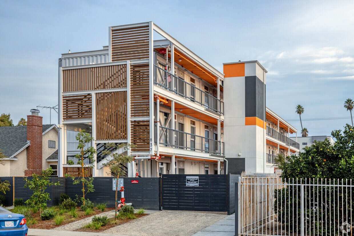
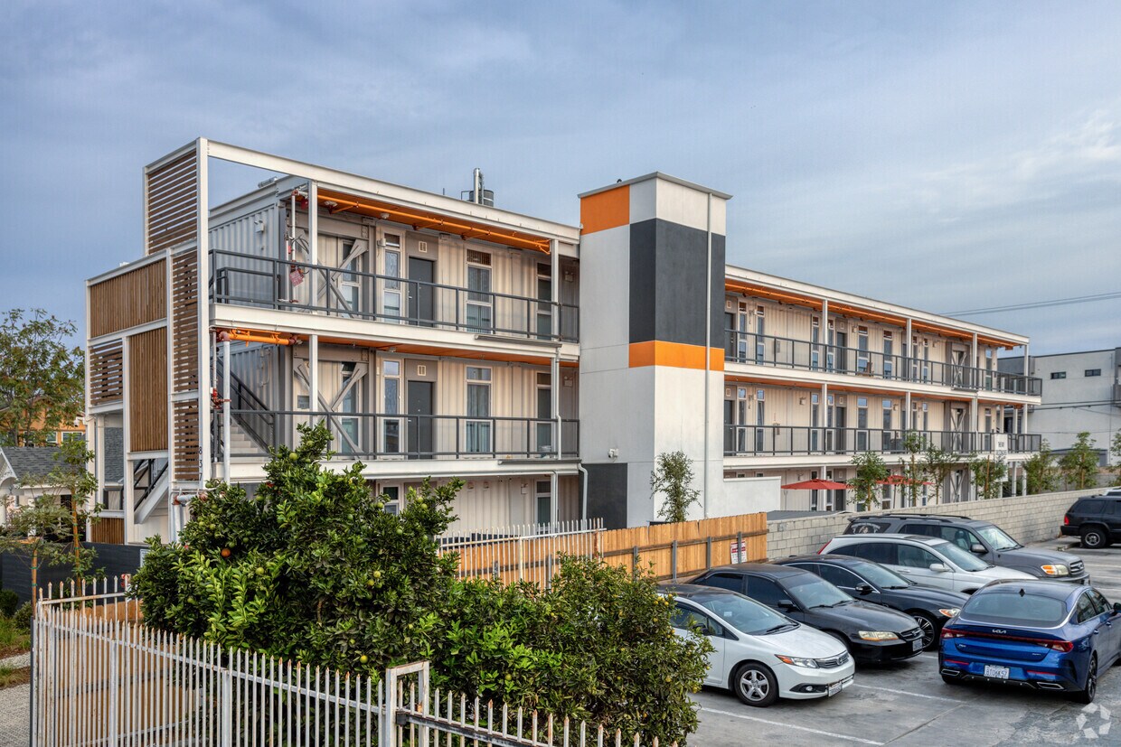
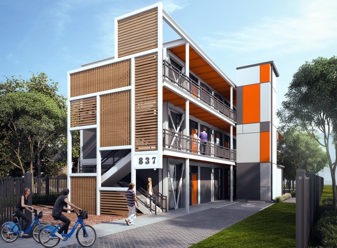

Enjoy Los Angeles living at 82nd Street Development. You'll find this community at 837 W 82nd St in Los Angeles. From amenities to availability, the professional leasing team is ready to help you find your dream apartment. Experience a better way of living at 82nd Street Development. Contact us or stop in to discuss your new apartment.
82nd Street Development is an apartment community located in Los Angeles County and the 90044 ZIP Code. This area is served by the Los Angeles Unified attendance zone.
Elevator
24 Hour Access
Property Manager on Site
Public Transportation
Air Conditioning
Tub/Shower
Heating
Oven
Historic South-Central Los Angeles is a storied neighborhood in the South Los Angeles region. South LA is home to the University of Southern California, a top-ranking university founded in 1880, a close-knit community, and a rich past.
Renting an apartment in South Central LA places you in an active neighborhood near many LA hotspots. This neighborhood had one of America's first jazz scenes (often nicknamed the West Coast Harlem) and was home to Kid Ory, a famous trombonist, and bandleader. Today, South Central LA offers residents terrific proximity to downtown, USC, and a variety of historic sites in addition to numerous freeways.
Learn more about living in South Central LACompare neighborhood and city base rent averages by bedroom.
| South Central LA | Los Angeles, CA | |
|---|---|---|
| Studio | $1,022 | $1,692 |
| 1 Bedroom | $1,181 | $2,168 |
| 2 Bedrooms | $1,786 | $2,992 |
| 3 Bedrooms | $3,103 | $4,282 |
| Colleges & Universities | Distance | ||
|---|---|---|---|
| Colleges & Universities | Distance | ||
| Drive: | 9 min | 3.8 mi | |
| Drive: | 10 min | 4.9 mi | |
| Drive: | 10 min | 5.2 mi | |
| Drive: | 9 min | 5.4 mi |


Transportation options available in Los Angeles include Vermont Station, located 2.8 miles from 82nd Street Development. 82nd Street Development is near Los Angeles International, located 8.4 miles or 16 minutes away, and Long Beach (Daugherty Field), located 16.5 miles or 24 minutes away.
| Transit / Subway | Distance | ||
|---|---|---|---|
| Transit / Subway | Distance | ||
|
|
Drive: | 5 min | 2.8 mi |
|
|
Drive: | 5 min | 2.9 mi |
|
|
Drive: | 6 min | 3.0 mi |
|
|
Drive: | 7 min | 3.4 mi |
| Drive: | 8 min | 3.8 mi |
| Commuter Rail | Distance | ||
|---|---|---|---|
| Commuter Rail | Distance | ||
|
|
Drive: | 14 min | 8.8 mi |
|
|
Drive: | 16 min | 8.9 mi |
|
|
Drive: | 21 min | 11.0 mi |
|
|
Drive: | 23 min | 12.5 mi |
| Drive: | 18 min | 12.8 mi |
| Airports | Distance | ||
|---|---|---|---|
| Airports | Distance | ||
|
Los Angeles International
|
Drive: | 16 min | 8.4 mi |
|
Long Beach (Daugherty Field)
|
Drive: | 24 min | 16.5 mi |
Time and distance from 82nd Street Development.
| Shopping Centers | Distance | ||
|---|---|---|---|
| Shopping Centers | Distance | ||
| Walk: | 11 min | 0.6 mi | |
| Walk: | 19 min | 1.0 mi | |
| Walk: | 19 min | 1.0 mi |
| Parks and Recreation | Distance | ||
|---|---|---|---|
| Parks and Recreation | Distance | ||
|
Watts Senior Center & Rose Garden
|
Drive: | 8 min | 3.9 mi |
|
Augustus Hawkins Natural Park
|
Drive: | 8 min | 4.1 mi |
|
Natural History Museum of LA County
|
Drive: | 8 min | 4.1 mi |
|
California Science Center
|
Drive: | 9 min | 4.3 mi |
|
Watts Towers-Rodia State Park
|
Drive: | 9 min | 4.6 mi |
| Hospitals | Distance | ||
|---|---|---|---|
| Hospitals | Distance | ||
| Drive: | 9 min | 4.7 mi | |
| Drive: | 9 min | 5.3 mi | |
| Drive: | 10 min | 5.3 mi |
| Military Bases | Distance | ||
|---|---|---|---|
| Military Bases | Distance | ||
| Drive: | 15 min | 9.3 mi |
What Are Walk Score®, Transit Score®, and Bike Score® Ratings?
Walk Score® measures the walkability of any address. Transit Score® measures access to public transit. Bike Score® measures the bikeability of any address.
What is a Sound Score Rating?
A Sound Score Rating aggregates noise caused by vehicle traffic, airplane traffic and local sources

837 W 82nd St
Los Angeles, CA 90044


