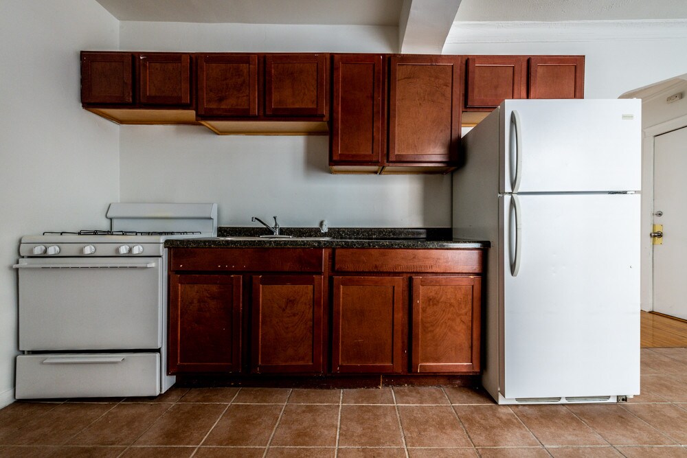
Presidential Towers
555 W Madison St,
Chicago, IL 60661
$1,640 - $9,365
Studio - 2 Beds

This 24-unit building is located in the Chatham neighborhood of Chicago near 83rd and Cottage Grove, and offers 1 and 2-bedroom apartments featuring great amenities. Walking distance to Dat Donut, Avalon Park, and Dollar Tree. Commute easily via ME Metra Electric at 83rd Street, with a stop just down the block! Also located near CTA Red Line, CTA bus lines 4 & 79, and a Divvy bike station. Pets are welcome. Call today to schedule a showing!
8241-49 S Ellis Ave is an apartment community located in Cook County and the 60619 ZIP Code. This area is served by the Chicago Public Schools attendance zone.
High Speed Internet Access
Hardwood Floors
Smoke Free
Porch
Situated on Chicago’s South Side, Chatham offers residents an urban aesthetic with rows of classic, red-brick bungalows and apartment buildings in addition to a host of suburban amenities, such as national retailers, chain restaurants, and lush parks.
Chatham’s spirited community also supports a bevy of locally owned businesses, including neighborhood institutions like Dat Donut, Harold’s Chicken Shack, and Fisherman’s Island. Getting around from Chatham is easy with access to several Metrarail stations, the Red Line, and the Dan Ryan Expressway.
Learn more about living in Chatham| Colleges & Universities | Distance | ||
|---|---|---|---|
| Colleges & Universities | Distance | ||
| Drive: | 8 min | 3.4 mi | |
| Drive: | 8 min | 4.0 mi | |
| Drive: | 14 min | 8.0 mi | |
| Drive: | 17 min | 8.3 mi |
 The GreatSchools Rating helps parents compare schools within a state based on a variety of school quality indicators and provides a helpful picture of how effectively each school serves all of its students. Ratings are on a scale of 1 (below average) to 10 (above average) and can include test scores, college readiness, academic progress, advanced courses, equity, discipline and attendance data. We also advise parents to visit schools, consider other information on school performance and programs, and consider family needs as part of the school selection process.
Transportation options available in Chicago include 79Th Street Station, located 2.7 miles from 8241-49 S Ellis Ave. 8241-49 S Ellis Ave is near Chicago Midway International, located 11.3 miles or 21 minutes away, and Chicago O'Hare International, located 28.3 miles or 43 minutes away.
| Transit / Subway | Distance | ||
|---|---|---|---|
| Transit / Subway | Distance | ||
|
|
Drive: | 6 min | 2.7 mi |
|
|
Drive: | 5 min | 2.9 mi |
|
|
Drive: | 6 min | 3.0 mi |
|
|
Drive: | 6 min | 3.1 mi |
|
|
Drive: | 7 min | 3.8 mi |
| Commuter Rail | Distance | ||
|---|---|---|---|
| Commuter Rail | Distance | ||
|
|
Walk: | 1 min | 0.1 mi |
|
|
Walk: | 13 min | 0.7 mi |
| Drive: | 2 min | 1.2 mi | |
|
|
Drive: | 3 min | 1.5 mi |
|
|
Drive: | 5 min | 2.0 mi |
| Airports | Distance | ||
|---|---|---|---|
| Airports | Distance | ||
|
Chicago Midway International
|
Drive: | 21 min | 11.3 mi |
|
Chicago O'Hare International
|
Drive: | 43 min | 28.3 mi |
Time and distance from 8241-49 S Ellis Ave.
| Shopping Centers | Distance | ||
|---|---|---|---|
| Shopping Centers | Distance | ||
| Walk: | 16 min | 0.9 mi | |
| Drive: | 5 min | 2.0 mi | |
| Drive: | 5 min | 2.1 mi |
| Parks and Recreation | Distance | ||
|---|---|---|---|
| Parks and Recreation | Distance | ||
|
Avalon Park
|
Walk: | 8 min | 0.4 mi |
|
Bronzeville Children's Museum
|
Drive: | 5 min | 2.2 mi |
|
Bessemer Park
|
Drive: | 6 min | 2.8 mi |
|
Hamilton Park
|
Drive: | 7 min | 3.1 mi |
|
Jackson Park
|
Drive: | 7 min | 3.1 mi |
| Hospitals | Distance | ||
|---|---|---|---|
| Hospitals | Distance | ||
| Drive: | 3 min | 1.7 mi | |
| Drive: | 5 min | 2.3 mi | |
| Drive: | 6 min | 2.9 mi |
What Are Walk Score®, Transit Score®, and Bike Score® Ratings?
Walk Score® measures the walkability of any address. Transit Score® measures access to public transit. Bike Score® measures the bikeability of any address.
What is a Sound Score Rating?
A Sound Score Rating aggregates noise caused by vehicle traffic, airplane traffic and local sources