
$2,999
/ Month
8 Almanac Ct
Burtonsville, MD 20866
1 Day Ago
|
Edit
Favorites
202-528-2464
-
Bedrooms
4
-
Bathrooms
3.5
-
Square Feet
--
-
Available
Available Now
Highlights
- Colonial Architecture
- Level Entry For Accessibility
- Central Heating and Cooling System
8 Almanac Ct

Favorites
About This Home
Available Now
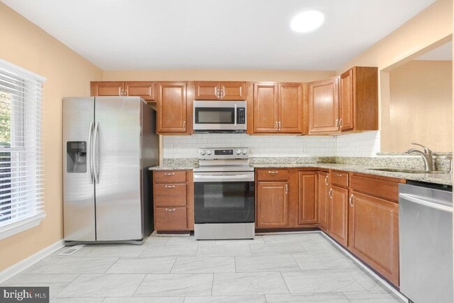
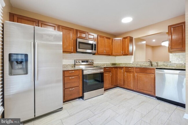
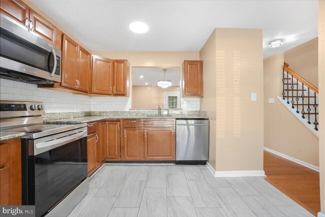
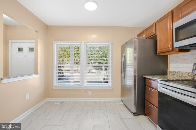
Welcome to this beautifully designed home offering the perfect blend of comfort and convenience. The main level features a bright and open living room, dining area, and kitchen, along with a handy powder room. Upstairs, you’ll find 3 spacious bedrooms and 2 full baths, including a private primary suite. The fully finished walkout basement with its own kitchenette is ideal for entertaining, guests, or extended family. Located just minutes from major transportation routes, this home makes commuting simple while keeping you close to everything you need.
8 Almanac Ct is a townhome located in Montgomery County and the 20866 ZIP Code. This area is served by the Montgomery County Public Schools attendance zone.
* Price shown is base rent. Excludes user-selected optional fees and variable or usage-based fees and required charges due at or prior to move-in or at move-out. Price, availability, fees, and any applicable rent special are subject to change without notice.
* Square footage definitions vary. Displayed square footage is approximate.
Home Details
Home Type
Interior Unit Townhome
Year Built
Built in 1985
Accessible Home Design
Level Entry For Accessibility
Bedrooms and Bathrooms
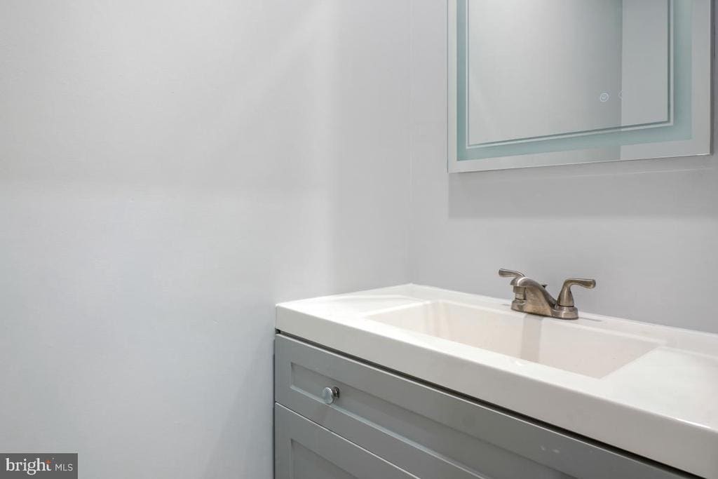
3.5 Bathrooms
4 Bedrooms
Finished Basement
Rear Basement Entry
Home Design
Colonial Architecture
Composite Building Materials
Permanent Foundation
Interior Spaces
1,178 Sq Ft Home
Property has 3 Levels
Listing and Financial Details
Security Deposit $2,999
12-Month Min and 60-Month Max Lease Term
Available 1/2/26
Assessor Parcel Number 160502474981
Residential Lease
Lot Details
1,520 Sq Ft Lot
Parking
On-Street Parking
Schools
Benjamin Banneker Middle School
Paint Branch High School
Utilities
Central Heating and Cooling System
Electric Water Heater
Community Details
Overview
Silverwood Subdivision
Pet Policy
No Pets Allowed
Contact
- Listed by Emmanuel Chimijomo | Samson Properties
- Phone Number
- Contact
-
Source
 Bright MLS, Inc.
Copyright © 2026 Bright MLS, Inc.
Location
Get Directions
Amenities
- Basement
Fairland is a park-like suburb with an active community. Fairland Recreational Park sits on the edge of town and offers extensive hiking and biking trails, athletic fields, and tennis courts. Nearby green spaces include Calverton-Galway Local Park, West Fairland Local Park, and Little Paint Branch Park. The Highway 29 and State Route 200 intersection sits near the heart of town, connecting residents to nearby destinations. Public schools, medical centers, and retail hubs reside in the neighborhood, but Fairland is mainly residential. Apartments, single-family homes, and townhomes are available for rent that range from moderately priced to upscale. Residents enjoy a quick commute into Washington, DC, located approximately 16 miles south of town, as well as Baltimore, located roughly 28 miles northeast.
Learn more about living in Fairland
Education
| Colleges & Universities | Distance | ||
|---|---|---|---|
| Colleges & Universities | Distance | ||
| Drive: | 16 min | 10.0 mi | |
| Drive: | 19 min | 10.0 mi | |
| Drive: | 17 min | 10.8 mi | |
| Drive: | 27 min | 16.0 mi |
8 Almanac Ct is within 19 minutes or 10.0 miles from University of Maryland. It is also near Montgomery Coll., Takoma Park and Howard Community College.
Schools


Public Elementary School
Grades PK-5
617 Students
Attendance Zone
Public Middle School
Grades 6-8
781 Students
Attendance Zone
Public High School
Grades 9-12
2,135 Students
Attendance Zone
Private Elementary School
Grades K-6
Nearby
Private Elementary, Middle & High School
Grades 4-12
30 Students
Nearby
Private Elementary & Middle School
Grades PK-8
518 Students
Nearby
School data provided by
 The GreatSchools Rating helps parents compare schools within a state based on a variety of school quality indicators and provides a helpful picture of how effectively each school serves all of its students. Ratings are on a scale of 1 (below average) to 10 (above average) and can include test scores, college readiness, academic progress, advanced courses, equity, discipline and attendance data. We also advise parents to visit schools, consider other information on school performance and programs, and consider family needs as part of the school selection process.
View GreatSchools Rating Methodology
Data provided by GreatSchools.org © 2026. All rights reserved.
View GreatSchools Rating Methodology
Data provided by GreatSchools.org © 2026. All rights reserved.
Transportation options available in Burtonsville include Glenmont, located 8.1 miles from 8 Almanac Ct. 8 Almanac Ct is near Ronald Reagan Washington Ntl, located 20.9 miles or 36 minutes away, and Baltimore/Washington International Thurgood Marshall, located 22.9 miles or 32 minutes away.
| Transit / Subway | Distance | ||
|---|---|---|---|
| Transit / Subway | Distance | ||
|
|
Drive: | 14 min | 8.1 mi |
| Drive: | 15 min | 9.0 mi | |
|
|
Drive: | 14 min | 9.0 mi |
|
|
Drive: | 17 min | 9.2 mi |
| Drive: | 21 min | 10.2 mi |
| Commuter Rail | Distance | ||
|---|---|---|---|
| Commuter Rail | Distance | ||
|
|
Drive: | 13 min | 7.1 mi |
|
|
Drive: | 11 min | 7.1 mi |
|
|
Drive: | 17 min | 8.2 mi |
|
|
Drive: | 15 min | 9.0 mi |
| Drive: | 15 min | 9.1 mi |
| Airports | Distance | ||
|---|---|---|---|
| Airports | Distance | ||
|
Ronald Reagan Washington Ntl
|
Drive: | 36 min | 20.9 mi |
|
Baltimore/Washington International Thurgood Marshall
|
Drive: | 32 min | 22.9 mi |
Time and distance from 8 Almanac Ct.
| Shopping Centers | Distance | ||
|---|---|---|---|
| Shopping Centers | Distance | ||
| Drive: | 3 min | 1.7 mi | |
| Drive: | 4 min | 1.8 mi | |
| Drive: | 5 min | 2.1 mi |
8 Almanac Ct has 3 shopping centers within 2.1 miles, which is about a 5-minute drive. The miles and minutes will be for the farthest away property.
| Parks and Recreation | Distance | ||
|---|---|---|---|
| Parks and Recreation | Distance | ||
|
Fairland Regional Park
|
Drive: | 5 min | 2.2 mi |
|
Maydale Conservation Park and Nature Center
|
Drive: | 8 min | 3.7 mi |
|
Brookside Nature Center
|
Drive: | 12 min | 6.9 mi |
|
Browns Bridge Recreation Area
|
Drive: | 14 min | 7.6 mi |
|
Brookside Gardens
|
Drive: | 13 min | 7.6 mi |
8 Almanac Ct has 5 parks within 7.6 miles, including Fairland Regional Park, Maydale Conservation Park and Nature Center, and Browns Bridge Recreation Area.
| Hospitals | Distance | ||
|---|---|---|---|
| Hospitals | Distance | ||
| Drive: | 7 min | 4.3 mi | |
| Drive: | 11 min | 4.8 mi | |
| Drive: | 15 min | 8.6 mi |
8 Almanac Ct has 3 hospitals within 8.6 miles, the nearest is Adventist Healthcare White Oak Medical Center which is 4.3 miles away and a 7 minute drive.
You May Also Like
Similar Rentals Nearby


What Are Walk Score®, Transit Score®, and Bike Score® Ratings?
Walk Score® measures the walkability of any address. Transit Score® measures access to public transit. Bike Score® measures the bikeability of any address.
What is a Sound Score Rating?
A Sound Score Rating aggregates noise caused by vehicle traffic, airplane traffic and local sources

8 Almanac Ct
Burtonsville, MD 20866