
The Riverdale Tower
3745 Riverdale Ave,
The Bronx, NY 10463
$2,200 - $4,500
Studio - 2 Beds
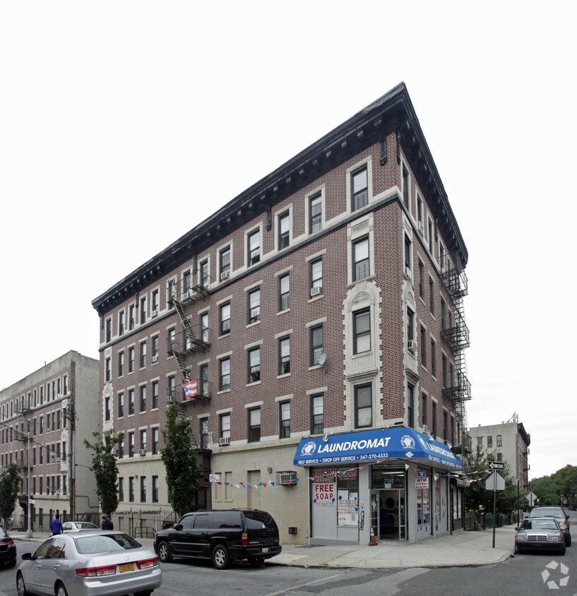
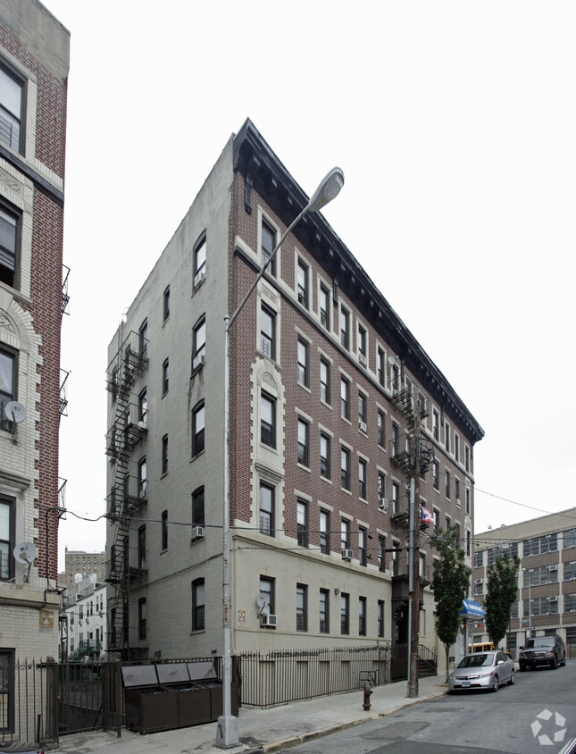
795 E 151st St in Bronx, NY is ready to be your home. The location of this community is at 795 E. 151st St. in the 10455 area of Bronx. Be sure to check out the apartment floorplan options. Here at this community, the professional leasing team will be ready to help you find your perfect place. It's time to find your next place. Contact or stop by 795 E 151st St to check the current floorplan availability today!
795 E 151St St is an apartment community located in Bronx County and the 10455 ZIP Code. This area is served by the New York City Geographic District # 7 attendance zone.
Refrigerator
Tub/Shower
Heating
Kitchen
Melrose is a residential neighborhood in the southern section of the Bronx about ten miles away from Manhattan. Melrose is served by MTA Regional Bus Operations, the New York City Subway at the Third Avenue-149th Street Station, and the Metro-North Railroad at Melrose Station. Residents can also travel along Interstate 87, which circles the borough, to get to New York City and beyond.
Within Melrose, residents will find that most of the walkable neighborhood’s businesses, stores, and eateries are located between Courtland Avenue and Brook Avenue. There are many green spaces with playgrounds, fields, and courts for Melrose residents to enjoy as well. The rental scene in Melrose consists of many different styles of apartments scattered throughout town in a range of expected prices for the New York City metro area.
Learn more about living in MelroseCompare neighborhood and city base rent averages by bedroom.
| Melrose | Bronx, NY | |
|---|---|---|
| Studio | $2,503 | $1,635 |
| 1 Bedroom | $1,612 | $1,636 |
| 2 Bedrooms | $1,628 | $2,089 |
| 3 Bedrooms | $1,502 | $2,373 |
| Colleges & Universities | Distance | ||
|---|---|---|---|
| Colleges & Universities | Distance | ||
| Drive: | 4 min | 1.5 mi | |
| Drive: | 9 min | 3.0 mi | |
| Drive: | 10 min | 4.5 mi | |
| Drive: | 10 min | 5.2 mi |


Transportation options available in Bronx include Jackson Avenue, located 0.2 mile from 795 E 151st St. 795 E 151st St is near LaGuardia, located 6.7 miles or 14 minutes away, and John F Kennedy International, located 17.9 miles or 27 minutes away.
| Transit / Subway | Distance | ||
|---|---|---|---|
| Transit / Subway | Distance | ||
|
|
Walk: | 4 min | 0.2 mi |
|
|
Walk: | 5 min | 0.3 mi |
|
|
Walk: | 8 min | 0.4 mi |
|
|
Walk: | 9 min | 0.5 mi |
|
|
Walk: | 12 min | 0.6 mi |
| Commuter Rail | Distance | ||
|---|---|---|---|
| Commuter Rail | Distance | ||
|
|
Drive: | 6 min | 1.8 mi |
|
|
Drive: | 6 min | 2.9 mi |
|
|
Drive: | 5 min | 3.0 mi |
|
|
Drive: | 8 min | 3.0 mi |
| Drive: | 9 min | 4.6 mi |
| Airports | Distance | ||
|---|---|---|---|
| Airports | Distance | ||
|
LaGuardia
|
Drive: | 14 min | 6.7 mi |
|
John F Kennedy International
|
Drive: | 27 min | 17.9 mi |
Time and distance from 795 E 151st St.
| Shopping Centers | Distance | ||
|---|---|---|---|
| Shopping Centers | Distance | ||
| Walk: | 12 min | 0.7 mi | |
| Walk: | 13 min | 0.7 mi | |
| Walk: | 14 min | 0.7 mi |
| Parks and Recreation | Distance | ||
|---|---|---|---|
| Parks and Recreation | Distance | ||
|
Captain Rivera Playground
|
Walk: | 6 min | 0.3 mi |
|
St. Mary's Park
|
Walk: | 11 min | 0.6 mi |
|
Concrete Plant Park
|
Drive: | 4 min | 1.6 mi |
|
Barretto Point Park
|
Drive: | 4 min | 1.7 mi |
|
Joyce Kilmer Park
|
Drive: | 8 min | 2.4 mi |
| Hospitals | Distance | ||
|---|---|---|---|
| Hospitals | Distance | ||
| Drive: | 3 min | 1.1 mi | |
| Drive: | 5 min | 1.9 mi | |
| Drive: | 7 min | 2.8 mi |
| Military Bases | Distance | ||
|---|---|---|---|
| Military Bases | Distance | ||
| Drive: | 19 min | 9.6 mi | |
| Drive: | 27 min | 13.3 mi |
What Are Walk Score®, Transit Score®, and Bike Score® Ratings?
Walk Score® measures the walkability of any address. Transit Score® measures access to public transit. Bike Score® measures the bikeability of any address.
What is a Sound Score Rating?
A Sound Score Rating aggregates noise caused by vehicle traffic, airplane traffic and local sources


