
$2,250
/ Month
7707 Watson St
Austin, TX 78757
Today
Favorites
512-461-2132
-
Bedrooms
4
-
Bathrooms
2
-
Square Feet
1,584 sq ft
-
Available
Available Now
Highlights
- Covered Patio or Porch
- Interior Lot
- Tile Flooring
- 1-Story Property
- Outdoor Storage
- Central Heating and Cooling System
7707 Watson St

Favorites
About This Home
Available Now
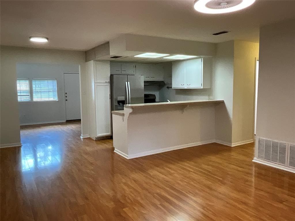
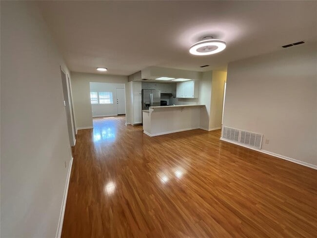
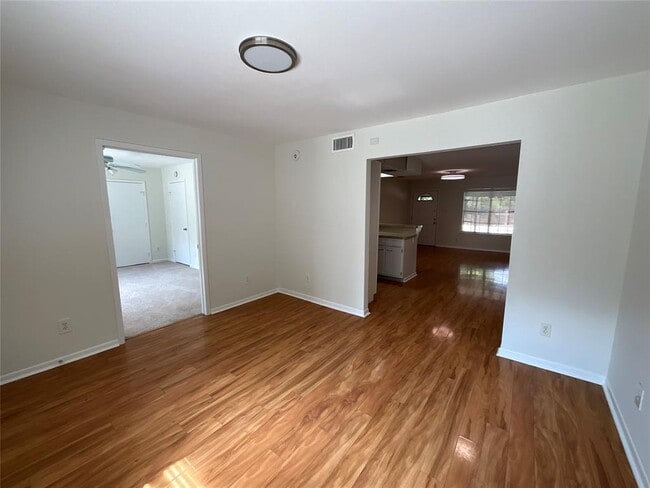
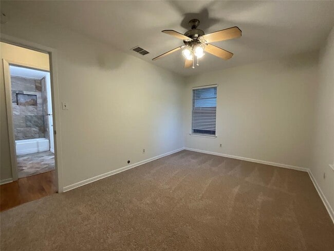
This spacious single-story home offers 4 bedrooms and 2 bathrooms in a convenient central Austin location. Freshly painted inside with brand-new carpet, it’s clean, comfortable, and ready for move-in. Enjoy easy access to Mopac, 183, and I-35, putting you just minutes from The Domain, Downtown, and ABIA Airport. Zoned to Brentwood Elementary and McCallum High School, this home provides great space and flexibility for anyone looking for comfort and convenience in the heart of Austin.
7707 Watson St is a house located in Travis County and the 78757 ZIP Code. This area is served by the Austin Independent attendance zone.
* Price shown is base rent. Excludes user-selected optional fees and variable or usage-based fees and required charges due at or prior to move-in or at move-out. Price, availability, fees, and any applicable rent special are subject to change without notice.
* Square footage definitions vary. Displayed square footage is approximate.
Home Details
Home Type
Single Family Detached Home
Year Built
Built in 1964
Bedrooms and Bathrooms
4 Main Level Bedrooms
2 Full Bathrooms
Flooring
Tile
Carpet
Laminate
Home Design
Composition Roof
Slab Foundation
Interior Spaces
1-Story Property
Ceiling Fan
1,584 Sq Ft Home
Blinds
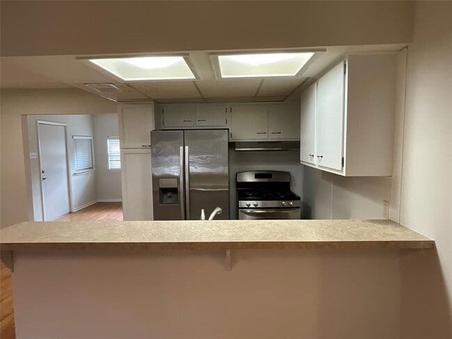
Kitchen
Gas Range
Free-Standing Range
Dishwasher
Disposal
Listing and Financial Details
Security Deposit $4,500
Negotiable Lease Term
$85 Application Fee
Assessor Parcel Number 02351007280000
Tenant pays for all utilities
Lot Details
0.25 Acre Lot
Interior Lot
West Facing Home
Wood Fence
Chain Link Fence
Level Lot
Outdoor Features
Covered Patio or Porch
Outdoor Storage
Parking
Carport
2 Parking Spaces
Schools
Brentwood Elementary School
Lamar Middle School
Mccallum High School
Utilities
Central Heating and Cooling System
Community Details
Overview
No Home Owners Association
Northgate Half Acres Subdivision
Pet Policy
Dogs Allowed
Pet Deposit $200
Fees and Policies
The fees below are based on community-supplied data and may exclude additional fees and utilities.
- Dogs Allowed
-
Fees not specified
-
Weight limit--
-
Pet Limit--
Contact
- Listed by Kyle King | Bramlett Partners
- Phone Number
- Contact
-
Source
 Austin Board of REALTORS®
The information included in this listing is provided exclusively for consumers’ personal, non-commercial use and may not be used for any purpose other than to identify prospective properties consumers may be interested in purchasing. The information on each listing is furnished by the owner and deemed reliable to the best of his/her knowledge, but should be verified by the purchaser. ABoR, ACTRIS and Estately assume no responsibility for typographical errors, misprints or misinformation. This property listing is offered without respect to any protected classes in accordance with the law. Copyright © 2025.
Location
Get Directions
Amenities
- Dishwasher
- Disposal
- Refrigerator
- Carpet
- Tile Floors
Developed on the site of an old dairy farm in the 1950s, Crestview offers a fascinating blend of old and new. The mid-century ranch homes and bungalows are being met with sleek, modern apartment buildings, offices, and the mixed-use development Midtown Commons. One of the landmarks in Crestview is the Wall of Welcome, a mosaic that stretches 120 feet along Woodrow Avenue.
While Crestview maintains its close-knit, suburban atmosphere, it is increasing in popularity due to its great location and the available mass transit. The Crestview Station is on the Red Line of the Capital MetroRail, and it also provides premium bus service by Capital MetroRapid. Crestview is located between Burnet Road and North Lamar Boulevard, extending from West Anderson Lane south to Justin Lane. It is roughly seven miles northeast of Downtown Austin.
Learn more about living in Crestview
Education
| Colleges & Universities | Distance | ||
|---|---|---|---|
| Colleges & Universities | Distance | ||
| Drive: | 10 min | 4.6 mi | |
| Drive: | 10 min | 5.8 mi | |
| Drive: | 13 min | 6.7 mi | |
| Drive: | 12 min | 7.3 mi |
7707 Watson St is within 10 minutes or 4.6 miles from Austin C.C., Northridge Campus. It is also near University of Texas at Austin and Austin C.C., Rio Grande Campus.
Schools


Public Elementary School
Grades PK-5
630 Students
Attendance Zone
Public Middle School
Grades 6-8
1,182 Students
Attendance Zone
Public High School
Grades 9-12
1,824 Students
Attendance Zone
Private Elementary, Middle & High School
Grades K-12
Nearby
Private Elementary & Middle School
Grades K-8
398 Students
Nearby
School data provided by
 The GreatSchools Rating helps parents compare schools within a state based on a variety of school quality indicators and provides a helpful picture of how effectively each school serves all of its students. Ratings are on a scale of 1 (below average) to 10 (above average) and can include test scores, college readiness, academic progress, advanced courses, equity, discipline and attendance data. We also advise parents to visit schools, consider other information on school performance and programs, and consider family needs as part of the school selection process.
View GreatSchools Rating Methodology
Data provided by GreatSchools.org © 2025. All rights reserved.
View GreatSchools Rating Methodology
Data provided by GreatSchools.org © 2025. All rights reserved.
Transportation options available in Austin include Crestview Station, located 0.7 mile from 7707 Watson St. 7707 Watson St is near Austin-Bergstrom International, located 17.8 miles or 28 minutes away.
| Transit / Subway | Distance | ||
|---|---|---|---|
| Transit / Subway | Distance | ||
| Walk: | 14 min | 0.7 mi | |
| Drive: | 3 min | 1.5 mi | |
| Drive: | 7 min | 3.4 mi | |
| Drive: | 8 min | 3.9 mi | |
| Drive: | 11 min | 5.6 mi |
| Commuter Rail | Distance | ||
|---|---|---|---|
| Commuter Rail | Distance | ||
|
|
Drive: | 15 min | 8.5 mi |
|
|
Drive: | 41 min | 33.2 mi |
| Airports | Distance | ||
|---|---|---|---|
| Airports | Distance | ||
|
Austin-Bergstrom International
|
Drive: | 28 min | 17.8 mi |
Time and distance from 7707 Watson St.
| Shopping Centers | Distance | ||
|---|---|---|---|
| Shopping Centers | Distance | ||
| Walk: | 6 min | 0.3 mi | |
| Walk: | 7 min | 0.4 mi | |
| Walk: | 8 min | 0.4 mi |
7707 Watson St has 3 shopping centers within 0.4 mile, which is about a 8-minute walk. The miles and minutes will be for the farthest away property.
| Parks and Recreation | Distance | ||
|---|---|---|---|
| Parks and Recreation | Distance | ||
|
Beverly S. Sheffield Northwest District Park
|
Drive: | 6 min | 2.0 mi |
|
Elisabet Ney Museum
|
Drive: | 8 min | 3.6 mi |
|
Thinkery
|
Drive: | 8 min | 4.3 mi |
|
The Stephen F. Austin Planetarium
|
Drive: | 9 min | 4.9 mi |
|
Bright Leaf Preserve
|
Drive: | 10 min | 5.2 mi |
7707 Watson St has 5 parks within 5.2 miles, including Beverly S. Sheffield Northwest District Park, Elisabet Ney Museum, and Thinkery.
| Hospitals | Distance | ||
|---|---|---|---|
| Hospitals | Distance | ||
| Drive: | 6 min | 3.0 mi | |
| Drive: | 7 min | 3.1 mi | |
| Drive: | 7 min | 3.4 mi |
7707 Watson St has 3 hospitals within 3.4 miles, the nearest is Northwest Hills Surgical Hospital which is 3.0 miles away and a 6 minute drive.
| Military Bases | Distance | ||
|---|---|---|---|
| Military Bases | Distance | ||
| Drive: | 85 min | 69.6 mi | |
| Drive: | 89 min | 72.6 mi |
7707 Watson St is 69.6 miles from Fort Hood, and is convenient to other military bases, including Randolph Air Force Base.
You May Also Like
Similar Rentals Nearby
-
-

-

-

-
1 / 32

-
-
-
1 / 23

-
-


What Are Walk Score®, Transit Score®, and Bike Score® Ratings?
Walk Score® measures the walkability of any address. Transit Score® measures access to public transit. Bike Score® measures the bikeability of any address.
What is a Sound Score Rating?
A Sound Score Rating aggregates noise caused by vehicle traffic, airplane traffic and local sources

7707 Watson St
Austin, TX 78757