
$2,200 / Month
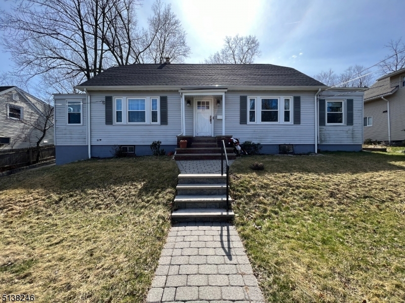
77 Myrtle Ave Unit 2
Cedar Grove, NJ 07009
2 Weeks Ago
Favorites
77 Myrtle Ave Unit 2

Favorites
Check Back Soon for Upcoming Availability
| Beds | Baths | Average SF |
|---|---|---|
| 2 Bedrooms 2 Bedrooms 2 Br | 1 Bath 1 Bath 1 Ba | — |
Fees and Policies
The fees below are based on community-supplied data and may exclude additional fees and utilities.
- Dogs Allowed
-
Fees not specified
- Cats Allowed
-
Fees not specified
About This Property
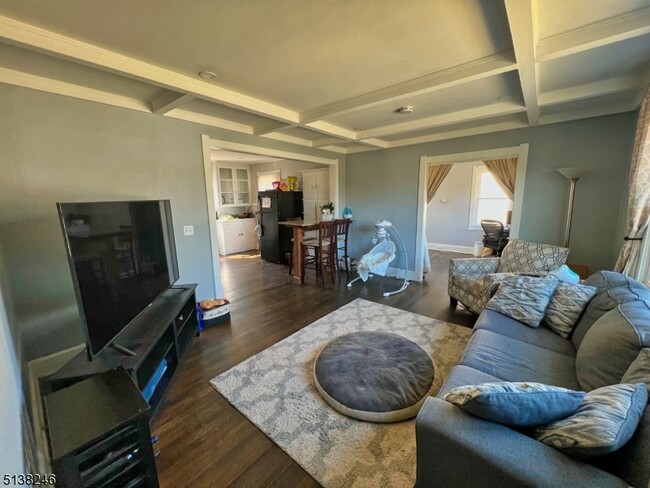
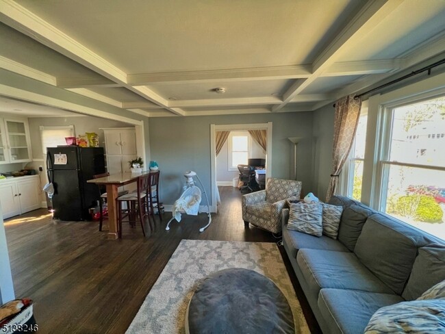
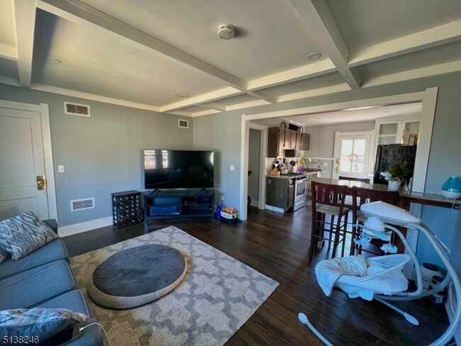
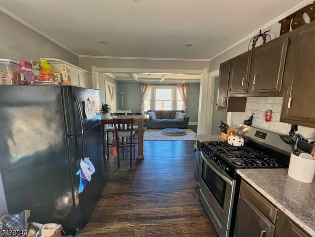
Modern, first floor, and move-in ready! This bright and sunny apartment features hardwood floors, one level living, updated kitchen (granite countertops & stainless steel appliances), central air, renovated bathroom, and a prime location. Enjoy the beautiful backyard complete with paver patio and yard space! Located right down the street from stores, restaurants, and public transportation! Laundry hook-ups and storage located in basement. Tenant must supply their own washer and dryer.
77 Myrtle Ave is an apartment community located in Essex County and the 07009 ZIP Code.
Features
- Range
- Tile Floors
- Patio
Location
Get Directions
Located about 20 miles northwest of New York City, Cedar Grove provides residents with a tranquil small-town atmosphere in Essex County. Pompton Avenue is Cedar Grove’s main commercial thoroughfare, where a bevy of quaint shops and diverse restaurants sit along a tree-lined street.
Several parks offer plenty of options for outdoor recreation in Cedar Grove, including the expansive Mills Reservation County Park, Hilltop Reservation, and Cedar Grove Community Park. Cedar Grove is also within minutes of Verona Park, Eagle Rock Reservation, and Brookdale Park. Quick access to numerous NJ Transit rail stations and major highways affords residents easy commutes and travels from Cedar Grove.
Learn more about living in Cedar Grove
Amenities
- Range
- Tile Floors
- Patio
Education
| Colleges & Universities | Distance | ||
|---|---|---|---|
| Colleges & Universities | Distance | ||
| Drive: | 8 min | 2.9 mi | |
| Drive: | 8 min | 3.4 mi | |
| Drive: | 9 min | 5.2 mi | |
| Drive: | 11 min | 5.9 mi |
77 Myrtle Ave Unit 2 is within 8 minutes or 2.9 miles from Montclair State University. It is also near Caldwell College and Berkeley College.
Transportation options available in Cedar Grove include Grove Street, located 6.4 miles from 77 Myrtle Ave Unit 2. 77 Myrtle Ave Unit 2 is near Newark Liberty International, located 14.9 miles or 25 minutes away, and LaGuardia, located 31.2 miles or 45 minutes away.
| Transit / Subway | Distance | ||
|---|---|---|---|
| Transit / Subway | Distance | ||
|
|
Drive: | 11 min | 6.4 mi |
|
|
Drive: | 13 min | 6.8 mi |
|
|
Drive: | 13 min | 6.9 mi |
|
|
Drive: | 13 min | 7.0 mi |
|
|
Drive: | 12 min | 7.3 mi |
| Commuter Rail | Distance | ||
|---|---|---|---|
| Commuter Rail | Distance | ||
|
|
Drive: | 5 min | 2.2 mi |
|
|
Drive: | 4 min | 2.2 mi |
|
|
Drive: | 6 min | 2.4 mi |
|
|
Drive: | 6 min | 2.5 mi |
|
|
Drive: | 8 min | 3.1 mi |
| Airports | Distance | ||
|---|---|---|---|
| Airports | Distance | ||
|
Newark Liberty International
|
Drive: | 25 min | 14.9 mi |
|
LaGuardia
|
Drive: | 45 min | 31.2 mi |
Time and distance from 77 Myrtle Ave Unit 2.
| Shopping Centers | Distance | ||
|---|---|---|---|
| Shopping Centers | Distance | ||
| Walk: | 6 min | 0.3 mi | |
| Walk: | 12 min | 0.6 mi | |
| Walk: | 15 min | 0.8 mi |
77 Myrtle Ave Unit 2 has 3 shopping centers within 0.8 mile, which is about a 15-minute walk. The miles and minutes will be for the farthest away property.
| Parks and Recreation | Distance | ||
|---|---|---|---|
| Parks and Recreation | Distance | ||
|
Presby Memorial Iris Gardens
|
Drive: | 5 min | 2.4 mi |
|
Van Vleck House & Gardens
|
Drive: | 5 min | 3.0 mi |
|
Edison National Historic Site
|
Drive: | 14 min | 6.9 mi |
|
NJ Audubon Essex County Environmental Center
|
Drive: | 13 min | 7.5 mi |
|
Fairfield Farm
|
Drive: | 13 min | 7.6 mi |
77 Myrtle Ave Unit 2 has 5 parks within 7.6 miles, including Presby Memorial Iris Gardens, Van Vleck House & Gardens, and Edison National Historic Site.
| Hospitals | Distance | ||
|---|---|---|---|
| Hospitals | Distance | ||
| Walk: | 11 min | 0.6 mi | |
| Drive: | 12 min | 7.5 mi | |
| Drive: | 14 min | 8.1 mi |
77 Myrtle Ave Unit 2 has 3 hospitals within 8.1 miles, the nearest is Essex County Hospital Center which is 0.6 mile away and a 11 minute walk.
| Military Bases | Distance | ||
|---|---|---|---|
| Military Bases | Distance | ||
| Drive: | 31 min | 18.8 mi | |
| Drive: | 37 min | 21.5 mi | |
| Drive: | 37 min | 23.9 mi |
77 Myrtle Ave Unit 2 has 3 military bases within 23.9 miles, the nearest is Military Ocean Terminal which is 18.8 miles away and a 31 minute drive.
You May Also Like
Similar Rentals Nearby


What Are Walk Score®, Transit Score®, and Bike Score® Ratings?
Walk Score® measures the walkability of any address. Transit Score® measures access to public transit. Bike Score® measures the bikeability of any address.
What is a Sound Score Rating?
A Sound Score Rating aggregates noise caused by vehicle traffic, airplane traffic and local sources
77 Myrtle Ave
Cedar Grove, NJ 07009