

77 Mayflower Rd
Needham, MA 02492
-
Bedrooms
1
-
Bathrooms
1
-
Square Feet
--
-
Available
Available Sep 1

About This Home
This nice 1 Bed 1 Bath place in the NEEDHAM area is available for 09-01-2025. Boston Pads is not responsible for any errors, omissions and change in price, prior sale, rent and withdrawal without notice. All information from sources reliable but not guaranteed. Photographs, videos, description and information about the properties reflect conditions at the time the information was obtained. We are pledged to this letter and spirit of U.S. policy for the achievement of equal housing opportunity throughout the Nation. We encourage and support an affirmative advertising and marketing program in which there are no barriers to obtaining housing because of race, color, religion, sex, handicap, familial status, or national origin. ListingID = 93850
77 Mayflower Rd is an apartment community located in Norfolk County and the 02492 ZIP Code.
Features
- High Speed Internet Access
- Cable Ready
Contact
- Phone Number
- Contact
-
Source

- High Speed Internet Access
- Cable Ready
Just west of Boston and East of Worcester sits Metro West, a region that houses a group of towns and cities with significant historical backgrounds. A total of 19 municipalities make up the core of this community, but other municipalities are considered to be a part of the Interstate 495/Metro West Corridor.
Learn more about living in Metro West| Colleges & Universities | Distance | ||
|---|---|---|---|
| Colleges & Universities | Distance | ||
| Walk: | 17 min | 0.9 mi | |
| Drive: | 8 min | 3.1 mi | |
| Drive: | 16 min | 7.2 mi | |
| Drive: | 16 min | 8.3 mi |
Transportation options available in Needham include Woodland Station, located 4.7 miles from 77 Mayflower Rd. 77 Mayflower Rd is near General Edward Lawrence Logan International, located 18.7 miles or 31 minutes away, and Worcester Regional, located 34.0 miles or 58 minutes away.
| Transit / Subway | Distance | ||
|---|---|---|---|
| Transit / Subway | Distance | ||
|
|
Drive: | 9 min | 4.7 mi |
|
|
Drive: | 10 min | 4.7 mi |
|
|
Drive: | 11 min | 4.8 mi |
|
|
Drive: | 11 min | 5.0 mi |
|
|
Drive: | 10 min | 5.4 mi |
| Commuter Rail | Distance | ||
|---|---|---|---|
| Commuter Rail | Distance | ||
|
|
Drive: | 3 min | 1.8 mi |
|
|
Drive: | 4 min | 2.1 mi |
|
|
Drive: | 5 min | 2.2 mi |
|
|
Drive: | 5 min | 2.4 mi |
|
|
Drive: | 5 min | 2.4 mi |
| Airports | Distance | ||
|---|---|---|---|
| Airports | Distance | ||
|
General Edward Lawrence Logan International
|
Drive: | 31 min | 18.7 mi |
|
Worcester Regional
|
Drive: | 58 min | 34.0 mi |
Time and distance from 77 Mayflower Rd.
| Shopping Centers | Distance | ||
|---|---|---|---|
| Shopping Centers | Distance | ||
| Drive: | 3 min | 1.8 mi | |
| Drive: | 4 min | 1.8 mi | |
| Drive: | 4 min | 2.1 mi |
| Parks and Recreation | Distance | ||
|---|---|---|---|
| Parks and Recreation | Distance | ||
|
Whitin Observatory
|
Drive: | 6 min | 2.5 mi |
|
Wellesley College Botanic Gardens
|
Drive: | 5 min | 2.8 mi |
|
Weezie's Garden for Children
|
Drive: | 11 min | 4.3 mi |
|
Elm Bank Reservation
|
Drive: | 11 min | 4.3 mi |
|
Horticultural Society at Elm Bank
|
Drive: | 11 min | 4.8 mi |
| Hospitals | Distance | ||
|---|---|---|---|
| Hospitals | Distance | ||
| Drive: | 4 min | 2.0 mi | |
| Drive: | 9 min | 4.4 mi | |
| Drive: | 15 min | 7.3 mi |
| Military Bases | Distance | ||
|---|---|---|---|
| Military Bases | Distance | ||
| Drive: | 11 min | 5.7 mi | |
| Drive: | 27 min | 14.6 mi |
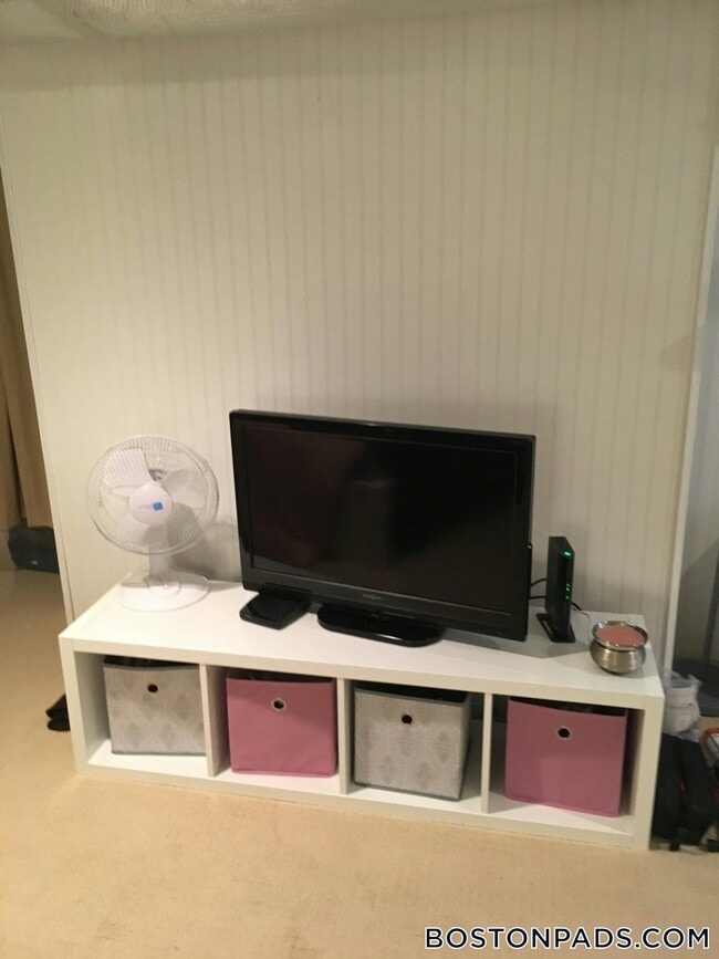
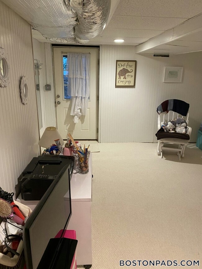
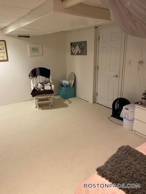
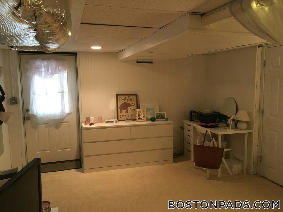
77 Mayflower Rd Photos
Nearby Apartments
Within 50 Miles of 77 Mayflower Rd Needham, MA 02492
-
The Franklin at Hancock Village
201 Sherman Rd
Brookline, MA 02445
1-3 Br $3,210-$8,680 5.5 mi
-
Hancock Village
1 Hancock Village Dr
Chestnut Hill, MA 02467
1-2 Br $2,970-$4,645 5.8 mi
-
The 305, A Broadstone Community
305 Winter St
Waltham, MA 02451
1-3 Br $2,831-$5,533 7.8 mi
-
95 Saint
95 St. Alphonsus St
Boston, MA 02120
1-2 Br $3,655-$5,375 9.0 mi
-
100 Hemenway
100 Hemenway St
Boston, MA 02115
2-3 Br $4,148-$6,615 9.8 mi
-
Waterfall Hills at Canton
55 Waterfall Dr
Canton, MA 02021
1-2 Br $2,665-$3,465 11.7 mi
What Are Walk Score®, Transit Score®, and Bike Score® Ratings?
Walk Score® measures the walkability of any address. Transit Score® measures access to public transit. Bike Score® measures the bikeability of any address.
What is a Sound Score Rating?
A Sound Score Rating aggregates noise caused by vehicle traffic, airplane traffic and local sources
77 Mayflower Rd
Needham, MA 02492