
1213 Walnut
1213 Walnut St,
Philadelphia, PA 19107
$2,350 - $5,739
Studio - 2 Beds

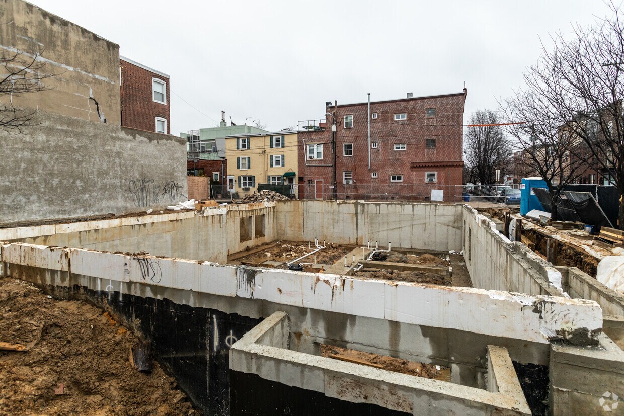
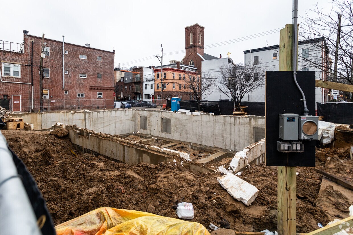
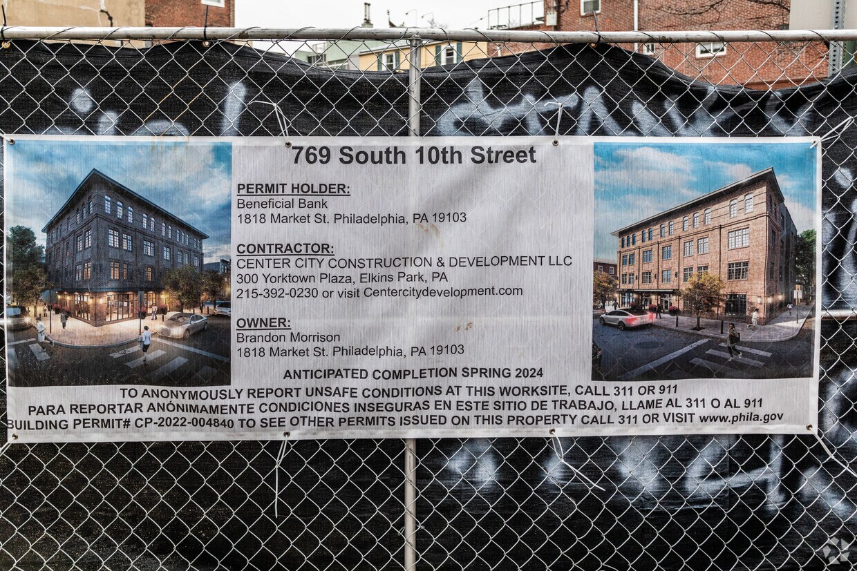

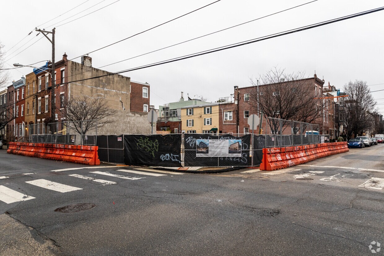
Discover your new place at 769 S 10th St. This community is located in the Bella Vista Southwark area of Philadelphia. Let the professional leasing staff show you everything this community has in store. Your new home awaits you at 769 S 10th St. Contact us or stop in to discuss your new apartment.
769 S 10th St is a townhouse community located in Philadelphia County and the 19147 ZIP Code. This area is served by the The School District of Philadelphia attendance zone.
Air Conditioning
Refrigerator
Tub/Shower
Heating
Bella Vista, which in Italian means “beautiful sight,” gets its name from the picturesque Philly skyline that can easily be seen from the community. Southwark is commonly referred to as Queen Village.
Together, the Bella Vista-Southwark community lies two miles southeast of Downtown Philadelphia, and encompasses many blocks between two of its liveliest commercial roads: South Street and Washington Avenue.
Old-world Italian influences play a major role in the charm of the community, and remains one of the main attractions to the area. Visitors and residents alike look forward to spending a couple of hours at the 9th Street Italian Market, where rich aromas of strong espresso, fresh seafood, and homemade pastas fill the room. Every year, a festival in honor of the market is held and features family-friendly entertainment and of course, delicious foods and treats!
In addition to housing one of the original open-air markets in the U.S.
Learn more about living in Bella Vista-SouthwarkCompare neighborhood and city base rent averages by bedroom.
| Bella Vista-Southwark | Philadelphia, PA | |
|---|---|---|
| Studio | $1,622 | $1,161 |
| 1 Bedroom | $2,533 | $1,302 |
| 2 Bedrooms | $2,891 | $1,732 |
| 3 Bedrooms | $5,472 | $2,160 |
| Colleges & Universities | Distance | ||
|---|---|---|---|
| Colleges & Universities | Distance | ||
| Walk: | 12 min | 0.6 mi | |
| Drive: | 5 min | 1.6 mi | |
| Drive: | 5 min | 1.9 mi | |
| Drive: | 5 min | 2.0 mi |


Transportation options available in Philadelphia include 9Th-10Th & Locust St, located 0.6 mile from 769 S 10th St. 769 S 10th St is near Philadelphia International, located 11.1 miles or 20 minutes away, and Trenton Mercer, located 34.6 miles or 51 minutes away.
| Transit / Subway | Distance | ||
|---|---|---|---|
| Transit / Subway | Distance | ||
|
|
Walk: | 11 min | 0.6 mi |
|
|
Walk: | 11 min | 0.6 mi |
|
|
Walk: | 14 min | 0.7 mi |
|
|
Walk: | 14 min | 0.7 mi |
|
|
Walk: | 22 min | 1.2 mi |
| Commuter Rail | Distance | ||
|---|---|---|---|
| Commuter Rail | Distance | ||
|
|
Walk: | 18 min | 1.0 mi |
|
|
Drive: | 5 min | 1.7 mi |
| Drive: | 6 min | 2.2 mi | |
|
|
Drive: | 6 min | 2.4 mi |
|
|
Drive: | 10 min | 3.4 mi |
| Airports | Distance | ||
|---|---|---|---|
| Airports | Distance | ||
|
Philadelphia International
|
Drive: | 20 min | 11.1 mi |
|
Trenton Mercer
|
Drive: | 51 min | 34.6 mi |
Scores provided by
Traffic
ActiveAirport
CalmBusinesses
BusyScores provided by
HowLoud What is a Sound Score Rating? A Sound Score Rating aggregates noise caused by vehicle traffic, airplane traffic and local sources. How It WorksTime and distance from 769 S 10th St.
| Shopping Centers | Distance | ||
|---|---|---|---|
| Shopping Centers | Distance | ||
| Walk: | 4 min | 0.2 mi | |
| Walk: | 7 min | 0.4 mi | |
| Walk: | 8 min | 0.4 mi |
| Parks and Recreation | Distance | ||
|---|---|---|---|
| Parks and Recreation | Distance | ||
|
Thaddeus Kosciuszko National Memorial
|
Walk: | 16 min | 0.8 mi |
|
Gloria Dei Church National Historic Site
|
Walk: | 19 min | 1.0 mi |
|
Lower Delaware National Wild and Scenic River
|
Drive: | 4 min | 1.5 mi |
|
Great Egg Harbor River
|
Drive: | 4 min | 1.5 mi |
|
Independence National Historical Park
|
Drive: | 5 min | 1.6 mi |
| Hospitals | Distance | ||
|---|---|---|---|
| Hospitals | Distance | ||
| Walk: | 9 min | 0.5 mi | |
| Walk: | 12 min | 0.7 mi | |
| Walk: | 14 min | 0.7 mi |
| Military Bases | Distance | ||
|---|---|---|---|
| Military Bases | Distance | ||
| Drive: | 11 min | 5.5 mi |
What Are Walk Score®, Transit Score®, and Bike Score® Ratings?
Walk Score® measures the walkability of any address. Transit Score® measures access to public transit. Bike Score® measures the bikeability of any address.
What is a Sound Score Rating?
A Sound Score Rating aggregates noise caused by vehicle traffic, airplane traffic and local sources.
769 S 10th St
Philadelphia, PA 19147


