
$2,000
/ Month
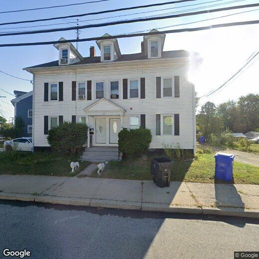
767 Providence St
West Warwick, RI 02893
Favorites
401-900-5885
-
Bedrooms
4
-
Bathrooms
1
-
Square Feet
--
-
Available
Available Jul 1
Highlights
- No Cooling
- Baseboard Heating
767 Providence St

Favorites
About This Home
$2,000 deposit,
Available Jul 1
MLS ID 1416433
767 Providence St is an apartment community located in Kent County and the 02893 ZIP Code.
* Price shown is base rent. Excludes user-selected optional fees and variable or usage-based fees and required charges due at or prior to move-in or at move-out. Price, availability, fees, and any applicable rent special are subject to change without notice.
* Square footage definitions vary. Displayed square footage is approximate.
Home Details
Bedrooms and Bathrooms
1 Full Bathroom
4 Bedrooms
Flooring
Laminate Flooring
Home Design
Apartment
Listing and Financial Details
Property Available on 7/1/26
Month-to-Month Lease Term
Assessor Parcel Number 767PROVIDENCESTWWAR
Utilities
No Cooling
Baseboard Heating
Heating System Uses Gas
Community Details
Overview
No Home Owners Association
Pet Policy
No Pets Allowed
Fees and Policies
The fees listed below are community-provided and may exclude utilities or add-ons. All payments are made directly to the property and are non-refundable unless otherwise specified. Use the Cost Calculator to determine costs based on your needs.
-
One-Time Basics
-
Security Deposit - Refundable$2,000
-
Property Fee Disclaimer: Based on community-supplied data and independent market research. Subject to change without notice. May exclude fees for mandatory or optional services and usage-based utilities.
Contact
- Listed by The Realpro Group | REALPRO by The Water
- Phone Number
- Contact
-
Source
State Wide MLS of Rhode Island, Inc.
Copyright © 2026 State Wide MLS of Rhode Island, Inc. All rights reserved. All information provided by the listing agent/broker is deemed reliable but is not guaranteed and should be independently verified.
Location
Get Directions
West Warwick sits along the Pawtuxet River as Rhode Island's youngest town, incorporated in 1913 after splitting from its larger neighbor, and that industrial heritage still shapes its character today. The town spans just nine square miles in Kent County, placing it within easy reach of Providence to the northeast and the coast to the south via Route 4. Compact and walkable in its core areas, West Warwick carries the feel of a working New England town where longtime residents and newer arrivals share the same tree-lined streets and local gathering spots.
The rental market reflects the town's modest scale, with a mix of converted mill buildings, two- and three-family homes, and smaller apartment communities that offer more space per dollar than many nearby communities. Studios through three-bedroom units are available across the town's distinct village areas, including Riverpoint, Arctic, and Phenix, each with its own pocket of character.
Learn more about living in West Warwick
Education
| Colleges & Universities | Distance | ||
|---|---|---|---|
| Colleges & Universities | Distance | ||
| Drive: | 4 min | 1.3 mi | |
| Drive: | 9 min | 4.9 mi | |
| Drive: | 17 min | 10.0 mi | |
| Drive: | 17 min | 10.0 mi |
767 Providence St is within 4 minutes or 1.3 miles from C.C. of Rhode Island, Knight. It is also near New England Tech and C.C. of Rhode Island, Liston.
Getting Around
 What do Walkability, Transit, Drivability, and Bikeability mean?
Walkability measures the walking distance to day-to-day needs.
Transit measures access to public transportation.
Drivability measures congestion, parking availability, and access to major roads.
Bikeability measures the suitability for cycling.
How It Works
What do Walkability, Transit, Drivability, and Bikeability mean?
Walkability measures the walking distance to day-to-day needs.
Transit measures access to public transportation.
Drivability measures congestion, parking availability, and access to major roads.
Bikeability measures the suitability for cycling.
How It Works
Fairly Walkable
Walkability
50
/ 100
Limited Public Transit
Transit
30
/ 100
Exceptionally Drivable
Drivability
90
/ 100
Fairly Bikeable
Bikeability
40
/ 100
Scores provided by
-
Soundscore™
-
/ 100
Traffic
-Airport
-Businesses
-Scores provided by
HowLoud What is a Sound Score Rating? A Sound Score Rating aggregates noise caused by vehicle traffic, airplane traffic and local sources. How It WorksYou May Also Like
Similar Rentals Nearby


767 Providence St
West Warwick, RI 02893