
Park 205 Apartments
205 W Touhy Ave,
Park Ridge, IL 60068
$2,773 - $4,298 Total Monthly Price
1-3 Beds
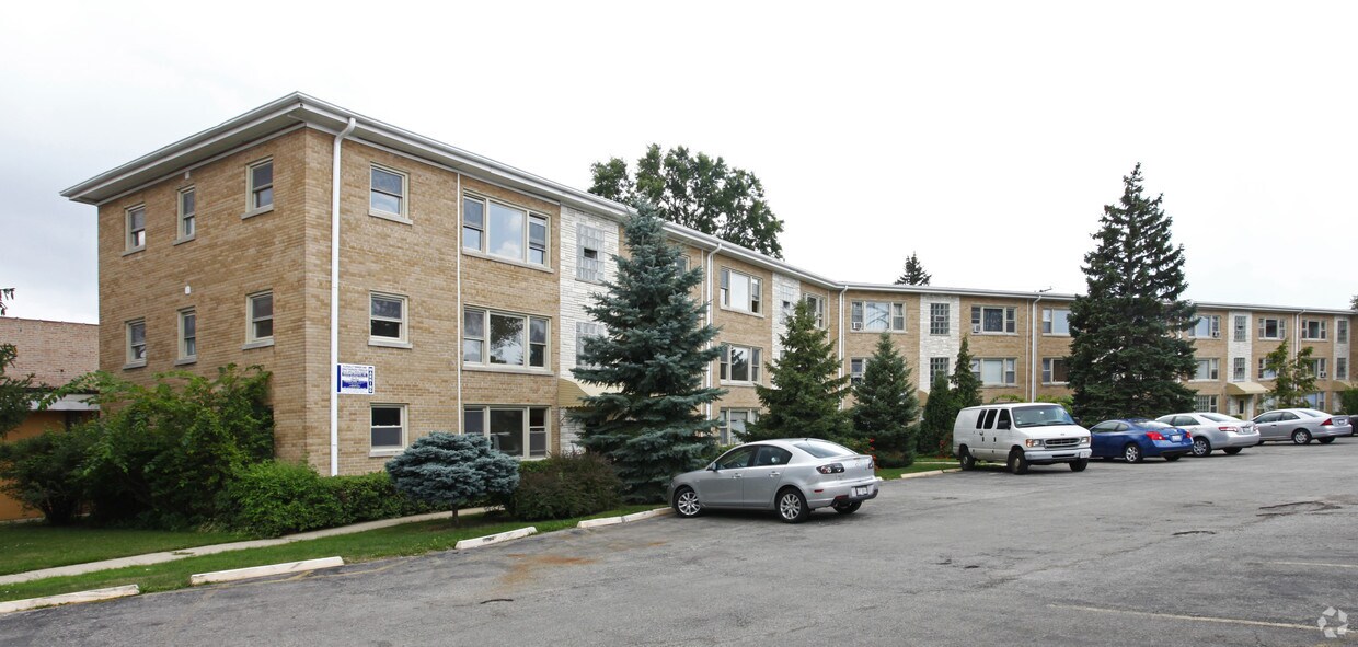
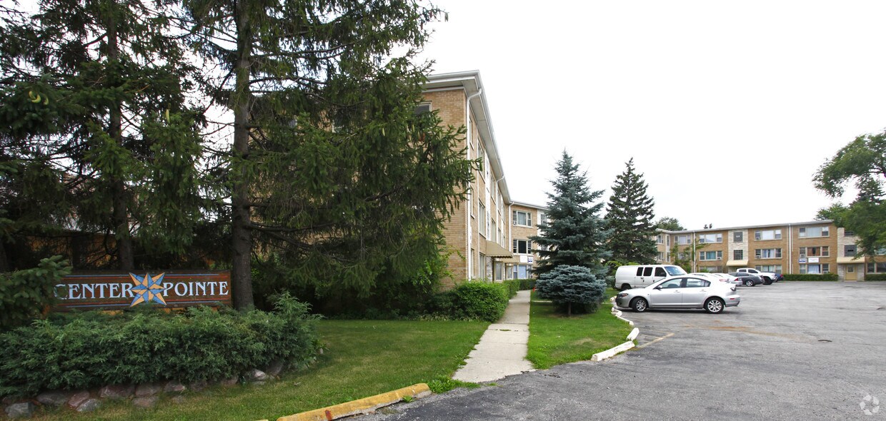
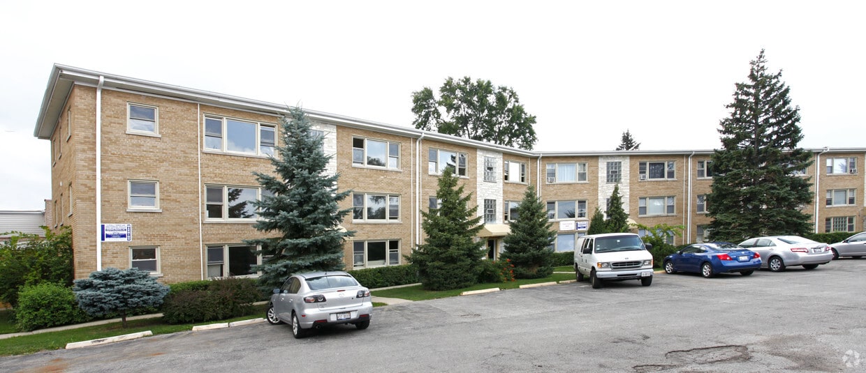

At 7626-7632 1/2 N Milwaukee Ave, experience fine living. In the 60714 area of Niles on 1/2 N. Milwaukee Ave, you have a quick connection to a number of points of interest within a few miles. From pricing to features, the professional leasing team is ready to help you in finding your perfect new place. Make a visit to view the available floorplans. Contact us or drop by the leasing office to check the availability and set up a tour today and find your new place at 7626-7632 1/2 N Milwaukee Ave.
7626-7632 1/2 N Milwaukee Ave is an apartment community located in Cook County and the 60714 ZIP Code. This area is served by the Park Ridge Community Consolidated School District 64 attendance zone.
Fitness Center
24 Hour Access
Trash Pickup - Curbside
Sauna
Refrigerator
Heating
Oven
Range
Niles is a Cook County village sitting directly along Chicago's northwest border, offering suburban calm without surrendering easy access to one of America's great cities. Spread across just six square miles, the community carries a settled, unhurried character shaped by decades of residential stability and a strong local identity. Metra rail lines and quick connections to I-90, I-94, and I-294 keep downtown Chicago well within reach, making Niles a practical base for anyone working or exploring throughout the metro area. The Golf Mill Shopping Center anchors commercial life locally, while nearby Skokie, Park Ridge, and Glenview add even more options just minutes away. In 1946, Niles launched one of the first free ambulance services in the state, a point of civic pride that still speaks to the community's character.
Learn more about living in Niles| Colleges & Universities | Distance | ||
|---|---|---|---|
| Colleges & Universities | Distance | ||
| Drive: | 7 min | 3.8 mi | |
| Drive: | 10 min | 5.1 mi | |
| Drive: | 12 min | 6.0 mi | |
| Drive: | 12 min | 6.5 mi |


Transportation options available in Niles include Oakton-Skokie, located 3.5 miles from 7626-7632 1/2 N Milwaukee Ave. 7626-7632 1/2 N Milwaukee Ave is near Chicago O'Hare International, located 7.8 miles or 14 minutes away, and Chicago Midway International, located 17.9 miles or 33 minutes away.
| Transit / Subway | Distance | ||
|---|---|---|---|
| Transit / Subway | Distance | ||
|
|
Drive: | 6 min | 3.5 mi |
|
|
Drive: | 8 min | 4.0 mi |
|
|
Drive: | 7 min | 4.1 mi |
|
|
Drive: | 10 min | 5.7 mi |
|
|
Drive: | 11 min | 6.8 mi |
| Commuter Rail | Distance | ||
|---|---|---|---|
| Commuter Rail | Distance | ||
|
|
Drive: | 4 min | 2.0 mi |
|
|
Drive: | 5 min | 2.2 mi |
|
|
Drive: | 4 min | 2.3 mi |
|
|
Drive: | 5 min | 2.6 mi |
|
|
Drive: | 7 min | 3.0 mi |
| Airports | Distance | ||
|---|---|---|---|
| Airports | Distance | ||
|
Chicago O'Hare International
|
Drive: | 14 min | 7.8 mi |
|
Chicago Midway International
|
Drive: | 33 min | 17.9 mi |
Scores provided by
Traffic
-Airport
-Businesses
-Scores provided by
HowLoud What is a Sound Score Rating? A Sound Score Rating aggregates noise caused by vehicle traffic, airplane traffic and local sources. How It WorksTime and distance from 7626-7632 1/2 N Milwaukee Ave.
| Shopping Centers | Distance | ||
|---|---|---|---|
| Shopping Centers | Distance | ||
| Walk: | 4 min | 0.2 mi | |
| Walk: | 5 min | 0.3 mi | |
| Walk: | 8 min | 0.4 mi |
| Parks and Recreation | Distance | ||
|---|---|---|---|
| Parks and Recreation | Distance | ||
|
Caldwell Woods
|
Drive: | 4 min | 2.0 mi |
|
Bunker Hill / Clayton Smith Preserves
|
Drive: | 4 min | 2.0 mi |
|
Norwood Park
|
Drive: | 5 min | 2.7 mi |
|
Laramie Park
|
Drive: | 6 min | 3.0 mi |
|
Wildwood Nature Center
|
Drive: | 8 min | 3.4 mi |
| Hospitals | Distance | ||
|---|---|---|---|
| Hospitals | Distance | ||
| Drive: | 5 min | 2.8 mi | |
| Drive: | 5 min | 2.9 mi | |
| Drive: | 9 min | 4.5 mi |
| Military Bases | Distance | ||
|---|---|---|---|
| Military Bases | Distance | ||
| Drive: | 20 min | 11.5 mi | |
| Drive: | 35 min | 26.3 mi | |
| Drive: | 43 min | 29.5 mi |
What Are Walk Score®, Transit Score®, and Bike Score® Ratings?
Walk Score® measures the walkability of any address. Transit Score® measures access to public transit. Bike Score® measures the bikeability of any address.
What is a Sound Score Rating?
A Sound Score Rating aggregates noise caused by vehicle traffic, airplane traffic and local sources.

7626-7632 1/2 N Milwaukee Ave
Niles, IL 60714


