
$3,100
/ Month
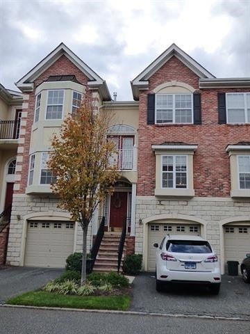
76 Osprey Ct
Secaucus, NJ 07094
2 Weeks Ago
|
Edit
Favorites
76 Osprey Ct

Favorites
Check Back Soon for Upcoming Availability
| Beds | Baths | Average SF |
|---|---|---|
| 2 Bedrooms 2 Bedrooms 2 Br | 2.5 Baths 2.5 Baths 2.5 Ba | 1,781 SF |
Fees and Policies
The fees below are based on community-supplied data and may exclude additional fees and utilities.
76 Osprey Ct is a house located in Hudson County and the 07094 ZIP Code. This area is served by the Secaucus Board Of Education attendance zone.
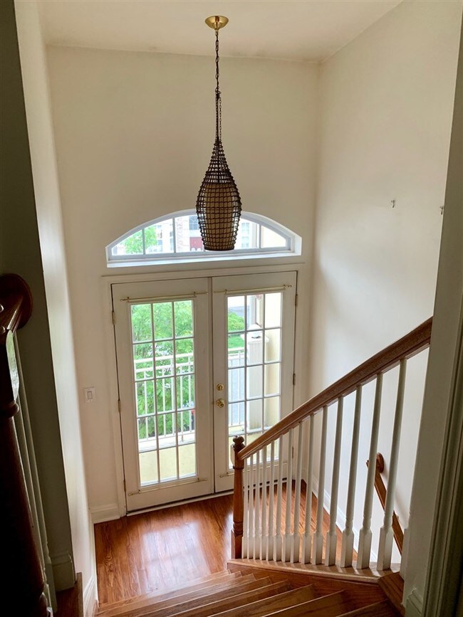
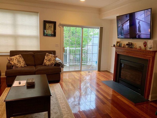
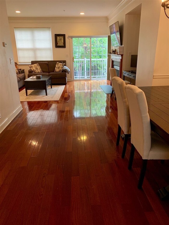
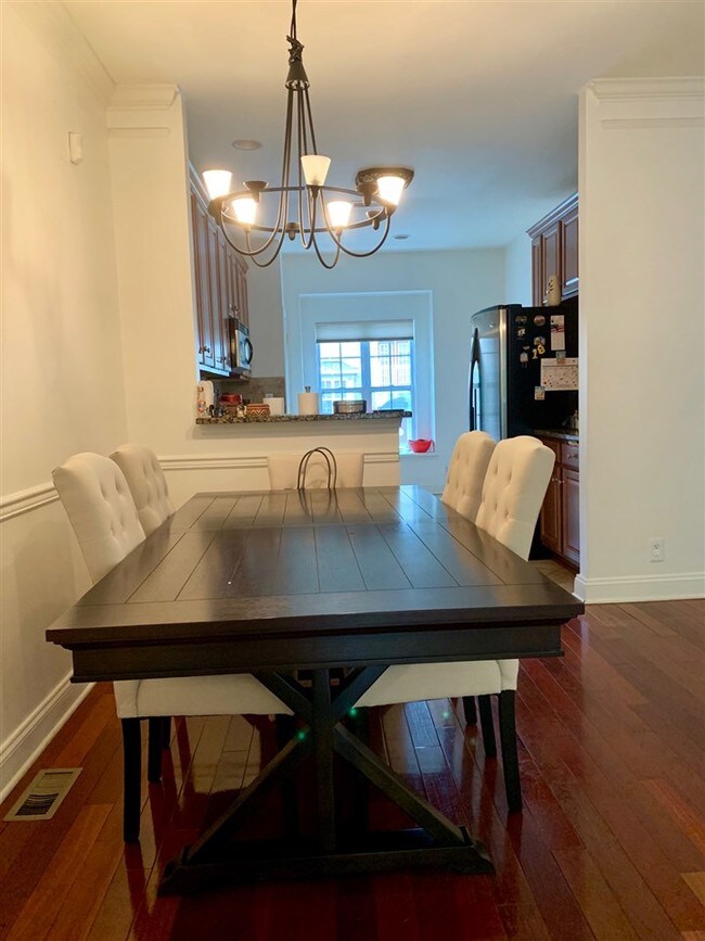
House Features
Suelos de madera maciza
Chimenea
Sistema de seguridad
Horno
- Sistema de seguridad
- Chimenea
- Horno
- Suelos de madera maciza
- Piscina exterior
Location
Get Directions
Nestled alongside the Hackensack River within the New Jersey Meadowlands, Secaucus is a dynamic suburb just five miles west of Midtown Manhattan. Secaucus residents enjoy a bevy of shopping opportunities in town, with popular retail centers like the Plaza at Harmon Meadow and the Secaucus Outlet Center providing a host of brand-name delights.
Despite Secaucus’ close proximity to Manhattan, the town maintains a distinct suburban vibe, with plenty of lush green space to relieve any urban anxiety and a host of convenient stores and restaurants for everyday needs. Among the town’s most popular venues for outdoor activities are Laurel Hill Park, Buchmuller Park, and Mill Creek Point Park.
Secaucus is also adjacent to the Meadowlands Sports Complex. Getting around from Secaucus is easy with convenience to I-95, the Frank R. Lautenberg Rail Station, and the Lincoln Tunnel.
Learn more about living in Secaucus
Amenities
- Sistema de seguridad
- Chimenea
- Horno
- Suelos de madera maciza
- Piscina exterior
Education
| Colleges & Universities | Distance | ||
|---|---|---|---|
| Colleges & Universities | Distance | ||
| Drive: | 7 min | 4.3 mi | |
| Drive: | 9 min | 5.3 mi | |
| Drive: | 14 min | 6.1 mi | |
| Drive: | 17 min | 7.5 mi |
76 Osprey Ct is within 7 minutes or 4.3 miles from Bergen C.C., Meadowlands. It is also near Felician College, Rutherford and Stevens Inst. of Technology.
Schools


Public Elementary School
Grades PK-5
633 Students
Nearby
Public Middle School
Grades 6-8
470 Students
Nearby
Public High School
Grades 9-12
637 Students
Attendance Zone
Private Elementary, Middle & High School
Grades 1-12
83 Students
Nearby
Private Elementary, Middle & High School
Grades PK-12
237 Students
Nearby
School data provided by
 The GreatSchools Rating helps parents compare schools within a state based on a variety of school quality indicators and provides a helpful picture of how effectively each school serves all of its students. Ratings are on a scale of 1 (below average) to 10 (above average) and can include test scores, college readiness, academic progress, advanced courses, equity, discipline and attendance data. We also advise parents to visit schools, consider other information on school performance and programs, and consider family needs as part of the school selection process.
View GreatSchools Rating Methodology
Data provided by GreatSchools.org © 2025. All rights reserved.
View GreatSchools Rating Methodology
Data provided by GreatSchools.org © 2025. All rights reserved.
Transportation options available in Secaucus include Tonnelle Avenue, located 3.4 miles from 76 Osprey Ct. 76 Osprey Ct is near Newark Liberty International, located 11.2 miles or 14 minutes away, and LaGuardia, located 15.8 miles or 32 minutes away.
| Transit / Subway | Distance | ||
|---|---|---|---|
| Transit / Subway | Distance | ||
|
|
Drive: | 6 min | 3.4 mi |
|
|
Drive: | 7 min | 4.2 mi |
|
|
Drive: | 7 min | 4.6 mi |
|
|
Drive: | 10 min | 5.7 mi |
|
|
Drive: | 12 min | 6.1 mi |
| Commuter Rail | Distance | ||
|---|---|---|---|
| Commuter Rail | Distance | ||
| Drive: | 4 min | 2.4 mi | |
|
|
Drive: | 5 min | 3.9 mi |
|
|
Drive: | 7 min | 4.2 mi |
|
|
Drive: | 7 min | 4.5 mi |
|
|
Drive: | 10 min | 4.9 mi |
| Airports | Distance | ||
|---|---|---|---|
| Airports | Distance | ||
|
Newark Liberty International
|
Drive: | 14 min | 11.2 mi |
|
LaGuardia
|
Drive: | 32 min | 15.8 mi |
Time and distance from 76 Osprey Ct.
| Shopping Centers | Distance | ||
|---|---|---|---|
| Shopping Centers | Distance | ||
| Walk: | 7 min | 0.4 mi | |
| Drive: | 3 min | 1.3 mi | |
| Drive: | 4 min | 1.8 mi |
76 Osprey Ct has 3 shopping centers within 1.8 miles, which is about a 4-minute drive. The miles and minutes will be for the farthest away property.
| Parks and Recreation | Distance | ||
|---|---|---|---|
| Parks and Recreation | Distance | ||
|
Laurel Hill Park
|
Drive: | 8 min | 3.6 mi |
|
Meadowlands Environment Center
|
Drive: | 14 min | 6.1 mi |
|
McDowell Observatory
|
Drive: | 14 min | 6.1 mi |
|
De Witt Clinton Park
|
Drive: | 16 min | 7.5 mi |
|
Richard W. DeKorte Park
|
Drive: | 15 min | 7.9 mi |
76 Osprey Ct has 5 parks within 7.9 miles, including Laurel Hill Park, Meadowlands Environment Center, and McDowell Observatory.
| Hospitals | Distance | ||
|---|---|---|---|
| Hospitals | Distance | ||
| Walk: | 17 min | 0.9 mi | |
| Drive: | 4 min | 1.9 mi | |
| Drive: | 13 min | 6.0 mi |
76 Osprey Ct has 3 hospitals within 6.0 miles, the nearest is Hudson Regional Hospital which is 0.9 mile away and a 17 minute walk.
| Military Bases | Distance | ||
|---|---|---|---|
| Military Bases | Distance | ||
| Drive: | 21 min | 11.5 mi | |
| Drive: | 20 min | 13.7 mi |
76 Osprey Ct is 11.5 miles from Governors Island Support Center, and is convenient to other military bases, including Military Ocean Terminal.
You May Also Like
How do I access Social Services in New Jersey?
Statewide service is free, confidential, multilingual and always open. Three easy ways to reach Social Services in NJ: Dial 2-1-1; text your zip code to 898-211; or chat at https://www.nj211.org
Similar Rentals Nearby


What Are Walk Score®, Transit Score®, and Bike Score® Ratings?
Walk Score® measures the walkability of any address. Transit Score® measures access to public transit. Bike Score® measures the bikeability of any address.
What is a Sound Score Rating?
A Sound Score Rating aggregates noise caused by vehicle traffic, airplane traffic and local sources

76 Osprey Ct
Secaucus, NJ 07094