
Presidential Towers
555 W Madison St,
Chicago, IL 60661
$1,800 - $4,946
Studio - 2 Beds
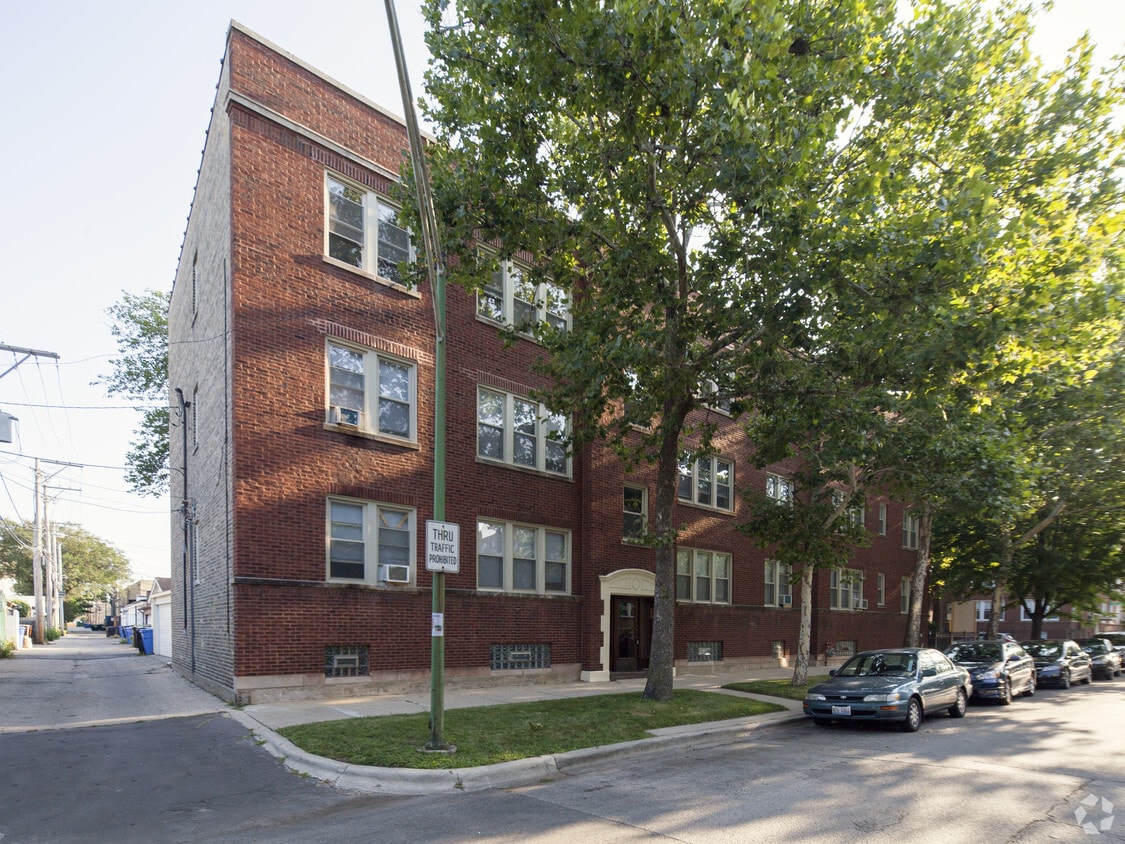
This charming red brick building with statement doorframe sits surrounded by trees in the Rogers Park neighborhood. Inside, you’ll find renovated two-bedroom apartment homes with plenty of character. Original hardwood floors throughout the apartment add a touch of elegance to each room. Updated kitchens include stone countertops, cherry wood cabinetry, and stainless steel appliances. Bathrooms have been renovated to include upgraded fixtures and vanities. Within a two-block radius, residents can find pharmacies, supermarkets, local restaurants, clothing stores, banks, and more.
7434 N. Artesian Ave. is an apartment community located in Cook County and the 60645 ZIP Code. This area is served by the Chicago Public Schools attendance zone.
Unique Features
Laundry Facilities
Gated
24 Hour Access
Maintenance on site
Dishwasher
Hardwood Floors
Granite Countertops
Microwave
West Ridge Park is located on the far north side of Chicago, an upscale community encompassed with tree-lined streets, multicultural establishments, and historic homes.
Many diverse restaurants can be found along West Devon Avenue, which is a couple of blocks south of Robert A. Black Golf Course. Many green spaces make up West Rogers Park, including Mather Park and Indian Boundary Park.
Residents of this lush Chicago community enjoy proximity to Rogers Park Train Station, Loyola Beach, and Lincoln Town Center mall.
Learn more about living in West Rogers ParkCompare neighborhood and city base rent averages by bedroom.
| West Rogers Park | Chicago, IL | |
|---|---|---|
| Studio | $980 | $1,629 |
| 1 Bedroom | $1,136 | $2,019 |
| 2 Bedrooms | $1,409 | $2,536 |
| 3 Bedrooms | $1,837 | $3,053 |
| Colleges & Universities | Distance | ||
|---|---|---|---|
| Colleges & Universities | Distance | ||
| Drive: | 6 min | 3.0 mi | |
| Drive: | 7 min | 3.5 mi | |
| Drive: | 8 min | 3.6 mi | |
| Drive: | 9 min | 4.1 mi |


Transportation options available in Chicago include Howard Terminal, located 1.3 miles from 7434 N. Artesian Ave.. 7434 N. Artesian Ave. is near Chicago O'Hare International, located 14.3 miles or 25 minutes away, and Chicago Midway International, located 18.5 miles or 34 minutes away.
| Transit / Subway | Distance | ||
|---|---|---|---|
| Transit / Subway | Distance | ||
|
|
Drive: | 3 min | 1.3 mi |
|
|
Drive: | 3 min | 1.5 mi |
|
|
Drive: | 4 min | 1.6 mi |
|
|
Drive: | 4 min | 1.8 mi |
|
|
Drive: | 5 min | 2.0 mi |
| Commuter Rail | Distance | ||
|---|---|---|---|
| Commuter Rail | Distance | ||
|
|
Drive: | 3 min | 1.3 mi |
|
|
Drive: | 3 min | 1.7 mi |
| Drive: | 4 min | 2.3 mi | |
|
|
Drive: | 5 min | 2.6 mi |
|
|
Drive: | 6 min | 3.5 mi |
| Airports | Distance | ||
|---|---|---|---|
| Airports | Distance | ||
|
Chicago O'Hare International
|
Drive: | 25 min | 14.3 mi |
|
Chicago Midway International
|
Drive: | 34 min | 18.5 mi |
Scores provided by
Traffic
-Airport
-Businesses
-Scores provided by
HowLoud What is a Sound Score Rating? A Sound Score Rating aggregates noise caused by vehicle traffic, airplane traffic and local sources. How It WorksTime and distance from 7434 N. Artesian Ave..
| Shopping Centers | Distance | ||
|---|---|---|---|
| Shopping Centers | Distance | ||
| Walk: | 3 min | 0.2 mi | |
| Walk: | 5 min | 0.3 mi | |
| Walk: | 5 min | 0.3 mi |
| Parks and Recreation | Distance | ||
|---|---|---|---|
| Parks and Recreation | Distance | ||
|
Rogers Park
|
Walk: | 9 min | 0.5 mi |
|
Warren Park
|
Drive: | 2 min | 1.2 mi |
|
Touhy Park
|
Drive: | 3 min | 1.4 mi |
|
Pooch Park
|
Drive: | 3 min | 1.8 mi |
|
Channelside Park
|
Drive: | 3 min | 1.8 mi |
| Hospitals | Distance | ||
|---|---|---|---|
| Hospitals | Distance | ||
| Walk: | 16 min | 0.8 mi | |
| Drive: | 6 min | 3.4 mi | |
| Drive: | 7 min | 3.7 mi |
| Military Bases | Distance | ||
|---|---|---|---|
| Military Bases | Distance | ||
| Drive: | 33 min | 17.9 mi |
What Are Walk Score®, Transit Score®, and Bike Score® Ratings?
Walk Score® measures the walkability of any address. Transit Score® measures access to public transit. Bike Score® measures the bikeability of any address.
What is a Sound Score Rating?
A Sound Score Rating aggregates noise caused by vehicle traffic, airplane traffic and local sources.

2432-2434 W Fargo Ave
Chicago, IL 60645


