
Venue Residences
3688 Overland Ave,
Los Angeles, CA 90034
$2,625 - $5,650
Studio - 2 Beds
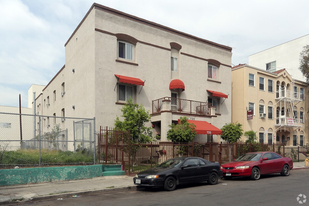
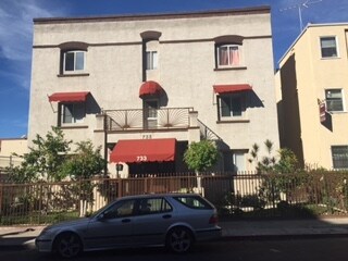
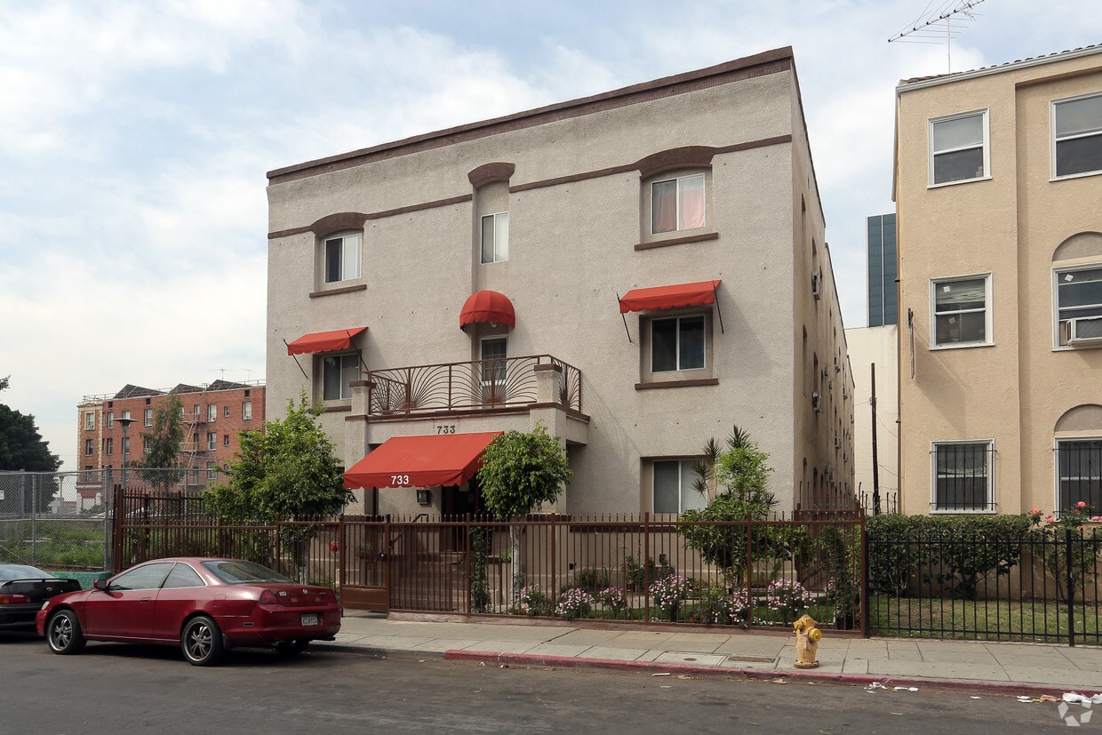
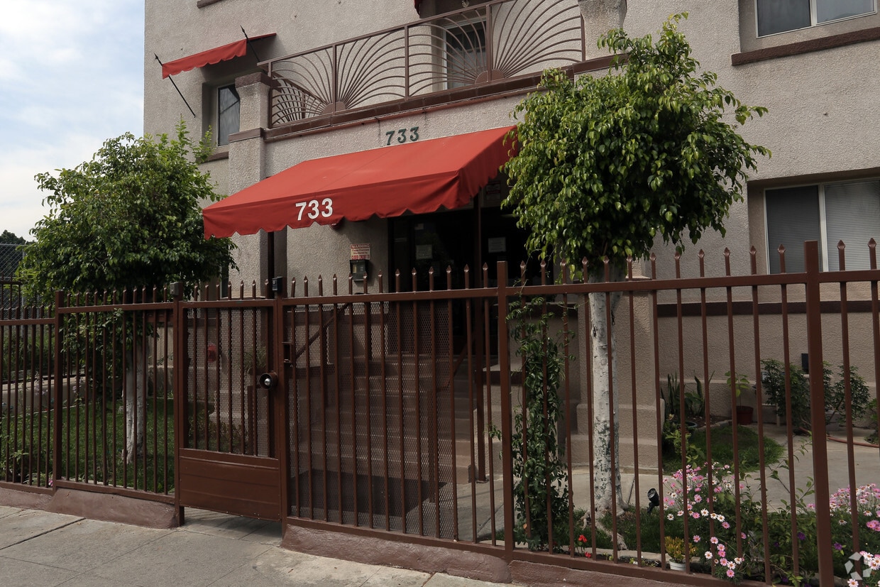
Discover your new home at 733 S Coronado St. This community is located in the MacArthur Park area of Los Angeles. The leasing staff will assist you in finding the best floor plan for your lifestyle. Drop by the leasing office to learn more about our community and see 733 S Coronado St.
733 S Coronado St is an apartment community located in Los Angeles County and the 90057 ZIP Code. This area is served by the Los Angeles Unified Rocp School District attendance zone.
High Speed Internet Access
Refrigerator
Smoke Free
Heating
MacArthur Park was billed as Los Angeles’ version of New York’s Central Park when it was under construction. Today it has become much more than the green grass and lake that comprise it. The park and the 2.72 mile area that surrounds it — also called Westlake — is one of LA’s most historic neighborhoods.
Victorian homes and apartment complexes characterize the area, but newer developments are going up quickly. On the east side of the park is where you’ll find an eclectic mix of bars and restaurants. Big-box stores will take care of most of your retail needs, while entertainment lovers will appreciate the Staples Center residing just across the 110.
The park is obviously the biggest calling card of the neighborhood, and it has become increasingly well-maintained over the last few years. Enjoy a picnic near the lake and the expansive view of the LA skyline in this up-and-coming locale.
Learn more about living in MacArthur ParkCompare neighborhood and city base rent averages by bedroom.
| MacArthur Park | Los Angeles, CA | |
|---|---|---|
| Studio | $1,320 | $1,711 |
| 1 Bedroom | $1,561 | $2,183 |
| 2 Bedrooms | $2,228 | $3,016 |
| 3 Bedrooms | $2,772 | $4,340 |
| Colleges & Universities | Distance | ||
|---|---|---|---|
| Colleges & Universities | Distance | ||
| Walk: | 10 min | 0.5 mi | |
| Drive: | 3 min | 1.6 mi | |
| Drive: | 3 min | 1.8 mi | |
| Drive: | 4 min | 1.9 mi |


Transportation options available in Los Angeles include Westlake/Macarthur Park Station, located 0.5 mile from 733 S Coronado St. 733 S Coronado St is near Bob Hope, located 13.2 miles or 22 minutes away, and Los Angeles International, located 14.1 miles or 24 minutes away.
| Transit / Subway | Distance | ||
|---|---|---|---|
| Transit / Subway | Distance | ||
|
|
Walk: | 9 min | 0.5 mi |
|
|
Walk: | 14 min | 0.7 mi |
|
|
Drive: | 2 min | 1.4 mi |
|
|
Drive: | 3 min | 1.8 mi |
|
|
Drive: | 3 min | 1.8 mi |
| Commuter Rail | Distance | ||
|---|---|---|---|
| Commuter Rail | Distance | ||
|
|
Drive: | 10 min | 3.9 mi |
|
|
Drive: | 8 min | 3.9 mi |
|
|
Drive: | 11 min | 6.3 mi |
| Drive: | 11 min | 8.0 mi | |
|
|
Drive: | 18 min | 10.3 mi |
| Airports | Distance | ||
|---|---|---|---|
| Airports | Distance | ||
|
Bob Hope
|
Drive: | 22 min | 13.2 mi |
|
Los Angeles International
|
Drive: | 24 min | 14.1 mi |
Scores provided by
Traffic
-Airport
-Businesses
-Scores provided by
HowLoud What is a Sound Score Rating? A Sound Score Rating aggregates noise caused by vehicle traffic, airplane traffic and local sources. How It WorksTime and distance from 733 S Coronado St.
| Shopping Centers | Distance | ||
|---|---|---|---|
| Shopping Centers | Distance | ||
| Walk: | 4 min | 0.2 mi | |
| Walk: | 4 min | 0.2 mi | |
| Walk: | 4 min | 0.2 mi |
| Parks and Recreation | Distance | ||
|---|---|---|---|
| Parks and Recreation | Distance | ||
|
MacArthur Park Lake
|
Walk: | 6 min | 0.3 mi |
|
Vista Hermosa Natural Park
|
Drive: | 4 min | 2.3 mi |
|
Echo Park Lake
|
Drive: | 5 min | 2.5 mi |
|
Exposition Park Rose Garden
|
Drive: | 7 min | 3.6 mi |
|
Chavez Ravine Arboretum
|
Drive: | 8 min | 3.6 mi |
| Hospitals | Distance | ||
|---|---|---|---|
| Hospitals | Distance | ||
| Walk: | 14 min | 0.8 mi | |
| Drive: | 3 min | 1.3 mi | |
| Drive: | 3 min | 1.9 mi |
| Military Bases | Distance | ||
|---|---|---|---|
| Military Bases | Distance | ||
| Drive: | 23 min | 16.4 mi | |
| Drive: | 37 min | 27.3 mi | |
| Drive: | 41 min | 28.3 mi |
Pets Allowed Fitness Center Pool Maintenance on site High-Speed Internet Controlled Access EV Charging
What Are Walk Score®, Transit Score®, and Bike Score® Ratings?
Walk Score® measures the walkability of any address. Transit Score® measures access to public transit. Bike Score® measures the bikeability of any address.
What is a Sound Score Rating?
A Sound Score Rating aggregates noise caused by vehicle traffic, airplane traffic and local sources.

733 S Coronado St
Los Angeles, CA 90057


