
Presidential Towers
555 W Madison St,
Chicago, IL 60661
$1,659 - $6,667
Studio - 2 Beds
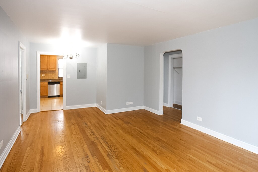

Recently Rehabbed One Bedroom-Condo Quality - Located on the Northside of Chicago, between Touhy and Howard, these apartments are recently renovated with hardwood floors, and updated kitchens, including a dishwasher and AC. There is parking and storage available, laundry on-site, and a beautiful garden in the courtyard. This location is a close walk to public transportation and has many options for shopping, restaurants, schools, and entertainment. All Utilities are included except electricity. Pets Welcome: Cats - Maximum 2 per unit Dogs - Maximum weight of 45 pounds, Maximum 1 per unit. Breed Restrictions Apply. Pet Rent: Dogs - $35 per month. Cats - $35 per month per cat. Fees: Application Fee: $60.00 per person Admin fee: $400.00 Parking available for rent at $150.00 per month * Photos shown may be from a similar unit. (RLNE4711687)
7320-7330 N Ridge Ave is an apartment community located in Cook County and the 60645 ZIP Code. This area is served by the Chicago Public Schools attendance zone.
Unique Features
West Ridge Park is located on the far north side of Chicago, an upscale community encompassed with tree-lined streets, multicultural establishments, and historic homes.
Many diverse restaurants can be found along West Devon Avenue, which is a couple of blocks south of Robert A. Black Golf Course. Many green spaces make up West Rogers Park, including Mather Park and Indian Boundary Park.
Residents of this lush Chicago community enjoy proximity to Rogers Park Train Station, Loyola Beach, and Lincoln Town Center mall.
Learn more about living in West Rogers ParkCompare neighborhood and city base rent averages by bedroom.
| West Rogers Park | Chicago, IL | |
|---|---|---|
| Studio | $987 | $1,651 |
| 1 Bedroom | $1,140 | $2,055 |
| 2 Bedrooms | $1,414 | $2,591 |
| 3 Bedrooms | $1,843 | $3,101 |
| Colleges & Universities | Distance | ||
|---|---|---|---|
| Colleges & Universities | Distance | ||
| Drive: | 7 min | 2.7 mi | |
| Drive: | 9 min | 3.9 mi | |
| Drive: | 10 min | 4.3 mi | |
| Drive: | 9 min | 4.4 mi |


Transportation options available in Chicago include Howard Terminal, located 1.3 miles from 7320-7330 N Ridge Ave. 7320-7330 N Ridge Ave is near Chicago O'Hare International, located 14.4 miles or 26 minutes away, and Chicago Midway International, located 22.7 miles or 35 minutes away.
| Transit / Subway | Distance | ||
|---|---|---|---|
| Transit / Subway | Distance | ||
|
|
Drive: | 4 min | 1.3 mi |
|
|
Drive: | 4 min | 1.5 mi |
|
|
Drive: | 4 min | 1.6 mi |
|
|
Drive: | 5 min | 1.7 mi |
|
|
Drive: | 5 min | 1.9 mi |
| Commuter Rail | Distance | ||
|---|---|---|---|
| Commuter Rail | Distance | ||
|
|
Walk: | 16 min | 0.9 mi |
|
|
Drive: | 5 min | 1.8 mi |
| Drive: | 4 min | 2.0 mi | |
|
|
Drive: | 6 min | 2.8 mi |
|
|
Drive: | 10 min | 4.4 mi |
| Airports | Distance | ||
|---|---|---|---|
| Airports | Distance | ||
|
Chicago O'Hare International
|
Drive: | 26 min | 14.4 mi |
|
Chicago Midway International
|
Drive: | 35 min | 22.7 mi |
Scores provided by
Traffic
-Airport
-Businesses
-Scores provided by
HowLoud What is a Sound Score Rating? A Sound Score Rating aggregates noise caused by vehicle traffic, airplane traffic and local sources. How It WorksTime and distance from 7320-7330 N Ridge Ave.
| Shopping Centers | Distance | ||
|---|---|---|---|
| Shopping Centers | Distance | ||
| Walk: | 8 min | 0.4 mi | |
| Walk: | 10 min | 0.5 mi | |
| Walk: | 11 min | 0.6 mi |
| Parks and Recreation | Distance | ||
|---|---|---|---|
| Parks and Recreation | Distance | ||
|
Rogers Park
|
Drive: | 3 min | 1.1 mi |
|
Touhy Park
|
Drive: | 3 min | 1.3 mi |
|
Warren Park
|
Drive: | 4 min | 1.3 mi |
|
Pooch Park
|
Drive: | 5 min | 2.1 mi |
|
Channelside Park
|
Drive: | 5 min | 2.1 mi |
| Hospitals | Distance | ||
|---|---|---|---|
| Hospitals | Distance | ||
| Walk: | 17 min | 0.9 mi | |
| Drive: | 8 min | 3.5 mi | |
| Drive: | 7 min | 3.6 mi |
| Military Bases | Distance | ||
|---|---|---|---|
| Military Bases | Distance | ||
| Drive: | 34 min | 18.2 mi | |
| Drive: | 38 min | 26.1 mi | |
| Drive: | 56 min | 36.1 mi |
What Are Walk Score®, Transit Score®, and Bike Score® Ratings?
Walk Score® measures the walkability of any address. Transit Score® measures access to public transit. Bike Score® measures the bikeability of any address.
What is a Sound Score Rating?
A Sound Score Rating aggregates noise caused by vehicle traffic, airplane traffic and local sources.

7320-7330 N Ridge Ave
Chicago, IL 60645


