
Presidential Towers
555 W Madison St,
Chicago, IL 60661
$1,800 - $4,946
Studio - 2 Beds

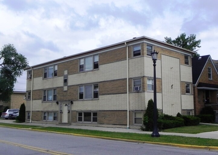
Find true Chicago living at 7245 W Fullerton Ave. This community is located on W. Fullerton Ave in Chicago. Schedule a time to check out the apartment floorplan options. The leasing team is ready and waiting for you to come by to check us out. Start living the good life at 7245 W Fullerton Ave. Contact or drop by to schedule a tour today.
7245 W Fullerton Ave is an apartment community located in Cook County and the 60707 ZIP Code. This area is served by the Elmwood Park Community Unit School District 401 attendance zone.
Chicago sprawls across roughly 228 square miles on the southwestern shore of Lake Michigan, with nearly 28 miles of lakefront where glass towers catch the morning light and commuter trains rumble through neighborhoods shaped by more than a century of reinvention. This is a city built on bold architecture and bolder ambition, where you can stand beneath the steel ribs of the “L” tracks one moment and find yourself strolling through Grant Park’s open lawns the next.
Renters here choose between classic greystone walk-ups in Lakeview, converted lofts in the West Loop’s Fulton Market district, and sleek high-rises with lake views in Streeterville. Logan Square draws crowds to its Milwaukee Avenue dining scene and the elevated 606 trail, while Lincoln Park offers tree-lined streets near the free zoo. River North packs art galleries alongside bustling restaurants, and Hyde Park anchors the South Side with the Museum of Science and Industry nearby.
Learn more about living in Chicago| Colleges & Universities | Distance | ||
|---|---|---|---|
| Colleges & Universities | Distance | ||
| Drive: | 4 min | 1.8 mi | |
| Drive: | 6 min | 2.4 mi | |
| Drive: | 6 min | 2.4 mi | |
| Drive: | 7 min | 3.3 mi |


Transportation options available in Chicago include Harlem/Lake Station (Green Line), located 2.8 miles from 7245 W Fullerton Ave. 7245 W Fullerton Ave is near Chicago O'Hare International, located 8.6 miles or 16 minutes away, and Chicago Midway International, located 12.6 miles or 23 minutes away.
| Transit / Subway | Distance | ||
|---|---|---|---|
| Transit / Subway | Distance | ||
|
|
Drive: | 7 min | 2.8 mi |
|
|
Drive: | 8 min | 3.2 mi |
|
|
Drive: | 9 min | 3.8 mi |
|
|
Drive: | 9 min | 4.6 mi |
|
|
Drive: | 10 min | 5.1 mi |
| Commuter Rail | Distance | ||
|---|---|---|---|
| Commuter Rail | Distance | ||
|
|
Walk: | 8 min | 0.4 mi |
|
|
Walk: | 11 min | 0.6 mi |
|
|
Drive: | 2 min | 1.2 mi |
|
|
Drive: | 3 min | 1.7 mi |
|
|
Drive: | 4 min | 1.7 mi |
| Airports | Distance | ||
|---|---|---|---|
| Airports | Distance | ||
|
Chicago O'Hare International
|
Drive: | 16 min | 8.6 mi |
|
Chicago Midway International
|
Drive: | 23 min | 12.6 mi |
Scores provided by
Traffic
-Airport
-Businesses
-Scores provided by
HowLoud What is a Sound Score Rating? A Sound Score Rating aggregates noise caused by vehicle traffic, airplane traffic and local sources. How It WorksTime and distance from 7245 W Fullerton Ave.
| Shopping Centers | Distance | ||
|---|---|---|---|
| Shopping Centers | Distance | ||
| Walk: | 14 min | 0.8 mi | |
| Walk: | 18 min | 1.0 mi | |
| Drive: | 3 min | 1.1 mi |
| Parks and Recreation | Distance | ||
|---|---|---|---|
| Parks and Recreation | Distance | ||
|
Riis Park
|
Drive: | 3 min | 1.6 mi |
|
Wonder Works Children's Museum
|
Drive: | 5 min | 2.4 mi |
|
Cernan Earth and Space Center
|
Drive: | 6 min | 3.1 mi |
|
Tyrell Trailside Museum / Thatcher Woods
|
Drive: | 8 min | 3.2 mi |
|
LaFollette Park
|
Drive: | 7 min | 3.8 mi |
| Hospitals | Distance | ||
|---|---|---|---|
| Hospitals | Distance | ||
| Drive: | 3 min | 1.3 mi | |
| Drive: | 6 min | 2.7 mi | |
| Drive: | 7 min | 3.1 mi |
| Military Bases | Distance | ||
|---|---|---|---|
| Military Bases | Distance | ||
| Drive: | 27 min | 16.9 mi |
What Are Walk Score®, Transit Score®, and Bike Score® Ratings?
Walk Score® measures the walkability of any address. Transit Score® measures access to public transit. Bike Score® measures the bikeability of any address.
What is a Sound Score Rating?
A Sound Score Rating aggregates noise caused by vehicle traffic, airplane traffic and local sources.
7245 W Fullerton Ave
Chicago, IL 60707


