
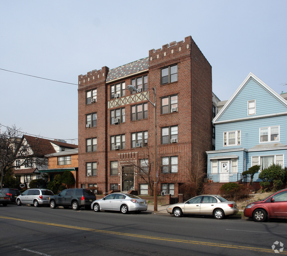
19 East
19 E 19th St,
Bayonne, NJ 07002
$2,200 - $3,200 Total Monthly Price
Studio - 2 Beds

***NO BROKERS FEE*** Beautiful and large 2 bedroom in very desirable area of Bayonne. Microwave, refrigerator, & stove included. Granite countertops, tile floors, eat-in kitchen. Walk to transportation, schools, shopping. Clean, well-kept building, with coin-operated laundry room available to all tenants. Building is equipped with camera system for security. Apartment is peaceful, well lit, with large kitchen cabinets and closet space.
713-715 Avenue C is an apartment community located in Hudson County and the 07002 ZIP Code. This area is served by the Bayonne School District attendance zone.
Hardwood Floors
Granite Countertops
Microwave
Refrigerator
Also known as Constable's Hook, historic Constable Hook is one of New Jersey and the East Coast’s oldest communities. Nestled between the Hudson River and Newark Bay, Constable Hook consists of the southern portion of Bayonne. Bayonne prides itself on natural conservation and the area is home to several marinas and waterfront greenspaces. Golf fans spend days on the green at the Bayonne Golf Club, while Dennis P. Collins Park is a local favorite for its skatepark and views of the Bayonne Bridge and freight and cruise ships. Along Broadway, residents have access to restaurants, shops, and bars giving the area the feel of a small town. The neighborhood has a relatively low cost of living and has a variety of mid-range to upscale options available for rent.
Learn more about living in Constable HookCompare neighborhood and city base rent averages by bedroom.
| Constable Hook | Bayonne, NJ | |
|---|---|---|
| Studio | $1,868 | $2,177 |
| 1 Bedroom | $2,255 | $2,369 |
| 2 Bedrooms | $2,756 | $3,057 |
| 3 Bedrooms | $1,763 | $3,676 |
| Colleges & Universities | Distance | ||
|---|---|---|---|
| Colleges & Universities | Distance | ||
| Drive: | 7 min | 3.4 mi | |
| Drive: | 10 min | 4.7 mi | |
| Drive: | 11 min | 5.4 mi | |
| Drive: | 18 min | 7.5 mi |


Transportation options available in Bayonne include 34Th Street, located 0.6 mile from 713-715 Avenue C. 713-715 Avenue C is near Newark Liberty International, located 6.4 miles or 11 minutes away, and LaGuardia, located 18.8 miles or 37 minutes away.
| Transit / Subway | Distance | ||
|---|---|---|---|
| Transit / Subway | Distance | ||
|
|
Walk: | 10 min | 0.6 mi |
|
|
Drive: | 3 min | 1.4 mi |
| Drive: | 3 min | 1.4 mi | |
|
|
Drive: | 5 min | 2.3 mi |
|
|
Drive: | 5 min | 2.5 mi |
| Commuter Rail | Distance | ||
|---|---|---|---|
| Commuter Rail | Distance | ||
|
|
Drive: | 20 min | 8.1 mi |
|
|
Drive: | 16 min | 8.3 mi |
|
|
Drive: | 19 min | 8.4 mi |
|
|
Drive: | 20 min | 8.8 mi |
|
|
Drive: | 19 min | 10.6 mi |
| Airports | Distance | ||
|---|---|---|---|
| Airports | Distance | ||
|
Newark Liberty International
|
Drive: | 11 min | 6.4 mi |
|
LaGuardia
|
Drive: | 37 min | 18.8 mi |
Scores provided by
Traffic
ActiveAirport
ActiveBusinesses
BusyScores provided by
HowLoud What is a Sound Score Rating? A Sound Score Rating aggregates noise caused by vehicle traffic, airplane traffic and local sources. How It WorksTime and distance from 713-715 Avenue C.
| Shopping Centers | Distance | ||
|---|---|---|---|
| Shopping Centers | Distance | ||
| Walk: | 15 min | 0.8 mi | |
| Walk: | 20 min | 1.0 mi | |
| Drive: | 4 min | 1.3 mi |
| Parks and Recreation | Distance | ||
|---|---|---|---|
| Parks and Recreation | Distance | ||
|
G. Thomas DiDomenico Park
|
Drive: | 3 min | 1.2 mi |
|
Stephen Gregg Park
|
Drive: | 4 min | 1.5 mi |
|
Faber Park
|
Drive: | 9 min | 4.3 mi |
|
Snug Harbor Cultural Center & Botanical Garden
|
Drive: | 14 min | 6.6 mi |
|
Staten Island Children's Museum
|
Drive: | 14 min | 6.6 mi |
| Hospitals | Distance | ||
|---|---|---|---|
| Hospitals | Distance | ||
| Walk: | 8 min | 0.5 mi | |
| Drive: | 10 min | 5.3 mi | |
| Drive: | 14 min | 6.4 mi |
| Military Bases | Distance | ||
|---|---|---|---|
| Military Bases | Distance | ||
| Drive: | 6 min | 1.9 mi | |
| Drive: | 21 min | 8.4 mi | |
| Drive: | 21 min | 11.0 mi |
What Are Walk Score®, Transit Score®, and Bike Score® Ratings?
Walk Score® measures the walkability of any address. Transit Score® measures access to public transit. Bike Score® measures the bikeability of any address.
What is a Sound Score Rating?
A Sound Score Rating aggregates noise caused by vehicle traffic, airplane traffic and local sources.

713-715 Avenue C
Bayonne, NJ 07002


