
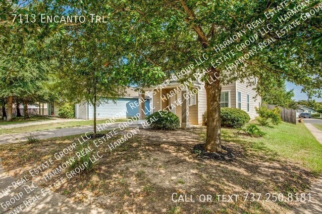
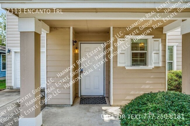
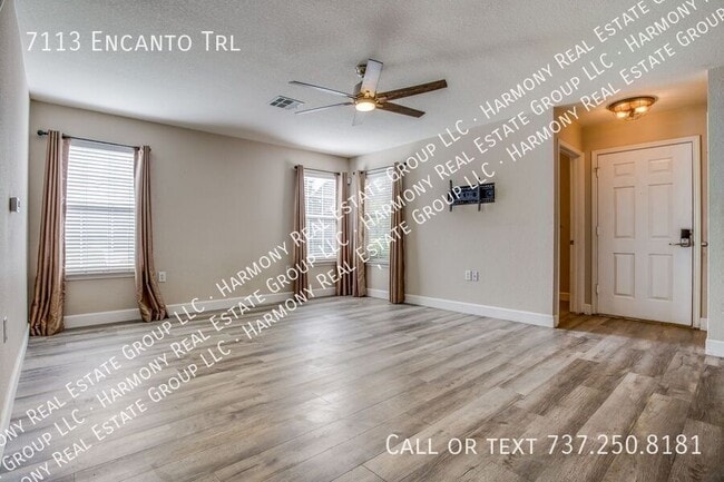
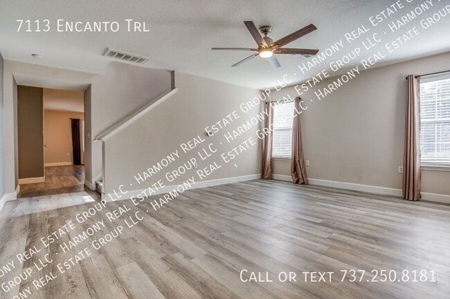
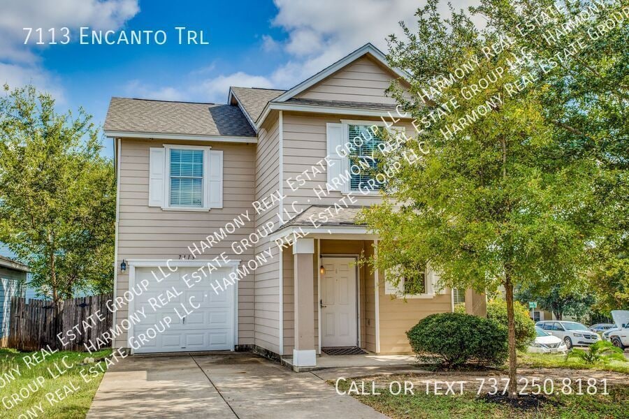
7113 Encanto Trail
Austin, TX 78744
-
Bedrooms
3
-
Bathrooms
2.5
-
Square Feet
2,019 sq ft
-
Available
Available Now
Highlight
- Pets Allowed

About This Home
Spacious 2 story home few minutes from Downtown Austin. 3 bedroom 2 bath with bonus loft area. Wood plank flooring, fenced backyard with good privacy, covered patio, convenient location! Hoa
7113 Encanto Trail is a house located in Travis County and the 78744 ZIP Code. This area is served by the Austin Independent School District attendance zone.
Fees and Policies
The fees listed below are community-provided and may exclude utilities or add-ons. All payments are made directly to the property and are non-refundable unless otherwise specified.
- Dogs Allowed
-
Fees not specified
- Cats Allowed
-
Fees not specified
Contact
- Phone Number
- Contact
Nestled about nine miles southeast of Downtown Austin, the small community of Bluff Springs provides a convenient alternative to downtown living. Bluff Springs began as a farming community in the 1850s, and that spacious feeling persists to this day, even as more residents discover this tiny gem engulfed in lush greenery.
Located along Onion Creek, Bluff Springs is home to the Onion Creek Metropolitan Park, a 555-acre regional park that offers plenty of scenic hiking trails, as well as the Onion Creek Greenbelt, which also has hiking trails, picnic areas, and a playground. Onion Creek meanders up to the sprawling McKinney Falls State Park, where visitors find waterfalls, hiking trails, campgrounds, and fishing areas in addition to the renowned Old Baldy, a cypress tree that’s more than 500 years old.
Southpark Meadows, the largest shopping plaza near Bluff Springs, is located along I-35. This plaza includes an array of national retailers and chain restaurants.
Learn more about living in Bluff Springs| Colleges & Universities | Distance | ||
|---|---|---|---|
| Colleges & Universities | Distance | ||
| Drive: | 8 min | 3.8 mi | |
| Drive: | 9 min | 4.8 mi | |
| Drive: | 14 min | 7.2 mi | |
| Drive: | 16 min | 9.1 mi |


View GreatSchools Rating Methodology
Data provided by GreatSchools.org © 2026. All rights reserved.
Transportation options available in Austin include Downtown Station, located 6.8 miles from 7113 Encanto Trail. 7113 Encanto Trail is near Austin-Bergstrom International, located 10.6 miles or 23 minutes away.
| Transit / Subway | Distance | ||
|---|---|---|---|
| Transit / Subway | Distance | ||
| Drive: | 10 min | 6.8 mi | |
| Drive: | 11 min | 7.4 mi | |
| Drive: | 14 min | 9.1 mi |
| Commuter Rail | Distance | ||
|---|---|---|---|
| Commuter Rail | Distance | ||
|
|
Drive: | 14 min | 8.4 mi |
|
|
Drive: | 33 min | 26.0 mi |
|
|
Drive: | 53 min | 42.4 mi |
| Airports | Distance | ||
|---|---|---|---|
| Airports | Distance | ||
|
Austin-Bergstrom International
|
Drive: | 23 min | 10.6 mi |
Scores provided by
Traffic
-Airport
-Businesses
-Scores provided by
HowLoud What is a Sound Score Rating? A Sound Score Rating aggregates noise caused by vehicle traffic, airplane traffic and local sources. How It WorksTime and distance from 7113 Encanto Trail.
| Shopping Centers | Distance | ||
|---|---|---|---|
| Shopping Centers | Distance | ||
| Walk: | 15 min | 0.8 mi | |
| Walk: | 16 min | 0.8 mi | |
| Drive: | 3 min | 1.2 mi |
| Parks and Recreation | Distance | ||
|---|---|---|---|
| Parks and Recreation | Distance | ||
|
Onion Creek Greenbelt Park
|
Drive: | 8 min | 2.3 mi |
|
Goat Cave Nature Preserve
|
Drive: | 7 min | 3.2 mi |
|
Blunn Creek Nature Preserve
|
Drive: | 9 min | 5.1 mi |
|
McKinney Falls State Park
|
Drive: | 14 min | 5.2 mi |
|
Slaughter Creek at Bauerle Ranch
|
Drive: | 14 min | 7.2 mi |
| Hospitals | Distance | ||
|---|---|---|---|
| Hospitals | Distance | ||
| Drive: | 8 min | 3.6 mi | |
| Drive: | 8 min | 3.7 mi | |
| Drive: | 10 min | 5.2 mi |
| Military Bases | Distance | ||
|---|---|---|---|
| Military Bases | Distance | ||
| Drive: | 75 min | 60.9 mi | |
| Drive: | 83 min | 71.2 mi | |
| Drive: | 104 min | 88.4 mi |
You May Also Like
What Are Walk Score®, Transit Score®, and Bike Score® Ratings?
Walk Score® measures the walkability of any address. Transit Score® measures access to public transit. Bike Score® measures the bikeability of any address.
What is a Sound Score Rating?
A Sound Score Rating aggregates noise caused by vehicle traffic, airplane traffic and local sources.
7113 Encanto Trail
Austin, TX 78744