
Luxury Rental With Private Parking
321 S Broad St,
Elizabeth, NJ 07202
$2,395 - $2,950
1-2 Beds
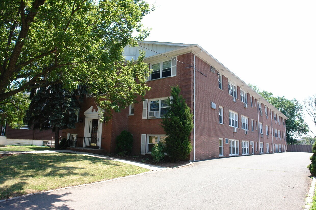
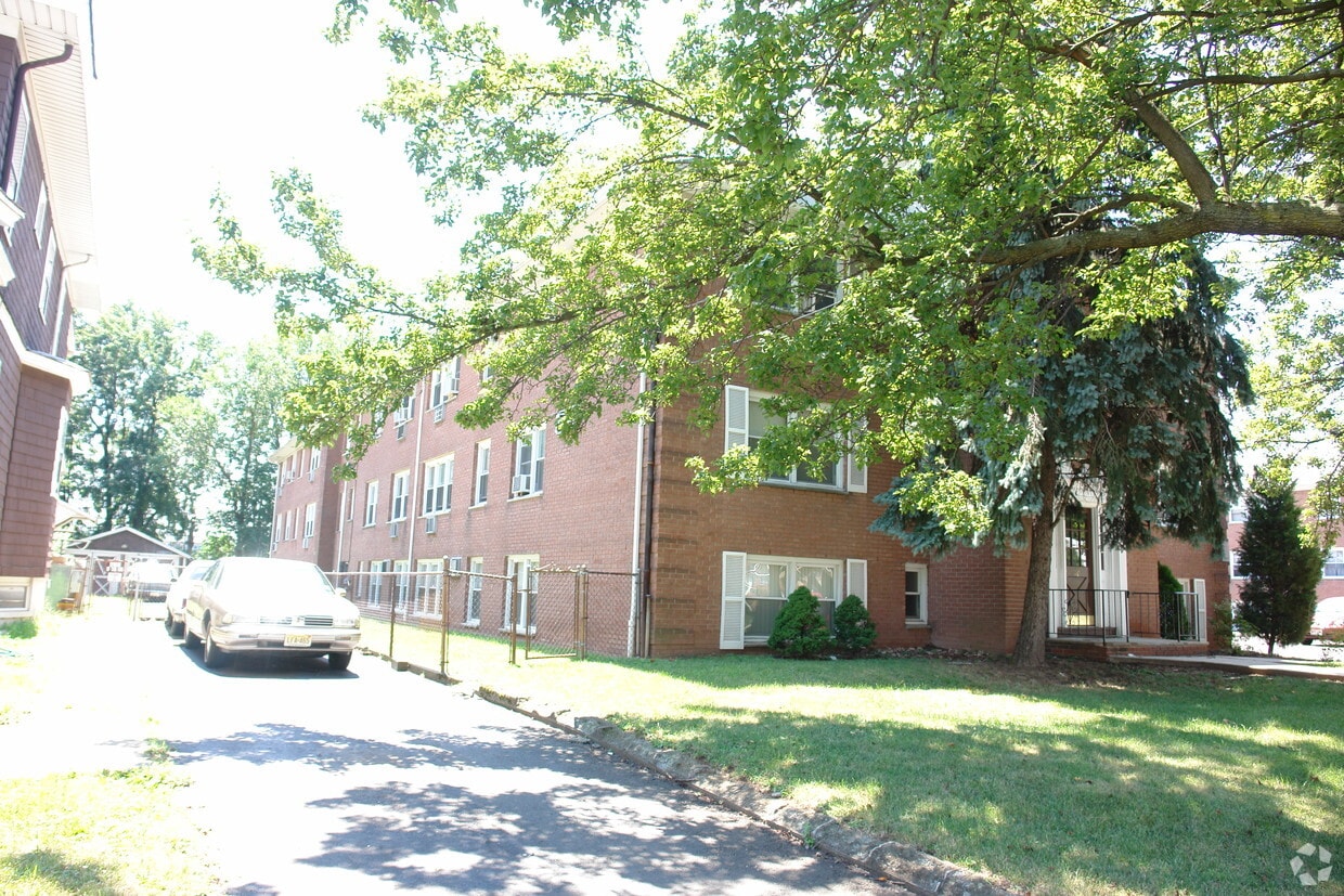

Enjoy Elizabeth living at 710 Westfield Ave. You'll find this community in the 7208 area of Elizabeth. Compare 0 to 2 bedroom apartments and then swing by for a tour of the community. The leasing staff is ready to help you find your new home. Give us a call now to check the current floor plan availability.
710 Westfield Ave is an apartment community located in Union County and the 07208 ZIP Code. This area is served by the Elizabeth Public attendance zone.
The largest city in Union County, Elizabeth is a bustling town in northeastern New Jersey, centrally located near Staten Island, New York City, Jersey City, and Newark. Elizabeth was built on shipping and industry, but has modernized into a picturesque residential community that’s teeming with urban amenities. This city has a rich history that can be seen through the city’s grand architecture like the Elizabeth Public Library and the Union County Courthouse.
Live music venues, shopping malls, local bars and restaurants, and riverfront green spaces are just a few of the perks of living in this New Jersey suburb. Just outside of Elizabeth, you’ll discover Kean University and Warinanco Park.
Learn more about living in Elizabeth| Colleges & Universities | Distance | ||
|---|---|---|---|
| Colleges & Universities | Distance | ||
| Drive: | 3 min | 1.4 mi | |
| Drive: | 4 min | 1.5 mi | |
| Drive: | 14 min | 5.1 mi | |
| Drive: | 18 min | 8.5 mi |


Transportation options available in Elizabeth include Norfolk Street, located 7.1 miles from 710 Westfield Ave. 710 Westfield Ave is near Newark Liberty International, located 8.1 miles or 14 minutes away, and LaGuardia, located 25.8 miles or 48 minutes away.
| Transit / Subway | Distance | ||
|---|---|---|---|
| Transit / Subway | Distance | ||
|
|
Drive: | 14 min | 7.1 mi |
|
|
Drive: | 12 min | 7.5 mi |
|
|
Drive: | 13 min | 8.1 mi |
|
|
Drive: | 14 min | 8.6 mi |
| Drive: | 16 min | 8.8 mi |
| Commuter Rail | Distance | ||
|---|---|---|---|
| Commuter Rail | Distance | ||
|
|
Drive: | 2 min | 1.3 mi |
|
|
Drive: | 4 min | 1.8 mi |
|
|
Drive: | 5 min | 2.0 mi |
|
|
Drive: | 5 min | 2.4 mi |
|
|
Drive: | 8 min | 4.1 mi |
| Airports | Distance | ||
|---|---|---|---|
| Airports | Distance | ||
|
Newark Liberty International
|
Drive: | 14 min | 8.1 mi |
|
LaGuardia
|
Drive: | 48 min | 25.8 mi |
Time and distance from 710 Westfield Ave.
| Shopping Centers | Distance | ||
|---|---|---|---|
| Shopping Centers | Distance | ||
| Walk: | 13 min | 0.7 mi | |
| Drive: | 3 min | 1.1 mi | |
| Drive: | 3 min | 1.4 mi |
| Parks and Recreation | Distance | ||
|---|---|---|---|
| Parks and Recreation | Distance | ||
|
William Miller Sperry Observatory
|
Drive: | 12 min | 4.9 mi |
|
Hawk Rise Sanctuary
|
Drive: | 12 min | 5.5 mi |
|
Staten Island Industrial Park
|
Drive: | 11 min | 6.2 mi |
|
Liberty State Park
|
Drive: | 14 min | 7.5 mi |
|
Faber Park
|
Drive: | 14 min | 7.6 mi |
| Hospitals | Distance | ||
|---|---|---|---|
| Hospitals | Distance | ||
| Drive: | 4 min | 1.7 mi | |
| Drive: | 8 min | 4.3 mi | |
| Drive: | 14 min | 7.1 mi |
| Military Bases | Distance | ||
|---|---|---|---|
| Military Bases | Distance | ||
| Drive: | 20 min | 8.3 mi | |
| Drive: | 17 min | 8.7 mi | |
| Drive: | 20 min | 11.9 mi |
What Are Walk Score®, Transit Score®, and Bike Score® Ratings?
Walk Score® measures the walkability of any address. Transit Score® measures access to public transit. Bike Score® measures the bikeability of any address.
What is a Sound Score Rating?
A Sound Score Rating aggregates noise caused by vehicle traffic, airplane traffic and local sources

710 Westfield Ave
Elizabeth, NJ 07208


